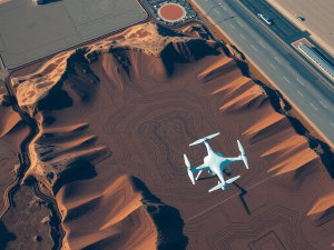
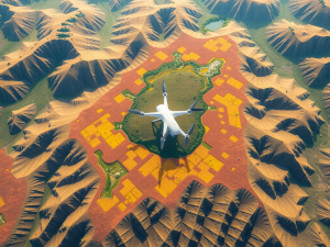
Innovative methods are reshaping the landscape of modern land assessment. Aerial surveys utilize unmanned aerial vehicles (UAVs) to collect high-resolution data and images, streamlining traditional evaluation processes.
Prior approaches often required extensive manpower and equipment, resulting in elevated costs and prolonged timelines.
UAVs, conversely, can swiftly reach difficult terrains, significantly reducing the duration of data gathering.
Trends in surveying technology, such as Lidar and photogrammetry, provide precise mapping capabilities that surpass those of conventional techniques. Notably, many contemporary drones incorporate eco-friendly features, which lessen their ecological footprint.
This evolution aligns with global sustainability initiatives, offering a greener choice for land management projects. The advantage of UAVs conducting thorough aerial surveys not only boosts accuracy but also facilitates informed decision-making in resource management.
Click here to learn more about: contact
Emerging Technologies In Aerial Surveying
The landscape of mapping has undergone a remarkable transformation due to the influence of cutting-edge technology. Drones equipped with advanced sensors facilitate the precise measurement and visualization of diverse terrains.
Notable innovations such as LiDAR and multispectral imaging empower surveyors to evaluate land features in ways that conventional methods cannot perform, including the ability to measure topography beneath thick vegetation.
This enhanced capability not only boosts accuracy but also significantly reduces the time required for thorough surveys.
A little-known fact is that UAVs are capable of autonomously navigating intricate flight paths, which optimizes data collection processes. The amalgamation of remote sensing technologies and 3D computer graphics produces detailed visualizations that support decision-making across multiple industries, including construction and environmental monitoring.
As these technologies continue to gain traction, they are poised to revolutionize aerial surveying practices, delivering rapid insights and improved operational capabilities.

The Role Of Drones In Mapping
The use of unmanned aerial vehicles has fundamentally altered the landscape of data acquisition and analysis. These aircraft are equipped with advanced sensors capable of capturing high-resolution images, especially in regions where conventional survey methods may struggle.
With the capability to navigate through complex infrastructures, such as dense forests or rugged terrains, drones provide invaluable information efficiently.
Utilizing technologies like hyperspectral imaging allows for data collection across various wavelengths, which is particularly beneficial for analyzing water quality and vegetation health within agriculture.
Enhanced visualization from techniques such as 3D modeling also plays a significant role in planning and decision-making processes. The advantage of real-time computing enables immediate data processing, significantly shortening the time between data collection and actionable insights.
As industries increasingly adopt this transformative technology, the efficiency and accuracy of mapping practices are notably improved, reshaping how various sectors operate.
Unmanned Aerial Vehicles
- Drones can capture high-resolution images in challenging environments where traditional methods are less effective.
- Hyperspectral imaging technology enables the analysis of water quality and vegetation health across multiple wavelengths.
- 3D modeling techniques enhance visualization, aiding in effective planning and decision-making.
- Real-time data processing allows for immediate insights, improving the speed of response in various industries.
Innovations In Geographic Information Systems
Innovations in the realm of geographic data management have transformed traditional methods of data gathering and analysis. Aerial technologies, particularly unmanned aerial vehicles, are now integral to this transformation.
These drones are capable of surveying extensive areas efficiently, covering up to 100 acres in a single flight.
This advancement enhances data collection processes, making them faster compared to legacy techniques.
Unique implementations of these innovations appear across multiple sectors. For instance, approximately 75% of environmental impact assessments now utilize UAV-derived data for precise analysis.
Lidar technology plays a significant role by penetrating dense forest canopies to acquire crucial topographical information, which is frequently overlooked by conventional surveying methods. As new technologies converge with mapping systems, precision agriculture, along with construction projects, greatly benefits, leading to improved resource management and planning outcomes.
Enhancing Accuracy With Lidar And 3D Modeling
Innovative technologies are reshaping how data is collected and analyzed in various industries, particularly through the use of advanced imaging techniques and mapping systems. Lidar technology, or Light Detection and Ranging, is transforming aerial surveying by providing unprecedented accuracy in data acquisition.
This system employs laser pulses to measure distances to the ground, generating detailed survey data that surpasses traditional methods.
Unlike ground-based surveys, this approach can penetrate dense vegetation, allowing for enhanced topographic mapping even in areas that are typically difficult to access.
The high-resolution images captured during these surveys can expose underlying geological features, significantly impacting construction and environmental assessments.
The integration of 3D models derived from survey data enables precise visualizations, facilitating better decision-making in urban planning and resource management. Through sophisticated algorithms, these models allow for real-time analysis, ultimately leading to improved workflows and reduced costs.
As drone technology continues to advance, the applications of Lidar and UAV mapping services are expanding across various sectors, including agriculture, mining, and real estate. Notably, aerial photography often complements surveying efforts by providing vital visual context to analytical processes, ensuring comprehensive data collection and enhanced project outcomes.
Automation in data collection processes is further streamlined through the collaboration of Lidar systems with machine learning initiatives, increasing overall efficiency.
Automation In Data Collection Processes
The advancement of technology is leading to transformative changes in the way data is collected, particularly in the realm of aerial surveying. Drones, formally known as unmanned aerial vehicles (UAVs), are revolutionizing how large areas are surveyed by providing high-resolution imagery and accurate data collection capabilities.
Equipped with an array of sensors, these devices can gather thermal, multispectral, and detailed aerial survey data, significantly enriching the information available for analysis.
The implementation of real-time data processing enhances the efficiency of survey projects.
A notable trend in land surveying is the incorporation of artificial intelligence, which streamlines the analysis of vast datasets generated by drones.
This ongoing evolution in surveying technology facilitates the automation of processes that were once labor-intensive, allowing for more precise and quicker results.
Utilizing automated systems diminishes the time and costs traditionally associated with surveying methods while also reducing the potential for human error. As drone technology continues to evolve, it is poised to redefine surveying and mapping practices, offering innovative solutions for professionals across various sectors, including construction, agriculture, and environmental monitoring.
Following advancements in UAV capabilities, the focus on sustainable practices in land surveying is also gaining traction. By using aerial data collection methods, professionals can efficiently survey large areas, measure distances, and analyze trends in land use through advanced surveying technology and real-time data processing from aerial survey data gathered by unmanned aerial vehicles.
Sustainable Practices In Land Surveying
Adopting environmentally conscious methods is becoming increasingly important within the surveying industry, especially as companies aim to lessen their ecological impact. Aerial survey technology plays a pivotal role in streamlining data collection processes.
Utilizing drones, professionals can capture high-resolution imagery while minimizing ground disruption.
This innovative technique conserves resources and significantly lowers the carbon emissions linked to traditional surveying methods.
The latest technology enables improved data management, allowing teams to analyze data with enhanced accuracy. Drones are capable of covering expansive areas in reduced timeframes, proving invaluable for land development initiatives requiring comprehensive environmental evaluations.
UAVs equipped with multispectral imaging tools can assess land health, supporting ongoing conservation efforts and monitoring practices.
Aerial Survey Technology
- Drones significantly reduce ground disruption during data collection.
- Utilizing drones can lower carbon emissions compared to traditional surveying methods.
- Multispectral imaging tools on UAVs enhance land health assessments.
- Drones enable faster coverage of large areas, aiding comprehensive environmental evaluations.
Future Directions For Survey Services
The evolution of mapping technologies is reshaping how professionals collect and analyze geographic data. One of the most notable trends involves the integration of AI in data processing and analysis, significantly enhancing the accuracy and efficiency of aerial surveys.
As drones gain prominence as vital tools in industries such as construction and environmental monitoring, they are recognized for their ability to generate high-resolution imagery and detailed topographical data swiftly.
These technology trends streamline surveying tasks, allowing for considerable time and cost savings when compared to traditional methodologies.
The implementation of UAV mapping techniques facilitates comprehensive 3D modeling and visualization, resulting in clearer data interpretation for stakeholders. Compliance with FAA regulations remains paramount, ensuring safe and effective survey operations.
This ongoing innovation in aerial survey services promises to unlock opportunities for market expansion and encourages collaboration across various industries.
The Impact Of Remote Sensing On Decision Making
The integration of advanced imaging techniques has revolutionized how industries acquire and utilize data for their operations. UAVs facilitate efficient data collection processes, capturing high-resolution images and spatial information with remarkable precision.
This capability enables the creation of detailed 3D models and digital elevation models, which were previously labor-intensive and costly to produce.
For instance, studies indicate that aerial surveys in precision agriculture can yield increases of up to 20%, enhancing overall productivity.
As technology continues to advance, the accuracy of data collection significantly improves, allowing for more rapid responses to environmental changes.
In sectors such as construction, the adoption of aerial data into surveying workflows optimizes project management by providing real-time updates, thereby reducing delays and minimizing costs.
The synergy between aerial imagery and GIS technologies has led to enhanced survey results, equipping stakeholders with actionable insights that drive informed decision-making. As regulations adapt to technological trends shaping the field, the landscape for drone operations in specialized mapping applications is expanding.
This shift serves to influence strategic planning across various industries, from urban development to environmental monitoring.
| Industry | Benefit |
|---|---|
| Precision Agriculture | Up to 20% increase in productivity |
| Construction | Real-time updates reduce delays and costs |
| Environmental Monitoring | Enhanced data accuracy for rapid response |
| Urban Development | Informed decision-making through actionable insights |
Drone Survey Advancements Unveiled
Remote Sensing Aerial Surveys Unique Maps