Utilizing advanced technology in aerial data collection has markedly refined the processes associated with mapping. Drones are capable of capturing high-resolution information at a much faster rate than conventional techniques.
Equipped with sophisticated sensors, these unmanned aerial vehicles can produce intricate 3D models and digital elevation models (DEMs) from multiple perspectives.
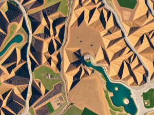
Such models enhance topographic mapping and reveal features that ground surveys might miss.
Interestingly, UAVs excel in environments where traditional surveying methods face obstacles, such as dense forests or rugged terrain. The incorporation of photogrammetry improves the fidelity of aerial imagery, enabling thorough assessments of land use.
Continuous advancements in regulations concerning UAV operation are solidifying the acceptance of these tools in professional contexts. Their applications span numerous sectors including construction, agriculture, and environmental monitoring, highlighting their versatility in mapping initiatives.
Click here to learn more about: contact
Revolutionizing Mapping With Drones
The introduction of unmanned aerial systems has transformed the landscape of geographic analysis, enabling efficiency and innovation in data collection. Aerial surveys utilizing advanced technology allow for the creation of detailed topographic maps with remarkable speed and accuracy.
Equipped with LiDAR sensors, these systems can generate point clouds that represent land features with exceptional precision.
Unlike traditional survey methods, drones can traverse vast areas—covering hundreds of acres in a single flight—effectively cutting down on project time and overall costs.
The combination of sophisticated software and aerial imagery facilitates seamless processing and visualization, which aids decision-making across various industries, including construction and agriculture. This evolution not only enhances operational efficiency but also significantly improves the accuracy of mapping efforts, leading to more informed project developments.

Understanding UAV Technology
Advancements in aerial technology are transforming the landscape of surveying across various sectors. These unmanned vehicles provide high-precision measurement capabilities, which significantly streamline data collection processes.
Unlike conventional methods, drones can cover extensive terrain in a reduced timeframe, resulting in improved productivity and lowered operational expenditures.
Equipped with sophisticated sensors such as Lidar and multispectral imaging, these UAVs enable the generation of detailed analytical insights that were once difficult to obtain.
For example, they can create accurate 3D reconstructions of landscapes, facilitating enhanced planning and development initiatives. Flight planning software plays a critical role in optimizing routes, ensuring efficient operations while maximizing the quality and scope of information gathered.
With the incorporation of electric battery technology, drones can achieve prolonged flight durations, enabling comprehensive surveys without the need for frequent battery changes.
This innovative approach is not only reshaping how mapping is conducted but also highlights the significant benefits of drone surveying services. From construction to environmental monitoring, the use of UAVs opens up new avenues for efficiency and accuracy, positioning them as invaluable tools in contemporary surveying practices.
Drone Surveying
- Drones can cover large areas in a fraction of the time compared to traditional surveying methods.
- Equipped with advanced sensors like Lidar, drones can produce detailed 3D models of landscapes.
- The use of drones in surveying leads to reduced operational costs and increased productivity.
- Electric battery technology allows drones to maintain longer flight times for extensive surveys.
Benefits Of Drone Surveying
Utilizing advanced technology for data collection has changed established practices across numerous fields. Drones can efficiently map and survey extensive terrains with impressive accuracy.
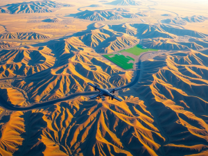
A striking aspect of these aerial systems is their ability to operate in environments that are often dangerous or inaccessible for human crews.
For example, aerial surveys can take place in dense forests or on steep cliffs, where traditional methods might pose significant risks.
Additionally, UAVs equipped with high-quality sensors, such as LiDAR, enable the creation of precise 3D models. The resulting detail enhances analysis in sectors such as construction and environmental monitoring.
Another noteworthy advantage is the considerable reduction in time needed for surveys; tasks that commonly take weeks can frequently be accomplished in mere days with drone capabilities, highlighting the efficiency of contemporary mapping techniques. This efficiency proves invaluable, particularly for projects that necessitate special mapping services, catering to diverse industry needs.
Precision In Aerial Topography
The utilization of advanced aerial technologies has transformed the way mapping and surveying are conducted. This approach employs unmanned aerial vehicles (UAVs), enabling professionals to gather data with exceptional accuracy.
Drones designed for surveying tasks can create intricate topographic maps that reveal detailed insights into terrain features.
A noteworthy aspect of aerial mapping lies in its ability to generate point clouds, essential for developing elevation models.
Unlike conventional land surveying methods, which often require extensive time and may be limited by accessibility issues, survey drones can easily reach locations that are otherwise challenging to access. For example, UAVs can traverse rugged landscapes or hazardous environments, significantly improving operational efficiency in survey projects.
Recent advancements in imaging technology have further enhanced UAV capabilities, allowing for the collection of multispectral data, which proves invaluable in agriculture and environmental monitoring.
Building on the benefits outlined in the previous section, the advancements in UAV technology have led to enhanced data collection techniques. These innovations not only streamline the process but also improve the quality of the data obtained.
Aerial imagery captured by drones offers a comprehensive visual context, augmenting the analytical possibilities for professionals across various fields.
With the integration of geospatial information systems (GIS) alongside drone data, surveyors can conduct more thorough spatial analyses, assisting in everything from construction planning to environmental assessments.
| Aspect of UAV Technology | Benefits |
|---|---|
| Data Collection Accuracy | Exceptional accuracy in gathering data |
| Access to Challenging Locations | Easily reaches rugged and hazardous environments |
| Point Cloud Generation | Essential for developing elevation models |
| Integration with GIS | Enables thorough spatial analyses for various applications |
Enhancing Data Collection Techniques
Recent advancements in technology have revolutionized how data is gathered in various fields, particularly in aerial surveying. Drones equipped with cutting-edge sensors like Lidar and multispectral cameras are capable of capturing detailed data across diverse terrains.
These unmanned aerial vehicles can generate digital surface models, which illustrate complex contour lines that often go unnoticed with conventional mapping methods.
The incorporation of advanced software solutions not only accelerates data processing but also allows for real-time analysis during drone flight, enhancing the overall efficiency of surveying and mapping tasks.
The accuracy achieved through these techniques significantly shortens project timelines while delivering superior results. The cost savings associated with using drones compared to manned aircraft present a compelling case for their adoption, especially in large-scale projects where traditional methods may prove less feasible.
As professionals explore aerial surveying techniques further, the transition into photogrammetry applications can offer even broader insights.
This technology complements traditional aerial surveys, providing high-resolution imagery that enriches the data collected. Utilizing these diverse methods allows for a more comprehensive understanding of environmental conditions and project parameters, ultimately supporting informed decision-making across various industries.
Exploring Photogrammetry Applications
Innovative techniques have emerged to revolutionize how professionals gather and analyze spatial data. Using advanced mapping software, high-resolution images captured from the sky transform into detailed digital elevation models, which offer profound insights into both topography and structural designs.
It is noteworthy that three-dimensional representations can be derived from two-dimensional photographs, significantly augmenting analysis across various industries.
The evolution of this technology traces back to the early 19th century, with modern drones capable of swiftly obtaining detailed data, thus enhancing the efficiency of data collection methods.
Equipped with advanced sensors, drones can capture information in locations that would traditionally pose accessibility issues, thereby elevating the accuracy of surveying companies engaged in diverse projects. Beyond conventional uses, this technology also plays a vital role in precision agriculture by enabling effective monitoring of crop health from an aerial perspective.
As the industry continues to evolve, integrating drone-based surveying with various software solutions broadens the scope for comprehensive insights, offering substantial improvements over traditional surveying methods. This progression paves the way for future innovations in optimizing flight planning strategies, which will further enhance the capabilities of aerial data collection.
Innovative Data Collection Techniques
- Advanced mapping software and high-resolution aerial imagery create detailed digital elevation models.
- Three-dimensional representations can be generated from two-dimensional photographs, enhancing analytical capabilities.
- Drones equipped with advanced sensors can access hard-to-reach locations, improving surveying accuracy.
- Drone-based surveying integrated with software solutions offers significant advantages over traditional methods in various industries.
Optimizing Flight Planning Strategies
Strategic flight preparation plays a significant role in the effectiveness of UAV services tailored for mapping endeavors. A thorough examination of site conditions can greatly impact the evaluation of terrain and the accuracy of drone imagery.
For instance, specialized drones can adapt their flight paths to capture diverse topographic features by varying altitudes, thus enhancing the detail in collected data.
Wind currents are another factor that can disrupt drone stability and degrade the integrity of drone survey data.
Analyzing local weather patterns before deployment is therefore paramount. Advanced software applications are instrumental in assisting drone pilots, allowing them to devise automated flight paths that adjust in real-time according to environmental fluctuations.
Such technological integration not only streamlines mission execution but also results in superior data collection methodologies, ultimately benefiting a wide range of applications across sectors such as construction and environmental monitoring.
Transforming Construction Projects With Drones
The integration of advanced aerial technology is reshaping how data is collected and analyzed in the construction sector. By utilizing drone surveying, teams can capture high-resolution images and spatial information that far exceed the capabilities of traditional survey methods.
Notably, employing a drone survey mapping approach can reduce survey time by as much as 80% compared to conventional techniques.
This substantial time savings facilitates quicker decision-making and more effective resource management.
Drone survey mapping offers a unique perspective on complex terrains, which is crucial for precise project planning. The ability to visualize projects from an aerial viewpoint enables teams to proactively identify and mitigate potential challenges, ensuring smoother project execution.
Compliance with regulations governing UAV operations is integral to maintaining safety and ensuring data integrity in these processes. The use of drone topographic mapping not only revolutionizes workflows but also establishes a new benchmark for managing construction projects.
Drone Surveying in Construction
- Drone surveying can reduce survey time by up to 80% compared to traditional methods.
- High-resolution images and spatial data captured by drones enhance project planning and decision-making.
- Aerial perspectives from drones help identify and mitigate potential challenges in complex terrains.
- Compliance with UAV regulations is essential for maintaining safety and data integrity in construction projects.
Geospatial Data Analysis Trends 2024 Insights On GIS Evolution
Remote Sensing Technology Updates NASA Earthdatas Unique Insights