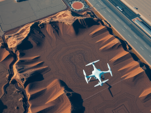
The logistics landscape is undergoing a significant transformation due to advancements in unmanned aerial vehicles. These vehicles offer innovative options for final delivery processes, enabling coverage of short distances at remarkable speeds, often exceeding those of conventional methods, and reducing delivery times by over 50%.
This increased efficiency enhances customer experience while also lowering operational costs for companies.
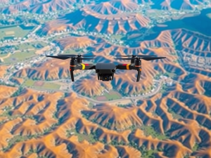
Recent developments in UAV technology include autonomous navigation and real-time data transmission, which are proving invaluable across various sectors, including healthcare.
For example, drones have successfully transported medical supplies to remote locations where traditional transport poses difficulties. The incorporation of artificial intelligence into flight operations facilitates smarter routing, further optimizing shipment logistics.
With urban populations on the rise, these unmanned aerial systems are being integrated into smart city frameworks, allowing them to collaborate with traffic management systems to evade congestion and ensure punctual deliveries. The relentless progress in drone technology is paving the way for a new era in delivery services.
Click here to learn more about: contact
Emerging Innovations In Drone Technology
Innovative developments are reshaping the landscape of unmanned aerial vehicles, particularly in the realms of mapping and surveying. Among the notable advancements is the incorporation of sophisticated sensor systems like Lidar and multispectral imaging, which significantly enhance the accuracy of collected data.
These technologies enable drones to gather intricate details about terrain and vegetation that traditional surveying techniques may overlook.
For example, Lidar technology is capable of penetrating dense foliage, thereby revealing the underlying topography with remarkable clarity.
The rise of autonomous flight capabilities allows these aircraft to conduct intricate mapping operations with minimal human oversight, which not only boosts efficiency but also lowers the likelihood of human error. Real-time data processing technologies are also making strides, providing immediate analysis of aerial data crucial for sectors such as construction and environmental monitoring.
As these technological advances progress, they are anticipated to revolutionize methods for environmental monitoring and resource management, paving the way for new applications and greater precision in various fields

The Role Of Ai In Aerial Delivery
Artificial intelligence transforms the landscape of logistics and aerial delivery, enhancing operational capabilities and decision-making processes. Utilizing real-time data analysis, algorithms can optimize flight paths and streamline logistics, which leads to significant reductions in delivery times.
Unique Fact: The capacity of AI to predict weather patterns enables unmanned aerial vehicles to navigate adverse conditions reliably, thereby improving service dependability.
The implementation of machine learning allows drones to identify and avoid obstacles in real-time, which greatly enhances flight safety.
Unique Fact: Historical flight data can inform AI models, refining navigation strategies and minimizing risks in aerial operations. AI’s ability to process large volumes of aerial data supports inventory management and demand forecasting.
Unique Fact: Predictive analytics enhances supply chain efficiency by accurately anticipating consumer needs, facilitating timely deliveries. As advancements continue to emerge, the integration of AI within the framework of drone technology will increasingly promote streamlined and effective operations
AI in Logistics and Aerial Delivery
- Real-time data analysis optimizes flight paths and reduces delivery times.
- AI can predict weather patterns, allowing drones to navigate adverse conditions effectively.
- Machine learning enables drones to identify and avoid obstacles in real-time, enhancing flight safety.
- Predictive analytics improves supply chain efficiency by anticipating consumer needs for timely deliveries.
Enhancing Surveillance With Unmanned Vehicles
Innovations in vehicle technology have ushered in a new era of oversight capabilities, optimizing the way data is gathered and analyzed. Unmanned systems enable operators to efficiently cover extensive areas, drastically minimizing operational time when juxtaposed with conventional methods.
For example, aerial vehicles equipped with sophisticated sensors can navigate challenging environments, including dense forests and uneven terrains, areas often difficult for human access.
Many may not realize that these machines can utilize advanced multispectral imaging, which captures data outside the visible spectrum.
This capability plays a significant role in environmental assessments, yielding valuable insights on vegetation condition and shifts in land utilization.
Autonomous aircraft can be scheduled for prolonged operations, allowing for thorough oversight of vast regions without the need for continuous human control.
The use of this technology is accelerating, with notable applications emerging in sectors such as safety and security, infrastructure development, and ecological conservation
Revolutionizing Agriculture Through Drones
Innovations in aerial technology are transforming traditional agricultural methods, providing farmers with advanced tools to tackle persistent challenges. Multispectral imaging enables farmers to assess crop health by detecting stress before visible symptoms appear, allowing for timely interventions.
This technology can survey large areas quickly, making it possible to evaluate more farmland in less time than traditional methods.
Drones can autonomously navigate rugged terrains that are difficult for trucks and humans to access, broadening the potential for agricultural expansion.
Automated aerial data collection improves efficiency in irrigation management and pest control, all while reducing labor costs. Advancements in battery technology and navigation systems enhance the operational range and reliability of these drones, significantly impacting agricultural productivity.
These technological advancements allow for a higher level of precision and efficiency in data collection, which is critical for effective crop management. As this field evolves, farmers can expect even more precise tools that streamline their operations through real-time data analysis, ultimately optimizing yield and resource allocation.
Innovations in Aerial Technology in Agriculture
- Multispectral imaging allows for early detection of crop stress, enabling timely interventions.
- Drones can cover large agricultural areas quickly, increasing efficiency compared to traditional methods.
- Automated aerial data collection reduces labor costs and improves management of irrigation and pest control.
- Advancements in battery technology and navigation systems enhance drone reliability and operational range.
Optimizing Logistics With UAV Solutions
Innovative technologies are redefining how industries approach logistics and delivery systems. Utilizing UAVs provides unprecedented advantages, such as significantly reduced flight times compared to conventional transport methods.
These aerial vehicles can reach remote locations that ground transport often cannot, ensuring timely deliveries even in challenging terrains.
A remarkable aspect of this technology is the role of machine learning algorithms, which facilitate dynamic routing adjustments based on real-time environmental conditions like traffic and weather.
This advanced capability not only improves delivery efficiency but also enhances operational reliability.
UAVs play a crucial role in aerial surveying, capturing high-resolution images and data essential for precise mapping and spatial analysis. The data collected through these methods can be applied across various sectors, including construction and environmental monitoring.
A less commonly known fact is the increasing adoption of drone swarms; multiple UAVs working collaboratively can undertake complex logistics tasks, thereby optimizing efficiency and resource usage. This trend reflects broader advancements in the drone industry, fostering improved data collection and more informed decision-making in supply chain management.
As these technological developments continue to evolve, logistics is becoming more streamlined, setting the stage for future innovations.
The integration of drones not only shapes the logistical landscape but also complements existing systems in various industries, paving the way for enhanced operational strategies. This ongoing shift will pave the way for advancements in drone technology that enhance flight times, improve privacy policy adherence, and leverage machine learning, ultimately shaping the future of the drone industry and enabling sophisticated drone swarms that operate within visual line of sight in our airspace.
The Future Of Autonomous Flight Systems
Innovative developments are set to redefine the landscape of aerial operations. Emerging trends in navigation systems lead to greater precision in UAV mapping and data collection.
Drones equipped with advanced technology can capture high-resolution imagery, crucial for efficient topographic mapping and spatial analysis.
The application of multiple drones within a single operation provides comprehensive coverage of vast areas, significantly benefiting sectors such as construction, agriculture, and environmental monitoring.
The integration of aerial survey techniques using UAVs allows for detailed assessments, facilitating better decision-making and resource management. Regulatory frameworks are adapting to support urban air mobility initiatives, paving the way for advanced drone delivery services.
As advancements in drone technology progress, the potential applications extend into various fields, enhancing workflows and enabling operations beyond the pilot’s line of sight. This evolution in technology not only streamlines processes but also improves monitoring capabilities, particularly in complex project environments.
Aerial Operations
- Drones can capture high-resolution imagery, essential for accurate topographic mapping.
- The use of multiple drones enhances coverage and efficiency in large area assessments.
- Advanced UAV technology facilitates improved decision-making and resource management.
- Regulatory changes are enabling the growth of urban air mobility and drone delivery services.
Integrating Machine Learning For Smarter Drones
Advancements in technology are transforming how aerial surveyors conduct mapping and data collection tasks. The incorporation of sophisticated algorithms allows unmanned aerial vehicles (UAVs) to perform complex analyses, making them incredibly useful for various sectors, including construction, real estate, and environmental monitoring.
These intelligent systems can process data from aerial surveys with remarkable efficiency; indeed, certain algorithms can achieve processing speeds up to 80% faster than traditional methods, which greatly expedites project timelines and enhances decision-making capabilities.
Unique to smart drones is their ability to utilize computer vision, enabling them to adapt their flight paths in real-time.
Such adaptability is particularly advantageous for projects in dense urban landscapes or rugged terrains, leading to more precise and effective mapping operations. Industries reporting these advancements, such as agriculture and energy, benefit from a notable 30% increase in accuracy and resource management.
With the integration of machine learning, drones are not merely tools; they are reshaping the future of aerial data collection and analysis, paving the way for innovations in enhancing urban air mobility in the coming years.
Enhancing Urban Air Mobility With Drones
Innovations in aerial technology are transforming the landscape of urban transportation and logistics. A significant aspect of this evolution involves the integration of drones for precise mapping and surveying services.
These UAVs can operate effectively, allowing for the creation of detailed 3D maps that serve urban planners and developers alike.
For example, drones can work together to cover extensive areas quickly, making them a game-changer in data collection methodologies.
The ability to capture high-resolution imagery enhances data analysis significantly, as these insights are often overlooked by traditional surveying techniques. Advanced sensors enable these flying devices to perform complex tasks beyond logistics, including environmental monitoring and infrastructure inspections.
This rapidly evolving landscape suggests that the role of unmanned aerial vehicles in urban mobility will continue to expand, offering cities innovative solutions to intricate challenges.