The rapid advancement of technology has transformed how we approach mapping and data collection across various industries. LiDAR, which stands for Light Detection and Ranging, employs laser pulses to create precise three-dimensional models of the Earth’s surface.
This method provides remarkable accuracy and detail compared to traditional survey techniques.
A unique aspect of LiDAR surveys is their ability to penetrate forest canopies, allowing for the mapping of forest floor topography that would otherwise remain obscured.
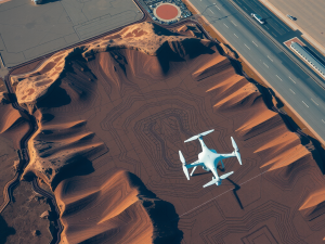
This capability is invaluable for environmental monitoring and conservation efforts. Drones equipped with LiDAR sensors can cover vast areas quickly, generating high-resolution point clouds that represent the terrain.
As a result, industries such as construction and real estate benefit from improved site analysis and planning. The integration of LiDAR technology with drones not only enhances efficiency but also ensures that critical information is readily accessible for better decision-making.
Click here to learn more about: contact
Exploring The Advantages Of Laser Technology
The application of advanced measurement techniques has led to significant advancements in various fields, particularly in the context of mapping and surveying. This innovative approach utilizes light to determine distances with remarkable accuracy, allowing for data collection that surpasses traditional methods.
Environmental monitoring benefits from this technology, given its ability to function effectively across diverse conditions, effectively addressing challenges posed by weather and terrain.
The capability to scan vast landscapes quickly not only accelerates survey completion but also diminishes the expenses tied to large projects.
The creation of high-resolution 3D computer graphics provides detailed visualizations that support informed decision-making across numerous industries, including construction, agriculture, and real estate, transforming our interaction with the environment.
Transitioning from the advances seen in UAV mapping services, it is essential to delve into the processes involved in data acquisition. This aspect further underscores the importance of precise measurement technologies and their significant role in enhancing the quality of gathered geographic information.

Understanding The Process Of Data Acquisition
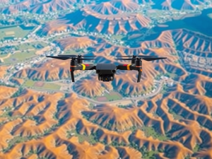
The procedure for acquiring geographic information involves a multifaceted approach that seamlessly integrates cutting-edge technology with systematic data collection methods. Aerial surveys harness the capabilities of unmanned aerial vehicles (UAVs) to capture high-resolution imagery, which significantly benefits various sectors, including construction and environmental monitoring.
These devices can operate in diverse landscapes, including steep terrains and urban settings, which are often difficult to navigate with conventional surveying techniques.
The ability of UAVs to function under varying light conditions and elevations enhances their utility, enabling surveyors to gather critical data regardless of environmental restrictions.
This technological advancement not only accelerates the data collection process but also improves data accuracy, facilitating thorough spatial analysis.
Transitioning from the advantages of laser technology previously discussed, the incorporation of drone services marks a significant leap in mapping precision. With UAVs, surveyors can collect geographic data and information that leads to more informed decision-making and resource management.
The use of thermal and multispectral imaging further augments data richness, providing insights that traditional methods may overlook.
The refinement of UAV mapping techniques underscores the ongoing evolution in this field, as these technologies continue to adapt and provide enhanced efficiency. As projects vary in scale—from small parcel evaluations to comprehensive environmental assessments—the tailored use of UAVs proves indispensable. The application of advanced imaging technology in conjunction with tools such as the Global Positioning System and unmanned aerial vehicles is revolutionizing fields like archaeology and environmental monitoring by providing precise geographic data and information that enhance our understanding of both natural and constructed landscapes.
| Technology | Benefits |
|---|---|
| Unmanned Aerial Vehicles (UAVs) | High-resolution imagery for various sectors |
| Thermal and Multispectral Imaging | Enhanced data richness and insights |
| Global Positioning System (GPS) | Improved mapping precision and accuracy |
| Adaptability to Diverse Landscapes | Effective data collection in challenging terrains |
Enhancing Mapping Accuracy With Drones
The application of unmanned aerial vehicles is reshaping how professionals conduct land assessments and mapping tasks. This technology has enabled significant improvements in the precision of data collection through the use of laser systems, particularly lidar.
Unlike conventional aerial imaging, lidar technology employs laser pulses to penetrate and measure distances through vegetation, resulting in a highly detailed point cloud of data.
This exceptional capability allows for the production of intricate topographic maps, especially in regions where ground surveys are impractical due to dense vegetation.
The efficiency of drone operations further enhances the mapping process, drastically cutting down the time and finances usually associated with extensive land evaluations. Research indicates that employing UAV systems can elevate accuracy levels by as much as 50% when juxtaposed with traditional surveying techniques.
The evolution of these methodologies not only boosts efficiency but also opens doors for diverse applications across various sectors, such as construction, agriculture, and environmental monitoring.
Key Applications Of Lidar In Environmental Monitoring
The application of advanced laser technology has significantly enhanced the ability to monitor environmental changes and assess ecosystem health. LiDAR systems collect data by emitting pulses of light and measuring the duration it takes for the reflected light to return to the sensor.
This innovative data collection method allows for the creation of detailed 3D models of vegetation structures, facilitating accurate assessments of forest canopy height and biomass.
Uniquely, this remote sensing technique can penetrate dense foliage, providing insights that traditional surveying methods often overlook.
Such capabilities are essential for evaluating ecosystem vitality and understanding carbon storage dynamics. LiDAR is crucial for mapping wetland boundaries, revealing shifts in hydrology that impact these sensitive ecosystems.
When combined with GIS technologies, researchers can conduct enhanced spatial analysis, which plays a significant role in informing conservation efforts. The ability to access hard-to-reach areas using UAVs further streamlines these processes, reflecting a shift towards more efficient mapping practices in environmental monitoring.
Revolutionizing Archaeological Surveys With Lidar
Innovative technologies are reshaping the methodologies employed by archaeologists in their investigations of historical sites. Traditional surveying techniques often require extensive ground assessments, which can be hindered by thick vegetation and other obstacles.
The high precision of Lidar equipment enables swift aerial data collection, resulting in a substantial reduction in survey time.
This technology allows researchers to generate detailed 3D models, uncovering structures like ancient roads and buildings that remain hidden beneath dense foliage.
The applications of Lidar extend far beyond archaeology; its capacity for accurate topographic mapping is noteworthy. By gathering vast amounts of data points, this method ensures more comprehensive representations of the landscape.
Recent advancements in data processing software have further enhanced analysis capabilities, making it possible to interpret results with greater accuracy. As these technologies continue to evolve, they play an increasingly critical role in the exploration of our past while facilitating efficient urban planning and environmental assessments.
The integration of aerial survey methods, including drones and UAVs, offers unparalleled access to difficult terrains, thereby enhancing data quality and overall survey outcomes.
Creating Detailed 3D Models Of Landscapes
Recent innovations have reshaped the methods used for mapping and analyzing landforms. Aerial survey techniques deploy drones that use lidar to accurately create detailed digital representations of terrain, enhancing both precision and efficiency in data collection.
The role of lidar is significant, as it can penetrate dense vegetation to capture ground elevations reliably.
This technology enables data collection from various angles, which can then be processed to generate comprehensive elevation models.
Unlike conventional surveying techniques, drone mapping facilitates rapid coverage of extensive areas, proving invaluable for sectors such as construction and environmental monitoring. UAVs equipped with lidar can deliver high-resolution topographic data, uncovering features frequently overlooked by traditional ground surveys.
Distinct applications include modeling flood plains and evaluating geological formations, where precise measurements are crucial for effective planning and management.
The Future Potential Of Remote Sensing Technology
The increasing integration of advanced data collection methods signifies a transformative phase for industries reliant on geographic information. This technology employs aerial platforms, such as drones, to capture data that would typically be labor-intensive or unattainable through conventional means.
Solid-state lidar represents a notable advancement, elevating mapping capabilities with its superior resolution and rapid data acquisition.
Unlike traditional lidar systems, these modern versions forgo moving parts, providing enhanced durability and minimizing maintenance requirements.
Applications that require high accuracy, such as urban planning, environmental monitoring, and construction, benefit greatly from lidar surveying work, which delivers impressive precision. This cutting-edge technology facilitates real-time analysis, significantly expediting decision-making processes across diverse sectors.
As these technological breakthroughs continue to develop, remote sensing is poised to emerge as an indispensable tool for addressing multifaceted challenges that contemporary industries face.
Harnessing The Power Of Point Cloud Data
The advancement of survey technology significantly enhances the ability to gather and analyze geographic information. Lidar technology has emerged as a key player in effectively collecting precise data from the environment.
It operates by sending rapid laser pulses toward the ground and measuring the speed of light as it returns, allowing for the generation of accurate three-dimensional models.
These models can capture vast amounts of data, representing complex terrains with remarkable precision.
Interestingly, digital elevation models generated from lidar data help provide essential insights for applications in fields such as construction and environmental monitoring. Many may not be aware that lidar mapping improves decision-making processes across a variety of sectors, including agriculture and urban planning.
As industries continue to choose lidar for their surveying needs, the impact of this technology on innovation and growth becomes increasingly evident. Notably, the incorporation of aerial survey techniques, particularly utilizing drones, further complements lidar’s capabilities by capturing high-resolution imagery.
This synergy not only enhances data visualization but also allows for efficient topographic mapping and spatial analysis.
As the potential for UAV services evolves, it is clear that the combined use of these technologies will continue to redefine the landscape of mapping and surveying.
Surveying With Drones A Fresh Take
3D Mapping Technology Visualize 3D Maps