Emerging innovations are set to redefine how industries approach data analysis related to spatial information. The evolution of Geographic Information Systems (GIS) involves advanced tools that elevate spatial analysis beyond traditional data visualization.
A noteworthy trend is the convergence of satellite imagery and artificial intelligence, enhancing how real-time data is processed.
Immediate updates in mapping applications directly benefit sectors such as urban planning and environmental monitoring.
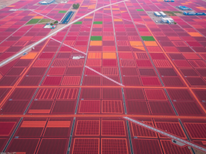
Aerial surveys utilizing drones are particularly impactful, delivering high-resolution imagery essential for diverse applications, including construction, agriculture, and resource management. Techniques like photogrammetry and Lidar significantly improve the accuracy and efficiency of data collection.
As these technologies continue to advance, integrating machine learning within spatial analytics will support enhanced decision-making processes. The anticipated growth in markets related to GIS technologies underscores their transformative role across multiple industries.
Click here to learn more about: contact
Emerging Geospatial Technologies
Technological advancements are reshaping the methodologies used for collecting and interpreting geographic data. A noteworthy innovation is the application of LiDAR, which utilizes laser light to measure distances with remarkable precision.
This technology uniquely penetrates dense forest canopies, facilitating the collection of accurate ground elevation data that traditional methods often miss.
Similarly, photogrammetry has evolved significantly, leveraging aerial imagery to produce detailed 3D models with centimeter-level accuracy, essential for comprehensive data analysis.
Additionally, multispectral imaging captures diverse wavelengths, offering insights into agricultural health by identifying plant stress long before it becomes visually apparent. These tools enhance the precision of mapping and enable real-time computing and analysis, making them indispensable across various sectors, including construction and environmental monitoring.
The integration of drones, or UAVs, into aerial surveying processes allows for efficient topographic mapping and data visualization, ensuring that even the most challenging terrains can be accurately documented. As these technologies continue to develop, industries are witnessing substantial improvements in operational efficiency and decision-making capabilities, particularly in resource management and infrastructure planning.

Innovations In Spatial Analysis
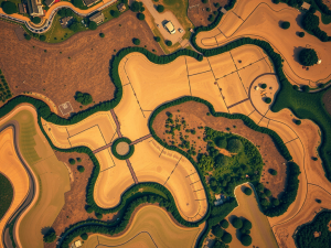
Advanced technologies have revolutionized the landscape of spatial data analysis, particularly through the use of aerial systems. The integration of unmanned aerial vehicles has modernized traditional methodologies employed for data gathering.
Utilizing aerial photography alongside advanced imaging techniques, such as Lidar and multispectral imaging, significantly enhances precision in topographic assessments.
An interesting yet often overlooked application of these technologies is their capacity to effectively monitor areas impacted by deforestation or natural disasters, delivering essential data for recovery and restoration efforts.
The usability of real-time data provided by these drones allows industries—including agriculture and construction—to optimize land use and refine their operational processes. Automated data processing enables stakeholders to analyze substantial volumes of aerial data in a timely manner.
This efficiency is particularly valuable for applications such as traffic flow management and environmental monitoring. As aerial technologies advance, they not only improve data visualization but also encourage collaboration across various sectors, which fosters more productive spatial analysis.
Transitioning from these innovations, the implications of machine learning are also becoming increasingly significant in refining analysis techniques and enhancing data interpretation.
Advanced Technologies in Spatial Data Analysis
- Unmanned aerial vehicles (UAVs) enhance traditional data gathering methodologies.
- Techniques like Lidar and multispectral imaging improve precision in topographic assessments.
- Drones provide real-time data, optimizing land use in industries such as agriculture and construction.
- Automated data processing allows for timely analysis of large volumes of aerial data.
The Impact Of Machine Learning
Advancements in data collection methods are reshaping the dynamics of various industries, particularly through the integration of aerial and UAV technologies. Enhanced algorithms process extensive volumes of geospatial data, resulting in a marked improvement in mapping precision.
These sophisticated systems can quickly analyze environmental trends, enabling stakeholders to make strategic decisions based on predictive analytics.
For example, through the study of historical patterns, machine learning applications facilitate forecasts related to land use changes and climate variations.
This capability not only supports construction and agriculture but also serves sectors like environmental monitoring and urban planning. As 2024 approaches, reliance on innovative analytics will expand, reflecting a significant trend towards smarter resource management.
The incorporation of these technologies into GIS frameworks indicates a transformative shift in understanding spatial data, paving the way for more effective decision-making processes. With the emergence of real-time data applications, urban planning has the potential to become increasingly agile, responding to challenges with enhanced foresight and adaptability.
Real Time Data In Urban Planning
The incorporation of immediate information significantly enhances the effectiveness of urban development efforts. Drones, equipped with various sensors, are deployed to capture high-resolution imagery, facilitating detailed spatial analysis necessary for comprehending dynamic city environments.
These UAV services streamline data collection while fostering collaboration among stakeholders engaged in developmental initiatives.
For example, real-time aerial surveys allow for monitoring construction progress, verifying zoning compliance, and conducting assessments of infrastructure health with increased efficiency.
A lesser-known application of these data sources lies in predictive modeling; here, machine learning algorithms analyze historical patterns and trends to forecast future urban growth scenarios. Such integration of geospatial datasets empowers planners to make informed decisions that reflect up-to-the-moment changes in the urban landscape, contributing to the design of more sustainable and efficient cities.
Urban Development with Drones
- Drones capture high-resolution imagery for detailed spatial analysis of urban environments.
- Real-time aerial surveys improve monitoring of construction progress and zoning compliance.
- Machine learning algorithms utilize historical data to predict future urban growth scenarios.
- Geospatial datasets enable planners to make informed decisions for sustainable city design.
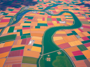
Integrating Satellite Imagery With GIS
The fusion of advanced imaging technology with spatial data platforms offers a transformative approach to geospatial analysis. This combination enhances mapping precision and allows for a comprehensive understanding of environmental phenomena.
High-resolution aerial surveys, often conducted using drones, can capture images revealing land features with remarkable clarity, distinguishing details as small as 30 cm.
As the geospatial industry evolves, professionals increasingly utilize this data to make informed decisions regarding urban planning and resource management.
High-resolution imagery obtained from UAVs not only improves visual representation but also supports complex data analyses. For example, employing big data techniques in climate research enables the identification of trends and the forecasting of future events, enriching our understanding of ecological shifts.
Nevertheless, effectively merging these diverse data sources necessitates sophisticated analytical tools to handle the extensive volumes of data produced. As advancements in technology progress, the availability of real-time satellite data stands to significantly alter methodologies in geospatial data analytics.
Future Applications Of Geospatial Analytics
Innovations in location-based data collection are poised to reshape various industries through enhanced analytical capabilities. The advent of aerial survey techniques using drones, including UAV mapping services, allows for the rapid acquisition of vast amounts of geospatial data while maintaining high levels of precision.
Technologies such as Lidar and photogrammetry facilitate detailed topographic mapping and spatial analysis, significantly reducing the time and costs associated with traditional surveying methods.
Many sectors, including construction, real estate, and environmental monitoring, are now harnessing this data to elevate their decision-making processes.
For example, urban planners leverage predictive analytics to anticipate the consequences of new developments on traffic patterns and resource allocation. The incorporation of real-time geospatial data empowers organizations to adapt quickly to changing conditions and optimize resource management.
As the integration of artificial intelligence further enhances this analysis, the use of various data sources ensures actionable insights are readily available. The continuous evolution of innovations in geospatial technologies signifies that their applications will only expand, reinforcing their importance within modern data science initiatives.
Enhancing Decision Making With Data Visualization
Transforming complex information into visual formats allows organizations to dissect vast amounts of data effectively. Aerial and drone services play a significant role in geospatial data collection, utilizing drones to capture high-resolution images and data that unveil intricate details often overlooked by traditional surveying methods.
When these images are integrated with various data types such as Lidar and photogrammetry, the depth of geospatial analysis techniques improves substantially.
For example, data on maps generated through UAV technology can help identify patterns and trends, guiding strategic planning in sectors like construction and environmental monitoring.
By harnessing these technologies, organizations are capable of interpreting large amounts of data swiftly, ultimately enhancing operational efficiency. This approach not only promotes the accessibility of geospatial data but also equips decision-makers with essential insights to take informed actions.
As technology continues to evolve, new applications for visualizing data will emerge, amplifying the potential for enhanced decision-making processes.
The Role Of Artificial Intelligence In GIS
The integration of sophisticated algorithms has the potential to transform how geographic information systems function, particularly in the context of mapping and analysis. Leveraging geospatial capabilities enables these algorithms to analyze data from sensors swiftly, translating vast quantities of raw data into usable insights.
Notably, one lesser-known application lies in the collaboration between artificial intelligence and unmanned aerial vehicles (UAVs), which significantly improves the accuracy of mapping efforts.
Drones equipped with cutting-edge sensors can perform aerial surveys that yield high-resolution images and robust data, facilitating real-time evaluations of environmental changes.
In addition, utilizing predictive analytics allows stakeholders to assess trends in urban development by analyzing historical data, thereby enhancing decision-making processes. The combination of AI and UAV services in geographic information systems not only optimizes workflows but also fosters innovative solutions across various sectors, including agriculture and construction, where precision is paramount.
Geographic Information Systems
- Advanced algorithms can quickly analyze data from various sensors, turning raw information into actionable insights.
- Drones equipped with high-resolution sensors conduct aerial surveys, providing detailed data for environmental assessments.
- Predictive analytics enables stakeholders to evaluate urban development trends by leveraging historical data.
- The integration of AI and UAVs enhances precision in sectors like agriculture and construction, improving overall workflow efficiency.
Aerial Photography Techniques Stunning Drone Shots
UAV Survey Applications Elevate Mapping With Drones