Drones and LiDAR: The Complete Guide to UAV Laser Scanning
Drones and LiDAR are transforming how we map the world. Together, they deliver engineering-grade 3D point clouds and bare-earth terrain models at a fraction of the cost of traditional aerial LiDAR — and they can see through vegetation that blocks photogrammetry. This guide explains how UAV-mounted LiDAR works, what it costs, and when it is the right tool for your project.
Get a LiDAR Drone Quote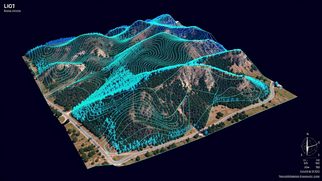
Point density: 50–200 pts/m²
Accuracy: 1–3 cm vertical
Sensor cost: $12K–$80K
Survey cost: $2,500–$15K+
What Are Drones and LiDAR?
To understand drones and LiDAR, it helps to separate the two components. A drone — technically an unmanned aerial vehicle or UAV — is the flying platform. It carries sensors, follows pre-programmed flight paths, and uses GPS to maintain precise positioning. LiDAR, which stands for Light Detection and Ranging, is the sensor the drone carries. The LiDAR unit fires hundreds of thousands of laser pulses per second in a scanning pattern below the drone. Each pulse hits a surface — a tree branch, a roof, the ground — and bounces back. The sensor measures the time of flight for each return, and combined with the drone's RTK or PK GPS position and the sensor's orientation (measured by an inertial measurement unit), the system calculates the precise 3D coordinates of every return point. The result is a point cloud: a dense cloud of millions or billions of 3D points representing everything the laser hit during the flight. What makes drones and LiDAR especially powerful together is vegetation penetration. Unlike a camera, which captures only the visible surface, laser pulses can slip through gaps in leaves and branches, reaching the ground beneath a forest canopy. Each pulse can generate multiple returns — the first return hits the treetop, a later return hits the ground — so a single flight captures the canopy surface, understory, and bare-earth terrain as separate, classifiable layers. This is something no other aerial technology can do at comparable cost and resolution. Drone-mounted LiDAR has become practical only recently. In 2020, a survey-grade LiDAR sensor weighed 10+ kg and required a large, expensive crewed aircraft or heavy-lift drone. By 2026, sensors weighing under 1 kg — like the DJI Zenmuse L2 at 920g — can be carried by a standard professional drone, and entry-level LiDAR units have dropped below $12,000. That price and weight convergence is why drones and LiDAR are now the fastest-growing segment of aerial data collection. For a focused deep dive on the drone-specific side, visit our LiDAR drone services page, or see our comprehensive LiDAR scanning services.
Bare-Earth Surface Generation
Drones and LiDAR together produce bare-earth digital terrain models in vegetated areas where photogrammetry fails. The laser pulses reach the ground through canopy gaps.
Multi-Layer Classification
A single LiDAR drone flight captures ground, understory, canopy, and man-made structures as separate classified layers — no need for multiple flights or sensors.
High Point Density at Low Cost
Drone-mounted LiDAR delivers 50 to 200 points per square meter at a fraction of the cost of crewed aircraft LiDAR, making high-density mapping accessible for site-scale projects.
All-Condition Operation
LiDAR drones operate in low light, at dawn or dusk, and under cloud cover — conditions where photogrammetry cannot capture usable imagery.
How Drones and LiDAR Work Together
The integration of drones and LiDAR involves three tightly coupled systems working in concert: the flight platform, the LiDAR sensor, and the post-processing pipeline. Each must be properly configured and calibrated for the final point cloud to meet engineering-grade accuracy standards.
The Drone Platform
Professional LiDAR drones like the DJI Matrice 350 RTK carry the sensor along pre-planned grid flight lines at 50 to 100 meters above ground level. RTK GPS provides real-time centimeter-level positioning, while an inertial measurement unit (IMU) records the drone's orientation 200+ times per second. Flight speed is typically 5 to 10 m/s, balancing point density with coverage efficiency.
The LiDAR Sensor
The sensor fires laser pulses — often 200,000 to 800,000 per second — in a scanning pattern that sweeps perpendicular to the flight direction. Each pulse can generate up to 3 to 5 returns, capturing canopy, understory, and ground. The sensor records return time, intensity, and scan angle for every point, data that feeds directly into classification algorithms.
Post-Processing
Raw LiDAR data is georeferenced using the drone's trajectory (GPS + IMU), then classified into ground, vegetation, and structure layers using algorithms like progressive TIN densification. Noise points are filtered, and final deliverables — classified LAS/LAZ files, DSM, DTM, contours — are exported and quality-checked against ground control points.
Why Choose AeriusView for Drone LiDAR
Flying a LiDAR sensor on a drone is significantly more complex than flying a camera. The sensor must be calibrated, the IMU must be aligned, the trajectory must be post-processed with survey-grade correction, and the point cloud classification requires specialized software and expertise. AeriusView handles all of this. We vet every LiDAR operator in our network for sensor experience and processing capability, require RTK or PPK GPS on every flight, and manage the full post-processing pipeline from raw data to classified, engineering-ready deliverables. We also maintain consistent quality standards across our network, so whether your project is in Oregon timberland or Texas pipeline corridors, you get the same accuracy, the same deliverable formats, and the same project management support. Our operators fly professional platforms — DJI Matrice 350 RTK with Zenmuse L2, Riegl miniVUX series, YellowScan Voyager — and deliver point clouds that meet ASPRS accuracy class requirements. See our LiDAR drone services for project specifics, or read our LiDAR vs photogrammetry comparison to determine if LiDAR is the right choice for your site.
Drones and LiDAR Use Cases & Industries
The combination of drones and LiDAR serves specialized applications where vegetation penetration, multi-layer classification, or engineering-grade accuracy are essential.
- Forestry inventory, biomass estimation, and canopy height mapping
- Transmission and pipeline corridor mapping with clearance analysis
- Floodplain modeling and hydrological surface generation
- Mining and quarry volume calculation and pit mapping
- Archaeological prospection beneath forest canopy
- Transportation corridor design and as-built verification
- Coastal erosion monitoring and shoreline change detection
- Urban canopy analysis and green infrastructure planning
FAQs About Drones and LiDAR
What is the difference between drones and LiDAR?
A drone is the platform — the unmanned aerial vehicle that carries sensors and flies a pre-planned route. LiDAR is the sensor — a Light Detection and Ranging unit that fires laser pulses to measure distances and build 3D point clouds. "Drones and LiDAR" refers to the combination: a UAV carrying a LiDAR sensor, which together enable low-cost, high-density aerial laser scanning at site scale.
How much does a drone LiDAR system cost?
A complete professional LiDAR drone package (drone + sensor + RTK GPS + processing software) ranges from $25,000 for entry-level setups to $120,000+ for survey-grade systems. Entry-level LiDAR sensors like the DJI Zenmuse L1 start around $12,000, while professional units like the Riegl miniVUX or YellowScan Voyager run $50,000 to $80,000.
When should I use drones and LiDAR vs photogrammetry?
Use drones and LiDAR when the site has vegetation and you need bare-earth ground models, when you need sub-centimeter vertical accuracy, when you need multi-layer classification, or when lighting conditions are poor. Use photogrammetry for open, vegetation-free sites in good lighting where visual detail and lower cost are priorities. Our LiDAR vs photogrammetry guide provides a full decision framework.
What point density can drone LiDAR achieve?
At typical flying heights of 50 to 100 meters above ground level, drone LiDAR systems deliver 50 to 200 points per square meter. Flying lower (20 to 50 m AGL) on smaller sites can achieve 500+ points per square meter for maximum detail. The tradeoff is coverage area — lower altitude means more flight lines and longer field time.
Can I hire a LiDAR drone operator through AeriusView?
Yes. AeriusView connects you with FAA-certified operators who own and operate professional-grade LiDAR drone systems. We handle flight planning, data collection, post-processing, and deliverable QA. Request a quote on our LiDAR drone services page or contact us directly.
Ready to Combine Drones and LiDAR?
Get matched with FAA-certified LiDAR drone operators. Engineering-grade point clouds, bare-earth models, and nationwide coverage.
Request a Quote