Aerial Mapping Glossary
80 essential terms every aerial mapping professional and client should know. From GSD and RTK to orthomosaic and point cloud, this is your reference for aerial mapping vocabulary.
Search by term or filter by category. Each definition links to relevant services where applicable.
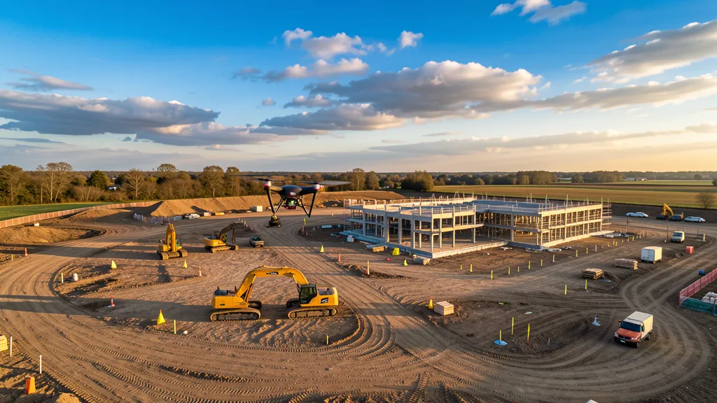
Aerial Mapping
GeneralThe process of collecting data from an airborne platform, typically a drone or aircraft, to create maps, 3D models, or inspect infrastructure. Drone-based aerial mapping flights are faster, cheaper, and safer than traditional ground-based data collection for large areas.
Aerial Triangulation
AT Photogrammetry & MappingThe process of calculating the position and orientation of each aerial photo in a dataset relative to ground control points. Aerial triangulation (AT) is a critical step in photogrammetry that ties the 3D model to real-world coordinates.
Agisoft Metashape
Photogrammetry & MappingA widely used photogrammetry software package that processes aerial images into orthomosaics, 3D models, and point clouds. Other popular options include Pix4D, DroneDeploy, and WebODM.
Altitude Above Ground Level
AGL GeneralThe height of the drone above the ground surface directly below it, not above sea level. AGL is the standard reference for flight planning because it determines image resolution (GSD) and legal compliance.
Bare-Earth Model
LiDAR & 3D ModelingA digital elevation model with all vegetation, buildings, and other surface objects removed, showing only the natural ground surface. Bare-earth models are typically produced from LiDAR data by classifying and removing non-ground points.
View Bare-Earth Model service →Bundled Adjustment
Photogrammetry & MappingAn optimization process in photogrammetry that simultaneously refines camera parameters, 3D point coordinates, and image positions to produce a consistent 3D reconstruction from multiple overlapping images.
Checkpoints
Photogrammetry & MappingGround control points that are not used in the processing of a photogrammetric model but are reserved to independently verify the accuracy of the final output. Checkpoints provide an unbiased measure of model quality.
Construction Monitoring
GeneralThe use of repeated aerial imaging flights over time to track construction progress. Orthomosaic maps and 3D models captured at regular intervals let project managers compare actual progress against plans, measure earthwork volumes, and document site conditions.
View Construction Monitoring service →Control Point
GPS & PositioningA physical marker on the ground with known coordinates, used to georeference aerial data. Ground control points (GCPs) are typically placed before a flight and measured with RTK GPS rovers to ensure survey-grade accuracy.
Digital Elevation Model
DEM Data & DeliverablesA 3D representation of terrain elevations as a raster grid. A DEM can represent either the bare earth (DTM) or the surface including objects (DSM). DEMs are used for contour generation, watershed analysis, and site planning.
View Digital Elevation Model service →Digital Surface Model
DSM Data & DeliverablesA digital elevation model that includes the tops of all surface features such as buildings, trees, and infrastructure. A DSM represents what the drone sees, while a DTM strips these features away to show only the ground.
Digital Terrain Model
DTM Data & DeliverablesA digital elevation model representing only the bare ground surface, with vegetation and structures removed. DTMs are essential for engineering design, flood modeling, and cut/fill calculations.
View Digital Terrain Model service →DroneDeploy
Photogrammetry & MappingA cloud-based drone mapping platform for flight planning, photogrammetric processing, and data sharing. DroneDeploy is popular in construction and agriculture for its ease of use and collaboration features.
DSM vs DTM
LiDAR & 3D ModelingA digital surface model (DSM) includes the tops of all objects on the terrain, while a digital terrain model (DTM) shows only the bare ground. The difference matters for engineering: a DSM would show a building on top of the ground, while a DTM shows the ground elevation beneath it.
View DSM vs DTM service →DJI Mavic 3 Enterprise
Sensors & EquipmentA popular enterprise drone for mapping and inspection, featuring a mechanical shutter, RTK compatibility, and a 4/3 CMOS sensor. The M3E is commonly used for topographic data collection projects, inspections, and photogrammetry missions.
FAA Part 107
Regulatory & SafetyThe FAA regulation governing commercial drone operations in the United States. Part 107 requires operators to pass an aeronautical knowledge test, register their drone, and follow operational rules including visual line-of-sight, daylight operations, and maximum altitude of 400 feet AGL.
View FAA Part 107 service →FAA Part 107.41
Regulatory & SafetyThe waiver provision under Part 107 that allows commercial drone operators to fly in controlled airspace near airports. Operators must obtain authorization through LAANC or the DroneZone portal before flying in Class B, C, D, or E surface airspace.
Flight Plan
GeneralA pre-programmed mission that tells the drone exactly where to fly, what altitude to maintain, how much overlap between photos, and what camera settings to use. Good flight planning is the foundation of accurate aerial mapping flights.
Forward Overlap
Photogrammetry & MappingThe percentage of image overlap between consecutive photos along the flight direction. Standard photogrammetry requires 75-85% forward overlap so that every point on the ground appears in at least three images for accurate 3D reconstruction.
Georeferencing
GPS & PositioningThe process of assigning real-world coordinates to aerial data so it aligns with known geographic reference systems. Georeferencing uses ground control points or direct georeferencing (RTK/PPK) to tie the model to a coordinate system like UTM or State Plane.
Ground Control Point
GCP GPS & PositioningA visible marker placed on the ground with precisely mapped coordinates. GCPs are identified in aerial photos during processing to anchor the 3D model in real-world space. The more GCPs used, the higher the absolute accuracy of the final model.
Buyer tip: GCPs add cost and time to your data collection because each point must be mapped on the ground. For most construction projects, 3-5 GCPs per 50 acres is sufficient. If your operator uses RTK, fewer GCPs are needed.
Ground Sample Distance
GSD Photogrammetry & MappingThe physical distance on the ground represented by one pixel in an aerial image, usually expressed in cm/px. A GSD of 2 cm/px means each pixel covers a 2x2 cm area. Lower GSD values mean higher resolution. GSD is determined by altitude, sensor size, and focal length.
Buyer tip: GSD directly determines your data collection cost. Lower GSD (higher resolution) requires flying lower or with a better camera, which takes more flight time. For construction sites, 2-3 cm/px is standard. For visual inspections, 5 cm/px is often sufficient.
Hyperspectral Imaging
Sensors & EquipmentA remote sensing technique that captures many narrow, contiguous spectral bands across the electromagnetic spectrum. Hyperspectral sensors can identify specific materials and compounds by their spectral signature, useful for mineral exploration and environmental analysis.
Image Overlap
Photogrammetry & MappingThe percentage by which consecutive aerial photos overlap, both forward (along the flight line) and side (between adjacent flight lines). Photogrammetry typically needs 75-85% forward overlap and 65-70% side overlap for reliable 3D reconstruction.
Interior Orientation
Photogrammetry & MappingThe process of establishing the geometric relationship between the camera sensor and the image, including focal length, principal point, and lens distortion. Interior orientation is the first step in photogrammetric processing.
Kinematic Positioning
GPS & PositioningA GPS/GNSS positioning method that uses carrier phase measurements from a base station and a rover to achieve centimeter-level accuracy in real time. RTK (real-time) and PPK (post-processed) are the two kinematic methods used in aerial imaging.
LiDAR
LiDAR LiDAR & 3D ModelingLight Detection and Ranging. A remote sensing method that uses laser pulses to measure distances to the ground. Drone-mounted LiDAR can penetrate vegetation canopy to produce bare-earth models, making it essential for aerial imaging forested or heavily vegetated terrain where photogrammetry fails.
View LiDAR service →Local Coordinates
GPS & PositioningA site-specific coordinate system that is not tied to a global or national reference frame. Local coordinates are sometimes used on construction sites for convenience but must be tied to known control points to integrate with broader data collection data.
Mechanical Shutter
Sensors & EquipmentA physical shutter mechanism in a camera that opens and closes to expose the sensor, as opposed to an electronic shutter. Mechanical shutters eliminate rolling shutter distortion, which is critical for accurate photogrammetry with moving drones.
Mesh
LiDAR & 3D ModelingA 3D surface representation composed of vertices, edges, and faces (typically triangles). Meshes are generated from point clouds and used for visualization, measurements, and export to CAD or BIM software.
Multispectral Imaging
Agriculture & EnvironmentalA remote sensing technique that captures images in multiple discrete spectral bands, including visible and near-infrared light. Multispectral sensors on drones are used for crop health analysis, NDVI mapping, and environmental monitoring.
View Multispectral Imaging service →Nadir Image
Photogrammetry & MappingAn aerial photo taken with the camera pointing straight down (90 degrees below horizontal). Nadir images are the standard capture angle for photogrammetric mapping. Oblique images, taken at an angle, are sometimes added for improved 3D reconstruction of vertical surfaces.
Normalized Difference Vegetation Index
NDVI Agriculture & EnvironmentalA widely used vegetation health index calculated from near-infrared and red light reflectance. NDVI values range from -1 to 1, with healthy vegetation typically scoring 0.6 to 0.9. Drone-mounted multispectral sensors produce NDVI maps for precision agriculture.
View Normalized Difference Vegetation Index service →Oblique Imagery
Photogrammetry & MappingAerial photos captured at an angle rather than straight down. Oblique images improve 3D reconstruction of building facades, cliff faces, and other vertical surfaces that nadir-only missions miss.
Orthomosaic
Data & DeliverablesA geometrically corrected, georeferenced aerial image created by stitching many individual photos into a single seamless map. Unlike a raw aerial photo, an orthomosaic has uniform scale throughout, meaning measurements taken on it are accurate like a map.
Buyer tip: The orthomosaic is the most common deliverable you will receive. You can measure distances and areas directly on it. Ask your operator for GeoTIFF format if you need to import it into GIS or CAD software.
Overlap
Photogrammetry & MappingThe amount by which adjacent aerial photos share the same ground area. High overlap (75-85% forward, 65-70% side) is required for photogrammetry so that software can match features across multiple images to build accurate 3D models.
Phantom 4 RTK
P4 RTK Sensors & EquipmentA DJI drone designed specifically for mapping, featuring an integrated RTK module for centimeter-level positioning without ground control points. The P4 RTK is popular for survey-grade photogrammetry due to its accuracy and relatively low cost.
Photogrammetry
Photogrammetry & MappingThe science of making reliable measurements from photographs. In aerial imaging, photogrammetry software processes hundreds of overlapping aerial images to produce orthomosaics, 3D models, point clouds, and digital elevation models.
Pix4D
Photogrammetry & MappingA professional photogrammetry software suite used to process drone imagery into maps, 3D models, and data collection deliverables. Pix4D is known for its survey-grade accuracy and is widely used in construction, mining, and agriculture.
Point Cloud
LiDAR & 3D ModelingA set of data points in 3D space representing the external surface of an object or terrain. Point clouds are the raw output of LiDAR and photogrammetry processing. Each point has X, Y, Z coordinates and may include color, intensity, or classification data.
Point Density
LiDAR & 3D ModelingThe number of LiDAR points per unit area, typically expressed as points per square meter. Higher point density produces more detailed models but requires slower flight speeds or lower altitudes. Survey-grade LiDAR typically needs 50-200 points per square meter.
View Point Density service →Post-Processed Kinematic
PPK GPS & PositioningA GPS positioning method where raw satellite data is logged during the flight and corrected afterward using base station data. PPK often achieves slightly higher accuracy than RTK because it can use more sophisticated post-processing algorithms.
PPK vs RTK
GPS & PositioningBoth achieve centimeter-level accuracy. RTK applies corrections in real time during flight, which is convenient but requires a live data link. PPK logs data during flight and applies corrections afterward, offering slightly higher reliability and accuracy because it is not dependent on a stable radio link during the mission.
Real-Time Kinematic
RTK GPS & PositioningA GPS/GNSS positioning technique that provides centimeter-level accuracy in real time by applying corrections from a base station or network during the flight. RTK enables direct georeferencing, reducing or eliminating the need for ground control points.
Buyer tip: RTK adds about $200-500 to aerial imaging cost but eliminates the need for most ground control points. If your project needs centimeter-level accuracy, RTK is worth it. For visual inspections or progress monitoring, standard GPS is fine.
Relative Accuracy
Photogrammetry & MappingThe accuracy of measurements between points within a 3D model, independent of their absolute position in the real world. A model can have high relative accuracy (internal dimensions are correct) but low absolute accuracy (the whole model is shifted from its true position).
Remote Pilot Certificate
Regulatory & SafetyThe FAA certification required to operate a drone commercially in the United States under Part 107. To obtain the certificate, a pilot must pass the initial aeronautical knowledge test and recurrent training every 24 calendar months.
View Remote Pilot Certificate service →Resolution
Photogrammetry & MappingThe level of detail in an aerial image or derived product, typically measured as ground sample distance (GSD) in cm/px. Lower GSD means higher resolution. For topographic data collection projects, 2-5 cm/px is standard. For inspections, sub-cm GSD may be required.
LiDAR Return
LiDAR & 3D ModelingIn LiDAR, a single laser pulse can produce multiple returns as it reflects off different surfaces (canopy, understory, ground). The number and distribution of returns indicate vegetation density and structure, which is valuable for forestry and biomass estimation.
View LiDAR Return service →Rolling Shutter
Sensors & EquipmentA camera shutter method where the sensor is exposed line by line rather than all at once. Rolling shutter can cause geometric distortion (jello effect) in images taken from a moving drone, which degrades photogrammetric accuracy. Mechanical or global shutters avoid this problem.
Side Overlap
Photogrammetry & MappingThe percentage of image overlap between adjacent flight lines (parallel flight paths). Standard photogrammetry requires 65-70% side overlap to ensure features appear in multiple image rows for robust 3D reconstruction.
Structure from Motion
SfM Photogrammetry & MappingThe photogrammetric technique of estimating 3D structure from a sequence of 2D images taken from different positions. SfM is the core algorithm behind modern drone mapping software, automatically matching features across overlapping photos to build 3D models.
Swath
Photogrammetry & MappingThe width of ground area covered by a single flight line, determined by altitude, sensor field of view, and image overlap. Wider swaths mean fewer flight lines to cover a site, but higher altitude means lower resolution.
Texture Map
LiDAR & 3D ModelingAn image applied to the surface of a 3D mesh to give it realistic appearance. In aerial imaging, the orthomosaic is draped over the 3D mesh to create a photorealistic 3D model of the mapped area.
Thermal Imaging
Sensors & EquipmentA remote sensing technique that captures infrared radiation to visualize temperature differences. Drone-mounted thermal sensors are used for roof inspections, solar panel diagnostics, electrical inspections, and animal aerial imaging flights.
View Thermal Imaging service →Tie Points
Photogrammetry & MappingFeatures in overlapping aerial images that photogrammetry software automatically matches to connect the images and build a 3D model. Tie points are distinct from ground control points, which have known real-world coordinates.
topographic data collection
GeneralA data collection that maps the elevation and features of a land surface, including natural terrain and man-made structures. Drone-based topographic data collection projects produce contour maps, DEMs, and 3D terrain models for construction, engineering, and land development.
View topographic data collection service →UTM Coordinates
UTM GPS & PositioningThe Universal Transverse Mercator coordinate system, a global grid that divides Earth into 60 zones. UTM is commonly used in aerial imaging because it provides distance in meters, making area and volume calculations straightforward.
Visual Line of Sight
VLOS Regulatory & SafetyThe FAA requirement that a remote pilot can see the drone with unaided vision (no binoculars) at all times during flight. VLOS is a core Part 107 rule. Flying beyond VLOS requires a waiver from the FAA.
Volume Calculation
Data & DeliverablesThe process of measuring the volume of a 3D object or surface feature from aerial imaging data. Common applications include stockpile inventory, cut/fill analysis for earthwork, and pit volume tracking in mining.
View Volume Calculation service → Estimate your volume aerial imaging costWebODM
Photogrammetry & MappingOpen Drone Map, a free, open-source photogrammetry toolkit for processing aerial images into orthomosaics, point clouds, and 3D models. WebODM is popular among operators who want full control over processing without subscription fees.
WingtraOne
Sensors & EquipmentA VTOL (vertical takeoff and landing) mapping drone that combines quadcopter hover capability with fixed-wing efficiency. The WingtraOne can cover large areas (up to 290 hectares per flight) while taking off and landing in tight spaces.
WingtraHub
Photogrammetry & MappingWingtra's cloud-based post-processing software that converts raw aerial imagery into PPK-corrected, georeferenced data ready for photogrammetric processing in Pix4D, Metashape, or other software.
Yaw
GeneralThe rotation of the drone around its vertical axis, controlling the direction the camera faces. In automated mapping missions, yaw is managed by the flight controller to ensure the camera consistently points along the flight line.
ZTM Altitude
ZTM GeneralAltitude above the home takeoff point, also called home-point altitude or relative altitude. ZTM is used by flight planning software to maintain consistent altitude over rolling terrain, though it does not account for elevation changes across the data collection area.
Beyond Visual Line of Sight
BVLOS Regulatory & SafetyOperating a drone beyond the pilot's unaided visual range. BVLOS operations require a special FAA waiver under Part 107 and are typically used for long-distance infrastructure inspections, pipeline aerial imaging flights, and large-area mapping. Most standard aerial imaging flights are flown within VLOS.
Contour Map
Data & DeliverablesA 2D map representation of terrain elevation using lines of constant elevation (contour lines). Closely spaced lines indicate steep slopes; widely spaced lines indicate gentle terrain. Contour maps are a standard deliverable for topographic data collection projects and are used for site planning, grading design, and drainage analysis.
View Contour Map service →Cut and Fill Analysis
Data & DeliverablesThe process of comparing two elevation surfaces (existing ground vs proposed design) to calculate how much material needs to be cut (removed) and filled (added) on a construction site. Drone data collection projects produce the existing-ground surface, and CAD software computes the cut/fill volumes against the design surface.
View Cut and Fill Analysis service →Aerial Imaging vs traditional ground-based method
GeneralDrone data collection projects are 50-70% cheaper and 10-50x faster than traditional ground-based data collection for sites over 5 acres. A drone can cover 50-100 acres per hour versus 1-2 acres per hour on foot. However, traditional data collection projects still excel at boundary determination, legal property corners, and high-accuracy control networks. Many projects combine both: drone for topographic data, traditional surveyor for legal boundaries.
Buyer tip: If your project involves legal property boundaries, you need a licensed land surveyor. For topographic data, stockpile volumes, or construction monitoring, an aerial imaging is faster and cheaper.
EXIF Data
EXIF Data & DeliverablesMetadata embedded in each aerial photo by the drone's camera, including GPS coordinates, timestamp, altitude, camera settings, and orientation. Photogrammetry software reads EXIF data to position each image in 3D space before matching features across overlapping photos.
Geotagging
GPS & PositioningThe process of assigning GPS coordinates to each aerial photo, either during capture (via the drone's GPS) or during post-processing (via PPK). Geotagged images enable direct georeferencing, reducing or eliminating the need for ground control points.
LiDAR vs Photogrammetry
Photogrammetry & MappingThe two main methods for generating 3D models from drone data. Photogrammetry uses overlapping RGB photos and is cheaper, higher visual detail, and works well for open terrain. LiDAR uses laser pulses and costs 2-3x more but penetrates vegetation canopy to produce bare-ground models. Choose photogrammetry for open sites, construction monitoring, and inspections. Choose LiDAR for forested terrain, vegetation-heavy sites, or when bare-earth accuracy is critical.
View LiDAR vs Photogrammetry service →Buyer tip: If your site has heavy tree cover, you need LiDAR. If it is open land or a construction site, photogrammetry is cheaper and gives better visual detail.
Orthorectification
Photogrammetry & MappingThe process of correcting an aerial image for lens distortion, camera tilt, and terrain relief so that it has uniform scale throughout, like a map. Orthorectification is what turns raw aerial photos into a measurable orthomosaic where every pixel represents the same ground distance.
Point Cloud Classification
LiDAR & 3D ModelingThe process of categorizing each point in a LiDAR point cloud by surface type: ground, vegetation, buildings, water, or noise. Classification is essential for producing bare-earth models (removing vegetation points) and for extracting building footprints or tree heights.
View Point Cloud Classification service →RTK vs PPK
GPS & PositioningBoth achieve centimeter-level accuracy. RTK applies corrections in real time during flight, which is convenient but requires a live data link. PPK logs data during flight and applies corrections afterward, offering slightly higher reliability and accuracy because it is not dependent on a stable radio link during the mission. Most survey-grade drone operators offer both.
Buyer tip: You do not need to choose. Your operator will select the right method for your site conditions. Both produce survey-grade results.
stockpile volume estimates
Data & Deliverablesan aerial imaging specifically conducted to measure the volume of material stockpiles (sand, gravel, aggregate, topsoil, ore). The drone captures aerial data, software generates a 3D surface model, and volume calculations are performed for each pile. Results are typically reported in cubic yards or tons, with material density applied for weight estimates.
View stockpile volume estimates service → Calculate your stockpile volumeSurvey-Grade Accuracy
GPS & PositioningPositional accuracy of 1-3 centimeters, sufficient for engineering design, construction staking, and regulatory submissions. Survey-grade accuracy requires RTK or PPK positioning, ground control points, and proper processing. Standard aerial imaging flights without RTK/GCPs achieve 2-5 meters accuracy (mapping-grade), suitable for visualization but not measurement.
Buyer tip: If you need cut/fill volumes, contour lines, or engineering-quality data, ask for RTK or GCPs. If you just need a visual overview, standard accuracy is fine and cheaper.
TIN (Triangulated Irregular Network)
TIN LiDAR & 3D ModelingA 3D surface model made of irregularly spaced triangles connecting known elevation points. TINs are the standard format for terrain representation in CAD and GIS software. aerial imaging data is often exported as a TIN for integration with engineering design tools like Civil 3D.
View TIN (Triangulated Irregular Network) service →Vertical Accuracy
Photogrammetry & MappingThe accuracy of elevation values in an aerial imaging model, typically 1-3 times the ground sample distance (GSD). For example, at 3 cm/px GSD, vertical accuracy is approximately 3-9 cm. Vertical accuracy is critical for cut/fill calculations, drainage design, and volume estimation. It is verified using independent checkpoints.
Buyer tip: For construction projects, vertical accuracy of 5-10 cm is typically sufficient. For detailed grading or drainage design, ask for 3-5 cm accuracy.
No terms found matching your search.
General
The process of collecting data from an airborne platform, typically a drone or aircraft, to create maps, 3D models, or inspect infrastructure. Drone-based aerial mapping flights are faster, cheaper, a...
The height of the drone above the ground surface directly below it, not above sea level. AGL is the standard reference for flight planning because it determines image resolution (GSD) and legal compli...
The use of repeated aerial imaging flights over time to track construction progress. Orthomosaic maps and 3D models captured at regular intervals let project managers compare actual progress against p...
A pre-programmed mission that tells the drone exactly where to fly, what altitude to maintain, how much overlap between photos, and what camera settings to use. Good flight planning is the foundation ...
A data collection that maps the elevation and features of a land surface, including natural terrain and man-made structures. Drone-based topographic data collection projects produce contour maps, DEMs...
The rotation of the drone around its vertical axis, controlling the direction the camera faces. In automated mapping missions, yaw is managed by the flight controller to ensure the camera consistently...
Altitude above the home takeoff point, also called home-point altitude or relative altitude. ZTM is used by flight planning software to maintain consistent altitude over rolling terrain, though it doe...
Drone data collection projects are 50-70% cheaper and 10-50x faster than traditional ground-based data collection for sites over 5 acres. A drone can cover 50-100 acres per hour versus 1-2 acres per h...
Photogrammetry & Mapping
The process of calculating the position and orientation of each aerial photo in a dataset relative to ground control points. Aerial triangulation (AT) is a critical step in photogrammetry that ties th...
A widely used photogrammetry software package that processes aerial images into orthomosaics, 3D models, and point clouds. Other popular options include Pix4D, DroneDeploy, and WebODM.
An optimization process in photogrammetry that simultaneously refines camera parameters, 3D point coordinates, and image positions to produce a consistent 3D reconstruction from multiple overlapping i...
Ground control points that are not used in the processing of a photogrammetric model but are reserved to independently verify the accuracy of the final output. Checkpoints provide an unbiased measure ...
A cloud-based drone mapping platform for flight planning, photogrammetric processing, and data sharing. DroneDeploy is popular in construction and agriculture for its ease of use and collaboration fea...
The percentage of image overlap between consecutive photos along the flight direction. Standard photogrammetry requires 75-85% forward overlap so that every point on the ground appears in at least thr...
The physical distance on the ground represented by one pixel in an aerial image, usually expressed in cm/px. A GSD of 2 cm/px means each pixel covers a 2x2 cm area. Lower GSD values mean higher resolu...
The percentage by which consecutive aerial photos overlap, both forward (along the flight line) and side (between adjacent flight lines). Photogrammetry typically needs 75-85% forward overlap and 65-7...
The process of establishing the geometric relationship between the camera sensor and the image, including focal length, principal point, and lens distortion. Interior orientation is the first step in ...
An aerial photo taken with the camera pointing straight down (90 degrees below horizontal). Nadir images are the standard capture angle for photogrammetric mapping. Oblique images, taken at an angle, ...
Aerial photos captured at an angle rather than straight down. Oblique images improve 3D reconstruction of building facades, cliff faces, and other vertical surfaces that nadir-only missions miss.
The amount by which adjacent aerial photos share the same ground area. High overlap (75-85% forward, 65-70% side) is required for photogrammetry so that software can match features across multiple ima...
The science of making reliable measurements from photographs. In aerial imaging, photogrammetry software processes hundreds of overlapping aerial images to produce orthomosaics, 3D models, point cloud...
A professional photogrammetry software suite used to process drone imagery into maps, 3D models, and data collection deliverables. Pix4D is known for its survey-grade accuracy and is widely used in co...
The accuracy of measurements between points within a 3D model, independent of their absolute position in the real world. A model can have high relative accuracy (internal dimensions are correct) but l...
The level of detail in an aerial image or derived product, typically measured as ground sample distance (GSD) in cm/px. Lower GSD means higher resolution. For topographic data collection projects, 2-5...
The percentage of image overlap between adjacent flight lines (parallel flight paths). Standard photogrammetry requires 65-70% side overlap to ensure features appear in multiple image rows for robust ...
The photogrammetric technique of estimating 3D structure from a sequence of 2D images taken from different positions. SfM is the core algorithm behind modern drone mapping software, automatically matc...
The width of ground area covered by a single flight line, determined by altitude, sensor field of view, and image overlap. Wider swaths mean fewer flight lines to cover a site, but higher altitude mea...
Features in overlapping aerial images that photogrammetry software automatically matches to connect the images and build a 3D model. Tie points are distinct from ground control points, which have know...
Open Drone Map, a free, open-source photogrammetry toolkit for processing aerial images into orthomosaics, point clouds, and 3D models. WebODM is popular among operators who want full control over pro...
Wingtra's cloud-based post-processing software that converts raw aerial imagery into PPK-corrected, georeferenced data ready for photogrammetric processing in Pix4D, Metashape, or other software.
The two main methods for generating 3D models from drone data. Photogrammetry uses overlapping RGB photos and is cheaper, higher visual detail, and works well for open terrain. LiDAR uses laser pulses...
The process of correcting an aerial image for lens distortion, camera tilt, and terrain relief so that it has uniform scale throughout, like a map. Orthorectification is what turns raw aerial photos i...
The accuracy of elevation values in an aerial imaging model, typically 1-3 times the ground sample distance (GSD). For example, at 3 cm/px GSD, vertical accuracy is approximately 3-9 cm. Vertical accu...
LiDAR & 3D Modeling
A digital elevation model with all vegetation, buildings, and other surface objects removed, showing only the natural ground surface. Bare-earth models are typically produced from LiDAR data by classi...
A digital surface model (DSM) includes the tops of all objects on the terrain, while a digital terrain model (DTM) shows only the bare ground. The difference matters for engineering: a DSM would show ...
Light Detection and Ranging. A remote sensing method that uses laser pulses to measure distances to the ground. Drone-mounted LiDAR can penetrate vegetation canopy to produce bare-earth models, making...
A 3D surface representation composed of vertices, edges, and faces (typically triangles). Meshes are generated from point clouds and used for visualization, measurements, and export to CAD or BIM soft...
A set of data points in 3D space representing the external surface of an object or terrain. Point clouds are the raw output of LiDAR and photogrammetry processing. Each point has X, Y, Z coordinates a...
The number of LiDAR points per unit area, typically expressed as points per square meter. Higher point density produces more detailed models but requires slower flight speeds or lower altitudes. Surve...
In LiDAR, a single laser pulse can produce multiple returns as it reflects off different surfaces (canopy, understory, ground). The number and distribution of returns indicate vegetation density and s...
An image applied to the surface of a 3D mesh to give it realistic appearance. In aerial imaging, the orthomosaic is draped over the 3D mesh to create a photorealistic 3D model of the mapped area.
The process of categorizing each point in a LiDAR point cloud by surface type: ground, vegetation, buildings, water, or noise. Classification is essential for producing bare-earth models (removing veg...
A 3D surface model made of irregularly spaced triangles connecting known elevation points. TINs are the standard format for terrain representation in CAD and GIS software. aerial imaging data is often...
GPS & Positioning
A physical marker on the ground with known coordinates, used to georeference aerial data. Ground control points (GCPs) are typically placed before a flight and measured with RTK GPS rovers to ensure s...
The process of assigning real-world coordinates to aerial data so it aligns with known geographic reference systems. Georeferencing uses ground control points or direct georeferencing (RTK/PPK) to tie...
A visible marker placed on the ground with precisely mapped coordinates. GCPs are identified in aerial photos during processing to anchor the 3D model in real-world space. The more GCPs used, the high...
A GPS/GNSS positioning method that uses carrier phase measurements from a base station and a rover to achieve centimeter-level accuracy in real time. RTK (real-time) and PPK (post-processed) are the t...
A site-specific coordinate system that is not tied to a global or national reference frame. Local coordinates are sometimes used on construction sites for convenience but must be tied to known control...
A GPS positioning method where raw satellite data is logged during the flight and corrected afterward using base station data. PPK often achieves slightly higher accuracy than RTK because it can use m...
Both achieve centimeter-level accuracy. RTK applies corrections in real time during flight, which is convenient but requires a live data link. PPK logs data during flight and applies corrections after...
A GPS/GNSS positioning technique that provides centimeter-level accuracy in real time by applying corrections from a base station or network during the flight. RTK enables direct georeferencing, reduc...
The Universal Transverse Mercator coordinate system, a global grid that divides Earth into 60 zones. UTM is commonly used in aerial imaging because it provides distance in meters, making area and volu...
The process of assigning GPS coordinates to each aerial photo, either during capture (via the drone's GPS) or during post-processing (via PPK). Geotagged images enable direct georeferencing, reducing ...
Both achieve centimeter-level accuracy. RTK applies corrections in real time during flight, which is convenient but requires a live data link. PPK logs data during flight and applies corrections after...
Positional accuracy of 1-3 centimeters, sufficient for engineering design, construction staking, and regulatory submissions. Survey-grade accuracy requires RTK or PPK positioning, ground control point...
Regulatory & Safety
The FAA regulation governing commercial drone operations in the United States. Part 107 requires operators to pass an aeronautical knowledge test, register their drone, and follow operational rules in...
The waiver provision under Part 107 that allows commercial drone operators to fly in controlled airspace near airports. Operators must obtain authorization through LAANC or the DroneZone portal before...
The FAA certification required to operate a drone commercially in the United States under Part 107. To obtain the certificate, a pilot must pass the initial aeronautical knowledge test and recurrent t...
The FAA requirement that a remote pilot can see the drone with unaided vision (no binoculars) at all times during flight. VLOS is a core Part 107 rule. Flying beyond VLOS requires a waiver from the FA...
Operating a drone beyond the pilot's unaided visual range. BVLOS operations require a special FAA waiver under Part 107 and are typically used for long-distance infrastructure inspections, pipeline ae...
Data & Deliverables
A 3D representation of terrain elevations as a raster grid. A DEM can represent either the bare earth (DTM) or the surface including objects (DSM). DEMs are used for contour generation, watershed anal...
A digital elevation model that includes the tops of all surface features such as buildings, trees, and infrastructure. A DSM represents what the drone sees, while a DTM strips these features away to s...
A digital elevation model representing only the bare ground surface, with vegetation and structures removed. DTMs are essential for engineering design, flood modeling, and cut/fill calculations.
A geometrically corrected, georeferenced aerial image created by stitching many individual photos into a single seamless map. Unlike a raw aerial photo, an orthomosaic has uniform scale throughout, me...
The process of measuring the volume of a 3D object or surface feature from aerial imaging data. Common applications include stockpile inventory, cut/fill analysis for earthwork, and pit volume trackin...
A 2D map representation of terrain elevation using lines of constant elevation (contour lines). Closely spaced lines indicate steep slopes; widely spaced lines indicate gentle terrain. Contour maps ar...
The process of comparing two elevation surfaces (existing ground vs proposed design) to calculate how much material needs to be cut (removed) and filled (added) on a construction site. Drone data coll...
Metadata embedded in each aerial photo by the drone's camera, including GPS coordinates, timestamp, altitude, camera settings, and orientation. Photogrammetry software reads EXIF data to position each...
an aerial imaging specifically conducted to measure the volume of material stockpiles (sand, gravel, aggregate, topsoil, ore). The drone captures aerial data, software generates a 3D surface model, an...
Sensors & Equipment
A popular enterprise drone for mapping and inspection, featuring a mechanical shutter, RTK compatibility, and a 4/3 CMOS sensor. The M3E is commonly used for topographic data collection projects, insp...
A remote sensing technique that captures many narrow, contiguous spectral bands across the electromagnetic spectrum. Hyperspectral sensors can identify specific materials and compounds by their spectr...
A physical shutter mechanism in a camera that opens and closes to expose the sensor, as opposed to an electronic shutter. Mechanical shutters eliminate rolling shutter distortion, which is critical fo...
A DJI drone designed specifically for mapping, featuring an integrated RTK module for centimeter-level positioning without ground control points. The P4 RTK is popular for survey-grade photogrammetry ...
A camera shutter method where the sensor is exposed line by line rather than all at once. Rolling shutter can cause geometric distortion (jello effect) in images taken from a moving drone, which degra...
A remote sensing technique that captures infrared radiation to visualize temperature differences. Drone-mounted thermal sensors are used for roof inspections, solar panel diagnostics, electrical inspe...
A VTOL (vertical takeoff and landing) mapping drone that combines quadcopter hover capability with fixed-wing efficiency. The WingtraOne can cover large areas (up to 290 hectares per flight) while tak...
Agriculture & Environmental
A remote sensing technique that captures images in multiple discrete spectral bands, including visible and near-infrared light. Multispectral sensors on drones are used for crop health analysis, NDVI ...
A widely used vegetation health index calculated from near-infrared and red light reflectance. NDVI values range from -1 to 1, with healthy vegetation typically scoring 0.6 to 0.9. Drone-mounted multi...
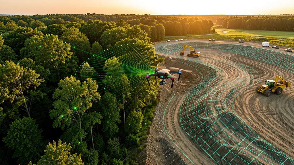
LiDAR and photogrammetry are two of the most important data capture methods in aerial mapping — see the full definitions below.
Common Aerial Mapping Questions
What GSD do I need for my aerial imaging?
For construction sites and topographic data collection, 2-3 cm/px GSD is standard. For visual inspections or progress monitoring, 5 cm/px is often sufficient. For detailed engineering work, ask for 1-2 cm/px. Lower GSD means higher resolution but requires more flight time, increasing cost.
Do I need RTK or PPK for my aerial imaging?
If you need centimeter-level accuracy for engineering design, cut/fill volumes, or regulatory submissions, you need RTK or PPK. Both achieve 1-3 cm accuracy. For visual inspections or progress monitoring, standard GPS accuracy (2-5 meters) is sufficient and cheaper. See RTK vs PPK comparison →
What is the difference between a DSM, DTM, and DEM?
DSM (Digital Surface Model) includes everything above ground: trees, buildings, vehicles. DTM (Digital Terrain Model) strips vegetation and structures to show bare ground. DEM (Digital Elevation Model) is the general term for any raster elevation model. For construction and grading, you want a DTM. For visualization and obstruction analysis, a DSM is more useful.
Should I choose LiDAR or photogrammetry for my project?
Choose photogrammetry for open terrain, construction sites, and inspections. It is cheaper and produces higher visual detail. Choose LiDAR for forested or vegetation-heavy sites where you need bare-ground elevation data. See full comparison →
How accurate are aerial imaging methods compared to traditional ground methods?
Drone aerial imaging with RTK or PPK achieves 1-3 cm horizontal and 3-9 cm vertical accuracy, comparable to traditional ground methods for topographic data. However, traditional ground methods by a licensed land surveyor are still required for legal property boundaries. See full comparison →
What deliverables do I get from aerial imaging?
Common deliverables include an orthomosaic (georeferenced aerial map), point cloud (3D data), DEM/DSM/DTM (elevation models), contour maps, and a 3D mesh model. For volumetric data collection, you also get stockpile volume reports. Most operators deliver data in standard formats (GeoTIFF, LAS/LAZ, DXF, PDF) compatible with GIS and CAD software.
Related Resources
Aerial Imaging Cost Calculator
Estimate aerial imaging costs by service type, acreage, and state.
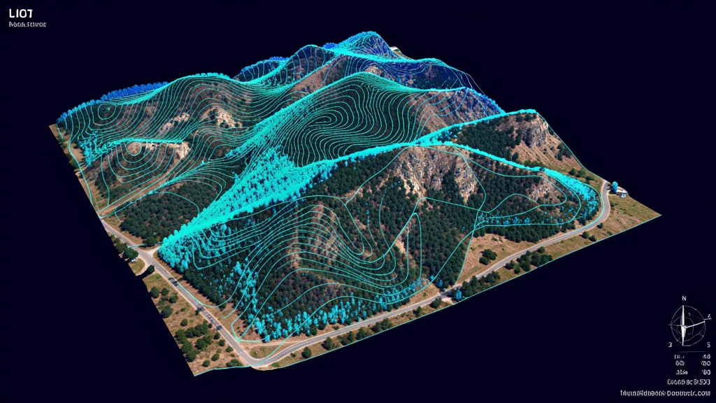
Topographic Data Collection
High-resolution terrain data for construction and engineering.
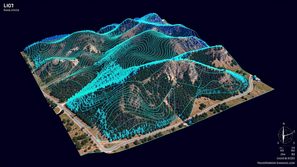
LiDAR Scanning
Precision 3D models with LiDAR for vegetation penetration.

For Drone Operators
Join our network and get matched with local projects.
Find Local Drone Operators
Browse 625+ cities with local FAA-certified operators.
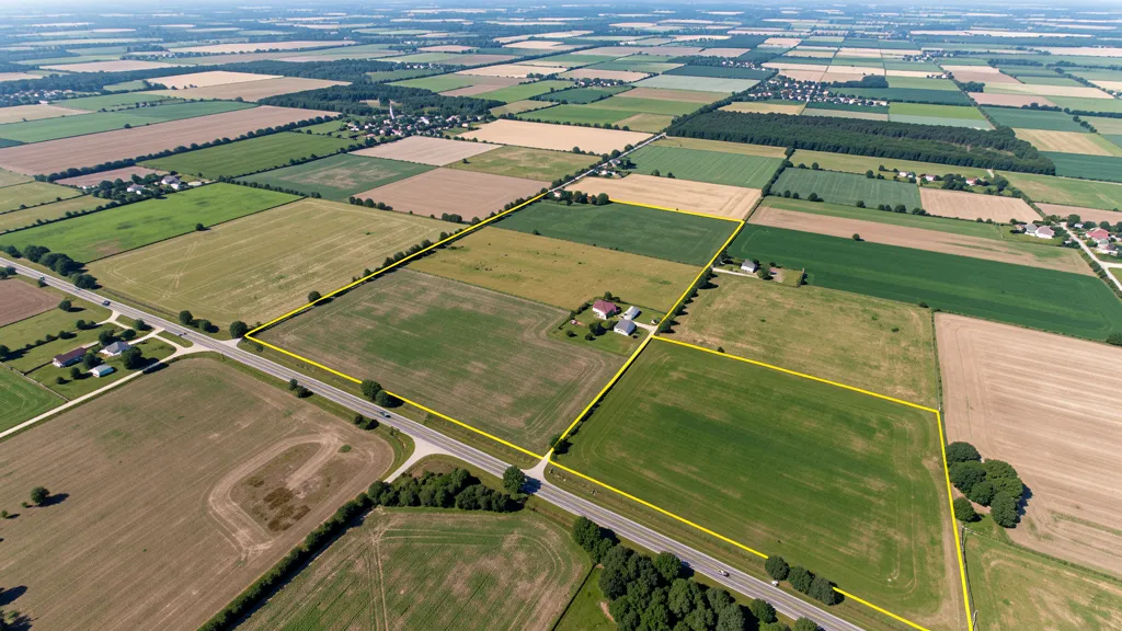
All Services
11 aerial data service categories for any project.
How It Works
Submit, get matched, compare quotes. Three simple steps.
FAQ
Common questions about aerial data services.
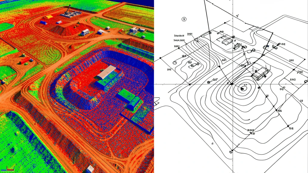
Aerial mapping produces a rich set of deliverables — the glossary above explains each format in detail.
Need Aerial Data Acquisition?
Get 3 free quotes from FAA-certified local operators. No cost, no obligation.
Get Free Quotes