Volumetric Analysis
Accurate stockpile volume measurement, cut/fill calculations, and aggregate inventory tracking — powered by drone photogrammetry. Get precise volumetric data without the safety risks and downtime of manual stockpile surveys.
Request a Survey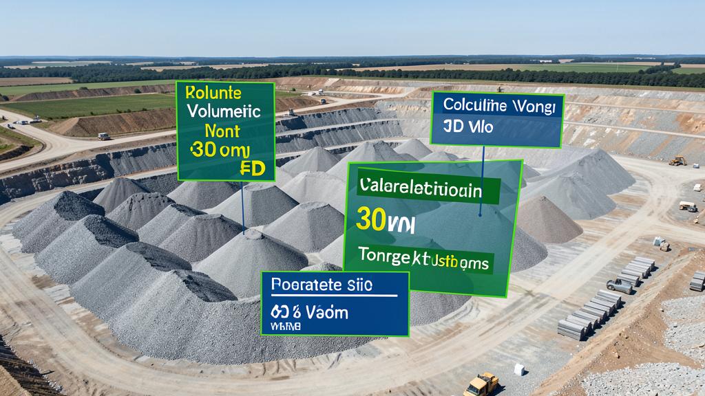
Cost range: $$800 – $$3,000
Turnaround: 1–3 business days
Coverage: Entire site per flight
Accuracy: 2–5% on volumes
Why Drone Volumetric Analysis?
Drone-based volume measurement eliminates the need to climb stockpiles or send surveyors into active work zones — all while delivering results comparable to traditional methods.
Precise Volume Calculations
Drone photogrammetry delivers stockpile and stockyard volume measurements with 2-5% accuracy — comparable to traditional methods at a fraction of the cost.
Safer Than Ground Surveys
No climbing stockpiles or navigating active construction zones. Drones capture all measurements from the air, keeping crews safe.
Fast Turnaround
Fly a site in under an hour and receive volume calculations within 1-3 business days. Perfect for monthly inventory reporting.
Cut/Fill Analysis
Compare surface models over time to track earthwork progress, calculate cut/fill volumes, and verify contractor quantities.
Common Use Cases
- Stockpile volume measurement for aggregate suppliers and quarries
- Cut/fill calculations for earthwork and grading contractors
- Monthly inventory audits for concrete, asphalt, and mulch yards
- Landfill and waste facility volume tracking for compliance reporting
- Mine and quarry material extraction volume tracking
- Construction site earthwork progress monitoring and verification
Volumetric Analysis FAQs
How accurate are drone-based volumetric calculations?
Drone photogrammetry typically achieves 2-5% accuracy on stockpile volumes when using proper ground control points and RTK/PPK GPS correction. For projects requiring higher precision, we can combine drone data with ground survey checkpoints to validate results.
What deliverables do I receive with a volumetric analysis?
Standard deliverables include a 3D point cloud, digital surface model (DSM), orthomosaic map, per-stockpile volume report with tonnage estimates (when bulk density is provided), and a comparison report showing changes over time if multiple surveys are conducted.
How often should I get stockpile surveys?
Most aggregate and construction clients schedule monthly surveys for inventory tracking. Some require quarterly audits for financial reporting, while active construction sites may benefit from bi-weekly or even weekly surveys to monitor earthwork progress.
Can you estimate tonnage from drone volume measurements?
Yes. When you provide the bulk density of your material (e.g., crushed stone, sand, gravel, asphalt), we convert measured volumes into tonnage estimates. This is commonly used for inventory valuation and sales reconciliation.
Ready to Measure Your Stockpiles?
Get matched with a local, FAA-certified surveyor. No cost, no obligation.
Request a Survey