Roof Inspection in Aurora, CO
Drone roof inspections with high-resolution imagery and 3D modeling. Identify damage, assess condition, and generate detailed reports for insurance and maintenance.
Serving Arapahoe County & the Denver-Aurora-Lakewood MSA area
Request a Free Quote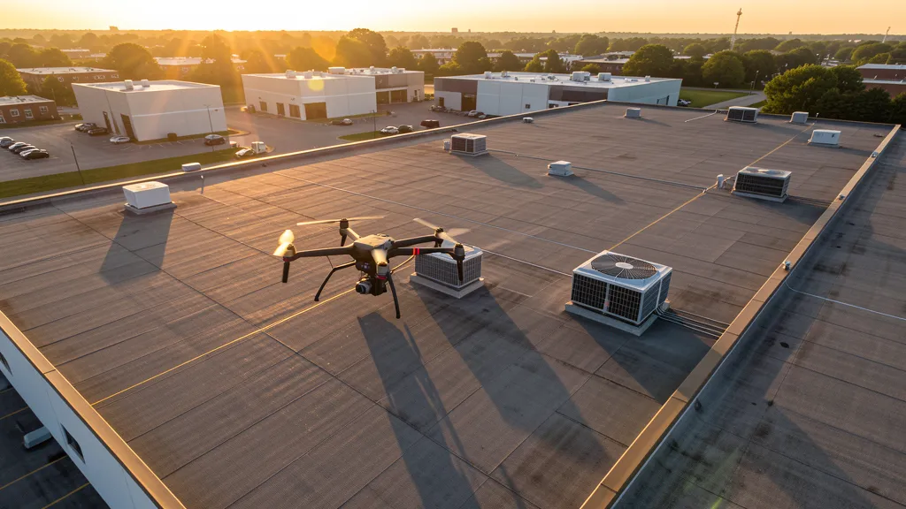
Get Matched With a Local Operator
Roof Inspection Pricing in Aurora, CO
Low End
$400
High End
$1,400
Turnaround
1-3 days
Cost ranges are based on market data for Denver-Aurora-Lakewood MSA. Actual pricing depends on site size, complexity, and deliverables.
Common Roof Inspection Applications in Aurora
- Pre-purchase roof assessments
- Insurance claim documentation
- Storm damage evaluation
- Routine maintenance inspections
Local Drone Regulations
Roof inspections in Aurora require compliance with local drone regulations:
Local Drone Ordinances:
Aurora prohibits drone takeoff and landing in all city parks, open spaces, and at Aurora Reservoir without prior written authorization from the Aurora Parks, Recreation and Open Space Department. Buckley SFB overflight is prohibited under federal law (18 U.S.C. 795). DEN Class B requires LAANC authorization for all drone operations, with many approach/departure corridor grids at zero altitude. Aurora has no separate city drone registration or licensing requirement, consistent with Colorado HB 1070 (2023) state preemption.
Restricted Airspace in Aurora:
- Class B airspace around Denver International (DEN) — multi-tier shelf extends across northern and central Aurora. LAANC available for most sub-400 ft AGL operations, but approach and departure corridors have zero-altitude grids where no authorization is granted.
- Buckley Space Force Base (Class D) — surface area around KBKF. Air National Guard F-16 training and Space Force missile-warning operations. LAANC available but with significant zero-altitude grids over the base. Drone flights over the base prohibited under 18 U.S.C. 795.
- Centennial Airport (APA) Class D — located south of Aurora in Englewood/Centennial. One of busiest GA airports in US. LAANC fully available.
- Front Range Airport (FTG) Class D — located east of Aurora in Watkins. Colorado Air and Space Port. LAANC available.
- Rocky Mountain Arsenal National Wildlife Refuge (Commerce City) — permanent TFR prohibiting drone flights below 3,000 ft AGL. Located northwest of Aurora.
Colorado drone regulations require FAA Part 107 certification for all commercial drone operations. Our network of verified operators in Aurora meets all federal and state requirements.
Drone Regulations in Aurora, CO
Airports & LAANC Zones
- DEN — Denver International Airport (Class B airspace)
- BKF — Buckley Space Force Base (Class D, military)
- APA — Centennial Airport (Class D, Englewood)
- FTG — Front Range Airport / Colorado Air and Space Port (Class D, Watkins)
Restricted Airspace
- Class B airspace around Denver International (DEN) — multi-tier shelf extends across northern and central Aurora. LAANC available for most sub-400 ft AGL operations, but approach and departure corridors have zero-altitude grids where no authorization is granted.
- Buckley Space Force Base (Class D) — surface area around KBKF. Air National Guard F-16 training and Space Force missile-warning operations. LAANC available but with significant zero-altitude grids over the base. Drone flights over the base prohibited under 18 U.S.C. 795.
- Centennial Airport (APA) Class D — located south of Aurora in Englewood/Centennial. One of busiest GA airports in US. LAANC fully available.
- Front Range Airport (FTG) Class D — located east of Aurora in Watkins. Colorado Air and Space Port. LAANC available.
- Rocky Mountain Arsenal National Wildlife Refuge (Commerce City) — permanent TFR prohibiting drone flights below 3,000 ft AGL. Located northwest of Aurora.
Local Ordinances
Aurora prohibits drone takeoff and landing in all city parks, open spaces, and at Aurora Reservoir without prior written authorization from the Aurora Parks, Recreation and Open Space Department. Buckley SFB overflight is prohibited under federal law (18 U.S.C. 795). DEN Class B requires LAANC authorization for all drone operations, with many approach/departure corridor grids at zero altitude. Aurora has no separate city drone registration or licensing requirement, consistent with Colorado HB 1070 (2023) state preemption.
All drone operations in Aurora must comply with FAA Part 107 rules. Operators must obtain LAANC authorization before flying in controlled airspace near Aurora airports. Our network operators handle all permitting and airspace authorizations as part of their service.
Roof Inspection FAQ — Aurora, CO
How does a drone roof inspection work in Aurora?
We fly a drone equipped with high-resolution and optional thermal cameras over your roof in Aurora, capturing detailed imagery of every surface, flashing, and penetration. No ladders, no scaffolding, no risk to personnel.
Can drone roof inspections detect leaks?
Yes. Thermal imaging detects moisture trapped under roofing materials by temperature differentials. This identifies active leaks and areas of concern before they become visible inside the building.
What does a roof inspection report include?
Your report includes high-resolution photos organized by roof section, a condition assessment with annotated problem areas, thermal imagery (if requested), and 3D model data for measurement and documentation. Reports are suitable for insurance claims and maintenance planning.
Drone Regulations FAQ — Aurora, CO
Can I fly a drone near Buckley Space Force Base in Aurora?
Buckley SFB has Class D controlled airspace requiring LAANC authorization, but many LAANC grids over the base are zero-altitude (no authorization available) due to F-16 Air National Guard training and Space Force missile-warning operations. Flying directly over the base is prohibited under 18 U.S.C. 795. The base location in east Aurora means much of the eastern development area is under its Class D footprint.
How does Denver International Airport Class B airspace affect aerial imaging projects in Aurora?
DEN Class B extends across northern and central Aurora with multiple tiers. LAANC is available for most sub-400 ft AGL operations, but approach and departure corridors (especially along the east-west and north-south runways) have zero-altitude grids where no authorization is granted. Commercial drone operators in Aurora should always check LAANC grid availability before quoting data collection jobs, particularly in zip codes 80011, 80019, and 80040.
Are drones allowed in Aurora city parks and open spaces?
No. Aurora prohibits takeoff and landing of drones in all city parks, open spaces, and at Aurora Reservoir without prior written authorization from the Aurora Parks, Recreation and Open Space Department. This is a time/place/manner restriction allowed under Colorado HB 1070, which otherwise preempts local drone licensing.
What major construction projects are driving aerial imaging demand in Aurora?
The Anschutz Medical Campus and Fitzsimons Innovation District is one of the largest healthcare-bioscience buildouts in the western US. The Aurora Highlands is a 4,000-acre master-planned community under active development in northeast Aurora. The Colfax corridor revitalization, E-470 southeast growth area logistics and data center projects, and ongoing RTD transit-oriented development all create sustained demand for aerial topographic, construction progress, and inspection data collection projects.
Do I need a Colorado state drone license to operate commercially in Aurora?
No. Colorado HB 1070 (2023) aligns state law with FAA Part 107 and preempts localities from requiring drone-specific licensing. Your FAA Part 107 Remote Pilot Certificate is sufficient for commercial operations. You must still comply with LAANC for controlled airspace (DEN Class B, Buckley SFB Class D), FAA registration, and Aurora park time/place/manner restrictions.
All Aerial Imaging Services in Aurora, CO
Compare pricing across all aerial imaging services available in Aurora, Colorado.
| Service | Low End | High End | Turnaround |
|---|---|---|---|
| Topographic Data Collection | $2,000 | $6,000 | 5-10 days |
| Drone Inspection | $1,300 | $4,800 | 3-7 days |
| LiDAR Scanning | $4,000 | $13,000 | 7-14 days |
| Environmental Monitoring | $2,200 | $7,000 | 5-10 days |
| Aerial Imagery | $900 | $3,500 | 2-5 days |
| Construction Monitoring | $1,600 | $6,500 | 3-7 days |
| Real Estate Photography | $450 | $2,000 | 1-3 days |
| Roof Inspection ← you are here | $400 | $1,400 | 1-3 days |
Pricing ranges are based on market data for Denver-Aurora-Lakewood MSA. Actual costs depend on project scope, site conditions, and required deliverables.
Roof Inspection in Nearby Cities
Are You a Drone Operator in Aurora, CO?
Join our network of FAA-certified operators. Get matched with roof inspection projects in Aurora and the surrounding Denver-Aurora-Lakewood MSA area.
Apply to Join