Roof Inspection in Beavercreek, OH
Drone roof inspections with high-resolution imagery and 3D modeling. Identify damage, assess condition, and generate detailed reports for insurance and maintenance.
Serving Greene & the Dayton Metropolitan Area (Greene County, east Dayton suburb) area
Request a Free Quote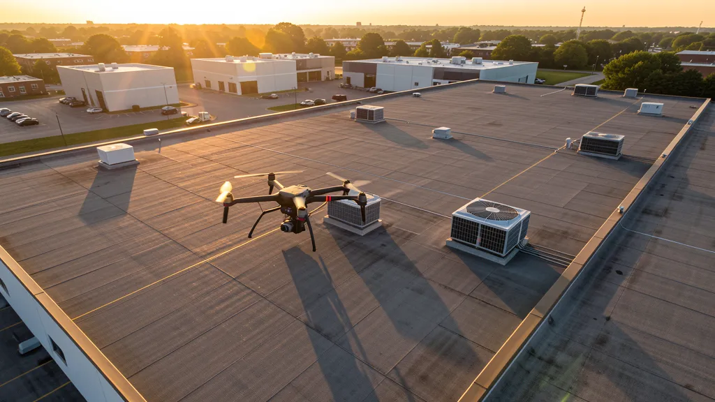
Get Matched With a Local Operator
Roof Inspection Pricing in Beavercreek, OH
Low End
$300
High End
$1,200
Turnaround
1-3 days
Cost ranges are based on market data for Dayton Metropolitan Area (Greene County, east Dayton suburb). Actual pricing depends on site size, complexity, and deliverables.
Common Roof Inspection Applications in Beavercreek
- Pre-purchase roof assessments
- Insurance claim documentation
- Storm damage evaluation
- Routine maintenance inspections
Local Drone Regulations
Roof inspections in Beavercreek require compliance with local drone regulations:
Local Drone Ordinances:
The City of Beavercreek does not have a specific municipal drone ordinance. Commercial drone operators conducting business within city limits must hold a valid City of Beavercreek business license. Drone takeoff and landing in Beavercreek city parks requires coordination with the Beavercreek Parks and Recreation Department, which manages over 200 acres including Rotary Park, Friendship Park, and the Beavercreek Golf Club. Operations near Wright-Patterson Air Force Base require LAANC authorization for the FFO Class D airspace and coordination with base operations for any flights near the perimeter. The base hosts NASIC and AFRL research facilities with heightened security requirements. Commercial operators should carry minimum $1M liability insurance and verify active NOTAMs before any mission near the base.
Restricted Airspace in Beavercreek:
- [object Object]
- [object Object]
- [object Object]
- [object Object]
Ohio drone regulations require FAA Part 107 certification for all commercial drone operations. Our network of verified operators in Beavercreek meets all federal and state requirements.
Drone Regulations in Beavercreek, OH
Airports & LAANC Zones
- DAY — Dayton International Airport (Class C airspace, approximately 12 NM northwest, primary commercial airport for the Dayton region)
- FFO — Wright-Patterson Air Force Base (Class D airspace, adjacent to Beavercreek on the west side, major military installation with restricted airspace)
- I19 — Greene County Lewis A. Jackson Regional Airport (Class E airspace, approximately 8 NM southeast in Jamestown, general aviation)
Restricted Airspace
- [object Object]
- [object Object]
- [object Object]
- [object Object]
Local Ordinances
The City of Beavercreek does not have a specific municipal drone ordinance. Commercial drone operators conducting business within city limits must hold a valid City of Beavercreek business license. Drone takeoff and landing in Beavercreek city parks requires coordination with the Beavercreek Parks and Recreation Department, which manages over 200 acres including Rotary Park, Friendship Park, and the Beavercreek Golf Club. Operations near Wright-Patterson Air Force Base require LAANC authorization for the FFO Class D airspace and coordination with base operations for any flights near the perimeter. The base hosts NASIC and AFRL research facilities with heightened security requirements. Commercial operators should carry minimum $1M liability insurance and verify active NOTAMs before any mission near the base.
All drone operations in Beavercreek must comply with FAA Part 107 rules. Operators must obtain LAANC authorization before flying in controlled airspace near Beavercreek airports. Our network operators handle all permitting and airspace authorizations as part of their service.
Roof Inspection FAQ — Beavercreek, OH
How does a drone roof inspection work in Beavercreek?
We fly a drone equipped with high-resolution and optional thermal cameras over your roof in Beavercreek, capturing detailed imagery of every surface, flashing, and penetration. No ladders, no scaffolding, no risk to personnel.
Can drone roof inspections detect leaks?
Yes. Thermal imaging detects moisture trapped under roofing materials by temperature differentials. This identifies active leaks and areas of concern before they become visible inside the building.
What does a roof inspection report include?
Your report includes high-resolution photos organized by roof section, a condition assessment with annotated problem areas, thermal imagery (if requested), and 3D model data for measurement and documentation. Reports are suitable for insurance claims and maintenance planning.
Drone Regulations FAQ — Beavercreek, OH
Do I need LAANC authorization to fly a drone in Beavercreek, OH?
Much of western Beavercreek falls within the Wright-Patterson Air Force Base (FFO) Class D airspace, which extends approximately 4.4 NM from the field up to 3,800 ft MSL. LAANC authorization is required for flights within the FFO Class D surface area, and military operations take priority. Northern Beavercreek near I-675 may also approach the Dayton International Airport (DAY) Class C outer shelf. Operators should check the FAA sectional chart and LAANC dashboard for their specific grid square before flight. Eastern Beavercreek generally operates in Class E/G uncontrolled airspace.
How does Wright-Patterson Air Force Base affect drone operations in Beavercreek?
Wright-Patterson AFB is immediately adjacent to western Beavercreek and is one of the largest Air Force installations in the United States. The base hosts the National Air and Space Intelligence Center (NASIC) and the Air Force Research Laboratory (AFRL). The FFO Class D airspace covers much of western Beavercreek, requiring LAANC authorization. The base may activate restricted areas and NOTAMs during military operations. Commercial operators should check active NOTAMs and coordinate with base operations for any flights near the perimeter. The base operates a 12,600-foot runway supporting military flight testing.
What major construction projects in Beavercreek need drone aerial imaging?
Beavercreek has active construction demand from Wright-Patterson AFB facility modernization and AFRL campus expansion, defense contractor campus construction along Colonel Glenn Highway (Northrop Grumman, Leidos, Ball Aerospace), the Soin Medical Center Kettering Health Network campus expansion, the Beavercreek Town Center mixed-use development, and master-planned residential subdivisions in the southeast expansion zone. Greene County construction permits have grown consistently, with Beavercreek leading the Dayton region in new commercial development.
Can I fly drones in Beavercreek city parks for commercial aerial imaging?
Commercial drone takeoff and landing in Beavercreek city parks requires coordination with the Beavercreek Parks and Recreation Department. The city manages over 200 acres of parkland including Rotary Park, Friendship Park, and the Beavercreek Golf Club. You must also hold a valid City of Beavercreek business license for commercial operations. Operators should avoid flying near Wright-Patterson AFB property and check for active NOTAMs before any mission in western Beavercreek.
Is Beavercreek a good market for drone aerial imaging businesses?
Beavercreek is one of the strongest drone aerial imaging markets in the Dayton region. The presence of Wright-Patterson AFB and its defense contractor ecosystem generates sustained demand for facility aerial imaging, infrastructure inspection, and construction monitoring. The growing healthcare and retail sectors add commercial development demand. The FFO Class D airspace creates a barrier to entry that benefits professional operators with Part 107 credentials and LAANC authorization capability. Low keyword competition for "aerial imaging Beavercreek OH" makes it an attractive SEO target for drone businesses.
What are the drone laws in Ohio for commercial operators?
Ohio does not have a comprehensive state-level drone law. The state enacted HB 292 (2018) establishing the Ohio Aerospace and Aviation Technology Committee, and ODOT hosts the Ohio UAS Center. Commercial operators must follow FAA Part 107 regulations, hold a valid Remote Pilot Certificate, and obtain LAANC authorization for controlled airspace. Ohio state parks require a special use permit for commercial drone operations. No additional state registration or licensing is required beyond FAA requirements.
All Aerial Imaging Services in Beavercreek, OH
Compare pricing across all aerial imaging services available in Beavercreek, Ohio.
| Service | Low End | High End | Turnaround |
|---|---|---|---|
| Topographic Data Collection | $1,100 | $4,200 | 1-2 weeks |
| Drone Inspection | $650 | $2,800 | 3-5 days |
| LiDAR Scanning | $2,000 | $7,500 | 1-2 weeks |
| Environmental Monitoring | $1,200 | $4,800 | 1-2 weeks |
| Aerial Imagery | $450 | $1,800 | 2-5 days |
| Construction Monitoring | $800 | $3,800 | Weekly |
| Real Estate Photography | $250 | $900 | 2-3 days |
| Roof Inspection ← you are here | $300 | $1,200 | 1-3 days |
Pricing ranges are based on market data for Dayton Metropolitan Area (Greene County, east Dayton suburb). Actual costs depend on project scope, site conditions, and required deliverables.
Other Aerial Imaging Services in Beavercreek, OH
Roof Inspection in Nearby Cities
Are You a Drone Operator in Beavercreek, OH?
Join our network of FAA-certified operators. Get matched with roof inspection projects in Beavercreek and the surrounding Dayton Metropolitan Area (Greene County, east Dayton suburb) area.
Apply to Join