Roof Inspection in Dearborn, MI
Drone roof inspections with high-resolution imagery and 3D modeling. Identify damage, assess condition, and generate detailed reports for insurance and maintenance.
Serving Wayne County & the Detroit-Warren-Dearborn, MI Metropolitan Statistical Area (Wayne County, part of Metro Detroit) area
Request a Free Quote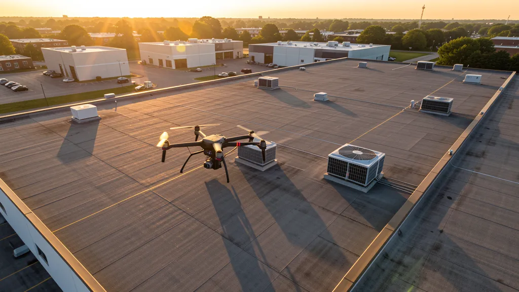
Get Matched With a Local Operator
Roof Inspection Pricing in Dearborn, MI
Low End
$350
High End
$1,400
Turnaround
1-3 days
Cost ranges are based on market data for Detroit-Warren-Dearborn, MI Metropolitan Statistical Area (Wayne County, part of Metro Detroit). Actual pricing depends on site size, complexity, and deliverables.
Common Roof Inspection Applications in Dearborn
- Pre-purchase roof assessments
- Insurance claim documentation
- Storm damage evaluation
- Routine maintenance inspections
Local Drone Regulations
Roof inspections in Dearborn require compliance with local drone regulations:
Local Drone Ordinances:
Dearborn operates under the Michigan Unmanned Aircraft Systems Act (Public Act 451 of 2016, MCL 259.301 et seq.) which preempts local regulation of drone flight paths and navigable airspace. The City of Dearborn requires a business license for commercial drone operators. Drone takeoff and landing in Dearborn parks requires coordination with the Dearborn Parks and Recreation Department, including Ford Field Park, Crowley Park, and the Rouge River trail system. Operations near the Ford Motor Company Rouge Complex and Dearborn campus require coordination with Ford Global Security. Operations near the Henry Ford Museum and Greenfield Village require coordination with the Henry Ford institution. Operations near the University of Michigan-Dearborn campus require coordination with UM-D Public Safety. DTW Class C and YIP Class D proximity may require LAANC authorization depending on operating location. Commercial operators should carry minimum $1M liability insurance.
Restricted Airspace in Dearborn:
- Detroit Metropolitan Wayne County Airport (DTW) Class C airspace extends approximately 10 NM from the airport with shelves reaching up to 5,000 feet MSL. While DTW is approximately 12 NM southwest of Dearborn, the outer shelves of the Class C airspace can affect western and southern Dearborn operations. Commercial drone operators conducting missions near the I-94 corridor toward the airport should check LAANC grid squares and NOTAMs. DTW handles over 30 million passengers annually with heavy commercial, cargo, and corporate traffic.
- Willow Run Airport (YIP) Class D airspace is approximately 8 NM west in Ypsilanti and extends 4.4 NM from the airport up to 3,000 feet MSL. Western Dearborn operations near the Ford Motor Company Dearborn Truck Plant and the Ford Proving Grounds may be affected by YIP proximity. The airport handles significant cargo traffic and is adjacent to the GM Willow Run transmission plant complex. Operators should check LAANC grid squares for the YIP Class D area.
- The Ford Motor Company Dearborn campus and Rouge Complex have enhanced security considerations for commercial drone operations. The Ford Rouge Center is one of the world's largest and oldest industrial complexes, covering approximately 600 acres and including the Dearborn Truck Plant (producing the Ford F-150), the Dearborn Stamping Plant, and the Dearborn Diversified Manufacturing Plant. The new Ford Michigan Central Station innovation district and the Ford BlueOval Battery Park of Michigan (a $1.8B EV battery manufacturing facility announced for the area) create both security restrictions and construction monitoring demand.
- The University of Michigan-Dearborn campus and the Henry Ford Museum / Greenfield Village complex have restrictions on unauthorized drone flights. The Henry Ford Museum of American Innovation is a National Historic Landmark and one of the most visited tourist attractions in Michigan. Greenfield Village is an outdoor living history museum covering 80 acres. Commercial drone operators should coordinate with the Henry Ford institution for flights near these properties. The Arab American National Museum in downtown Dearborn also has security considerations.
- The I-94, I-96, and Southfield Freeway (M-39) interchange complex in Dearborn has critical infrastructure considerations. MDOT has an active drone inspection program for bridge and highway infrastructure. The I-94 corridor through Dearborn is one of the busiest freight corridors in Michigan, connecting Detroit Metropolitan Airport to downtown Detroit. The Michigan Avenue (US-12) corridor has ongoing development requiring aerial monitoring, and the Rotunda Drive/Ford Road commercial corridor has construction activity associated with Ford campus expansion.
Michigan drone regulations require FAA Part 107 certification for all commercial drone operations. Our network of verified operators in Dearborn meets all federal and state requirements.
Drone Regulations in Dearborn, MI
Airports & LAANC Zones
- DTW — Detroit Metropolitan Wayne County Airport (Class C airspace, approximately 12 NM southwest in Romulus, major international commercial airport with over 30 million annual passengers, serves as the primary airport for Metro Detroit and is the Delta Air Lines hub for the Midwest)
- DET — Coleman A. Young International Airport (formerly Detroit City Airport, Class D airspace, approximately 8 NM northeast in Detroit, handles general aviation and limited cargo operations)
- YIP — Willow Run Airport (Class D airspace, approximately 8 NM west in Ypsilanti, major cargo and general aviation facility built during WWII for bomber production, now a significant logistics hub)
- PTK — Oakland County International Airport (Class D airspace, approximately 20 NM north in Waterford Township, corporate and general aviation facility)
Restricted Airspace
- Detroit Metropolitan Wayne County Airport (DTW) Class C airspace extends approximately 10 NM from the airport with shelves reaching up to 5,000 feet MSL. While DTW is approximately 12 NM southwest of Dearborn, the outer shelves of the Class C airspace can affect western and southern Dearborn operations. Commercial drone operators conducting missions near the I-94 corridor toward the airport should check LAANC grid squares and NOTAMs. DTW handles over 30 million passengers annually with heavy commercial, cargo, and corporate traffic.
- Willow Run Airport (YIP) Class D airspace is approximately 8 NM west in Ypsilanti and extends 4.4 NM from the airport up to 3,000 feet MSL. Western Dearborn operations near the Ford Motor Company Dearborn Truck Plant and the Ford Proving Grounds may be affected by YIP proximity. The airport handles significant cargo traffic and is adjacent to the GM Willow Run transmission plant complex. Operators should check LAANC grid squares for the YIP Class D area.
- The Ford Motor Company Dearborn campus and Rouge Complex have enhanced security considerations for commercial drone operations. The Ford Rouge Center is one of the world's largest and oldest industrial complexes, covering approximately 600 acres and including the Dearborn Truck Plant (producing the Ford F-150), the Dearborn Stamping Plant, and the Dearborn Diversified Manufacturing Plant. The new Ford Michigan Central Station innovation district and the Ford BlueOval Battery Park of Michigan (a $1.8B EV battery manufacturing facility announced for the area) create both security restrictions and construction monitoring demand.
- The University of Michigan-Dearborn campus and the Henry Ford Museum / Greenfield Village complex have restrictions on unauthorized drone flights. The Henry Ford Museum of American Innovation is a National Historic Landmark and one of the most visited tourist attractions in Michigan. Greenfield Village is an outdoor living history museum covering 80 acres. Commercial drone operators should coordinate with the Henry Ford institution for flights near these properties. The Arab American National Museum in downtown Dearborn also has security considerations.
- The I-94, I-96, and Southfield Freeway (M-39) interchange complex in Dearborn has critical infrastructure considerations. MDOT has an active drone inspection program for bridge and highway infrastructure. The I-94 corridor through Dearborn is one of the busiest freight corridors in Michigan, connecting Detroit Metropolitan Airport to downtown Detroit. The Michigan Avenue (US-12) corridor has ongoing development requiring aerial monitoring, and the Rotunda Drive/Ford Road commercial corridor has construction activity associated with Ford campus expansion.
Local Ordinances
Dearborn operates under the Michigan Unmanned Aircraft Systems Act (Public Act 451 of 2016, MCL 259.301 et seq.) which preempts local regulation of drone flight paths and navigable airspace. The City of Dearborn requires a business license for commercial drone operators. Drone takeoff and landing in Dearborn parks requires coordination with the Dearborn Parks and Recreation Department, including Ford Field Park, Crowley Park, and the Rouge River trail system. Operations near the Ford Motor Company Rouge Complex and Dearborn campus require coordination with Ford Global Security. Operations near the Henry Ford Museum and Greenfield Village require coordination with the Henry Ford institution. Operations near the University of Michigan-Dearborn campus require coordination with UM-D Public Safety. DTW Class C and YIP Class D proximity may require LAANC authorization depending on operating location. Commercial operators should carry minimum $1M liability insurance.
All drone operations in Dearborn must comply with FAA Part 107 rules. Operators must obtain LAANC authorization before flying in controlled airspace near Dearborn airports. Our network operators handle all permitting and airspace authorizations as part of their service.
Roof Inspection FAQ — Dearborn, MI
How does a drone roof inspection work in Dearborn?
We fly a drone equipped with high-resolution and optional thermal cameras over your roof in Dearborn, capturing detailed imagery of every surface, flashing, and penetration. No ladders, no scaffolding, no risk to personnel.
Can drone roof inspections detect leaks?
Yes. Thermal imaging detects moisture trapped under roofing materials by temperature differentials. This identifies active leaks and areas of concern before they become visible inside the building.
What does a roof inspection report include?
Your report includes high-resolution photos organized by roof section, a condition assessment with annotated problem areas, thermal imagery (if requested), and 3D model data for measurement and documentation. Reports are suitable for insurance claims and maintenance planning.
Drone Regulations FAQ — Dearborn, MI
Do I need LAANC authorization to fly a drone in Dearborn, MI?
Dearborn is in proximity to two controlled airspace areas. The Detroit Metropolitan Wayne County Airport (DTW) Class C outer shelves can affect western and southern Dearborn operations. The Willow Run Airport (YIP) Class D airspace is approximately 8 NM west. Commercial drone operators should check LAANC grid squares for their specific operating location, particularly near the I-94 corridor toward DTW or the western city limits near YIP. Use the FAA B4UFLY app or LAANC provider apps to verify airspace boundaries before takeoff.
What are the drone laws in Michigan for commercial operators?
Michigan regulates commercial drone operations through the Michigan Unmanned Aircraft Systems Act (Public Act 451 of 2016, MCL 259.301 et seq.). The Act prohibits using drones to surveil or photograph individuals without consent in areas with a reasonable expectation of privacy and restricts drone use for hunting or fishing harassment. Commercial operators must hold a valid FAA Part 107 Remote Pilot Certificate and obtain LAANC authorization for controlled airspace. Michigan does not require additional state-level drone registration or licensing beyond FAA requirements.
Can I fly drones near the Ford Rouge Complex or Michigan Central Station?
The Ford Rouge Center is a 600-acre industrial complex with enhanced security considerations. Commercial drone operators should coordinate with Ford Global Security for flights near the Rouge Complex, the Dearborn Truck Plant, or the Ford research campus. The Michigan Central Station innovation district is an active construction and development site with security protocols. The Henry Ford Museum and Greenfield Village are National Historic Landmarks with restrictions on unauthorized drone flights; operators should coordinate with the Henry Ford institution. The University of Michigan-Dearborn campus also requires coordination with UM-D Public Safety for drone operations.
What major construction projects in Dearborn need drone aerial imaging?
Dearborn has active construction demand from Ford Motor Company's Michigan Central Station innovation district, the $1.8B BlueOval Battery Park of Michigan EV battery manufacturing facility, the Ford Rouge Center modernization and Dearborn Truck Plant upgrades for the hybrid F-150, the Ford Research and Engineering Center campus redevelopment, Beaumont Hospital Dearborn campus expansion, University of Michigan-Dearborn campus construction, the West Village DDA district redevelopment, and I-94 modernization by MDOT. Wayne County construction permit values exceed $800 million annually.
Is Dearborn a good market for drone aerial imaging businesses?
Dearborn is one of the strongest drone aerial imaging markets in Michigan due to the Ford Motor Company's multi-billion dollar campus transformation. The Michigan Central Station innovation district, the $1.8B BlueOval Battery Park EV battery manufacturing facility, and the Rouge Center modernization create sustained construction monitoring demand. The proximity to DTW Class C and YIP Class D airspace creates a competitive barrier for unlicensed operators. The diversified base spanning automotive manufacturing, EV battery production, healthcare, higher education, and downtown redevelopment makes Dearborn a high-value and resilient market for professional drone aerial imaging businesses.
How does Detroit Metropolitan Wayne County Airport affect drone operations in Dearborn?
Detroit Metropolitan Wayne County Airport (DTW) is approximately 12 miles southwest of Dearborn in Romulus. While DTW's Class C airspace core does not directly cover Dearborn, the outer shelves and approach/departure corridors can affect operations in western and southern parts of the city, particularly near the I-94 corridor. DTW handles over 30 million passengers annually as the Delta hub for the Midwest. Commercial drone operators should check LAANC grid squares for their operating area. The Willow Run Airport (YIP) Class D airspace 8 NM west in Ypsilanti may also affect western Dearborn operations. Both airports create a competitive advantage for licensed Part 107 operators who can navigate LAANC authorization.
All Aerial Imaging Services in Dearborn, MI
Compare pricing across all aerial imaging services available in Dearborn, Michigan.
| Service | Low End | High End | Turnaround |
|---|---|---|---|
| Topographic Data Collection | $1,100 | $5,200 | 1-2 weeks |
| Drone Inspection | $650 | $3,300 | 3-5 days |
| LiDAR Scanning | $2,300 | $8,500 | 1-2 weeks |
| Environmental Monitoring | $1,300 | $5,500 | 1-2 weeks |
| Aerial Imagery | $500 | $2,300 | 2-5 days |
| Construction Monitoring | $800 | $4,200 | Weekly |
| Real Estate Photography | $300 | $1,100 | 2-3 days |
| Roof Inspection ← you are here | $350 | $1,400 | 1-3 days |
Pricing ranges are based on market data for Detroit-Warren-Dearborn, MI Metropolitan Statistical Area (Wayne County, part of Metro Detroit). Actual costs depend on project scope, site conditions, and required deliverables.
Are You a Drone Operator in Dearborn, MI?
Join our network of FAA-certified operators. Get matched with roof inspection projects in Dearborn and the surrounding Detroit-Warren-Dearborn, MI Metropolitan Statistical Area (Wayne County, part of Metro Detroit) area.
Apply to Join