Roof Inspection in Flower Mound, TX
Drone roof inspections with high-resolution imagery and 3D modeling. Identify damage, assess condition, and generate detailed reports for insurance and maintenance.
Serving Denton County & the Dallas-Fort Worth-Arlington area
Request a Free Quote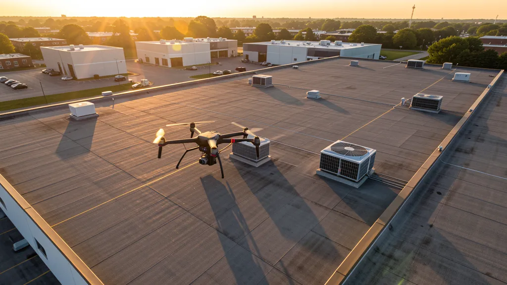
Get Matched With a Local Operator
Roof Inspection Pricing in Flower Mound, TX
Low End
$200
High End
$750
Turnaround
1-2 days
Cost ranges are based on market data for Dallas-Fort Worth-Arlington. Actual pricing depends on site size, complexity, and deliverables.
Common Roof Inspection Applications in Flower Mound
- Pre-purchase roof assessments
- Insurance claim documentation
- Storm damage evaluation
- Routine maintenance inspections
Local Drone Regulations
Roof inspections in Flower Mound require compliance with local drone regulations:
Local Drone Ordinances:
Flower Mound follows Denton County regulations and FAA Part 107 rules. The town is only 8 miles from DFW International Airport, meaning essentially all commercial drone flights require LAANC authorization for Class B airspace. Denton Enterprise Airport Class D airspace affects the northern portion. The town prohibits drone takeoff/landing in town parks without a permit. The Lakeside DFW mixed-use development along Lake Grapevine is a major construction zone requiring aerial mapping support.
Restricted Airspace in Flower Mound:
- Class B airspace around DFW extends 30 nautical miles. Flower Mound is only 8 miles from DFW, deeply within Class B airspace. LAANC authorization required for essentially all commercial drone flights.
- Class D airspace around Denton Enterprise Airport (DTO) — requires LAANC authorization within 4 nautical miles. DTO is 10 miles north.
- Class D airspace around Addison Airport (ADS) — requires LAANC authorization within 4 nautical miles.
- Flower Mound town parks prohibit drone takeoff/landing without a special use permit. Lakeside DFW development area has active construction zones with potential TFRs.
Texas drone regulations require FAA Part 107 certification for all commercial drone operations. Our network of verified operators in Flower Mound meets all federal and state requirements.
Drone Regulations in Flower Mound, TX
Airports & LAANC Zones
- DFW — Dallas/Fort Worth International Airport (Class B airspace, 8 miles S)
- DTO — Denton Enterprise Airport (Class D, 10 miles N)
- GPM — Grand Prairie Municipal Airport (Class D, 15 miles S)
- ADS — Addison Airport (Class D, 12 miles E)
Restricted Airspace
- Class B airspace around DFW extends 30 nautical miles. Flower Mound is only 8 miles from DFW, deeply within Class B airspace. LAANC authorization required for essentially all commercial drone flights.
- Class D airspace around Denton Enterprise Airport (DTO) — requires LAANC authorization within 4 nautical miles. DTO is 10 miles north.
- Class D airspace around Addison Airport (ADS) — requires LAANC authorization within 4 nautical miles.
- Flower Mound town parks prohibit drone takeoff/landing without a special use permit. Lakeside DFW development area has active construction zones with potential TFRs.
Local Ordinances
Flower Mound follows Denton County regulations and FAA Part 107 rules. The town is only 8 miles from DFW International Airport, meaning essentially all commercial drone flights require LAANC authorization for Class B airspace. Denton Enterprise Airport Class D airspace affects the northern portion. The town prohibits drone takeoff/landing in town parks without a permit. The Lakeside DFW mixed-use development along Lake Grapevine is a major construction zone requiring aerial mapping support.
All drone operations in Flower Mound must comply with FAA Part 107 rules. Operators must obtain LAANC authorization before flying in controlled airspace near Flower Mound airports. Our network operators handle all permitting and airspace authorizations as part of their service.
Roof Inspection FAQ — Flower Mound, TX
How does a drone roof inspection work in Flower Mound?
We fly a drone equipped with high-resolution and optional thermal cameras over your roof in Flower Mound, capturing detailed imagery of every surface, flashing, and penetration. No ladders, no scaffolding, no risk to personnel.
Can drone roof inspections detect leaks?
Yes. Thermal imaging detects moisture trapped under roofing materials by temperature differentials. This identifies active leaks and areas of concern before they become visible inside the building.
What does a roof inspection report include?
Your report includes high-resolution photos organized by roof section, a condition assessment with annotated problem areas, thermal imagery (if requested), and 3D model data for measurement and documentation. Reports are suitable for insurance claims and maintenance planning.
Drone Regulations FAQ — Flower Mound, TX
Do I need a permit for an aerial imaging in Flower Mound?
No town-specific permit is required for commercial drone operations from private property. However, Flower Mound is only 8 miles from DFW Airport, meaning essentially all flights require LAANC authorization for Class B airspace. Denton Enterprise Airport Class D airspace affects the northern portion. Takeoff/landing in town parks requires a permit.
How much does an aerial imaging cost in Flower Mound, TX?
Topographic data collection projects in Denton County typically range from $1,800 to $4,500. Roof inspections run $200-$750. LiDAR scanning for the Lakeside DFW or River Walk projects costs $2,800-$8,000. Real estate drone photography starts at $175, with premium rates for lakefront properties.
Can I fly a drone near DFW Airport from Flower Mound?
Flower Mound is only 8 miles from DFW, deeply within Class B airspace. All commercial drone flights require LAANC authorization. The town is also affected by Denton Enterprise Airport Class D airspace to the north. Our drone operators handle all LAANC approvals automatically.
What construction projects need aerial imaging projects in Flower Mound?
The Lakeside DFW mixed-use development, River Walk at Flower Mound (158 acres), FM 407 and FM 1171 commercial corridor development, and high-end residential construction near Grapevine Lake all require aerial mappings. The town proximity to DFW makes construction monitoring particularly active.
How long does a topographic data collection take in Flower Mound?
A standard 50-acre site can be flown in under an hour, but LAANC authorization scheduling may add time. Deliverables including DEM, contour maps, orthomosaic, and point cloud are ready within 3-5 business days. Morning flights are preferred due to DFW traffic patterns and afternoon winds off Lake Grapevine.
All Aerial Imaging Services in Flower Mound, TX
Compare pricing across all aerial imaging services available in Flower Mound, Texas.
| Service | Low End | High End | Turnaround |
|---|---|---|---|
| Topographic Data Collection | $1,800 | $4,500 | 3-5 days |
| Drone Inspection | $250 | $850 | 1-2 days |
| LiDAR Scanning | $2,800 | $8,000 | 5-7 days |
| Environmental Monitoring | $800 | $3,000 | 2-4 days |
| Aerial Imagery | $175 | $500 | 1-2 days |
| Construction Monitoring | $1,100 | $3,200 | Monthly |
| Real Estate Photography | $175 | $500 | 1-2 days |
| Roof Inspection ← you are here | $200 | $750 | 1-2 days |
Pricing ranges are based on market data for Dallas-Fort Worth-Arlington. Actual costs depend on project scope, site conditions, and required deliverables.
Other Aerial Imaging Services in Flower Mound, TX
Roof Inspection in Nearby Cities
Are You a Drone Operator in Flower Mound, TX?
Join our network of FAA-certified operators. Get matched with roof inspection projects in Flower Mound and the surrounding Dallas-Fort Worth-Arlington area.
Apply to Join