Roof Inspection in Great Falls, MT
Drone roof inspections with high-resolution imagery and 3D modeling. Identify damage, assess condition, and generate detailed reports for insurance and maintenance.
Serving Cascade & the Great Falls, MT Metropolitan Statistical Area (Missouri River corridor, north-central Montana) area
Request a Free Quote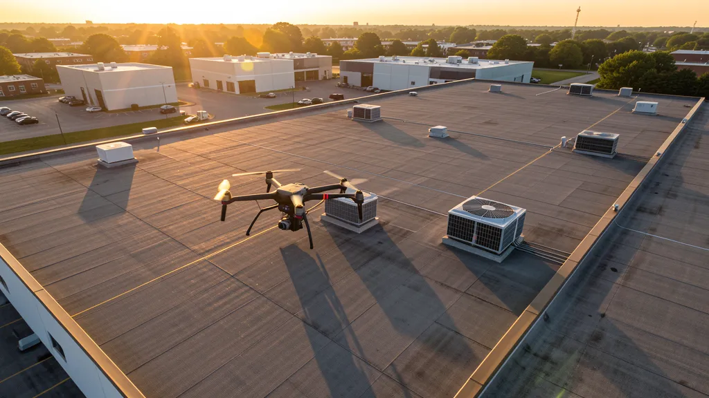
Get Matched With a Local Operator
Roof Inspection Pricing in Great Falls, MT
Low End
$250
High End
$600
Turnaround
1-2 days
Cost ranges are based on market data for Great Falls, MT Metropolitan Statistical Area (Missouri River corridor, north-central Montana). Actual pricing depends on site size, complexity, and deliverables.
Common Roof Inspection Applications in Great Falls
- Pre-purchase roof assessments
- Insurance claim documentation
- Storm damage evaluation
- Routine maintenance inspections
Local Drone Regulations
Roof inspections in Great Falls require compliance with local drone regulations:
Local Drone Ordinances:
Great Falls does not have a comprehensive city-specific drone ordinance, relying on FAA Part 107 regulations and Montana state law. Commercial drone operators must hold a valid FAA Part 107 Remote Pilot Certificate. The Great Falls Parks and Recreation Department requires authorization for commercial drone takeoff and landing on city-owned park property, including Gibson Park, Lions Park, and Broadwater Bay. Operations near Great Falls International Airport (GTF) require LAANC authorization for the Class D surface area within 4 NM of the airport. Malmstrom Air Force Base restricted airspace (R-2301, R-2302) prohibits all unauthorized drone flights within 10 miles of the installation. Montana Fish, Wildlife & Parks requires permits for drone operations in state parks, including Giant Springs State Park and First Peoples Buffalo Jump State Park. The Calumet Montana Refining facility is critical infrastructure with FAA Part 107 restrictions on overflights. Montana Code Annotated § 60-1-101 includes drones in the definition of aircraft, but the state defers to FAA authority for Part 107 commercial operations.
Restricted Airspace in Great Falls:
- Great Falls International Airport (GTF) has Class D airspace extending from the surface to 7,400 feet MSL within 4 nautical miles of the airport. LAANC authorization is required for commercial drone operations within this controlled airspace. GTF handles approximately 300,000 passengers annually with commercial service from United, Delta, and Allegiant. The airport is located 4 miles southwest of downtown Great Falls, with approach corridors extending along the Missouri River valley. Drone operators must use the FAA B4UFLY app or approved LAANC providers (Aloft, AirMap) for authorization before flying within the Class D surface area. GTF air traffic control tower frequency is 119.5 MHz.
- Malmstrom Air Force Base, located 10 miles east of Great Falls, is a major active military installation with restricted airspace. The base operates Minuteman III intercontinental ballistic missile (ICBM) launch facilities across a vast area of north-central Montana. The base has its own Class D airspace and restricted areas (R-2301, R-2302) that prohibit unauthorized drone flights entirely. FAA Part 107 commercial drone operators must never fly over, near, or within the restricted airspace surrounding Malmstrom AFB without explicit authorization from the base. The base flight operations include helicopter missions and security patrols. Contact Malmstrom AFB Public Affairs at (406) 731-4050 for any commercial drone operations within 10 miles of the installation. Violations carry severe federal penalties under 18 USC 1307 and 32 CFR 903.
- The Missouri River corridor running through Great Falls includes a series of hydroelectric dams operated by PPL Montana/NorthWestern Energy: Rainbow Dam, Cochrane Dam, Ryan Dam, and Black Eagle Dam. These facilities are classified as critical infrastructure under FAA regulations. Drone operations over or near hydroelectric dams and associated powerhouses are restricted under FAA Part 107 and may trigger federal critical infrastructure protection regulations. The dams have security perimeters and surveillance systems. Drone operators should maintain a minimum 500-foot lateral distance from dam infrastructure unless authorized, and should never fly directly over penstocks, spillways, or powerhouses. The Great Falls of the Missouri River — the namesake of the city — is a series of cascading waterfalls visible from Ryan Island Park and Giant Springs Heritage State Park.
- The Calumet Montana Refining facility in Great Falls is a petroleum refinery classified as critical infrastructure under FAA regulations. The refinery processes approximately 60,000 barrels per day of crude oil from the Bakken formation and Canada. Drone operations over or near the refinery and associated tank farms are restricted under FAA Part 107 and may trigger federal critical infrastructure protection regulations. The refinery is located on the north side of the city along the Missouri River. Drone operators should maintain a minimum 500-foot lateral distance from refinery infrastructure unless authorized, and should never fly directly over pipeline corridors or tank farms. The refinery area has rail spur infrastructure and tank farm facilities that require additional coordination with facility operators.
- Giant Springs State Park and Heritage State Park, located 5 miles northeast of downtown along the Missouri River, requires Montana Fish, Wildlife & Parks permits for commercial drone operations. The park features one of the largest freshwater springs in the United States and the Roe River, once listed as the shortest river in the world. The park attracts large numbers of visitors, especially during summer. FAA Part 107 prohibits flying directly over non-participants. The adjacent First Peoples Buffalo Jump State Park 15 miles southwest also requires FWP permits. Commercial drone operators conducting real estate, data collection, or mapping work near these state parks should contact the FWP regional office in Great Falls for special use permits.
Montana drone regulations require FAA Part 107 certification for all commercial drone operations. Our network of verified operators in Great Falls meets all federal and state requirements.
Drone Regulations in Great Falls, MT
Airports & LAANC Zones
- GTF — Great Falls International Airport (Class D airspace, 4 miles southwest, controlled airspace requiring LAANC for commercial drone ops within 4 NM, third-busiest airport in Montana)
- JCT — Choteau Airport (Class E airspace, 30 miles west, general aviation, uncontrolled)
- HVR — Havre City-County Airport (Class E airspace, 90 miles northeast, general aviation reference for north-central Montana)
- LWT — Lewistown Municipal Airport (Class E airspace, 100 miles southeast, general aviation, no control tower)
Restricted Airspace
- Great Falls International Airport (GTF) has Class D airspace extending from the surface to 7,400 feet MSL within 4 nautical miles of the airport. LAANC authorization is required for commercial drone operations within this controlled airspace. GTF handles approximately 300,000 passengers annually with commercial service from United, Delta, and Allegiant. The airport is located 4 miles southwest of downtown Great Falls, with approach corridors extending along the Missouri River valley. Drone operators must use the FAA B4UFLY app or approved LAANC providers (Aloft, AirMap) for authorization before flying within the Class D surface area. GTF air traffic control tower frequency is 119.5 MHz.
- Malmstrom Air Force Base, located 10 miles east of Great Falls, is a major active military installation with restricted airspace. The base operates Minuteman III intercontinental ballistic missile (ICBM) launch facilities across a vast area of north-central Montana. The base has its own Class D airspace and restricted areas (R-2301, R-2302) that prohibit unauthorized drone flights entirely. FAA Part 107 commercial drone operators must never fly over, near, or within the restricted airspace surrounding Malmstrom AFB without explicit authorization from the base. The base flight operations include helicopter missions and security patrols. Contact Malmstrom AFB Public Affairs at (406) 731-4050 for any commercial drone operations within 10 miles of the installation. Violations carry severe federal penalties under 18 USC 1307 and 32 CFR 903.
- The Missouri River corridor running through Great Falls includes a series of hydroelectric dams operated by PPL Montana/NorthWestern Energy: Rainbow Dam, Cochrane Dam, Ryan Dam, and Black Eagle Dam. These facilities are classified as critical infrastructure under FAA regulations. Drone operations over or near hydroelectric dams and associated powerhouses are restricted under FAA Part 107 and may trigger federal critical infrastructure protection regulations. The dams have security perimeters and surveillance systems. Drone operators should maintain a minimum 500-foot lateral distance from dam infrastructure unless authorized, and should never fly directly over penstocks, spillways, or powerhouses. The Great Falls of the Missouri River — the namesake of the city — is a series of cascading waterfalls visible from Ryan Island Park and Giant Springs Heritage State Park.
- The Calumet Montana Refining facility in Great Falls is a petroleum refinery classified as critical infrastructure under FAA regulations. The refinery processes approximately 60,000 barrels per day of crude oil from the Bakken formation and Canada. Drone operations over or near the refinery and associated tank farms are restricted under FAA Part 107 and may trigger federal critical infrastructure protection regulations. The refinery is located on the north side of the city along the Missouri River. Drone operators should maintain a minimum 500-foot lateral distance from refinery infrastructure unless authorized, and should never fly directly over pipeline corridors or tank farms. The refinery area has rail spur infrastructure and tank farm facilities that require additional coordination with facility operators.
- Giant Springs State Park and Heritage State Park, located 5 miles northeast of downtown along the Missouri River, requires Montana Fish, Wildlife & Parks permits for commercial drone operations. The park features one of the largest freshwater springs in the United States and the Roe River, once listed as the shortest river in the world. The park attracts large numbers of visitors, especially during summer. FAA Part 107 prohibits flying directly over non-participants. The adjacent First Peoples Buffalo Jump State Park 15 miles southwest also requires FWP permits. Commercial drone operators conducting real estate, data collection, or mapping work near these state parks should contact the FWP regional office in Great Falls for special use permits.
Local Ordinances
Great Falls does not have a comprehensive city-specific drone ordinance, relying on FAA Part 107 regulations and Montana state law. Commercial drone operators must hold a valid FAA Part 107 Remote Pilot Certificate. The Great Falls Parks and Recreation Department requires authorization for commercial drone takeoff and landing on city-owned park property, including Gibson Park, Lions Park, and Broadwater Bay. Operations near Great Falls International Airport (GTF) require LAANC authorization for the Class D surface area within 4 NM of the airport. Malmstrom Air Force Base restricted airspace (R-2301, R-2302) prohibits all unauthorized drone flights within 10 miles of the installation. Montana Fish, Wildlife & Parks requires permits for drone operations in state parks, including Giant Springs State Park and First Peoples Buffalo Jump State Park. The Calumet Montana Refining facility is critical infrastructure with FAA Part 107 restrictions on overflights. Montana Code Annotated § 60-1-101 includes drones in the definition of aircraft, but the state defers to FAA authority for Part 107 commercial operations.
All drone operations in Great Falls must comply with FAA Part 107 rules. Operators must obtain LAANC authorization before flying in controlled airspace near Great Falls airports. Our network operators handle all permitting and airspace authorizations as part of their service.
Roof Inspection FAQ — Great Falls, MT
How does a drone roof inspection work in Great Falls?
We fly a drone equipped with high-resolution and optional thermal cameras over your roof in Great Falls, capturing detailed imagery of every surface, flashing, and penetration. No ladders, no scaffolding, no risk to personnel.
Can drone roof inspections detect leaks?
Yes. Thermal imaging detects moisture trapped under roofing materials by temperature differentials. This identifies active leaks and areas of concern before they become visible inside the building.
What does a roof inspection report include?
Your report includes high-resolution photos organized by roof section, a condition assessment with annotated problem areas, thermal imagery (if requested), and 3D model data for measurement and documentation. Reports are suitable for insurance claims and maintenance planning.
Drone Regulations FAQ — Great Falls, MT
Do I need LAANC authorization for drone flights in Great Falls?
Yes, if you are flying within 4 nautical miles of Great Falls International Airport (GTF), which has Class D airspace extending from the surface to 7,400 feet MSL. LAANC authorization is required for commercial drone operations within the GTF Class D surface area. Use the FAA B4UFLY app or an approved LAANC provider (Aloft or AirMap) to request authorization. GTF is located 4 miles southwest of downtown Great Falls, and approach corridors extend along the Missouri River valley. The airport handles approximately 300,000 passengers annually with commercial service from United, Delta, and Allegiant. Always check the airspace class at your specific flight location before flying.
Can I fly a drone near Malmstrom Air Force Base?
No. Malmstrom Air Force Base, located 10 miles east of Great Falls, has restricted airspace (R-2301, R-2302) that prohibits all unauthorized drone flights. The base operates Minuteman III ICBM launch facilities across north-central Montana. FAA Part 107 commercial drone operators must never fly over, near, or within the restricted airspace surrounding Malmstrom AFB without explicit authorization from the base. Contact Malmstrom AFB Public Affairs at (406) 731-4050 for any commercial drone operations within 10 miles of the installation. Violations carry severe federal penalties under 18 USC 1307 and 32 CFR 903. This is one of the most restrictive airspace environments in Montana for commercial drone operators.
Are there drone restrictions near the Great Falls hydroelectric dams?
The Missouri River corridor through Great Falls includes four hydroelectric dams operated by NorthWestern Energy: Rainbow Dam, Cochrane Dam, Ryan Dam, and Black Eagle Dam. These facilities are classified as critical infrastructure under FAA regulations. Drone operations over or near hydroelectric dams and associated powerhouses are restricted under FAA Part 107 and may trigger federal critical infrastructure protection regulations. Drone operators should maintain a minimum 500-foot lateral distance from dam infrastructure unless authorized, and should never fly directly over penstocks, spillways, or powerhouses. The Great Falls of the Missouri River is a series of cascading waterfalls visible from Ryan Island Park and Giant Springs Heritage State Park.
What is the cost of an aerial imaging for a construction site in Great Falls?
Topographic drone data collection in Great Falls typically ranges from $800 to $2,500 depending on acreage and terrain complexity. The Missouri River valley terrain and the relatively flat plains of north-central Montana make most data collection sites straightforward, though the river corridor and bluff areas can increase complexity. Construction monitoring visits cost $300 to $1,000 per session. LiDAR scanning runs $1,600 to $5,000. Great Falls issued approximately 350 building permits in 2024, with Malmstrom AFB facilities maintenance and the Benefis Health System expansion driving much of the construction market.
Are there drone restrictions near the Calumet Montana Refining facility?
The Calumet Montana Refining facility in Great Falls is a petroleum refinery that processes approximately 60,000 barrels per day of crude oil from the Bakken formation and Canada. It is classified as critical infrastructure under FAA regulations. Drone operations over or near the refinery and associated tank farms are restricted under FAA Part 107 and may trigger federal critical infrastructure protection regulations. The refinery is located on the north side of the city along the Missouri River. Drone operators should maintain a minimum 500-foot lateral distance from refinery infrastructure unless authorized, and should never fly directly over pipeline corridors or tank farms. Coordinate with facility operators before conducting any aerial mapping work near the refinery area.
Can I fly a drone in Great Falls city parks for commercial work?
The Great Falls Parks and Recreation Department requires authorization for commercial drone takeoff and landing on city-owned park property, including Gibson Park, Lions Park, and Broadwater Bay. Contact the Parks and Recreation Department to request authorization for commercial operations. FAA Part 107 regulations still apply in all city parks — no flying directly over non-participants, maintain visual line of sight, and adhere to the 400-foot AGL ceiling. For operations near GTF Class D airspace, LAANC authorization is additionally required. Giant Springs State Park, located 5 miles northeast along the Missouri River, requires Montana Fish, Wildlife & Parks permits for commercial drone operations and has restrictions near the springs and Roe River.
All Aerial Imaging Services in Great Falls, MT
Compare pricing across all aerial imaging services available in Great Falls, Montana.
| Service | Low End | High End | Turnaround |
|---|---|---|---|
| Topographic Data Collection | $800 | $2,500 | 2-4 days |
| Drone Inspection | $300 | $1,200 | 1-3 days |
| LiDAR Scanning | $1,600 | $5,000 | 3-7 days |
| Environmental Monitoring | $450 | $1,800 | 2-5 days |
| Aerial Imagery | $250 | $800 | 1-2 days |
| Construction Monitoring | $300 | $1,000 | 1-2 days per visit |
| Real Estate Photography | $150 | $400 | 1-2 days |
| Roof Inspection ← you are here | $250 | $600 | 1-2 days |
Pricing ranges are based on market data for Great Falls, MT Metropolitan Statistical Area (Missouri River corridor, north-central Montana). Actual costs depend on project scope, site conditions, and required deliverables.
Other Aerial Imaging Services in Great Falls, MT
Are You a Drone Operator in Great Falls, MT?
Join our network of FAA-certified operators. Get matched with roof inspection projects in Great Falls and the surrounding Great Falls, MT Metropolitan Statistical Area (Missouri River corridor, north-central Montana) area.
Apply to Join