Roof Inspection in Greenville, SC
Drone roof inspections with high-resolution imagery and 3D modeling. Identify damage, assess condition, and generate detailed reports for insurance and maintenance.
Serving Greenville County & the Greenville-Anderson-Greer Metropolitan Statistical Area area
Request a Free Quote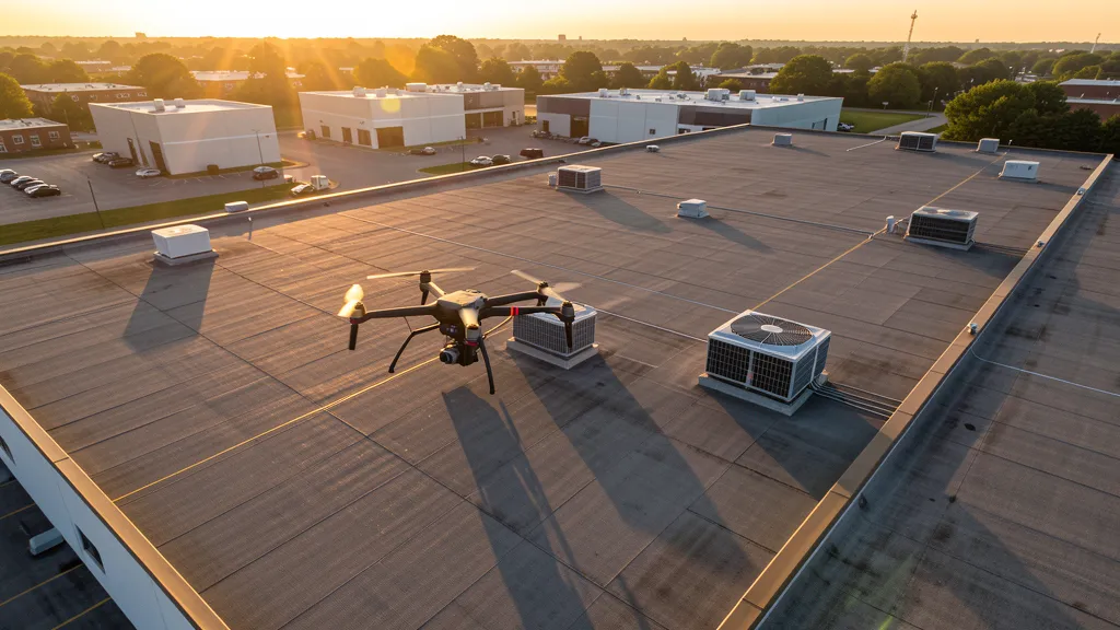
Get Matched With a Local Operator
Roof Inspection Pricing in Greenville, SC
Low End
$400
High End
$1,600
Turnaround
1-3 days
Cost ranges are based on market data for Greenville-Anderson-Greer Metropolitan Statistical Area. Actual pricing depends on site size, complexity, and deliverables.
Common Roof Inspection Applications in Greenville
- Pre-purchase roof assessments
- Insurance claim documentation
- Storm damage evaluation
- Routine maintenance inspections
Local Drone Regulations
Roof inspections in Greenville require compliance with local drone regulations:
Local Drone Ordinances:
The City of Greenville does not have a specific municipal drone ordinance, but commercial drone operations within city parks require a permit from Greenville Parks and Recreation. Flights over the Reedy River corridor and Falls Park on the Reedy require coordination with the City Parks Department. Greenville County requires commercial operators conducting construction aerial imaging on county contracts to carry general liability insurance of at least $1 million. Operations near Greenville-Spartanburg International Airport require LAANC authorization through the FAA. The SC State Park Service requires a special use permit for drone operations in state parks including Caesars Head, Jones Gap, and Paris Mountain. The City of Greenville prohibits drone takeoff and landing from public roadways and right-of-ways without prior authorization from the Public Works Department.
Restricted Airspace in Greenville:
- [object Object]
- [object Object]
- [object Object]
- [object Object]
- [object Object]
South Carolina drone regulations require FAA Part 107 certification for all commercial drone operations. Our network of verified operators in Greenville meets all federal and state requirements.
Drone Regulations in Greenville, SC
Airports & LAANC Zones
- GSP — Greenville-Spartanburg International Airport (Class C airspace)
- GMU — Greenville Downtown Airport (Class E, general aviation)
- GYH — Donaldson Center Airport (Class E, former Air Force base, industrial park)
- SPA — Spartanburg Downtown Memorial Airport (Class E, general aviation)
Restricted Airspace
- [object Object]
- [object Object]
- [object Object]
- [object Object]
- [object Object]
Local Ordinances
The City of Greenville does not have a specific municipal drone ordinance, but commercial drone operations within city parks require a permit from Greenville Parks and Recreation. Flights over the Reedy River corridor and Falls Park on the Reedy require coordination with the City Parks Department. Greenville County requires commercial operators conducting construction aerial imaging on county contracts to carry general liability insurance of at least $1 million. Operations near Greenville-Spartanburg International Airport require LAANC authorization through the FAA. The SC State Park Service requires a special use permit for drone operations in state parks including Caesars Head, Jones Gap, and Paris Mountain. The City of Greenville prohibits drone takeoff and landing from public roadways and right-of-ways without prior authorization from the Public Works Department.
All drone operations in Greenville must comply with FAA Part 107 rules. Operators must obtain LAANC authorization before flying in controlled airspace near Greenville airports. Our network operators handle all permitting and airspace authorizations as part of their service.
Roof Inspection FAQ — Greenville, SC
How does a drone roof inspection work in Greenville?
We fly a drone equipped with high-resolution and optional thermal cameras over your roof in Greenville, capturing detailed imagery of every surface, flashing, and penetration. No ladders, no scaffolding, no risk to personnel.
Can drone roof inspections detect leaks?
Yes. Thermal imaging detects moisture trapped under roofing materials by temperature differentials. This identifies active leaks and areas of concern before they become visible inside the building.
What does a roof inspection report include?
Your report includes high-resolution photos organized by roof section, a condition assessment with annotated problem areas, thermal imagery (if requested), and 3D model data for measurement and documentation. Reports are suitable for insurance claims and maintenance planning.
Drone Regulations FAQ — Greenville, SC
What airspace restrictions apply around Greenville-Spartanburg International Airport?
Greenville-Spartanburg International Airport (GSP) is surrounded by Class C airspace extending approximately 5 nautical miles from the airport up to 4,000 feet MSL. Commercial drone operators must obtain authorization through LAANC (Low Altitude Authorization and Notification Capability) before operating within this controlled airspace. The FAA LAANC dashboard shows available grid squares and maximum altitudes. Contact GSP Approach Control for coordination outside LAANC grid coverage.
Can I fly a drone over Falls Park on the Reedy in downtown Greenville?
Falls Park on the Reedy is a City of Greenville park, and commercial drone takeoff and landing within city parks requires a permit from Greenville Parks and Recreation. The park is located in the heart of downtown near the GSP Class C airspace boundary — check the LAANC grid before flying. The Reedy River corridor has seen over $2 billion in mixed-use development, creating strong demand for drone aerial imaging and aerial progress documentation on adjacent parcels outside park boundaries.
How does BMW manufacturing expansion affect drone aerial imaging demand in the Greenville area?
BMW's Spartanburg plant, located 10 miles from downtown Greenville, is the largest BMW manufacturing facility in the world and continues expanding with $1.7B in recent investments for EV production. The supplier network spans across Greenville and Spartanburg counties, driving industrial site preparation, topographic mapping for new supplier facilities, construction monitoring for plant expansions, and infrastructure corridor mapping along the I-85 corridor. The density of automotive industrial construction creates consistent demand for licensed drone aerial imaging operators.
Do I need a permit to fly drones in South Carolina state parks near Greenville?
Yes. South Carolina State Parks require a special use permit for commercial drone operations. Contact the SC State Park Service for permit applications. Caesars Head State Park and Jones Gap State Park in the Mountain Bridge Wilderness Area of northern Greenville County are particularly sensitive — they contain nesting peregrine falcons and rare plant communities. Avoid low-altitude flights during nesting season (March-June). Paris Mountain State Park, closer to downtown Greenville, also requires a special use permit.
What are the major construction projects driving aerial imaging demand in Greenville?
Greenville has over $2 billion in active or recent downtown mixed-use development including County Square redevelopment (40-acre project replacing the former county government complex), Camperdown ($100M+ mixed-use on Academy Street), and RiverPlace along the Reedy River. The I-85 corridor is undergoing continuous widening and interchange improvements. Residential master-planned communities like Bridgeway Station in Powdersville and the Greer corridor growth drive subdivision aerial imaging. BMW supplier park expansion across Greenville County adds industrial aerial imaging demand.
Is Greenville a good market for starting a drone aerial imaging business?
Greenville is one of the strongest drone aerial imaging markets in the Southeast. The Greenville-Anderson-Greer MSA has surpassed 1.5 million residents with 18% population growth in the last decade, making it the largest and fastest-growing metro in South Carolina. The combination of BMW automotive manufacturing expansion, $2B+ in downtown mixed-use development, rapid suburban residential growth in Powdersville/Simpsonville/Greer, and I-85 infrastructure corridor spending creates year-round demand for topographic data collection, construction monitoring, LiDAR scanning, and aerial mapping. The relatively mild climate allows for extended flying seasons compared to northern markets.
All Aerial Imaging Services in Greenville, SC
Compare pricing across all aerial imaging services available in Greenville, South Carolina.
| Service | Low End | High End | Turnaround |
|---|---|---|---|
| Topographic Data Collection | $1,400 | $5,500 | 1-2 weeks |
| Drone Inspection | $900 | $3,800 | 3-7 days |
| LiDAR Scanning | $2,600 | $10,000 | 1-2 weeks |
| Environmental Monitoring | $1,700 | $6,500 | 1-2 weeks |
| Aerial Imagery | $700 | $2,800 | 2-5 days |
| Construction Monitoring | $1,100 | $4,500 | Weekly |
| Real Estate Photography | $350 | $1,400 | 2-3 days |
| Roof Inspection ← you are here | $400 | $1,600 | 1-3 days |
Pricing ranges are based on market data for Greenville-Anderson-Greer Metropolitan Statistical Area. Actual costs depend on project scope, site conditions, and required deliverables.
Roof Inspection in Nearby Cities
Are You a Drone Operator in Greenville, SC?
Join our network of FAA-certified operators. Get matched with roof inspection projects in Greenville and the surrounding Greenville-Anderson-Greer Metropolitan Statistical Area area.
Apply to Join