Roof Inspection in Kennesaw, GA
Drone roof inspections with high-resolution imagery and 3D modeling. Identify damage, assess condition, and generate detailed reports for insurance and maintenance.
Serving Cobb & the Atlanta-Sandy Springs-Roswell MSA area
Request a Free Quote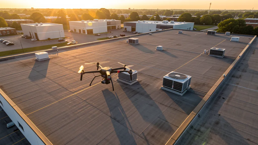
Get Matched With a Local Operator
Roof Inspection Pricing in Kennesaw, GA
Low End
$280
High End
$1,050
Turnaround
1-2 days
Cost ranges are based on market data for Atlanta-Sandy Springs-Roswell MSA. Actual pricing depends on site size, complexity, and deliverables.
Common Roof Inspection Applications in Kennesaw
- Pre-purchase roof assessments
- Insurance claim documentation
- Storm damage evaluation
- Routine maintenance inspections
Local Drone Regulations
Roof inspections in Kennesaw require compliance with local drone regulations:
Local Drone Ordinances:
Kennesaw does not have a city-specific drone ordinance. Commercial operators follow Georgia SB 465 and FAA Part 107. A Cobb County business license is required. McCollum Field (RYY) Class D airspace is immediately south of the city, and LAANC authorization is required for controlled airspace operations. Kennesaw Mountain National Battlefield Park, partially within city limits, has NPS drone prohibitions on takeoff and landing. Kennesaw State University has no formal restrictions, but commercial flights over campus should be coordinated with university public safety.
Restricted Airspace in Kennesaw:
- RYY (McCollum Field) Class D airspace is immediately south of Kennesaw. Operations within 5 miles of RYY require LAANC authorization.
- Kennesaw Mountain National Battlefield Park is partially within Kennesaw. NPS drone prohibition applies to takeoff and landing on park grounds.
- Kennesaw State University campus has no formal drone restrictions, but commercial flights over campus should be coordinated with university administration and public safety.
- The Town Center at Cobb area has no formal drone restrictions, but the commercial zone has heavy vehicular and pedestrian traffic.
Georgia drone regulations require FAA Part 107 certification for all commercial drone operations. Our network of verified operators in Kennesaw meets all federal and state requirements.
Drone Regulations in Kennesaw, GA
Airports & LAANC Zones
- RYY — Cobb County International-McCollum Field (Class D airspace, adjacent to city)
Restricted Airspace
- RYY (McCollum Field) Class D airspace is immediately south of Kennesaw. Operations within 5 miles of RYY require LAANC authorization.
- Kennesaw Mountain National Battlefield Park is partially within Kennesaw. NPS drone prohibition applies to takeoff and landing on park grounds.
- Kennesaw State University campus has no formal drone restrictions, but commercial flights over campus should be coordinated with university administration and public safety.
- The Town Center at Cobb area has no formal drone restrictions, but the commercial zone has heavy vehicular and pedestrian traffic.
Local Ordinances
Kennesaw does not have a city-specific drone ordinance. Commercial operators follow Georgia SB 465 and FAA Part 107. A Cobb County business license is required. McCollum Field (RYY) Class D airspace is immediately south of the city, and LAANC authorization is required for controlled airspace operations. Kennesaw Mountain National Battlefield Park, partially within city limits, has NPS drone prohibitions on takeoff and landing. Kennesaw State University has no formal restrictions, but commercial flights over campus should be coordinated with university public safety.
All drone operations in Kennesaw must comply with FAA Part 107 rules. Operators must obtain LAANC authorization before flying in controlled airspace near Kennesaw airports. Our network operators handle all permitting and airspace authorizations as part of their service.
Roof Inspection FAQ — Kennesaw, GA
How does a drone roof inspection work in Kennesaw?
We fly a drone equipped with high-resolution and optional thermal cameras over your roof in Kennesaw, capturing detailed imagery of every surface, flashing, and penetration. No ladders, no scaffolding, no risk to personnel.
Can drone roof inspections detect leaks?
Yes. Thermal imaging detects moisture trapped under roofing materials by temperature differentials. This identifies active leaks and areas of concern before they become visible inside the building.
What does a roof inspection report include?
Your report includes high-resolution photos organized by roof section, a condition assessment with annotated problem areas, thermal imagery (if requested), and 3D model data for measurement and documentation. Reports are suitable for insurance claims and maintenance planning.
Drone Regulations FAQ — Kennesaw, GA
Can I fly a drone near Kennesaw State University?
Kennesaw State University does not have a formal drone prohibition, but commercial flights over campus should be coordinated with the KSU Department of Public Safety. The university is a large campus with heavy pedestrian traffic between classes. Standard FAA Part 107 rules for operations over people apply. Check for LAANC requirements if the campus is within the RYY Class D lateral boundary.
Are there drone restrictions at Kennesaw Mountain National Battlefield Park?
Kennesaw Mountain National Battlefield Park is managed by the National Park Service, which prohibits drone takeoff and landing on NPS property. The park partially overlaps with Kennesaw city limits. You can fly over the park from private property outside its boundaries, but cannot launch from or land on park grounds under 36 CFR 1.5 and 36 CFR 4.20.
What drone services are most in demand in Kennesaw?
Chastain Road corridor mixed-use and student housing construction monitoring, Town Center commercial development documentation, residential real estate photography for Stilesboro Road and Paul Samuel Road communities, and university campus expansion data collection projects are the main demand drivers.
What is the cost of an aerial imaging in Kennesaw?
Topographic drone data collection in Kennesaw ranges from $1,300 to $4,800 depending on lot size and terrain. Construction monitoring visits cost $380 to $2,000 per session. Real estate photography runs $220 to $850 per property.
Do I need LAANC authorization to fly a drone in Kennesaw?
McCollum Field (RYY) Class D airspace is immediately south of Kennesaw. If your flight location falls within the RYY Class D lateral boundary, you need LAANC authorization. Many areas of Kennesaw, particularly north of the city center, are outside controlled airspace and do not require LAANC for low-altitude operations under 400 ft AGL.
Can I fly a drone at the Town Center at Cobb area?
The Town Center at Cobb commercial area has no formal drone restrictions, but it has heavy vehicular and pedestrian traffic. Commercial operations should follow Part 107 rules for operations over people and vehicles. Launch from private property with owner permission rather than from parking lots or public right-of-way.
All Aerial Imaging Services in Kennesaw, GA
Compare pricing across all aerial imaging services available in Kennesaw, Georgia.
| Service | Low End | High End | Turnaround |
|---|---|---|---|
| Topographic Data Collection | $1,300 | $4,800 | 3-7 days |
| Drone Inspection | $400 | $2,400 | 1-3 days |
| LiDAR Scanning | $2,000 | $8,500 | 5-10 days |
| Environmental Monitoring | $650 | $3,200 | 2-5 days |
| Aerial Imagery | $300 | $1,300 | 1-2 days |
| Construction Monitoring | $380 | $2,000 | 1-3 days per visit |
| Real Estate Photography | $220 | $850 | 1-2 days |
| Roof Inspection ← you are here | $280 | $1,050 | 1-2 days |
Pricing ranges are based on market data for Atlanta-Sandy Springs-Roswell MSA. Actual costs depend on project scope, site conditions, and required deliverables.
Roof Inspection in Nearby Cities
Are You a Drone Operator in Kennesaw, GA?
Join our network of FAA-certified operators. Get matched with roof inspection projects in Kennesaw and the surrounding Atlanta-Sandy Springs-Roswell MSA area.
Apply to Join