Roof Inspection in Lincoln, NE
Drone roof inspections with high-resolution imagery and 3D modeling. Identify damage, assess condition, and generate detailed reports for insurance and maintenance.
Serving Lancaster & the Lincoln, NE MSA (Lancaster County) area
Request a Free Quote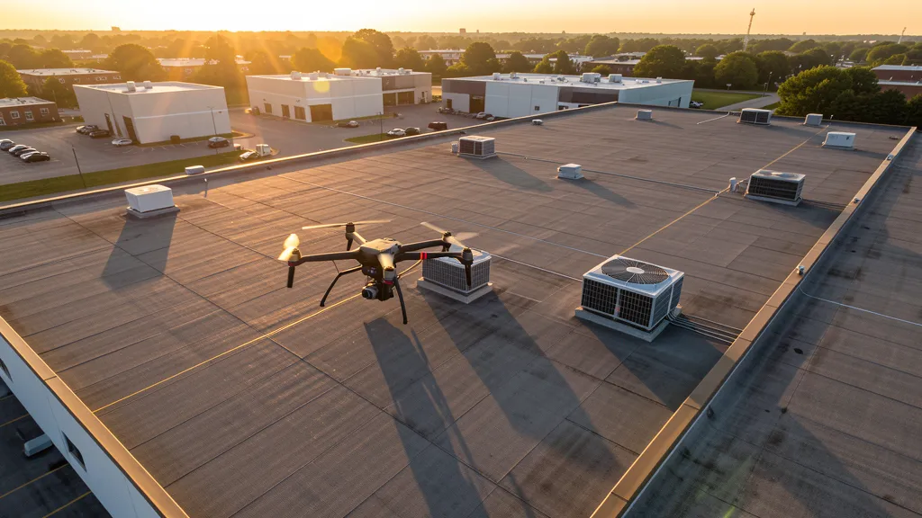
Get Matched With a Local Operator
Roof Inspection Pricing in Lincoln, NE
Low End
$200
High End
$700
Turnaround
1-2 days
Cost ranges are based on market data for Lincoln, NE MSA (Lancaster County). Actual pricing depends on site size, complexity, and deliverables.
Common Roof Inspection Applications in Lincoln
- Pre-purchase roof assessments
- Insurance claim documentation
- Storm damage evaluation
- Routine maintenance inspections
Local Drone Regulations
Roof inspections in Lincoln require compliance with local drone regulations:
Local Drone Ordinances:
Lincoln does not have a comprehensive city drone ordinance, relying on FAA Part 107 regulations and Nebraska state law. Commercial drone operators must hold a valid FAA Part 107 Remote Pilot Certificate. The Lincoln Parks and Recreation Department requires permits for commercial drone takeoff and landing on city-owned park property, including Pioneers Park, Holmes Lake Park, Antelope Park, and Tierra Park. Operations near Lincoln Airport (LNK) Class C airspace require LAANC authorization via the FAA B4UFLY app or approved providers (Aloft, AirMap). Lincoln Army National Guard helicopter operations at LNK have military training areas on the south side of the field — drone operators should check NOTAMs for active military operations. Nebraska Revised Statute § 2-4,119 restricts drone surveillance of agricultural operations without owner consent, relevant to the agricultural areas surrounding Lancaster County. Nebraska Game and Parks Commission requires permits for drone operations in state parks and wildlife management areas.
Restricted Airspace in Lincoln:
- Lincoln Airport (LNK) Class C airspace extends approximately 5 nautical miles from the airport center with a surface area up to 4,000 feet MSL, and an outer ring from 1,200 feet to 4,000 feet MSL extending to 10 NM. LAANC authorization is required for commercial drone operations within the Class C surface area. The airport is located northwest of downtown Lincoln, and the Class C zone covers much of northwest Lincoln and the Salt Creek corridor. Use the FAA B4UFLY app or Aloft for real-time authorization.
- Lincoln Army National Guard operates helicopter units at Lincoln Airport with military training routes and occasional TFRs on the south side of the airfield. Drone operators should check NOTAMs for active military flight operations, especially during weekday training hours. The ANG apron and military ramp have heightened security restrictions.
- University of Nebraska-Lincoln (UNL) Memorial Stadium hosts Husker football games with capacity exceeding 86,000 people, triggering temporary flight restrictions (TFRs) extending up to 3 nautical miles on game days (typically September through November, and occasional spring games). TFRs are active from one hour before events to one hour after. FAA Part 107 also prohibits flying over non-participants at all times.
- Pioneers Park Nature Center and Wilderness Park are managed by the Lincoln Parks and Recreation Department, which requires authorization for commercial drone takeoff and landing. Antelope Park, Holmes Lake Park, and Tierra Park are popular recreational areas where drone operations need prior approval. The Salt Creek floodplain and Antelope Creek corridor have additional flood control district restrictions.
- The Nebraska State Capitol building and surrounding government complex in downtown Lincoln have security-restricted airspace considerations. While not a designated TFR zone, drone operations near the Capitol and state office buildings should be coordinated with the Nebraska State Patrol. Critical infrastructure along the Salt Creek corridor includes railroad yards, power substations, and water treatment facilities that warrant caution.
Nebraska drone regulations require FAA Part 107 certification for all commercial drone operations. Our network of verified operators in Lincoln meets all federal and state requirements.
Drone Regulations in Lincoln, NE
Airports & LAANC Zones
- LNK — Lincoln Airport (Class C airspace, 6 NM northwest of downtown, joint civil-military facility with Lincoln ANG base, commercial and general aviation)
- MLE — Millard Municipal Airport (Class E airspace, 45 NM east in Omaha, general aviation, no control tower)
- AHS — Wahoo Municipal Airport (Class E airspace, 25 NM north in Saunders County, general aviation)
- LNK — Lincoln Army National Guard operates at Lincoln Airport with military helicopter operations and restricted zones on the south side of the field
Restricted Airspace
- Lincoln Airport (LNK) Class C airspace extends approximately 5 nautical miles from the airport center with a surface area up to 4,000 feet MSL, and an outer ring from 1,200 feet to 4,000 feet MSL extending to 10 NM. LAANC authorization is required for commercial drone operations within the Class C surface area. The airport is located northwest of downtown Lincoln, and the Class C zone covers much of northwest Lincoln and the Salt Creek corridor. Use the FAA B4UFLY app or Aloft for real-time authorization.
- Lincoln Army National Guard operates helicopter units at Lincoln Airport with military training routes and occasional TFRs on the south side of the airfield. Drone operators should check NOTAMs for active military flight operations, especially during weekday training hours. The ANG apron and military ramp have heightened security restrictions.
- University of Nebraska-Lincoln (UNL) Memorial Stadium hosts Husker football games with capacity exceeding 86,000 people, triggering temporary flight restrictions (TFRs) extending up to 3 nautical miles on game days (typically September through November, and occasional spring games). TFRs are active from one hour before events to one hour after. FAA Part 107 also prohibits flying over non-participants at all times.
- Pioneers Park Nature Center and Wilderness Park are managed by the Lincoln Parks and Recreation Department, which requires authorization for commercial drone takeoff and landing. Antelope Park, Holmes Lake Park, and Tierra Park are popular recreational areas where drone operations need prior approval. The Salt Creek floodplain and Antelope Creek corridor have additional flood control district restrictions.
- The Nebraska State Capitol building and surrounding government complex in downtown Lincoln have security-restricted airspace considerations. While not a designated TFR zone, drone operations near the Capitol and state office buildings should be coordinated with the Nebraska State Patrol. Critical infrastructure along the Salt Creek corridor includes railroad yards, power substations, and water treatment facilities that warrant caution.
Local Ordinances
Lincoln does not have a comprehensive city drone ordinance, relying on FAA Part 107 regulations and Nebraska state law. Commercial drone operators must hold a valid FAA Part 107 Remote Pilot Certificate. The Lincoln Parks and Recreation Department requires permits for commercial drone takeoff and landing on city-owned park property, including Pioneers Park, Holmes Lake Park, Antelope Park, and Tierra Park. Operations near Lincoln Airport (LNK) Class C airspace require LAANC authorization via the FAA B4UFLY app or approved providers (Aloft, AirMap). Lincoln Army National Guard helicopter operations at LNK have military training areas on the south side of the field — drone operators should check NOTAMs for active military operations. Nebraska Revised Statute § 2-4,119 restricts drone surveillance of agricultural operations without owner consent, relevant to the agricultural areas surrounding Lancaster County. Nebraska Game and Parks Commission requires permits for drone operations in state parks and wildlife management areas.
All drone operations in Lincoln must comply with FAA Part 107 rules. Operators must obtain LAANC authorization before flying in controlled airspace near Lincoln airports. Our network operators handle all permitting and airspace authorizations as part of their service.
Roof Inspection FAQ — Lincoln, NE
How does a drone roof inspection work in Lincoln?
We fly a drone equipped with high-resolution and optional thermal cameras over your roof in Lincoln, capturing detailed imagery of every surface, flashing, and penetration. No ladders, no scaffolding, no risk to personnel.
Can drone roof inspections detect leaks?
Yes. Thermal imaging detects moisture trapped under roofing materials by temperature differentials. This identifies active leaks and areas of concern before they become visible inside the building.
What does a roof inspection report include?
Your report includes high-resolution photos organized by roof section, a condition assessment with annotated problem areas, thermal imagery (if requested), and 3D model data for measurement and documentation. Reports are suitable for insurance claims and maintenance planning.
Drone Regulations FAQ — Lincoln, NE
Do I need LAANC authorization to fly a drone in Lincoln?
Yes, if you are within the Lincoln Airport (LNK) Class C airspace, which covers much of northwest Lincoln and the Salt Creek corridor. The Class C surface area extends about 5 nautical miles from LNK. LAANC authorization is available through the FAA B4UFLY app or approved providers like Aloft and AirMap. Lincoln Army National Guard helicopter operations at LNK also have military training areas — check NOTAMs before any flight in the Lincoln metro area.
What is the cost of an aerial imaging for a construction site in Lincoln?
Topographic drone data collection in Lincoln typically ranges from $900 to $2,800 depending on acreage and terrain. Construction monitoring visits cost $300 to $1,200 per session. LiDAR scanning runs $1,600 to $5,500. The relatively flat Great Plains terrain makes Lincoln aerial imaging efficient, but the active construction market — including UNL campus expansion, the South Haymarket redevelopment, and the South Beltway highway project — creates strong demand for aerial mapping services across Lancaster County.
Can I fly a drone near Memorial Stadium during Husker football games?
No. Memorial Stadium hosts Nebraska Husker football games with attendance exceeding 86,000, which triggers temporary flight restrictions (TFRs) extending up to 3 nautical miles around the stadium. TFRs are active from one hour before kickoff to one hour after the game ends, typically September through November. FAA Part 107 also prohibits flying directly over non-participants at all times. Downtown Lincoln sees massive pedestrian traffic on game days, so drone operators should plan around these restrictions and check NOTAMs daily during football season.
Can I fly a drone over Lincoln parks like Pioneers Park or Holmes Lake?
Commercial drone takeoff and landing on Lincoln city park property requires a permit from Lincoln Parks and Recreation. Pioneers Park Nature Center, Holmes Lake Park, Antelope Park, and Tierra Park are popular recreational areas where unauthorized drone operations can result in citations. The Salt Creek and Antelope Creek floodplain corridors have additional flood control district restrictions. Always verify park-specific rules before conducting commercial drone operations.
Are there drone restrictions near the Nebraska State Capitol?
The Nebraska State Capitol and surrounding government complex in downtown Lincoln have security considerations. While not a designated TFR zone, drone operations near the Capitol and state office buildings should be coordinated with the Nebraska State Patrol. The Capitol is a National Historic Landmark with heightened security protocols. Commercial operators should maintain a safe distance and avoid loitering flights over government buildings.
Does Nebraska require state drone registration for commercial operators?
No. Nebraska does not require state-level drone registration. Commercial operators need a valid FAA Part 107 Remote Pilot Certificate and must comply with federal regulations. Nebraska Revised Statute § 2-4,119 (2019) restricts drone surveillance of agricultural operations without owner consent, which is relevant for operators working in the agricultural areas surrounding Lancaster County. Nebraska Game and Parks Commission requires permits for drone operations in state parks and wildlife management areas.
All Aerial Imaging Services in Lincoln, NE
Compare pricing across all aerial imaging services available in Lincoln, Nebraska.
| Service | Low End | High End | Turnaround |
|---|---|---|---|
| Topographic Data Collection | $900 | $2,800 | 3-5 days |
| Drone Inspection | $300 | $1,400 | 1-3 days |
| LiDAR Scanning | $1,600 | $5,500 | 3-7 days |
| Environmental Monitoring | $400 | $2,000 | 2-4 days |
| Aerial Imagery | $250 | $900 | 1-2 days |
| Construction Monitoring | $300 | $1,200 | 1-3 days per visit |
| Real Estate Photography | $150 | $500 | 1-2 days |
| Roof Inspection ← you are here | $200 | $700 | 1-2 days |
Pricing ranges are based on market data for Lincoln, NE MSA (Lancaster County). Actual costs depend on project scope, site conditions, and required deliverables.
Roof Inspection in Nearby Cities
Are You a Drone Operator in Lincoln, NE?
Join our network of FAA-certified operators. Get matched with roof inspection projects in Lincoln and the surrounding Lincoln, NE MSA (Lancaster County) area.
Apply to Join