Roof Inspection in Marvin, NC
Drone roof inspections with high-resolution imagery and 3D modeling. Identify damage, assess condition, and generate detailed reports for insurance and maintenance.
Serving Union & the Charlotte-Concord-Gastonia MSA area
Request a Free Quote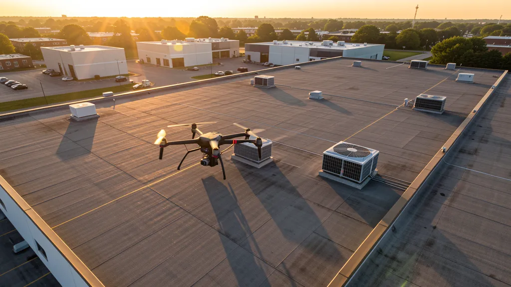
Get Matched With a Local Surveyor
Roof Inspection Pricing in Marvin, NC
Low End
$300
High End
$1,200
Turnaround
1 day
Cost ranges are based on market data for Charlotte-Concord-Gastonia MSA. Actual pricing depends on site size, complexity, and deliverables.
Common Roof Inspection Applications in Marvin
- Pre-purchase roof assessments
- Insurance claim documentation
- Storm damage evaluation
- Routine maintenance inspections
Local Drone Regulations
Roof inspections in Marvin require compliance with local drone regulations:
Local Drone Ordinances:
Marvin follows NC state law requiring NCDOT commercial drone operator permits. Union County parks prohibit drone takeoff and landing without a permit. The village is primarily residential with large-lot zoning, and commercial drone operators should respect private property boundaries per FAA Part 107 privacy guidelines.
Restricted Airspace in Marvin:
- Marvin is outside Charlotte Douglas Class B and Monroe Regional Class E controlled airspace. Commercial operators should verify on the FAA LAANC map.
- Union County parks prohibit drone takeoff and landing without a local permit.
- Large-lot residential properties require homeowner awareness per FAA Part 107 privacy guidelines.
- The Marvin Efird Park area has no specific restrictions but is a designated passive recreation area where drone operations may disturb wildlife.
North Carolina drone regulations require FAA Part 107 certification for all commercial drone operations. Our network of verified operators in Marvin meets all federal and state requirements.
Drone Regulations in Marvin, NC
Airports & LAANC Zones
- CLT — Charlotte Douglas International Airport (Class B airspace, approximately 20 NM northwest)
- EQY — Monroe Regional Airport (Class E airspace, approximately 10 NM northeast)
Restricted Airspace
- Marvin is outside Charlotte Douglas Class B and Monroe Regional Class E controlled airspace. Commercial operators should verify on the FAA LAANC map.
- Union County parks prohibit drone takeoff and landing without a local permit.
- Large-lot residential properties require homeowner awareness per FAA Part 107 privacy guidelines.
- The Marvin Efird Park area has no specific restrictions but is a designated passive recreation area where drone operations may disturb wildlife.
Local Ordinances
Marvin follows NC state law requiring NCDOT commercial drone operator permits. Union County parks prohibit drone takeoff and landing without a permit. The village is primarily residential with large-lot zoning, and commercial drone operators should respect private property boundaries per FAA Part 107 privacy guidelines.
All drone operations in Marvin must comply with FAA Part 107 rules. Operators must obtain LAANC authorization before flying in controlled airspace near Marvin airports. Our network operators handle all permitting and airspace authorizations as part of their service.
Roof Inspection FAQ — Marvin, NC
How does a drone roof inspection work in Marvin?
We fly a drone equipped with high-resolution and optional thermal cameras over your roof in Marvin, capturing detailed imagery of every surface, flashing, and penetration. No ladders, no scaffolding, no risk to personnel.
Can drone roof inspections detect leaks?
Yes. Thermal imaging detects moisture trapped under roofing materials by temperature differentials. This identifies active leaks and areas of concern before they become visible inside the building.
What does a roof inspection report include?
Your report includes high-resolution photos organized by roof section, a condition assessment with annotated problem areas, thermal imagery (if requested), and 3D model data for measurement and documentation. Reports are suitable for insurance claims and maintenance planning.
Drone Regulations FAQ — Marvin, NC
Do I need LAANC authorization to fly a drone in Marvin?
Marvin is outside Charlotte Douglas Class B and Monroe Regional Class E controlled airspace. No LAANC authorization is typically required, but commercial operators should always verify on the FAA LAANC map before flying.
What is driving construction demand in Marvin?
Custom estate home building on large lots along Marvin Road, Waxhaw-Marvin Road, and Pleasant Plains Road is the primary driver. The village maintains strict zoning for equestrian and rural-residential character, so construction is exclusively high-end custom homes.
What is the cost of a drone survey in Marvin?
Topographic drone surveys range from $1,200 to $4,500 for large estate lots. Construction monitoring visits cost $400 to $2,000 per session. LiDAR scanning runs $2,200 to $8,000. Real estate photography commands premium rates for luxury estate properties.
Does Marvin have a local drone ordinance?
Marvin follows NC state law requiring NCDOT commercial drone operator permits. Union County parks prohibit drone takeoff and landing without a permit. The village does not have a separate drone-specific ordinance beyond state requirements.
Can I fly a drone over Marvin Efird Park?
Union County parks prohibit drone takeoff and landing without a permit. Marvin Efird Park is a passive recreation area with walking trails and wildlife habitat. Commercial operators should contact Union County Parks and Recreation for permit applications and avoid disturbing wildlife.
How does Marvin differ from Weddington for drone operations?
Marvin is smaller and even more exclusive than Weddington, with a stronger equestrian character. Both communities have large-lot zoning, but Marvin has fewer planned developments and more individual custom estate construction. Survey work is typically for individual estate properties rather than subdivision-scale projects.
All Drone Survey Services in Marvin, NC
Compare pricing across all drone survey services available in Marvin, North Carolina.
| Service | Low End | High End | Turnaround |
|---|---|---|---|
| Topographic Survey | $1,200 | $4,500 | 2-5 days |
| Drone Inspection | $450 | $2,400 | 1-2 days |
| LiDAR Scanning | $2,200 | $8,000 | 4-8 days |
| Environmental Monitoring | $700 | $3,500 | 2-4 days |
| Aerial Imagery | $300 | $1,500 | 1 day |
| Construction Monitoring | $400 | $2,000 | 1-2 days per visit |
| Real Estate Photography | $250 | $1,000 | 1 day |
| Roof Inspection ← you are here | $300 | $1,200 | 1 day |
Pricing ranges are based on market data for Charlotte-Concord-Gastonia MSA. Actual costs depend on project scope, site conditions, and required deliverables.
Are You a Drone Surveyor in Marvin, NC?
Join our network of FAA-certified operators. Get matched with roof inspection projects in Marvin and the surrounding Charlotte-Concord-Gastonia MSA area.
Apply to Join