Roof Inspection in O’Fallon, MO
Drone roof inspections with high-resolution imagery and 3D modeling. Identify damage, assess condition, and generate detailed reports for insurance and maintenance.
Serving St. Charles & the St. Louis Metropolitan Area area
Request a Free Quote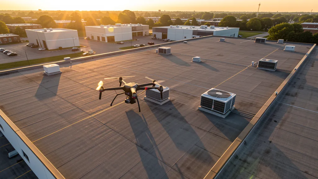
Get Matched With a Local Operator
Roof Inspection Pricing in O’Fallon, MO
Low End
$400
High End
$1,500
Turnaround
1-3 days
Cost ranges are based on market data for St. Louis Metropolitan Area. Actual pricing depends on site size, complexity, and deliverables.
Common Roof Inspection Applications in O’Fallon
- Pre-purchase roof assessments
- Insurance claim documentation
- Storm damage evaluation
- Routine maintenance inspections
Local Drone Regulations
Roof inspections in O’Fallon require compliance with local drone regulations:
Local Drone Ordinances:
O'Fallon does not have a specific municipal drone ordinance, but commercial drone operators conducting business within city limits must hold a valid City of O'Fallon business license. Drone takeoff and landing in O'Fallon city parks requires a permit from the O'Fallon Parks and Recreation Department — contact (636) 379-5606. St. Charles County parks may have additional restrictions for commercial drone operations. Operations near SUS require LAANC authorization through the FAA. The City of O'Fallon requires commercial operators to carry general liability insurance of at least $1 million for drone aerial imaging on city-related projects. Missouri state parks in the region (Klondike Park, Busch Memorial Conservation Area) may require special use permits from the Missouri Department of Natural Resources or Missouri Department of Conservation for commercial drone operations.
Restricted Airspace in O’Fallon:
- [object Object]
- [object Object]
- [object Object]
- [object Object]
Missouri drone regulations require FAA Part 107 certification for all commercial drone operations. Our network of verified operators in O’Fallon meets all federal and state requirements.
Drone Regulations in O’Fallon, MO
Airports & LAANC Zones
- SUS — Spirit of St. Louis Airport (Class D airspace, general aviation, located in Chesterfield adjacent to O'Fallon)
- STL — St. Louis Lambert International Airport (Class B airspace, approximately 20 miles east)
- CPS — St. Charles County Smartt Airport (Class E, general aviation, nearby St. Charles)
Restricted Airspace
- [object Object]
- [object Object]
- [object Object]
- [object Object]
Local Ordinances
O'Fallon does not have a specific municipal drone ordinance, but commercial drone operators conducting business within city limits must hold a valid City of O'Fallon business license. Drone takeoff and landing in O'Fallon city parks requires a permit from the O'Fallon Parks and Recreation Department — contact (636) 379-5606. St. Charles County parks may have additional restrictions for commercial drone operations. Operations near SUS require LAANC authorization through the FAA. The City of O'Fallon requires commercial operators to carry general liability insurance of at least $1 million for drone aerial imaging on city-related projects. Missouri state parks in the region (Klondike Park, Busch Memorial Conservation Area) may require special use permits from the Missouri Department of Natural Resources or Missouri Department of Conservation for commercial drone operations.
All drone operations in O’Fallon must comply with FAA Part 107 rules. Operators must obtain LAANC authorization before flying in controlled airspace near O’Fallon airports. Our network operators handle all permitting and airspace authorizations as part of their service.
Roof Inspection FAQ — O’Fallon, MO
How does a drone roof inspection work in O’Fallon?
We fly a drone equipped with high-resolution and optional thermal cameras over your roof in O’Fallon, capturing detailed imagery of every surface, flashing, and penetration. No ladders, no scaffolding, no risk to personnel.
Can drone roof inspections detect leaks?
Yes. Thermal imaging detects moisture trapped under roofing materials by temperature differentials. This identifies active leaks and areas of concern before they become visible inside the building.
What does a roof inspection report include?
Your report includes high-resolution photos organized by roof section, a condition assessment with annotated problem areas, thermal imagery (if requested), and 3D model data for measurement and documentation. Reports are suitable for insurance claims and maintenance planning.
Drone Regulations FAQ — O’Fallon, MO
Do I need LAANC authorization to fly a drone in O'Fallon, MO?
Yes, most of O'Fallon falls within the Class D airspace of Spirit of St. Louis Airport (SUS), which extends approximately 4.4 nautical miles from the airport up to 3,000 feet MSL. Commercial drone operators must obtain LAANC (Low Altitude Authorization and Notification Capability) authorization before operating in this controlled airspace. The outer shelf of Lambert International Airport's Class B airspace may also affect operations at higher altitudes in eastern parts of O'Fallon. Check the FAA LAANC dashboard for available grid squares and maximum altitudes in your specific area.
What are the drone laws in Missouri for commercial operators?
Missouri does not have a comprehensive state-level drone law. Several UAS-related bills have been introduced in the Missouri General Assembly but none have been enacted. Commercial operators must follow FAA Part 107 regulations, hold a valid Remote Pilot Certificate, and obtain LAANC authorization for controlled airspace. Missouri state parks require a special use permit for commercial drone operations. The state does not require additional registration or licensing beyond FAA requirements. Municipalities may regulate takeoff and landing on public property they own.
Can I fly drones in O'Fallon city parks for commercial aerial imaging?
Commercial drone takeoff and landing in O'Fallon city parks requires a permit from the O'Fallon Parks and Recreation Department. Contact (636) 379-5606 to apply for a park use permit. You must also hold a valid City of O'Fallon business license for commercial operations. Nearby conservation areas managed by the Missouri Department of Conservation, such as Busch Memorial Conservation Area, may have separate requirements — contact the area manager for commercial drone operation permits.
What major construction projects in O'Fallon need drone aerial imaging?
O'Fallon has active construction demand from the Dardenne Commerce Park and O'Fallon Commerce Park build-outs, master-planned residential communities along the Highway K corridor, I-64 corridor widening and improvements by MoDOT, Progress West Hospital expansions, and ongoing Fort Zumwalt School District facility construction. Logistics and distribution development along the I-70 corridor through St. Charles County creates additional demand for topographic data collection, construction monitoring, and aerial mapping.
Is O'Fallon a good market for drone aerial imaging businesses?
O'Fallon is one of the strongest drone aerial imaging markets in the St. Louis metro area. As one of the fastest-growing cities in Missouri with sustained residential, commercial, and infrastructure development, the city generates consistent demand for topographic data collection, construction monitoring, LiDAR scanning, and real estate photography. The I-64 and I-70 corridors through St. Charles County are under continuous development, and the city's business-friendly environment makes permitting straightforward. The combination of suburban growth, transportation infrastructure projects, and commercial park development creates year-round demand for licensed drone aerial imaging operators.
How close is O'Fallon to Lambert Airport's restricted airspace?
O'Fallon is approximately 20 miles west of Lambert International Airport (STL). While the city is outside the primary Class B surface area, the outer shelf of Lambert's Class B airspace starts at 3,000 feet MSL and extends west toward St. Charles County. Most drone operations below 400 feet AGL in O'Fallon are not within Lambert's Class B, but operators should check the FAA sectional chart for precise boundaries. The more immediate airspace concern is Spirit of St. Louis Airport (SUS) Class D airspace, which directly affects much of O'Fallon.
All Aerial Imaging Services in O’Fallon, MO
Compare pricing across all aerial imaging services available in O’Fallon, Missouri.
| Service | Low End | High End | Turnaround |
|---|---|---|---|
| Topographic Data Collection | $1,200 | $5,000 | 1-2 weeks |
| Drone Inspection | $800 | $3,500 | 3-5 days |
| LiDAR Scanning | $2,500 | $9,000 | 1-2 weeks |
| Environmental Monitoring | $1,500 | $6,000 | 1-2 weeks |
| Aerial Imagery | $600 | $2,500 | 2-5 days |
| Construction Monitoring | $1,000 | $4,500 | Weekly |
| Real Estate Photography | $350 | $1,200 | 2-3 days |
| Roof Inspection ← you are here | $400 | $1,500 | 1-3 days |
Pricing ranges are based on market data for St. Louis Metropolitan Area. Actual costs depend on project scope, site conditions, and required deliverables.
Roof Inspection in Nearby Cities
Are You a Drone Operator in O’Fallon, MO?
Join our network of FAA-certified operators. Get matched with roof inspection projects in O’Fallon and the surrounding St. Louis Metropolitan Area area.
Apply to Join