Roof Inspection in Oxnard, CA
Drone roof inspections with high-resolution imagery and 3D modeling. Identify damage, assess condition, and generate detailed reports for insurance and maintenance.
Serving Ventura County & the Oxnard-Thousand Oaks-Ventura area
Request a Free Quote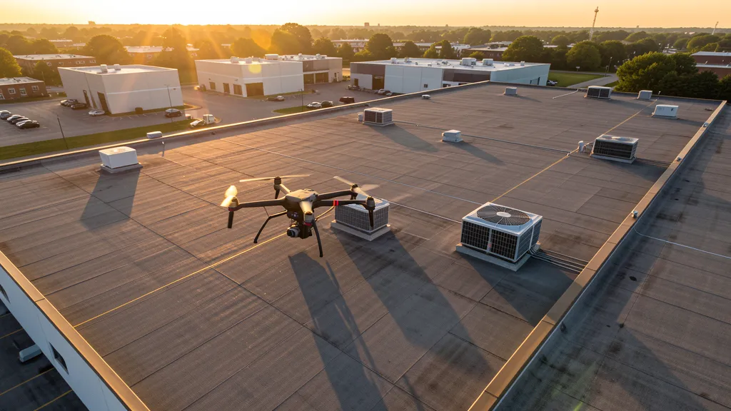
Get Matched With a Local Surveyor
Roof Inspection Pricing in Oxnard, CA
Low End
$200
High End
$750
Turnaround
1-2 days
Cost ranges are based on market data for Oxnard-Thousand Oaks-Ventura. Actual pricing depends on site size, complexity, and deliverables.
Common Roof Inspection Applications in Oxnard
- Pre-purchase roof assessments
- Insurance claim documentation
- Storm damage evaluation
- Routine maintenance inspections
Local Drone Regulations
Roof inspections in Oxnard require compliance with local drone regulations:
Local Drone Ordinances:
The City of Oxnard requires a commercial drone permit for operations taking off or landing on city-owned property, including parks, beaches, and public facilities. Flights from private property (with owner permission) do not require a city permit but must comply with FAA Part 107 rules. LAANC authorization is required for operations within controlled airspace around Oxnard and Camarillo airports. The city's coastal location means operators should be aware of Naval Base Ventura County restricted airspace near Port Hueneme.
Restricted Airspace in Oxnard:
- Class D airspace around Oxnard Airport (OXR) — extends approximately 4 nautical miles, surface to 3,000 ft AGL. LAANC authorization required for all commercial drone flights within this zone.
- Class D airspace around Camarillo Airport (CMA) — located approximately 6 miles east. Requires LAANC authorization for commercial operations within 4 nautical miles.
- Naval Base Ventura County (NBVC) — Point Mugu and Port Hueneme facilities have restricted airspace. Drone flights near the coastal facilities may encounter military operating areas and TFRs. Check for active restrictions before planning coastal missions.
- Channel Islands Harbor — drone flights over the harbor and marina areas are regulated by the Ventura County Harbor Department. Commercial operators should notify harbor operations before flights near the harbor.
- Oxnard city parks and beaches — drone takeoff and landing prohibited on city park and beach property without a special use permit from the Oxnard Parks and Recreation Department.
California drone regulations require FAA Part 107 certification for all commercial drone operations. Our network of verified operators in Oxnard meets all federal and state requirements.
Drone Regulations in Oxnard, CA
Airports & LAANC Zones
- OXR — Oxnard Airport (Class D, Oxnard)
- CMA — Camarillo Airport (Class D, Camarillo)
- SBA — Santa Barbara Airport (Class C, Santa Barbara)
- VNY — Van Nuys Airport (Class C, general aviation)
Restricted Airspace
- Class D airspace around Oxnard Airport (OXR) — extends approximately 4 nautical miles, surface to 3,000 ft AGL. LAANC authorization required for all commercial drone flights within this zone.
- Class D airspace around Camarillo Airport (CMA) — located approximately 6 miles east. Requires LAANC authorization for commercial operations within 4 nautical miles.
- Naval Base Ventura County (NBVC) — Point Mugu and Port Hueneme facilities have restricted airspace. Drone flights near the coastal facilities may encounter military operating areas and TFRs. Check for active restrictions before planning coastal missions.
- Channel Islands Harbor — drone flights over the harbor and marina areas are regulated by the Ventura County Harbor Department. Commercial operators should notify harbor operations before flights near the harbor.
- Oxnard city parks and beaches — drone takeoff and landing prohibited on city park and beach property without a special use permit from the Oxnard Parks and Recreation Department.
Local Ordinances
The City of Oxnard requires a commercial drone permit for operations taking off or landing on city-owned property, including parks, beaches, and public facilities. Flights from private property (with owner permission) do not require a city permit but must comply with FAA Part 107 rules. LAANC authorization is required for operations within controlled airspace around Oxnard and Camarillo airports. The city's coastal location means operators should be aware of Naval Base Ventura County restricted airspace near Port Hueneme.
All drone operations in Oxnard must comply with FAA Part 107 rules. Operators must obtain LAANC authorization before flying in controlled airspace near Oxnard airports. Our network operators handle all permitting and airspace authorizations as part of their service.
Roof Inspection FAQ — Oxnard, CA
How does a drone roof inspection work in Oxnard?
We fly a drone equipped with high-resolution and optional thermal cameras over your roof in Oxnard, capturing detailed imagery of every surface, flashing, and penetration. No ladders, no scaffolding, no risk to personnel.
Can drone roof inspections detect leaks?
Yes. Thermal imaging detects moisture trapped under roofing materials by temperature differentials. This identifies active leaks and areas of concern before they become visible inside the building.
What does a roof inspection report include?
Your report includes high-resolution photos organized by roof section, a condition assessment with annotated problem areas, thermal imagery (if requested), and 3D model data for measurement and documentation. Reports are suitable for insurance claims and maintenance planning.
Drone Regulations FAQ — Oxnard, CA
Do I need a permit for a drone survey in Oxnard?
You need a City of Oxnard commercial drone permit only if you plan to take off or land on city-owned property, including parks, beaches, and public facilities. Surveys conducted from private property (with owner permission) do not require a city permit. All commercial drone operations require an FAA Part 107 Remote Pilot Certificate.
Can I fly a drone near Naval Base Ventura County?
Naval Base Ventura County (NBVC) includes facilities at Point Mugu and Port Hueneme with restricted airspace. Drone flights near these facilities may encounter military operating areas and TFRs. Check for active restrictions before planning coastal missions in the Port Hueneme area.
How much does a drone survey cost in Oxnard?
Topographic surveys in the Oxnard area typically range from $1,800 to $4,500. Roof inspections run $200-$750. LiDAR scanning for agricultural or industrial sites can cost $2,800-$8,000. Real estate drone photography starts at $150.
Can I fly a drone over Oxnard beaches?
Drone takeoff and landing are prohibited on city beach property without a special use permit from the Oxnard Parks and Recreation Department. Commercial operators should plan flights from private property with owner permission or apply for permits in advance. Beach areas also fall within proximity to Naval Base Ventura County airspace.
What construction projects are driving drone survey demand in Oxnard?
Channel Islands Harbor development, downtown revitalization, agricultural land conversion to residential use, and industrial expansion near the harbor are the primary drivers. The city's coastal location also creates demand for coastal bluff monitoring and environmental surveys.
Can drones be used for agricultural mapping in the Oxnard area?
Yes. Oxnard is in one of California's most productive agricultural regions, and drone-based agricultural mapping is a growing service. Multispectral imaging, crop health analysis, and irrigation monitoring are common applications. Operators should be aware of airspace restrictions near Oxnard and Camarillo airports when planning flights over agricultural areas.
All Drone Survey Services in Oxnard, CA
Compare pricing across all drone survey services available in Oxnard, California.
| Service | Low End | High End | Turnaround |
|---|---|---|---|
| Topographic Survey | $1,800 | $4,500 | 3-5 days |
| Drone Inspection | $250 | $800 | 1-2 days |
| LiDAR Scanning | $2,800 | $8,000 | 5-7 days |
| Environmental Monitoring | $750 | $2,800 | 2-4 days |
| Aerial Imagery | $150 | $500 | 1-2 days |
| Construction Monitoring | $1,000 | $2,800 | Monthly |
| Real Estate Photography | $150 | $450 | 1-2 days |
| Roof Inspection ← you are here | $200 | $750 | 1-2 days |
Pricing ranges are based on market data for Oxnard-Thousand Oaks-Ventura. Actual costs depend on project scope, site conditions, and required deliverables.
Are You a Drone Surveyor in Oxnard, CA?
Join our network of FAA-certified operators. Get matched with roof inspection projects in Oxnard and the surrounding Oxnard-Thousand Oaks-Ventura area.
Apply to Join