Roof Inspection in Springdale, AR
Drone roof inspections with high-resolution imagery and 3D modeling. Identify damage, assess condition, and generate detailed reports for insurance and maintenance.
Serving Washington County & the Fayetteville-Springdale-Rogers, AR-MSA (Northwest Arkansas) area
Request a Free Quote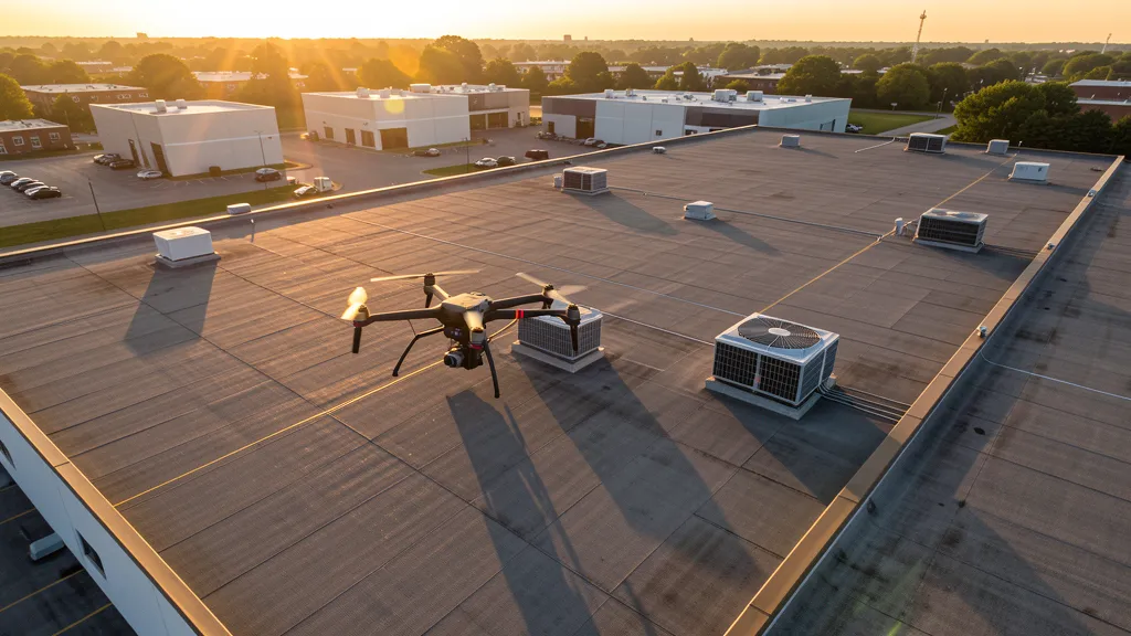
Get Matched With a Local Operator
Roof Inspection Pricing in Springdale, AR
Low End
$250
High End
$850
Turnaround
1-2 days
Cost ranges are based on market data for Fayetteville-Springdale-Rogers, AR-MSA (Northwest Arkansas). Actual pricing depends on site size, complexity, and deliverables.
Common Roof Inspection Applications in Springdale
- Pre-purchase roof assessments
- Insurance claim documentation
- Storm damage evaluation
- Routine maintenance inspections
Local Drone Regulations
Roof inspections in Springdale require compliance with local drone regulations:
Local Drone Ordinances:
Springdale operates under Arkansas state drone law (Act 819 of 2019) with local regulations limited by Ark. Code Ann. § 14-361-120, which preempts municipalities from regulating flight paths and navigable airspace. The City of Springdale requires permits for commercial drone takeoff and landing on city-owned property, including parks and public facilities. Springdale Parks and Recreation manages Murphy Park, Luther George Park, and the Razorback Regional Greenway trail segments, where commercial drone operations require prior authorization. Springdale Municipal Airport (ASG) requires drone operators to coordinate with the airport manager for any flights within 5 nautical miles, particularly during corporate jet traffic hours serving Tyson Foods. The Springdale Planning Department requires aerial imaging documentation for major development site plans submitted under the city Unified Development Ordinance, especially for industrial and warehouse projects along the Don Tyson Parkway corridor.
Restricted Airspace in Springdale:
- Northwest Arkansas National Airport (XNA) Class D airspace extends to 4.3 nautical miles from the airport center. LAANC authorization required for commercial drone operations within this radius. The XNA Class D shelf sits at 2,500 feet MSL up to 5,000 feet MSL. The northwest edge of Springdale falls within this radius, so operators in the Harmon and Oak Grove areas should check the FAA B4UFLY app before flying.
- Springdale Municipal Airport (ASG) is an active general aviation airport within city limits along Robinson Avenue. While it does not have controlled Class D airspace, drone operators must notify the airport manager before flying within 5 nautical miles. The airport handles corporate jet traffic serving Tyson Foods headquarters and has an active traffic pattern that should be avoided during business hours.
- Arvest Ballpark, home of the Northwest Arkansas Naturals (Minor League Baseball), hosts large public gatherings during the season. FAA Part 107 prohibits flying directly over non-participants. Game days can trigger temporary flight restrictions (TFRs) extending up to 3 nautical miles around the stadium, typically from 1 hour before to 1 hour after events.
- Murphy Park and the Razorback Regional Greenway trail system are high-traffic recreational corridors. Commercial drone takeoff and landing on city-owned park property requires authorization from Springdale Parks and Recreation. The Springdale Creek Watershed and urban waterways have additional environmental sensitivity restrictions.
- Ebbing Air National Guard Base in Fort Smith (approximately 85 NM south) has restricted airspace that does not extend into Washington or Benton County. However, TFRs for military training operations can occasionally affect the broader NWA region. Check NOTAMs before flying.
Arkansas drone regulations require FAA Part 107 certification for all commercial drone operations. Our network of verified operators in Springdale meets all federal and state requirements.
Drone Regulations in Springdale, AR
Airports & LAANC Zones
- ASG — Springdale Municipal Airport (Class E airspace, within city limits)
- XNA — Northwest Arkansas National Airport (Class D airspace, approximately 12 NM northwest near Highfill)
- ROG — Rogers Executive Airport (Class E airspace, approximately 8 NM northeast in Rogers)
- FYV — Drake Field Airport (Class E airspace, approximately 12 NM south in Fayetteville)
Restricted Airspace
- Northwest Arkansas National Airport (XNA) Class D airspace extends to 4.3 nautical miles from the airport center. LAANC authorization required for commercial drone operations within this radius. The XNA Class D shelf sits at 2,500 feet MSL up to 5,000 feet MSL. The northwest edge of Springdale falls within this radius, so operators in the Harmon and Oak Grove areas should check the FAA B4UFLY app before flying.
- Springdale Municipal Airport (ASG) is an active general aviation airport within city limits along Robinson Avenue. While it does not have controlled Class D airspace, drone operators must notify the airport manager before flying within 5 nautical miles. The airport handles corporate jet traffic serving Tyson Foods headquarters and has an active traffic pattern that should be avoided during business hours.
- Arvest Ballpark, home of the Northwest Arkansas Naturals (Minor League Baseball), hosts large public gatherings during the season. FAA Part 107 prohibits flying directly over non-participants. Game days can trigger temporary flight restrictions (TFRs) extending up to 3 nautical miles around the stadium, typically from 1 hour before to 1 hour after events.
- Murphy Park and the Razorback Regional Greenway trail system are high-traffic recreational corridors. Commercial drone takeoff and landing on city-owned park property requires authorization from Springdale Parks and Recreation. The Springdale Creek Watershed and urban waterways have additional environmental sensitivity restrictions.
- Ebbing Air National Guard Base in Fort Smith (approximately 85 NM south) has restricted airspace that does not extend into Washington or Benton County. However, TFRs for military training operations can occasionally affect the broader NWA region. Check NOTAMs before flying.
Local Ordinances
Springdale operates under Arkansas state drone law (Act 819 of 2019) with local regulations limited by Ark. Code Ann. § 14-361-120, which preempts municipalities from regulating flight paths and navigable airspace. The City of Springdale requires permits for commercial drone takeoff and landing on city-owned property, including parks and public facilities. Springdale Parks and Recreation manages Murphy Park, Luther George Park, and the Razorback Regional Greenway trail segments, where commercial drone operations require prior authorization. Springdale Municipal Airport (ASG) requires drone operators to coordinate with the airport manager for any flights within 5 nautical miles, particularly during corporate jet traffic hours serving Tyson Foods. The Springdale Planning Department requires aerial imaging documentation for major development site plans submitted under the city Unified Development Ordinance, especially for industrial and warehouse projects along the Don Tyson Parkway corridor.
All drone operations in Springdale must comply with FAA Part 107 rules. Operators must obtain LAANC authorization before flying in controlled airspace near Springdale airports. Our network operators handle all permitting and airspace authorizations as part of their service.
Roof Inspection FAQ — Springdale, AR
How does a drone roof inspection work in Springdale?
We fly a drone equipped with high-resolution and optional thermal cameras over your roof in Springdale, capturing detailed imagery of every surface, flashing, and penetration. No ladders, no scaffolding, no risk to personnel.
Can drone roof inspections detect leaks?
Yes. Thermal imaging detects moisture trapped under roofing materials by temperature differentials. This identifies active leaks and areas of concern before they become visible inside the building.
What does a roof inspection report include?
Your report includes high-resolution photos organized by roof section, a condition assessment with annotated problem areas, thermal imagery (if requested), and 3D model data for measurement and documentation. Reports are suitable for insurance claims and maintenance planning.
Drone Regulations FAQ — Springdale, AR
Do I need LAANC authorization to fly a drone in Springdale?
The northwest edge of Springdale, including the Harmon and Oak Grove areas, falls within the Northwest Arkansas National Airport (XNA) Class D airspace radius of 4.3 nautical miles. Use the FAA B4UFLY app or LAANC provider apps (Aloft, AirMap) to request near-real-time authorization if your flight location is within this zone. Springdale Municipal Airport (ASG) does not have controlled Class D airspace but requires operator notification for flights within 5 nautical miles, especially during corporate jet traffic hours.
What is the cost of an aerial imaging for a construction site in Springdale?
Topographic drone data collection in Springdale typically ranges from $1,100 to $3,600 depending on acreage and terrain complexity. Construction monitoring visits cost $350 to $1,600 per session. LiDAR scanning runs $1,900 to $7,200. The rolling Ozark terrain and active industrial and warehouse construction along Don Tyson Parkway make aerial mapping valuable for both commercial and residential development sites across the NWA corridor.
Can I fly a drone over Arvest Ballpark or Murphy Park in Springdale?
Arvest Ballpark, home of the Northwest Arkansas Naturals, is a high-traffic public venue. FAA Part 107 prohibits flying directly over non-participants. Game days can trigger temporary flight restrictions (TFRs) extending up to 3 nautical miles around the stadium. Murphy Park and the Razorback Regional Greenway trail are city-owned recreational areas where commercial drone takeoff and landing requires authorization from Springdale Parks and Recreation.
Are there restrictions near Springdale Municipal Airport (ASG)?
Springdale Municipal Airport (ASG) is a general aviation airport within city limits along Robinson Avenue. While it does not have controlled Class D airspace, drone operators must notify the airport manager before flying within 5 nautical miles. The airport handles corporate jet traffic serving Tyson Foods headquarters and has active traffic patterns during business hours. Avoid the approach and departure corridors, especially during morning and evening corporate flight peaks.
Can I fly a drone over Springdale parks or city facilities?
Commercial drone takeoff and landing on city-owned property in Springdale requires authorization from Springdale Parks and Recreation. Murphy Park, Luther George Park, and the Razorback Regional Greenway trail segments have recreational traffic and event-specific restrictions. The Springdale Planning Department requires aerial imaging documentation for major site plan submissions under the city Unified Development Ordinance, particularly for industrial and warehouse projects along the Don Tyson Parkway corridor.
Does Arkansas require state drone registration for commercial operators?
No. Arkansas does not require state drone registration. Operators need a valid FAA Part 107 Remote Pilot Certificate and must comply with Ark. Code Ann. § 5-60-130 privacy restrictions under Act 819 of 2019. The state preempts local regulation of drone flight paths under Ark. Code Ann. § 14-361-120, though Springdale may regulate takeoff and landing on public property. Arkansas state parks require a permit from the Department of Parks, Heritage and Tourism for commercial drone operations.
All Aerial Imaging Services in Springdale, AR
Compare pricing across all aerial imaging services available in Springdale, Arkansas.
| Service | Low End | High End | Turnaround |
|---|---|---|---|
| Topographic Data Collection | $1,100 | $3,600 | 3-6 days |
| Drone Inspection | $350 | $1,800 | 1-3 days |
| LiDAR Scanning | $1,900 | $7,200 | 4-9 days |
| Environmental Monitoring | $500 | $2,700 | 2-4 days |
| Aerial Imagery | $300 | $1,100 | 1-2 days |
| Construction Monitoring | $350 | $1,600 | 1-3 days per visit |
| Real Estate Photography | $175 | $600 | 1-2 days |
| Roof Inspection ← you are here | $250 | $850 | 1-2 days |
Pricing ranges are based on market data for Fayetteville-Springdale-Rogers, AR-MSA (Northwest Arkansas). Actual costs depend on project scope, site conditions, and required deliverables.
Other Aerial Imaging Services in Springdale, AR
Roof Inspection in Nearby Cities
Are You a Drone Operator in Springdale, AR?
Join our network of FAA-certified operators. Get matched with roof inspection projects in Springdale and the surrounding Fayetteville-Springdale-Rogers, AR-MSA (Northwest Arkansas) area.
Apply to Join