Roof Inspection in Springfield, MA
Drone roof inspections with high-resolution imagery and 3D modeling. Identify damage, assess condition, and generate detailed reports for insurance and maintenance.
Serving Hampden County & the Springfield, MA-CT Metropolitan Statistical Area (Hampden County, Massachusetts and Hartford County, Connecticut) area
Request a Free Quote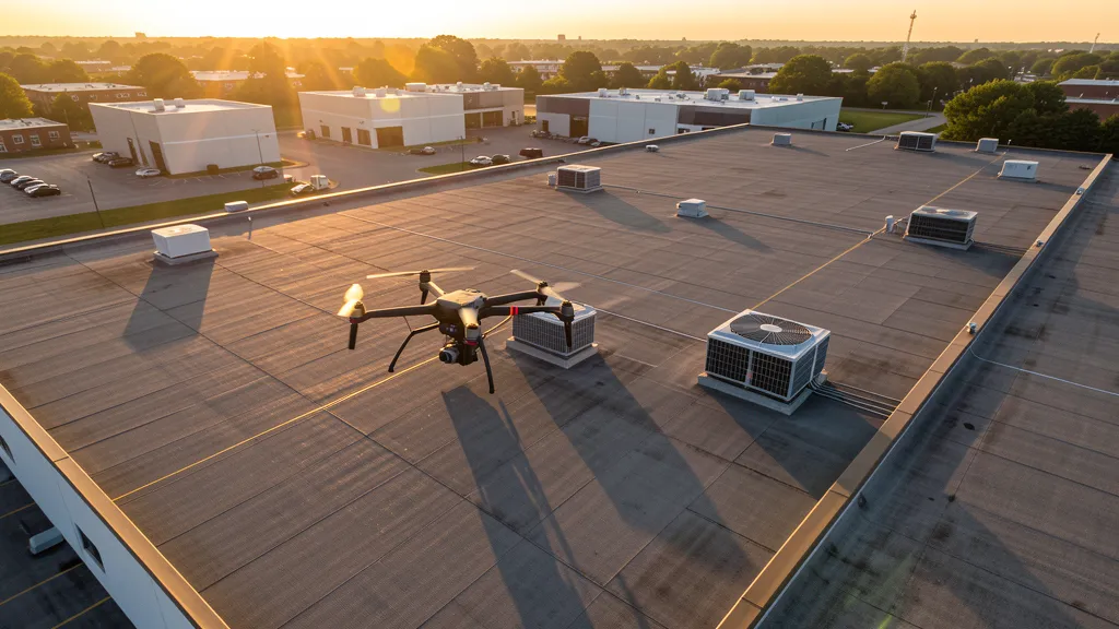
Get Matched With a Local Operator
Roof Inspection Pricing in Springfield, MA
Low End
$250
High End
$700
Turnaround
1-2 days
Cost ranges are based on market data for Springfield, MA-CT Metropolitan Statistical Area (Hampden County, Massachusetts and Hartford County, Connecticut). Actual pricing depends on site size, complexity, and deliverables.
Common Roof Inspection Applications in Springfield
- Pre-purchase roof assessments
- Insurance claim documentation
- Storm damage evaluation
- Routine maintenance inspections
Local Drone Regulations
Roof inspections in Springfield require compliance with local drone regulations:
Local Drone Ordinances:
Springfield is governed by Massachusetts state drone law (MGL Ch. 90 § 48C, 2024) and FAA Part 107 regulations. The City of Springfield does not have a specific municipal drone ordinance as of 2026, but commercial drone takeoff and landing on city-owned property requires authorization from the Springfield Department of Parks, Buildings, and Recreation Management. City parks including Forest Park, Van Horn Park, and Blunt Park require explicit permission for commercial drone operations. The Massachusetts DCR prohibits drone takeoff and landing in state parks under 350 CMR 12.00 without a special use permit. The Robinson State Park in Agawam and the Mount Tom State Reservation require DCR special use permits. Commercial drone filming for the MGM Springfield casino, the MassMutual Center, or downtown projects requires a film permit from the Springfield Office of Film and Entertainment. FAA Part 107 Remote Pilot Certification is required for all commercial operations. LAANC authorization is required for flights within BAF Class D airspace (western Springfield) and CEF Class D airspace (northeastern Springfield near Chicopee). Operators near Westover Air Reserve Base should check NOTAMs for military TFRs.
Restricted Airspace in Springfield:
- Westfield-Barnes Regional Airport (BAF) has Class D airspace with a 4.4 NM radius extending from the surface to 2,600 feet MSL. While the airport is 5 NM west of downtown Springfield, the Class D lateral boundaries extend into western Springfield neighborhoods including Forest Park and East Longmeadow borders. Commercial drone operations in western Springfield should verify their position relative to the BAF Class D. LAANC authorization is available through Aloft or DroneUp.
- Bradley International Airport (BDL) has Class C airspace with a 5 NM radius surface area and an outer area extending to 10 NM, located 20 NM south in Windsor Locks, CT. While Springfield is outside the BDL Class C surface area, the outer area may extend into southern Hampden County. Operators in Agawam, Longmeadow, and East Longmeadow should verify altitude shelves using the FAA B4UFLY app.
- Westover Air Reserve Base (CEF) is a joint-use military/civilian airport 8 NM northeast in Chicopee, MA. The base conducts C-5 Galaxy heavy airlift operations and can issue TFRs during military exercises. The CEF Class D airspace extends 4.4 NM from the airport to 2,600 feet MSL. Commercial operators in the Chicopee and Indian Orchard areas should check NOTAMs for military TFRs and coordinate with base operations if flying near the Westover area. The base also hosts the Westover Air Show, which generates large TFRs.
- The Connecticut River corridor through Springfield has no specific airspace restrictions, but operators should be aware of bridge inspection activities and the Memorial Bridge, South End Bridge, and North End Bridge corridors. The MGM Springfield casino complex and the MassMutual Center are not specifically restricted but require coordination for commercial filming operations near large public venues.
- Critical infrastructure restrictions under MGL Ch. 90 § 48C include the Indian Orchard industrial corridor, the Springfield Water and Sewer Commission facilities, and the Eversource West Springfield substation complex. Forest Park and the Van Horn Park are under city jurisdiction, requiring Parks Department authorization for commercial drone takeoff and landing.
Massachusetts drone regulations require FAA Part 107 certification for all commercial drone operations. Our network of verified operators in Springfield meets all federal and state requirements.
Drone Regulations in Springfield, MA
Airports & LAANC Zones
- BAF — Westfield-Barnes Regional Airport (Class D airspace, 5 NM west in Westfield, MA — GA, corporate, and military traffic; LAANC available)
- BDL — Bradley International Airport (Class C airspace, 20 NM south in Windsor Locks, CT — major regional commercial airport; LAANC available)
- CEF — Westover Air Reserve Base / Metropolitan Airport (military/civilian joint-use, 8 NM northeast in Chicopee — C-5 Galaxy operations; LAANC available for civilian areas, military TFRs common)
Restricted Airspace
- Westfield-Barnes Regional Airport (BAF) has Class D airspace with a 4.4 NM radius extending from the surface to 2,600 feet MSL. While the airport is 5 NM west of downtown Springfield, the Class D lateral boundaries extend into western Springfield neighborhoods including Forest Park and East Longmeadow borders. Commercial drone operations in western Springfield should verify their position relative to the BAF Class D. LAANC authorization is available through Aloft or DroneUp.
- Bradley International Airport (BDL) has Class C airspace with a 5 NM radius surface area and an outer area extending to 10 NM, located 20 NM south in Windsor Locks, CT. While Springfield is outside the BDL Class C surface area, the outer area may extend into southern Hampden County. Operators in Agawam, Longmeadow, and East Longmeadow should verify altitude shelves using the FAA B4UFLY app.
- Westover Air Reserve Base (CEF) is a joint-use military/civilian airport 8 NM northeast in Chicopee, MA. The base conducts C-5 Galaxy heavy airlift operations and can issue TFRs during military exercises. The CEF Class D airspace extends 4.4 NM from the airport to 2,600 feet MSL. Commercial operators in the Chicopee and Indian Orchard areas should check NOTAMs for military TFRs and coordinate with base operations if flying near the Westover area. The base also hosts the Westover Air Show, which generates large TFRs.
- The Connecticut River corridor through Springfield has no specific airspace restrictions, but operators should be aware of bridge inspection activities and the Memorial Bridge, South End Bridge, and North End Bridge corridors. The MGM Springfield casino complex and the MassMutual Center are not specifically restricted but require coordination for commercial filming operations near large public venues.
- Critical infrastructure restrictions under MGL Ch. 90 § 48C include the Indian Orchard industrial corridor, the Springfield Water and Sewer Commission facilities, and the Eversource West Springfield substation complex. Forest Park and the Van Horn Park are under city jurisdiction, requiring Parks Department authorization for commercial drone takeoff and landing.
Local Ordinances
Springfield is governed by Massachusetts state drone law (MGL Ch. 90 § 48C, 2024) and FAA Part 107 regulations. The City of Springfield does not have a specific municipal drone ordinance as of 2026, but commercial drone takeoff and landing on city-owned property requires authorization from the Springfield Department of Parks, Buildings, and Recreation Management. City parks including Forest Park, Van Horn Park, and Blunt Park require explicit permission for commercial drone operations. The Massachusetts DCR prohibits drone takeoff and landing in state parks under 350 CMR 12.00 without a special use permit. The Robinson State Park in Agawam and the Mount Tom State Reservation require DCR special use permits. Commercial drone filming for the MGM Springfield casino, the MassMutual Center, or downtown projects requires a film permit from the Springfield Office of Film and Entertainment. FAA Part 107 Remote Pilot Certification is required for all commercial operations. LAANC authorization is required for flights within BAF Class D airspace (western Springfield) and CEF Class D airspace (northeastern Springfield near Chicopee). Operators near Westover Air Reserve Base should check NOTAMs for military TFRs.
All drone operations in Springfield must comply with FAA Part 107 rules. Operators must obtain LAANC authorization before flying in controlled airspace near Springfield airports. Our network operators handle all permitting and airspace authorizations as part of their service.
Roof Inspection FAQ — Springfield, MA
How does a drone roof inspection work in Springfield?
We fly a drone equipped with high-resolution and optional thermal cameras over your roof in Springfield, capturing detailed imagery of every surface, flashing, and penetration. No ladders, no scaffolding, no risk to personnel.
Can drone roof inspections detect leaks?
Yes. Thermal imaging detects moisture trapped under roofing materials by temperature differentials. This identifies active leaks and areas of concern before they become visible inside the building.
What does a roof inspection report include?
Your report includes high-resolution photos organized by roof section, a condition assessment with annotated problem areas, thermal imagery (if requested), and 3D model data for measurement and documentation. Reports are suitable for insurance claims and maintenance planning.
Drone Regulations FAQ — Springfield, MA
Do I need LAANC authorization to fly a drone in Springfield?
It depends on location. Westfield-Barnes Regional Airport (BAF) has Class D airspace extending into western Springfield neighborhoods including Forest Park and East Longmeadow. Westover Air Reserve Base (CEF) has Class D airspace affecting the Indian Orchard and Chicopee areas. Most of downtown Springfield is in Class E airspace and does not require LAANC authorization. However, operators should always check the FAA B4UFLY app for current airspace status, especially near BAF, CEF, and Bradley International Airport (BDL) Class C to the south.
What is the cost of an aerial imaging for a construction site in Springfield?
Topographic drone data collection in Springfield typically ranges from $1,100 to $3,800 depending on acreage, terrain, and proximity to BAF or CEF Class D airspace. Construction monitoring visits cost $300 to $1,200 per session. LiDAR scanning runs $1,900 to $6,000. The MGM Springfield complex, Union Station, and Baystate Health expansion create steady demand for aerial mapping on urban and institutional sites. Springfield offers more competitive pricing than Boston due to lower airspace complexity and operating costs.
Are there restrictions near Westover Air Reserve Base?
Yes. Westover Air Reserve Base (CEF) in Chicopee, approximately 8 miles northeast of downtown Springfield, is a joint-use military/civilian airport conducting C-5 Galaxy heavy airlift operations. The CEF Class D airspace extends 4.4 NM to 2,600 feet MSL. The base can issue TFRs during military exercises and the Westover Air Show. Commercial operators in the Indian Orchard and Chicopee areas should check NOTAMs for military TFRs and coordinate with base operations. LAANC authorization is available for the civilian portion of the CEF Class D area.
Can I fly a drone over Forest Park or other Springfield parks?
Springfield city parks including Forest Park, Van Horn Park, and Blunt Park require authorization from the Springfield Department of Parks, Buildings, and Recreation Management for commercial drone takeoff and landing. Massachusetts state parks including Robinson State Park in Agawam and Mount Tom State Reservation prohibit drone operations under DCR regulation 350 CMR 12.00 without a special use permit. FAA Part 107 prohibits flying directly over non-participants, so active parks and recreational areas require careful timing.
What construction projects are driving drone aerial imaging demand in Springfield?
Springfield is experiencing significant redevelopment driven by the MGM Springfield casino ($960M investment), the Union Station multimodal transit center, the CRRC railcar manufacturing facility ($95M), the Baystate Health campus expansion, and the Paramount Theater restoration. With $180+ million in annual construction permits, I-90/I-91/I-291 highway access, and the most affordable commercial real estate among Massachusetts major cities, Springfield offers strong opportunities for drone aerial imaging firms serving the casino, institutional, manufacturing, and transit-oriented development sectors.
Does Massachusetts require state drone registration for commercial operators in Springfield?
No. Massachusetts does not require state drone registration. Operators need a valid FAA Part 107 Remote Pilot Certificate and must comply with Massachusetts General Laws Ch. 90 § 48C (2024), which addresses drone surveillance, privacy, and critical infrastructure restrictions. The state generally follows FAA Part 107 preemption on airspace regulation. Commercial operators near Westover Air Reserve Base should check NOTAMs for military TFRs. The City of Springfield regulates takeoff and landing on public property but cannot regulate airspace.
All Aerial Imaging Services in Springfield, MA
Compare pricing across all aerial imaging services available in Springfield, Massachusetts.
| Service | Low End | High End | Turnaround |
|---|---|---|---|
| Topographic Data Collection | $1,100 | $3,800 | 3-7 days |
| Drone Inspection | $300 | $1,400 | 1-3 days |
| LiDAR Scanning | $1,900 | $6,000 | 4-10 days |
| Environmental Monitoring | $400 | $2,000 | 2-5 days |
| Aerial Imagery | $225 | $950 | 1-2 days |
| Construction Monitoring | $300 | $1,200 | 1-3 days per visit |
| Real Estate Photography | $150 | $500 | 1-2 days |
| Roof Inspection ← you are here | $250 | $700 | 1-2 days |
Pricing ranges are based on market data for Springfield, MA-CT Metropolitan Statistical Area (Hampden County, Massachusetts and Hartford County, Connecticut). Actual costs depend on project scope, site conditions, and required deliverables.
Other Aerial Imaging Services in Springfield, MA
Are You a Drone Operator in Springfield, MA?
Join our network of FAA-certified operators. Get matched with roof inspection projects in Springfield and the surrounding Springfield, MA-CT Metropolitan Statistical Area (Hampden County, Massachusetts and Hartford County, Connecticut) area.
Apply to Join