Roof Inspection in St. Charles, IL
Drone roof inspections with high-resolution imagery and 3D modeling. Identify damage, assess condition, and generate detailed reports for insurance and maintenance.
Serving Kane & the Chicago metropolitan area area
Request a Free Quote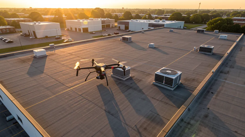
Get Matched With a Local Operator
Roof Inspection Pricing in St. Charles, IL
Low End
$175
High End
$550
Turnaround
1-2 days
Cost ranges are based on market data for Chicago metropolitan area. Actual pricing depends on site size, complexity, and deliverables.
Common Roof Inspection Applications in St. Charles
- Pre-purchase roof assessments
- Insurance claim documentation
- Storm damage evaluation
- Routine maintenance inspections
Local Drone Regulations
Roof inspections in St. Charles require compliance with local drone regulations:
Local Drone Ordinances:
St. Charles does not issue a separate city-level commercial drone permit. FAA Part 107 certification and LAANC authorization for any controlled airspace are the primary requirements. The City of St. Charles parks and recreation department manages drone takeoff and landing in city parks — operators should contact the Parks Department for permission. Flights over the Fox River and adjacent forest preserves require awareness of Illinois Department of Natural Resources and Kane County Forest Preserve District regulations. Operators flying near the historic downtown district should be mindful of pedestrian traffic and private property. Downtown festival and event areas (e.g., Scarecrow Festival, Festival of the Fox) have temporary flight restrictions during events.
Restricted Airspace in St. Charles:
- Class B airspace surrounds Chicago O'Hare (ORD) approximately 25 miles northeast. The outer Class B shelf extends over much of the western suburbs; check FAA UAS Facility Maps and LAANC grids before flying. LAANC authorization is required for controlled airspace portions.
- Class D airspace around Chicago Executive Airport (PWK) approximately 20 miles northeast. LAANC authorization required for flights within the Class D footprint. PWK is a busy general aviation and corporate jet airport with high traffic volume.
- Class D airspace around Aurora Municipal Airport (ARR) approximately 15 miles southwest. LAANC authorization required. ARR serves general aviation and glider operations.
- Class D airspace around Schaumburg Regional Airport (06C) approximately 18 miles east. LAANC authorization required for flights within the Class D area.
- The Fox River corridor runs through the center of St. Charles. Low-altitude flights over the river, forest preserves, and public parks require awareness of recreational boat traffic, pedestrians, and the Kane County Forest Preserve drone regulations.
- Severe weather: St. Charles is in the northern Illinois tornado and severe thunderstorm risk zone. Spring and summer storms (April-August) produce high winds, hail, and occasional tornadoes. Post-storm roof and property inspection is a significant aerial imaging use case.
Illinois drone regulations require FAA Part 107 certification for all commercial drone operations. Our network of verified operators in St. Charles meets all federal and state requirements.
Drone Regulations in St. Charles, IL
Airports & LAANC Zones
- ORD — Chicago O'Hare International Airport (Class B, 25 miles northeast — major commercial hub, LAANC required in shelf areas)
- PWK — Chicago Executive Airport (Class D, 20 miles northeast in Wheeling/Prospect Heights — LAANC required)
- ARR — Aurora Municipal Airport (Class D, 15 miles southwest near Sugar Grove — LAANC required)
- 06C — Schaumburg Regional Airport (Class D, 18 miles east — LAANC required)
Restricted Airspace
- Class B airspace surrounds Chicago O'Hare (ORD) approximately 25 miles northeast. The outer Class B shelf extends over much of the western suburbs; check FAA UAS Facility Maps and LAANC grids before flying. LAANC authorization is required for controlled airspace portions.
- Class D airspace around Chicago Executive Airport (PWK) approximately 20 miles northeast. LAANC authorization required for flights within the Class D footprint. PWK is a busy general aviation and corporate jet airport with high traffic volume.
- Class D airspace around Aurora Municipal Airport (ARR) approximately 15 miles southwest. LAANC authorization required. ARR serves general aviation and glider operations.
- Class D airspace around Schaumburg Regional Airport (06C) approximately 18 miles east. LAANC authorization required for flights within the Class D area.
- The Fox River corridor runs through the center of St. Charles. Low-altitude flights over the river, forest preserves, and public parks require awareness of recreational boat traffic, pedestrians, and the Kane County Forest Preserve drone regulations.
- Severe weather: St. Charles is in the northern Illinois tornado and severe thunderstorm risk zone. Spring and summer storms (April-August) produce high winds, hail, and occasional tornadoes. Post-storm roof and property inspection is a significant aerial imaging use case.
Local Ordinances
St. Charles does not issue a separate city-level commercial drone permit. FAA Part 107 certification and LAANC authorization for any controlled airspace are the primary requirements. The City of St. Charles parks and recreation department manages drone takeoff and landing in city parks — operators should contact the Parks Department for permission. Flights over the Fox River and adjacent forest preserves require awareness of Illinois Department of Natural Resources and Kane County Forest Preserve District regulations. Operators flying near the historic downtown district should be mindful of pedestrian traffic and private property. Downtown festival and event areas (e.g., Scarecrow Festival, Festival of the Fox) have temporary flight restrictions during events.
All drone operations in St. Charles must comply with FAA Part 107 rules. Operators must obtain LAANC authorization before flying in controlled airspace near St. Charles airports. Our network operators handle all permitting and airspace authorizations as part of their service.
Roof Inspection FAQ — St. Charles, IL
How does a drone roof inspection work in St. Charles?
We fly a drone equipped with high-resolution and optional thermal cameras over your roof in St. Charles, capturing detailed imagery of every surface, flashing, and penetration. No ladders, no scaffolding, no risk to personnel.
Can drone roof inspections detect leaks?
Yes. Thermal imaging detects moisture trapped under roofing materials by temperature differentials. This identifies active leaks and areas of concern before they become visible inside the building.
What does a roof inspection report include?
Your report includes high-resolution photos organized by roof section, a condition assessment with annotated problem areas, thermal imagery (if requested), and 3D model data for measurement and documentation. Reports are suitable for insurance claims and maintenance planning.
Drone Regulations FAQ — St. Charles, IL
Do I need a permit for an aerial imaging in St. Charles?
St. Charles does not issue a separate city-level drone permit. FAA Part 107 certification is mandatory. LAANC authorization is required for any controlled airspace within ORD Class B shelves or PWK/ARR/06C Class D zones. Drone takeoff and landing in city parks requires permission from the St. Charles Parks and Recreation Department.
How much does an aerial imaging cost in St. Charles?
St. Charles pricing reflects the Chicago western suburban market. Topographic data collection projects typically range from $1,200 to $3,800. LiDAR scanning runs $2,000 to $6,500. Roof inspections cost $175 to $550 per building. Real estate photography starts at $125.
What airspace restrictions affect drone operations in St. Charles?
Chicago O'Hare (ORD) Class B airspace is approximately 25 miles northeast and its outer shelves may extend over portions of the region. Chicago Executive (PWK) Class D is 20 miles northeast, Aurora Municipal (ARR) Class D is 15 miles southwest, and Schaumburg Regional (06C) Class D is 18 miles east. Always check FAA UAS Facility Maps and LAANC grids before flying.
Are there seasonal considerations for aerial imaging projects in St. Charles?
Northern Illinois spring and summer thunderstorms (April-August) can produce high winds, hail, and tornadoes. Post-storm roof and property inspection is a major use case. Winter snow cover (December-March) can limit ground-level topographic detail but supports roof snow load inspection. Always check NOTAMs and weather before flying.
Can I fly a drone over the Fox River or downtown St. Charles?
Flights over the Fox River corridor require awareness of recreational boat traffic, pedestrians, and private property. The historic downtown district and event areas (Scarecrow Festival, Festival of the Fox) may have temporary flight restrictions during events. Kane County Forest Preserve District regulations apply to drone use on preserve land. Coordinate with the City Parks Department for takeoff and landing permissions.
What makes St. Charles unique for aerial imaging work?
As the largest of the Fox River Tri-Cities, St. Charles blends a historic downtown resort heritage with active western-suburban development along the Randall Road corridor. The mix of riverfront mixed-use redevelopment, Charlestowne Mall revitalization, residential expansion, and Kane County transportation projects creates diverse data collection demand — all under the influence of ORD Class B and multiple Class D airspaces in the Chicago metro region.
All Aerial Imaging Services in St. Charles, IL
Compare pricing across all aerial imaging services available in St. Charles, Illinois.
| Service | Low End | High End | Turnaround |
|---|---|---|---|
| Topographic Data Collection | $1,200 | $3,800 | 3-5 days |
| Drone Inspection | $200 | $650 | 1-2 days |
| LiDAR Scanning | $2,000 | $6,500 | 5-7 days |
| Environmental Monitoring | $650 | $2,600 | 2-4 days |
| Aerial Imagery | $150 | $450 | 1-2 days |
| Construction Monitoring | $700 | $2,200 | Monthly |
| Real Estate Photography | $125 | $400 | 1-2 days |
| Roof Inspection ← you are here | $175 | $550 | 1-2 days |
Pricing ranges are based on market data for Chicago metropolitan area. Actual costs depend on project scope, site conditions, and required deliverables.
Other Aerial Imaging Services in St. Charles, IL
Roof Inspection in Nearby Cities
Are You a Drone Operator in St. Charles, IL?
Join our network of FAA-certified operators. Get matched with roof inspection projects in St. Charles and the surrounding Chicago metropolitan area area.
Apply to Join