Drone Property Surveys: Fast, Accurate Aerial Land Surveying
Drone property surveys deliver boundary data, topographic maps, and elevation models for your land in hours — not the weeks a traditional ground crew needs. AeriusView connects you with FAA-certified local drone operators who capture sub-inch-accuracy aerial data for residential lots, commercial parcels, and rural acreage at a fraction of traditional surveying costs.
Get a Property Survey Quote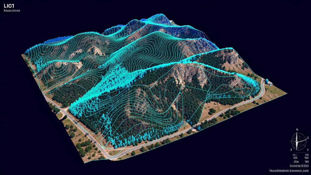
Cost range: $400 – $5,000
Turnaround: 2–5 business days
Accuracy: 1–3 cm with RTK/PPK
Coverage: Up to 500 acres/flight
What Is a Drone Property Survey?
A drone property survey uses an unmanned aerial vehicle (UAV) equipped with a high-resolution camera, RTK/PPK GPS, and sometimes a LiDAR sensor to capture aerial imagery and elevation data over a parcel of land. The drone flies a pre-planned grid pattern, capturing hundreds of overlapping geo-tagged photos. Post-processing software stitches these images into a single geo-referenced orthomosaic map, generates a digital surface model, and extracts contour lines and point clouds — all the spatial data a property owner, developer, or surveyor needs to understand the land. Unlike a traditional ground-based property survey that sends a crew walking the perimeter with total stations and GPS rovers, a drone survey captures the entire parcel from above in a fraction of the time. The aerial data can then be used directly for preliminary planning, or handed to a licensed land surveyor who uses it to accelerate field work and produce a stamped boundary survey. AeriusView's network of FAA-certified operators covers the entire United States, so whether you need a land surveyor drone flight for a rural 200-acre tract or a quick residential lot survey, we match you with a qualified local provider.
Rapid Site Coverage
A drone property survey covers 50 to 500 acres in a single flight, delivering boundary and topographic data in hours instead of the days or weeks required by traditional ground survey crews.
Sub-Inch Accuracy
RTK/PPK-corrected drone surveys achieve 1 to 3 cm horizontal and vertical accuracy — sufficient for boundary stakeout, elevation certificates, and preliminary site design.
Cost Savings Up to 70%
Drone property surveys cut field time and crew costs dramatically. A 100-acre tract that costs $5,000-plus for a traditional crew survey often comes in at $1,500 to $2,500 with aerial data collection.
Comprehensive Deliverables
Every drone property survey includes orthomosaic maps, digital surface models, contour lines, point clouds, and GPS-referenced boundary data — delivered in formats your surveyor, engineer, or GIS team can use immediately.
How Drone Property Surveys Work
The drone property survey process is straightforward and transparent, from initial request to final deliverables. AeriusView handles operator matching, flight planning, and quality assurance so you receive consistent, professional results every time.
Request & Match
Tell us your parcel size, location, and deliverable needs. We match you with a vetted, FAA-certified local drone operator.
Flight Planning
The operator plans the flight grid, sets ground control points, and files any required airspace authorizations with the FAA.
Data Capture
The drone flies the grid capturing overlapping geo-tagged photos. A 100-acre parcel is typically flown in under 90 minutes.
Processing & Delivery
Imagery is processed into orthomosaic maps, DSMs, DTMs, and contour lines. Deliverables arrive in 2 to 5 business days.
Why Choose AeriusView for Drone Property Surveys
AeriusView is the only national network that connects property owners, developers, and surveyors directly with FAA-certified drone operators experienced in property and boundary data collection. Every operator in our network holds a Part 107 Remote Pilot Certificate, carries liability insurance, and has been vetted for quality and reliability. We do not just hand you a name — we manage the project end-to-end, from flight planning to deliverable QA, so you get consistent results whether your parcel is in rural Texas or suburban New Jersey. Our operators use professional-grade RTK and PK-equipped drones, not consumer quadcopters, which means your survey data meets the accuracy standards required for engineering design, legal documentation, and county submission. We also maintain relationships with licensed land surveyors across the country, so if your project requires a stamped boundary survey or recorded plat, we can coordinate the aerial data collection with a licensed professional who can sign and seal the final deliverable. That end-to-end coordination is what sets AeriusView apart from booking a drone pilot off a gig platform. Learn more about how we work on our how it works page, or explore our full range of aerial data services.
Drone Property Survey Use Cases & Industries
Drone property surveys serve a wide range of property types and professional needs. Here are the most common applications our operators handle.
- Residential lot boundary verification and subdivision planning
- Agricultural land assessment and acreage calculation
- Commercial real estate site selection and due diligence
- Easement and right-of-way documentation
- Flood zone and elevation certificate support data
- Timber and rural property boundary marking
- Pre-construction site surveys for developers and builders
- Property dispute resolution and legal documentation
FAQs About Drone Property Surveys
Can a drone property survey replace a licensed land surveyor?
A drone property survey accelerates data collection and can provide preliminary boundary, topographic, and elevation data with high accuracy. However, official boundary determinations and recorded plats require a licensed land surveyor. AeriusView partners your aerial data with licensed surveyors when a stamped survey is needed.
How accurate are drone property surveys?
With RTK or PPK GPS correction, drone property surveys achieve 1 to 3 cm (0.4 to 1.2 inch) horizontal and vertical accuracy. This is sufficient for most preliminary site work, topographic mapping, and elevation documentation. Higher-accuracy ground control points can improve results further.
How much does a drone property survey cost?
Pricing depends on parcel size, terrain, vegetation, and deliverable requirements. Small residential lots (5 to 20 acres) typically range from $400 to $1,200. Larger tracts (50 to 500 acres) range from $1,500 to $5,000. Request a quote for site-specific pricing.
What do I receive from a drone property survey?
Standard deliverables include a geo-referenced orthomosaic map, digital surface model (DSM), digital terrain model (DTM), contour lines at your specified interval, point cloud data, and a survey report. Files are delivered in PDF, GeoTIFF, DWG, and LAS formats.
How long does a drone property survey take?
Field data collection for a typical 50 to 100 acre parcel is completed in a single 1 to 2 hour flight. Processing and delivery take 2 to 5 business days depending on deliverable complexity. Rush turnaround is available.
Need a Drone Property Survey?
Get matched with a local, FAA-certified drone operator for your property survey. Accurate data, fast turnaround, no obligation.
Request a Quote