Land Surveyor Drone Services: UAV-Accelerated Aerial Surveying
Pair a land surveyor with a drone and you get the best of both worlds: the speed and coverage of aerial data collection plus the legal authority of a licensed professional. AeriusView connects you with FAA-certified drone operators and coordinates with licensed land surveyors to deliver fast, accurate, stampable boundary and topographic surveys for any parcel in the United States.
Find a Land Surveyor Drone Operator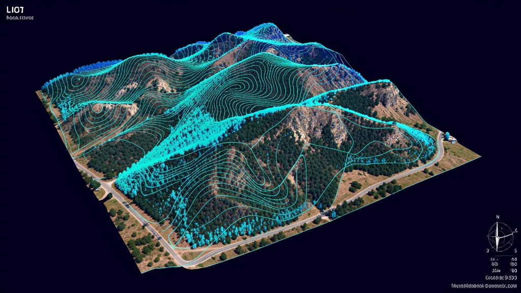
Cost range: $1,000 – $7,500
Turnaround: 3–7 business days
Accuracy: 1–3 cm with RTK/PPK
Coverage: Up to 500 acres/flight
What Is a Land Surveyor Drone?
A land surveyor drone is an unmanned aerial vehicle operated by or coordinated with a licensed land surveyor to capture the spatial data needed for boundary determination, topographic mapping, and elevation documentation. The drone is equipped with survey-grade GPS — typically Real-Time Kinematic (RTK) or Post-Processed Kinematic (PPK) — that provides centimeter-level positional accuracy, along with a high-resolution camera for photogrammetry or a LiDAR sensor for three-dimensional point cloud generation. The traditional land surveying workflow sends a two-person crew walking the site with total stations, GPS rovers, and measuring tapes, a process that can take a full week on a 100-acre parcel. A land surveyor drone captures that same area in a single 90-minute flight, generating an orthomosaic map, digital surface model, and point cloud that the surveyor uses to identify monumentation, trace boundaries, and produce topographic deliverables without spending days in the field. The licensed surveyor then reviews the aerial data, performs targeted ground verification at control points and property corners, and stamps the final survey for legal recording. This hybrid approach — drone for coverage, surveyor for authority — is why land surveyor drone services have become the fastest-growing segment of aerial data collection. AeriusView's network covers the entire country, so if you need a drone property survey or a full stamped boundary survey, we can match you with the right operator and surveyor team for your jurisdiction.
Licensed Surveyor Coordination
AeriusView does not just fly drones. We coordinate aerial data collection with licensed land surveyors so your final deliverable can be stamped, signed, and recorded when the project requires it.
10x Faster Field Work
A land surveyor drone captures 100 acres of topographic and boundary data in a single 90-minute flight, reducing field time from a full week of ground crew work to a single afternoon.
Survey-Grade Accuracy
RTK and PPK GPS correction delivers 1 to 3 cm positional accuracy, meeting the precision requirements for boundary stakeout, construction staking, and elevation certificates.
Nationwide Coverage
Our network of FAA-certified Part 107 drone operators spans all 50 states. Whether your project is urban or rural, we have a vetted local pilot who knows your terrain and airspace.
How Land Surveyor Drone Services Work
AeriusView manages the entire process, from operator matching through licensed surveyor coordination and final deliverable QA. Here is how a typical land surveyor drone project flows from request to stamped survey.
Project Intake
Share parcel location, acreage, and whether you need a stamped survey. We determine if a licensed surveyor is required and match accordingly.
Flight & Ground Control
The drone operator sets RTK/PPK ground control points, flies the grid, and captures overlapping geo-tagged imagery across the full parcel.
Surveyor Review
A licensed land surveyor reviews the aerial data, performs ground verification at key points, and prepares the boundary determination or topographic map.
Stamped Delivery
The surveyor signs and seals the final deliverable. You receive a stamped survey, orthomosaic, DSM, DTM, and point cloud in your requested formats.
Why Choose AeriusView for Land Surveyor Drone Services
AeriusView is the only national platform that coordinates both the drone operator and the licensed land surveyor in a single, managed engagement. Booking a drone pilot off a gig marketplace gets you aerial photos — it does not get you a stampable survey. Hiring a traditional survey firm gets you a licensed professional, but you pay full ground-crew rates and wait weeks for field work that a drone could complete in an afternoon. AeriusView bridges that gap. Every operator in our network holds a current FAA Part 107 Remote Pilot Certificate, carries a minimum of $1 million in liability insurance, and has been vetted for survey-grade data collection experience. Our licensed surveyor partners are registered in their respective states and familiar with local recording requirements, monumentation standards, and jurisdictional platting rules. We also handle project management, quality assurance, and deliverable formatting, so you are not left reconciling data from two separate vendors. Whether you need a quick drone property survey for due diligence or a full ALTA/NSPS land title survey coordinated with aerial data collection, AeriusView delivers a single point of contact and a consistent, professional result. Explore our topographic survey services or our full services directory to learn more.
Land Surveyor Drone Use Cases & Industries
Land surveyor drone services are used across residential, commercial, industrial, and agricultural sectors. Here are the most common applications.
- ALTA/NSPS land title surveys with aerial data support
- Subdivision platting and lot boundary stakeout
- Topographic surveys for site design and grading plans
- Elevation certificates for flood zone determination
- Construction staking and as-built surveys
- Right-of-way and easement surveys for utilities
- Large-acreage agricultural and ranchland mapping
- Mortgage and inspection surveys with aerial verification
FAQs About Land Surveyor Drones
What is a land surveyor drone?
A land surveyor drone is a UAV equipped with survey-grade GPS (RTK or PPK), a high-resolution camera or LiDAR sensor, used by or coordinated with a licensed land surveyor to capture boundary, topographic, and elevation data. The drone dramatically accelerates field data collection while the licensed surveyor ensures the final deliverable meets legal and professional standards.
Do I need a licensed surveyor for a drone survey?
If you need a stamped, recorded, or legally binding boundary survey, yes — a licensed land surveyor must sign and seal the final deliverable. For preliminary topographic data, elevation models, orthomosaic maps, and planning purposes, a drone survey alone is sufficient. AeriusView offers both standalone aerial data collection and licensed-surveyor-coordinated services.
How does a drone help a land surveyor?
A drone captures comprehensive aerial imagery and elevation data in a single flight, covering terrain that would take a ground crew days to traverse. The surveyor uses this data to accelerate boundary determination, identify monumentation, and produce topographic maps — reducing field time by up to 90% while improving data density and coverage.
What equipment do land surveyor drones use?
Professional land surveyor drones carry RTK or PPK GPS receivers for centimeter-level positioning, high-resolution cameras (20MP+) for photogrammetry, and sometimes LiDAR sensors for vegetation penetration. Common platforms include the DJI Matrice 300/350 RTK, DJI Mavic 3 Enterprise, and senseFly eBee X, paired with sensors like the Zenmuse P1, L1, or L2.
How much does a land surveyor drone service cost?
Standalone drone data collection for a 50 to 100 acre parcel typically costs $1,000 to $2,500. Adding a licensed surveyor for boundary determination and stamping adds $1,500 to $5,000 depending on complexity and jurisdiction. Request a quote for project-specific pricing.
Need a Land Surveyor Drone?
Get matched with FAA-certified drone operators and licensed land surveyors. Fast, accurate, stampable surveys for any parcel.
Request a Quote