Drone Survey Services in Bastrop, TX
From The Boring Company headquarters and The Colony master-planned community to Camp Swift redevelopment and SH 71 commercial growth, Bastrop is an Austin exurb booming with industrial, residential, and infrastructure construction.
Serving Bastrop County & the Austin-Round Rock-San Marcos area
Request a Free Quote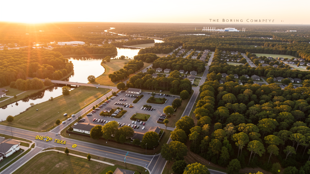
Get Matched With a Local Surveyor
Drone Survey Services Available in Bastrop, TX
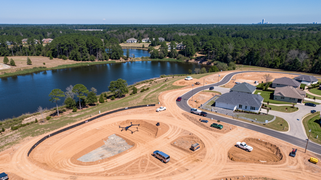
Bastrop sits in Bastrop County along SH 71 and the Colorado River, about 30 miles east of Austin. The city is an Austin exurb experiencing rapid growth as development pushes east. The Boring Company established its headquarters near Bastrop, bringing industrial construction and employee housing demand. The Colony, a 1,500-acre master-planned community, and Camp Swift redevelopment are major residential projects. The SH 71 corridor is the primary commercial development zone.
Drone Surveys for Bastrop's Construction Market
Bastrop is an Austin exurb experiencing rapid growth as development pushes east along SH 71. The Boring Company established its headquarters near Bastrop, bringing industrial construction and employee housing demand. The Colony development, a 1,500-acre master-planned community, is under construction along the Colorado River. Camp Swift, a former military training area, is being redeveloped for mixed-use. The SH 71 corridor is seeing commercial development including retail, medical offices, and distribution centers. Bastrop County issued over 1,200 residential permits in the most recent year.
Active Developers in the Area:
Typical Project Costs in Texas
Cost ranges are based on market data for Austin-Round Rock-San Marcos. Actual pricing depends on site size, complexity, and deliverables.
| Service Type | Low End | High End |
|---|---|---|
| Topographic Survey | $1,800 | $4,500 |
| Drone Inspection | $250 | $850 |
| LiDAR Scanning | $2,800 | $8,000 |
| Environmental Monitoring | $800 | $3,000 |
| Aerial Imagery | $175 | $500 |
| Construction Monitoring | $1,100 | $3,200 |
| Real Estate Photography | $150 | $450 |
| Roof Inspection | $200 | $750 |
Local Airspace & Regulations in Bastrop, TX
FAA Part 107 Requirements
All commercial drone operations in Texas require the pilot to hold an active FAA Part 107 Remote Pilot Certificate. Our network surveyors are verified Part 107 holders.
State Drone Laws
Texas Government Code Chapter 423 restricts drone use over critical infrastructure facilities, including oil and gas pipelines, refineries, power plants, and water treatment facilities. HB 1484 (2023) added protections for agricultural operations and expanded penalties for drone surveillance of private property. Commercial operators must hold a valid FAA Part 107 Remote Pilot Certificate. Texas does not require a separate state drone license, but operators flying near critical infrastructure must obtain authorization from the facility owner. The Texas Department of Public Safety maintains additional guidelines for drone operations near state facilities.
Local Ordinances
Bastrop follows Bastrop County regulations and FAA Part 107 rules. No city-specific drone permit is required for operations from private property. The city has a small municipal airport and pilots should notify the airport manager when operating nearby. Bastrop State Park prohibits drone use without a Texas Parks and Wildlife film permit. The Boring Company facility area may have advisory flight zones. Commercial drone operations for construction monitoring along SH 71 and Highway 21 are common.
Restricted Airspace
- Class C airspace around Austin-Bergstrom (AUS) extends 20 nautical miles. The western edge of Bastrop County may fall within LAANC-required zones depending on altitude.
- Bastrop County Airport (BAST) is Class E airspace — no LAANC required but pilots must notify the airport if operating within 5 miles.
- Bastrop State Park and the Lost Pines area have no formal drone restrictions, but commercial flights should coordinate with Texas Parks and Wildlife.
- The Boring Company (The Boring Company headquarters) facility may have security-related flight advisory zones. Check NOTAMs before flying near the facility.
Airports in the area: undefined (undefined), undefined (undefined), undefined (undefined), undefined (undefined)
Why Hire Through Aerius View in Bastrop, TX?
FAA-Certified
Every surveyor holds an active Part 107 Remote Pilot Certificate.
Local to Bastrop
Surveyors who know the Texas airspace and local permitting.
No Cost to Quote
Submit your project at no charge. Pay the surveyor directly if you proceed.
Fast Turnaround
A local surveyor contacts you within 2 business days.
How Our Bastrop Matching Process Works
We're actively building our network of FAA-certified drone operators in Bastrop, TX. Here's exactly what happens when you submit a project request.
Submit Your Project
Tell us your site location, acreage, and what you need (topographic survey, LiDAR, inspection, etc.). Takes 60 seconds. No cost, no obligation.
We Match & Vet
We identify Part 107-certified operators in Texas with the right equipment for your project. Every pilot is verified for active certification, insurance, and relevant experience in Texas airspace.
You Get Quotes
Matched surveyors contact you within 2 business days with quotes. You compare pricing, timelines, and deliverables, then choose the right fit. You pay the surveyor directly, no markup.
What Deliverables Do You Get?
Every project includes professional-grade deliverables compatible with standard construction and engineering software:
- Orthomosaic maps (GeoTIFF) for site overview and documentation
- Point clouds (LAS/LAZ) for 3D modeling and volumetric analysis
- DEM/DSM terrain models for cut/fill and grade analysis
- Contour lines (DXF/DWG, CAD-ready) for Civil 3D and Revit
- Progress reports with side-by-side comparisons for construction monitoring
- Coordinate systems matched to your project datum (State Plane, UTM, or local)
Insurance & Liability Protection
Pilot Insurance Required
Every operator in our network must carry active liability insurance. Minimum coverage: $1,000,000 general liability. Proof of insurance is verified before any pilot joins the network.
FAA Part 107 Verified
We confirm each pilot's Remote Pilot Certificate is active and in good standing through the FAA Airmen Inquiry system. Expired certificates are flagged automatically.
Equipment Documentation
Pilots list their drone models, sensors (RGB, LiDAR, thermal, multispectral), and payload specs so we can match the right equipment to your project requirements.
Site Safety Coordination
Pilots coordinate with your site superintendent for safe operations on active construction sites, including flight plans that avoid worker areas and equipment zones.
Bastrop, TX Drone Survey FAQs
Do I need a permit for a drone survey in Bastrop?
No city-specific permit is required for commercial drone operations from private property in Bastrop. All flights must comply with FAA Part 107 rules. Bastrop State Park prohibits drone use without a Texas Parks and Wildlife film permit. The Boring Company facility area may have advisory flight zones.
How much does a drone survey cost in Bastrop, TX?
Topographic surveys in Bastrop County typically range from $1,800 to $4,500. Roof inspections run $200-$750. LiDAR scanning for commercial or industrial sites costs $2,800-$8,000. Real estate drone photography starts at $150, with premium rates for Colorado River frontage properties.
Can I fly a drone near the Boring Company facility?
The Boring Company facility near Bastrop may have advisory flight zones for security purposes. There is no published TFR, but pilots should check NOTAMs before flying near the facility. Commercial drone operators should coordinate with The Boring Company security team for surveys on or adjacent to the property.
What is driving construction growth in Bastrop?
Bastrop is an Austin exurb benefiting from eastward expansion along SH 71. The Boring Company headquarters, The Colony master-planned community (1,500 acres), Camp Swift redevelopment, and SH 71 commercial corridor development are the primary drivers. Bastrop County issued over 1,200 residential permits last year.
How long does a topographic survey take in Bastrop?
A standard 50-acre site can be flown in under an hour. Deliverables including DEM, contour maps, orthomosaic, and point cloud are ready within 3-5 business days. The Lost Pines terrain and Colorado River areas may require additional planning for tree canopy and wind. Summer heat limits flights to early morning.
Nearby Cities
Are You a Drone Surveyor in Bastrop?
Get pre-qualified leads in your service area. No membership fees, no monthly minimums. First lead free.
Ready to Start Your Project in Bastrop, TX?
Get matched with a local, FAA-certified surveyor. No cost, no obligation.
Request a Free Quote