Drone Survey Services in Hobbs, NM
Permian Basin oilfield landscape with pump jacks and pipeline infrastructure across the high plains
Serving Lea County & the Hobbs Micropolitan Area area
Request a Free Quote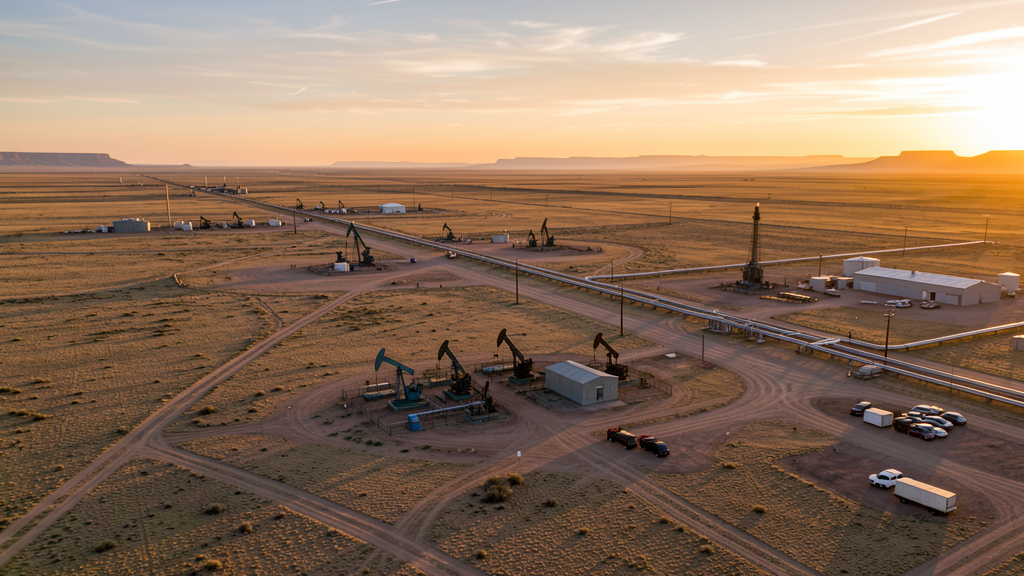
Get Matched With a Local Surveyor
Drone Survey Services Available in Hobbs, NM
Hobbs is the economic center of the New Mexico Permian Basin. Oil and gas infrastructure construction drives nearly all drone survey demand, from pipeline routing surveys to volumetric stockpile analysis at frac sand operations.
Drone Surveys for Hobbs's Construction Market
Hobbs is the center of the New Mexico oil and gas industry in the Permian Basin. Construction is driven by energy infrastructure, including pipeline construction, compressor station buildout, and oilfield service facilities. The city also has residential development to support the energy workforce and a new healthcare facility expansion at Covenant Health Hobbs.
Active Developers in the Area:
- Permian Basin energy companies — Pipeline infrastructure, compressor stations, and oilfield service facilities
- Covenant Health — Hospital expansion and medical office construction
- Lea County — County facility upgrades and road infrastructure

Typical Project Costs in New Mexico
Cost ranges are based on market data for Hobbs Micropolitan Area. Actual pricing depends on site size, complexity, and deliverables.
| Service Type | Low End | High End |
|---|---|---|
| Topographic Survey | $1,200 | $6,000 |
| Drone Inspection | $500 | $2,800 |
| LiDAR Scanning | $2,000 | $10,000 |
| Environmental Monitoring | $1,000 | $5,000 |
| Aerial Imagery | $300 | $1,800 |
| Construction Monitoring | $600 | $3,000 |
| Real Estate Photography | $200 | $1,200 |
| Roof Inspection | $250 | $1,500 |
Local Airspace & Regulations in Hobbs, NM
FAA Part 107 Requirements
All commercial drone operations in New Mexico require the pilot to hold an active FAA Part 107 Remote Pilot Certificate. Our network surveyors are verified Part 107 holders.
State Drone Laws
New Mexico enacted SB 240 (2021), the UAS Act, which established a state UAS Advisory Commission under the New Mexico Department of Transportation and preempted local municipalities from enacting their own drone flight regulations. The law prohibits weaponization of drones and restricts surveillance of private property without consent. New Mexico hosts extensive restricted military airspace — including White Sands Missile Range, Kirtland Air Force Base, Cannon Air Force Base (home to the 27th Special Operations Wing MQ-9 Reaper drone operations), Holloman Air Force Base (F-16 and MQ-9 training), and Los Alamos National Laboratory — each with active no-drone zones. Spaceport America near Truth or Consequences has restricted airspace during launch operations. Commercial operators must hold a valid FAA Part 107 Remote Pilot Certificate. The state does not require a separate state drone license, but operators flying near military installations, national laboratories, or tribal lands must coordinate with the controlling agency. New Mexico's high desert terrain and density altitude considerations affect drone performance at elevations above 5,000 feet.
Local Ordinances
Hobbs follows FAA Part 107 regulations. The city does not have additional municipal drone ordinances. Oil and gas operators in the area may have private restrictions on drone flights near their facilities. Operators should coordinate with energy companies before flying near pipeline and well infrastructure.
Restricted Airspace
- Class D airspace around Lea County Regional Airport (HOB)
- Extensive oil and gas infrastructure with potential TFRs
- Cannon Air Force Base restricted airspace to the north (distance)
Airports in the area: Lea County Regional Airport (HOB)
Why Hire Through Aerius View in Hobbs, NM?
FAA-Certified
Every surveyor holds an active Part 107 Remote Pilot Certificate.
Local to Hobbs
Surveyors who know the New Mexico airspace and local permitting.
No Cost to Quote
Submit your project at no charge. Pay the surveyor directly if you proceed.
Fast Turnaround
A local surveyor contacts you within 2 business days.
How Our Hobbs Matching Process Works
We're actively building our network of FAA-certified drone operators in Hobbs, NM. Here's exactly what happens when you submit a project request.
Submit Your Project
Tell us your site location, acreage, and what you need (topographic survey, LiDAR, inspection, etc.). Takes 60 seconds. No cost, no obligation.
We Match & Vet
We identify Part 107-certified operators in New Mexico with the right equipment for your project. Every pilot is verified for active certification, insurance, and relevant experience in New Mexico airspace.
You Get Quotes
Matched surveyors contact you within 2 business days with quotes. You compare pricing, timelines, and deliverables, then choose the right fit. You pay the surveyor directly, no markup.
What Deliverables Do You Get?
Every project includes professional-grade deliverables compatible with standard construction and engineering software:
- Orthomosaic maps (GeoTIFF) for site overview and documentation
- Point clouds (LAS/LAZ) for 3D modeling and volumetric analysis
- DEM/DSM terrain models for cut/fill and grade analysis
- Contour lines (DXF/DWG, CAD-ready) for Civil 3D and Revit
- Progress reports with side-by-side comparisons for construction monitoring
- Coordinate systems matched to your project datum (State Plane, UTM, or local)
Insurance & Liability Protection
Pilot Insurance Required
Every operator in our network must carry active liability insurance. Minimum coverage: $1,000,000 general liability. Proof of insurance is verified before any pilot joins the network.
FAA Part 107 Verified
We confirm each pilot's Remote Pilot Certificate is active and in good standing through the FAA Airmen Inquiry system. Expired certificates are flagged automatically.
Equipment Documentation
Pilots list their drone models, sensors (RGB, LiDAR, thermal, multispectral), and payload specs so we can match the right equipment to your project requirements.
Site Safety Coordination
Pilots coordinate with your site superintendent for safe operations on active construction sites, including flight plans that avoid worker areas and equipment zones.
Hobbs, NM Drone Survey FAQs
Can I fly a drone over oil and gas facilities in Hobbs?
Oil and gas facilities in the Hobbs area are private industrial property. While not all are in restricted airspace, operators should coordinate with facility managers before flying near pipelines, compressor stations, and well pads. Some energy companies have security policies that prohibit unauthorized drone overflights.
What drone services are most needed in the Hobbs area?
Pipeline survey and inspection is the primary drone service demand in Hobbs. Volumetric analysis of frac sand and aggregate stockpiles, oilfield facility inspections, and construction monitoring for energy infrastructure projects are also in high demand.
Does Hobbs have controlled airspace?
Lea County Regional Airport (HOB) has Class D airspace. Drone operators flying within the Class D radius need LAANC authorization. The airport primarily serves general aviation and oil industry traffic.
What is the construction market like in Hobbs?
Hobbs construction is almost entirely driven by the oil and gas industry. Pipeline construction, compressor station buildout, and oilfield service facilities are the primary projects. Residential development follows workforce demand, which fluctuates with energy prices.
Are there environmental monitoring needs for drone surveys in Hobbs?
Yes. The dense oil and gas activity in the Hobbs area creates significant environmental monitoring demand, including methane leak detection, vegetation impact assessment around well pads, and spill documentation. Multispectral imaging for land reclamation monitoring is also valuable.
How does Hobbs weather affect drone operations?
Hobbs experiences strong winds, especially in spring, with gusts frequently exceeding 25 mph. Dust storms can reduce visibility. Summer temperatures above 100 degrees reduce drone performance. Operators should plan flights for early morning calm conditions and monitor wind forecasts closely.
Nearby Cities
Are You a Drone Surveyor in Hobbs?
Get pre-qualified leads in your service area. No membership fees, no monthly minimums. First lead free.
Ready to Start Your Project in Hobbs, NM?
Get matched with a local, FAA-certified surveyor. No cost, no obligation.
Request a Free Quote