Drone Survey Services in Litchfield Park, AZ
From the historic Wigwam Resort renovation and Dreaming Draw luxury residential development to golf course and residential infill construction, Litchfield Park is a small, affluent city positioned between Luke Air Force Base and Phoenix Goodyear Airport.
Serving Maricopa Co. & the Phoenix-Mesa-Chandler area
Request a Free Quote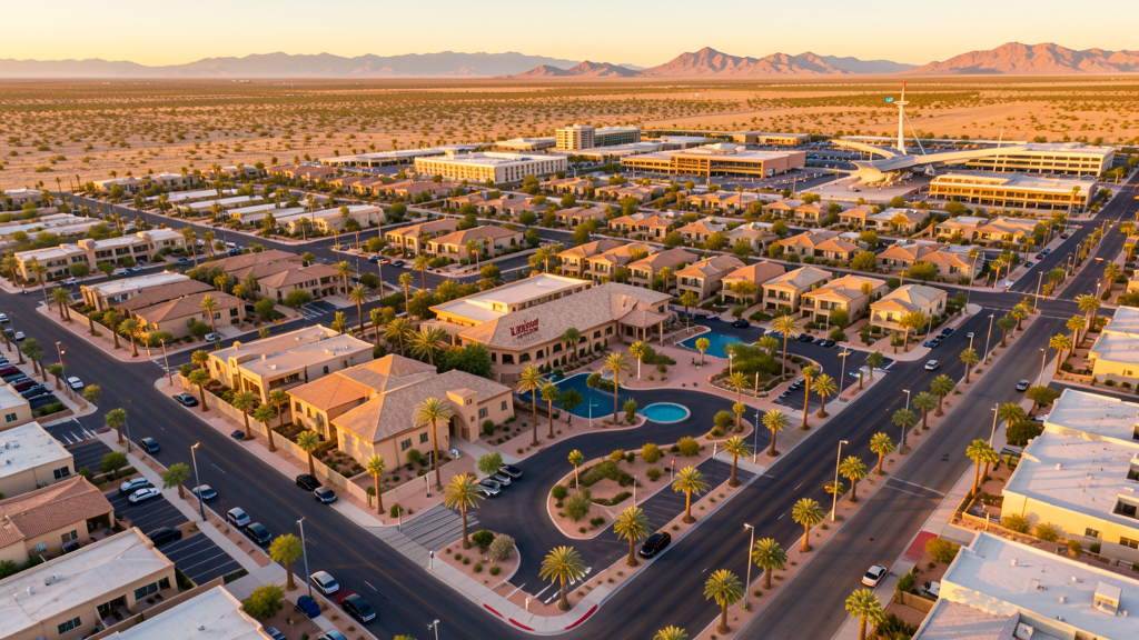
Get Matched With a Local Surveyor
Drone Survey Services Available in Litchfield Park, AZ
Litchfield Park sits in western Maricopa County with 7,000 residents. The city is positioned between Luke Air Force Base (3 miles north) and Phoenix Goodyear Airport (3 miles south), creating complex airspace requirements. Litchfield Park is known for the historic Wigwam Resort and luxury residential developments. The city is surrounded by the rapidly growing cities of Goodyear and Avondale, benefiting from westward Phoenix metro expansion.
Drone Surveys for Litchfield Park's Construction Market
Litchfield Park is a small, affluent residential city with 7,000 residents, positioned between Luke Air Force Base and Phoenix Goodyear Airport. The city is known for the historic Wigwam Resort and luxury residential developments. Major construction includes the Wigwam Resort renovation and expansion, luxury residential infill along the Wigwam Boulevard corridor, and the Dreaming Draw development. The city is surrounded by Goodyear and Avondale, which are growing rapidly. Litchfield Park benefits from the westward Phoenix metro expansion, with high-end residential and resort construction.
Active Developers in the Area:
Typical Project Costs in Arizona
Cost ranges are based on market data for Phoenix-Mesa-Chandler. Actual pricing depends on site size, complexity, and deliverables.
| Service Type | Low End | High End |
|---|---|---|
| Topographic Survey | $1,800 | $4,500 |
| Drone Inspection | $250 | $850 |
| LiDAR Scanning | $2,800 | $8,000 |
| Environmental Monitoring | $800 | $3,000 |
| Aerial Imagery | $175 | $500 |
| Construction Monitoring | $1,100 | $3,200 |
| Real Estate Photography | $150 | $450 |
| Roof Inspection | $200 | $750 |
Local Airspace & Regulations in Litchfield Park, AZ
FAA Part 107 Requirements
All commercial drone operations in Arizona require the pilot to hold an active FAA Part 107 Remote Pilot Certificate. Our network surveyors are verified Part 107 holders.
State Drone Laws
Arizona SB 1449 (2016) was the first state law regulating drone use, prohibiting drone operations that interfere with law enforcement, emergency responders, or wildfire suppression efforts. The law prohibits drone flights within 3 miles of a wildfire or prescribed burn and makes violation a class 1 misdemeanor. ARS Title 13 Chapter 29 Article 3 restricts drone surveillance of private property and weaponization of drones. Commercial operators must hold a valid FAA Part 107 Remote Pilot Certificate. Arizona does not require a separate state drone license, but operators must comply with FAA Part 107 rules and any local ordinances. The Arizona Department of Public Safety maintains guidelines for drone operations near critical infrastructure including power plants, dams, and military installations.
Local Ordinances
Litchfield Park follows Maricopa County regulations and FAA Part 107 rules. No city-specific drone permit is required for operations from private property. Luke Air Force Base is only 3 miles north with Class D and restricted military airspace, requiring coordination. Phoenix Goodyear Airport Class D airspace is 3 miles south. The city prohibits drone takeoff/landing in parks without a permit. Litchfield Park is a small, affluent residential city adjacent to Luke AFB with luxury home construction and resort development.
Restricted Airspace
- Luke Air Force Base (LUF) is only 3 miles north with Class D and restricted military airspace. Drone flights near the base require coordination with base operations.
- Class D airspace around Phoenix Goodyear Airport (GYR) — requires LAANC authorization within 4 nautical miles. GYR is 3 miles S.
- Litchfield Park city parks prohibit drone takeoff/landing without a special use permit. The Wigwam Resort area has additional event-related restrictions.
- The city is small and primarily residential, with limited commercial construction zones.
Airports in the area: undefined (undefined), undefined (undefined), undefined (undefined), undefined (undefined)
Why Hire Through Aerius View in Litchfield Park, AZ?
FAA-Certified
Every surveyor holds an active Part 107 Remote Pilot Certificate.
Local to Litchfield Park
Surveyors who know the Arizona airspace and local permitting.
No Cost to Quote
Submit your project at no charge. Pay the surveyor directly if you proceed.
Fast Turnaround
A local surveyor contacts you within 2 business days.
How Our Litchfield Park Matching Process Works
We're actively building our network of FAA-certified drone operators in Litchfield Park, AZ. Here's exactly what happens when you submit a project request.
Submit Your Project
Tell us your site location, acreage, and what you need (topographic survey, LiDAR, inspection, etc.). Takes 60 seconds. No cost, no obligation.
We Match & Vet
We identify Part 107-certified operators in Arizona with the right equipment for your project. Every pilot is verified for active certification, insurance, and relevant experience in Arizona airspace.
You Get Quotes
Matched surveyors contact you within 2 business days with quotes. You compare pricing, timelines, and deliverables, then choose the right fit. You pay the surveyor directly, no markup.
What Deliverables Do You Get?
Every project includes professional-grade deliverables compatible with standard construction and engineering software:
- Orthomosaic maps (GeoTIFF) for site overview and documentation
- Point clouds (LAS/LAZ) for 3D modeling and volumetric analysis
- DEM/DSM terrain models for cut/fill and grade analysis
- Contour lines (DXF/DWG, CAD-ready) for Civil 3D and Revit
- Progress reports with side-by-side comparisons for construction monitoring
- Coordinate systems matched to your project datum (State Plane, UTM, or local)
Insurance & Liability Protection
Pilot Insurance Required
Every operator in our network must carry active liability insurance. Minimum coverage: $1,000,000 general liability. Proof of insurance is verified before any pilot joins the network.
FAA Part 107 Verified
We confirm each pilot's Remote Pilot Certificate is active and in good standing through the FAA Airmen Inquiry system. Expired certificates are flagged automatically.
Equipment Documentation
Pilots list their drone models, sensors (RGB, LiDAR, thermal, multispectral), and payload specs so we can match the right equipment to your project requirements.
Site Safety Coordination
Pilots coordinate with your site superintendent for safe operations on active construction sites, including flight plans that avoid worker areas and equipment zones.
Litchfield Park, AZ Drone Survey FAQs
Do I need a permit for a drone survey in Litchfield Park?
No city-specific permit is required for commercial drone operations from private property in Litchfield Park. Luke Air Force Base is only 3 miles north with restricted military airspace, requiring coordination. Phoenix Goodyear Airport Class D airspace is 3 miles south. Takeoff/landing in city parks requires a permit.
How much does a drone survey cost in Litchfield Park, AZ?
Topographic surveys in Maricopa County typically range from $1,800 to $4,500, with premium rates for luxury properties. Roof inspections run $200-$750. LiDAR scanning for resort or residential sites costs $2,800-$8,000. Real estate drone photography for luxury homes starts at $175.
Can I fly a drone near Luke Air Force Base from Litchfield Park?
Luke Air Force Base is only 3 miles north of Litchfield Park with Class D and restricted military airspace. Essentially all commercial drone flights require coordination with base operations and LAANC authorization. Phoenix Goodyear Airport is also 3 miles south. Our surveyors handle all military and FAA coordination.
What construction projects need drone surveys in Litchfield Park?
Wigwam Resort renovation and expansion, Dreaming Draw luxury residential development, residential infill along the Wigwam Boulevard corridor, and golf course renovation projects require aerial surveys. Litchfield Park is a small, affluent city with high-end residential and resort construction.
How does desert terrain affect drone surveys in Litchfield Park?
Litchfield Park sits in flat Sonoran Desert terrain. Summer temperatures exceeding 110 degrees reduce battery life 20-30%. The flat terrain is straightforward for flights when heat and military airspace are managed. Luke AFB airspace coordination is the primary scheduling factor. Our surveyors handle all coordination and heat management.
Nearby Cities
Are You a Drone Surveyor in Litchfield Park?
Get pre-qualified leads in your service area. No membership fees, no monthly minimums. First lead free.
Ready to Start Your Project in Litchfield Park, AZ?
Get matched with a local, FAA-certified surveyor. No cost, no obligation.
Request a Free Quote