Drone Survey Services in Moab, UT
Red rock desert canyon landscape with Colorado River and La Sal Mountains backdrop
Serving Grand County & the Moab Micropolitan Area area
Request a Free Quote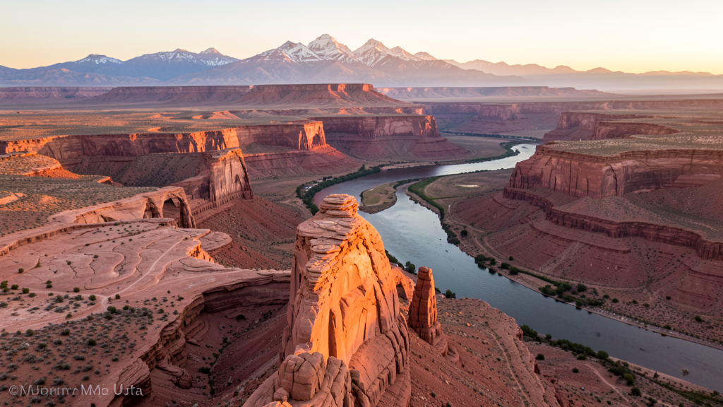
Get Matched With a Local Surveyor
Drone Survey Services Available in Moab, UT
Moab is a world-renowned outdoor recreation destination surrounded by Arches and Canyonlands National Parks (both no-drone zones). Tourism infrastructure, airport expansion, and the DOE uranium remediation project drive construction, with the national park drone restrictions creating a complex operating environment.
Drone Surveys for Moab's Construction Market
Moab is a world-renowned outdoor recreation destination. Construction is driven by tourism infrastructure, including hotel and lodge development, restaurant construction, and the Moab Regional Airport expansion. The city has ongoing residential development for the tourism workforce. The uranium mining legacy creates environmental remediation construction demand. The Moab Brands retail area and commercial development along Main Street provide steady construction activity.
Active Developers in the Area:
- Tourism and hospitality developers — Hotel, lodge, and resort construction for the outdoor recreation market
- Moab Regional Airport — Airport facility expansion and terminal upgrades
- US Department of Energy — Uranium mill tailing remediation project near Moab

Typical Project Costs in Utah
Cost ranges are based on market data for Moab Micropolitan Area. Actual pricing depends on site size, complexity, and deliverables.
| Service Type | Low End | High End |
|---|---|---|
| Topographic Survey | $1,400 | $6,500 |
| Drone Inspection | $500 | $2,800 |
| LiDAR Scanning | $2,200 | $11,000 |
| Environmental Monitoring | $1,200 | $5,500 |
| Aerial Imagery | $350 | $2,000 |
| Construction Monitoring | $650 | $3,200 |
| Real Estate Photography | $300 | $1,500 |
| Roof Inspection | $300 | $1,500 |
Local Airspace & Regulations in Moab, UT
FAA Part 107 Requirements
All commercial drone operations in Utah require the pilot to hold an active FAA Part 107 Remote Pilot Certificate. Our network surveyors are verified Part 107 holders.
State Drone Laws
Utah enacted SB 167 (2019), establishing state authority over UAS operations and preempting local municipalities from regulating drone flight paths, airspace, or pilot requirements. SB 210 (2021) added privacy protections and restrictions on drone surveillance of private property. Utah has significant restricted military airspace including Hill Air Force Base (home to F-35 and F-16 fighter wings and the Ogden Air Logistics Center), Dugway Proving Ground, and Utah Test and Training Range. The state also has extensive National Park and National Monument no-drone zones, including Zion, Bryce Canyon, Arches, Canyonlands, Capitol Reef, and Grand Staircase-Escalante. Commercial operators must hold a valid FAA Part 107 Remote Pilot Certificate. Utah does not require a separate state drone license. Operators flying near military installations, national parks, tribal lands, or ski areas must coordinate with the controlling agency. Utah mountain terrain and winter weather create significant operational challenges, with density altitude affecting performance at elevations above 5,000 feet and winter storms limiting flying windows.
Local Ordinances
Moab follows FAA Part 107 regulations. Under Utah state law (SB 167, 2019), only the state may regulate drone flight paths. Arches National Park, directly north of Moab, is a strict no-drone zone under National Park Service regulations. Canyonlands National Park to the southwest is also a no-drone zone. Dead Horse Point State Park has Utah State Parks drone restrictions. The surrounding BLM land may have additional restrictions.
Restricted Airspace
- Class D airspace around Canyonlands Field Airport (CNY)
- Arches National Park no-drone zone directly north of city (NPS restriction)
- Canyonlands National Park no-drone zone to the southwest (NPS restriction)
- Dead Horse Point State Park drone restrictions nearby
Airports in the area: Canyonlands Field Airport (CNY)
Why Hire Through Aerius View in Moab, UT?
FAA-Certified
Every surveyor holds an active Part 107 Remote Pilot Certificate.
Local to Moab
Surveyors who know the Utah airspace and local permitting.
No Cost to Quote
Submit your project at no charge. Pay the surveyor directly if you proceed.
Fast Turnaround
A local surveyor contacts you within 2 business days.
How Our Moab Matching Process Works
We're actively building our network of FAA-certified drone operators in Moab, UT. Here's exactly what happens when you submit a project request.
Submit Your Project
Tell us your site location, acreage, and what you need (topographic survey, LiDAR, inspection, etc.). Takes 60 seconds. No cost, no obligation.
We Match & Vet
We identify Part 107-certified operators in Utah with the right equipment for your project. Every pilot is verified for active certification, insurance, and relevant experience in Utah airspace.
You Get Quotes
Matched surveyors contact you within 2 business days with quotes. You compare pricing, timelines, and deliverables, then choose the right fit. You pay the surveyor directly, no markup.
What Deliverables Do You Get?
Every project includes professional-grade deliverables compatible with standard construction and engineering software:
- Orthomosaic maps (GeoTIFF) for site overview and documentation
- Point clouds (LAS/LAZ) for 3D modeling and volumetric analysis
- DEM/DSM terrain models for cut/fill and grade analysis
- Contour lines (DXF/DWG, CAD-ready) for Civil 3D and Revit
- Progress reports with side-by-side comparisons for construction monitoring
- Coordinate systems matched to your project datum (State Plane, UTM, or local)
Insurance & Liability Protection
Pilot Insurance Required
Every operator in our network must carry active liability insurance. Minimum coverage: $1,000,000 general liability. Proof of insurance is verified before any pilot joins the network.
FAA Part 107 Verified
We confirm each pilot's Remote Pilot Certificate is active and in good standing through the FAA Airmen Inquiry system. Expired certificates are flagged automatically.
Equipment Documentation
Pilots list their drone models, sensors (RGB, LiDAR, thermal, multispectral), and payload specs so we can match the right equipment to your project requirements.
Site Safety Coordination
Pilots coordinate with your site superintendent for safe operations on active construction sites, including flight plans that avoid worker areas and equipment zones.
Moab, UT Drone Survey FAQs
Can I fly a drone in Arches National Park near Moab?
No. Arches National Park, directly north of Moab, is a strict no-drone zone under National Park Service regulations. Drone operations are prohibited within park boundaries without a special use permit, which are rarely granted. The park boundary is very close to Moab, so operators should check the NPS boundary map carefully.
What drone services are most needed in Moab?
Tourism infrastructure construction monitoring for hotels and lodges is a primary demand. The Moab Regional Airport expansion creates facility survey needs. The DOE uranium mill tailing remediation project creates environmental monitoring demand. Real estate photography for tourism-related properties is a steady market. BLM land activity monitoring provides additional opportunities.
Can I fly a drone over Canyonlands National Park from Moab?
No. Canyonlands National Park to the southwest of Moab is also a no-drone zone under National Park Service regulations. The park is vast, and its boundary extends relatively close to Moab in some areas. Operators should check both Arches and Canyonlands NPS boundary maps before flying near Moab.
Does Moab have controlled airspace?
Canyonlands Field Airport (CNY) has Class D airspace. Drone operators flying within the Class D radius need LAANC authorization. The airport primarily serves general aviation and tourism charter traffic. The surrounding national park no-drone zones are the dominant constraint for drone operators.
How does Moab summer heat affect drone flying?
Moab experiences extreme summer temperatures frequently above 100 degrees. The desert environment provides no shade. Drone battery life and motor performance are severely reduced. The red rock terrain absorbs and radiates heat. Schedule flights for early morning hours. Carry extra batteries and monitor motor temperature closely.
Can I fly a drone on BLM land near Moab?
The Bureau of Land Management manages significant land around Moab outside the national parks. BLM land generally allows drone flights under FAA Part 107 rules, but check current BLM guidelines for any area-specific restrictions. The BLM land includes popular recreation areas like the Slickrock Bike Trail and Gemini Bridges that may have visitor safety considerations for drone flights.
Nearby Cities
Are You a Drone Surveyor in Moab?
Get pre-qualified leads in your service area. No membership fees, no monthly minimums. First lead free.
Ready to Start Your Project in Moab, UT?
Get matched with a local, FAA-certified surveyor. No cost, no obligation.
Request a Free Quote