Drone Survey Services in Phoenix, AZ
From master-planned communities in the West Valley to downtown infill projects, Phoenix is one of the fastest-growing construction markets in the country — and our local surveyors know the airspace, terrain, and regulations that come with it.
Serving Maricopa County & the Phoenix-Mesa-Chandler area
Request a Free Quote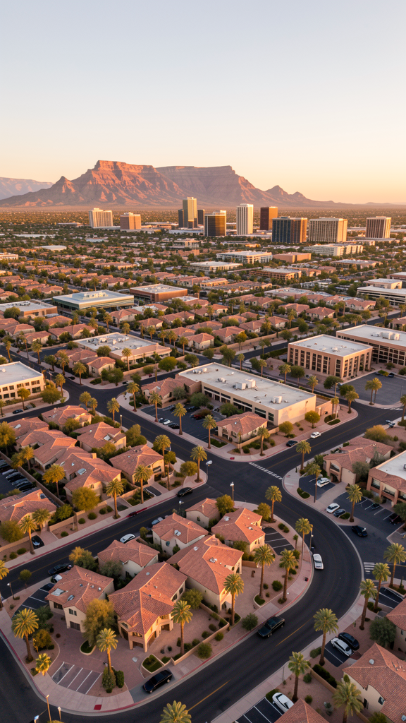
Get Matched With a Local Surveyor
Drone Survey Services Available in Phoenix, AZ
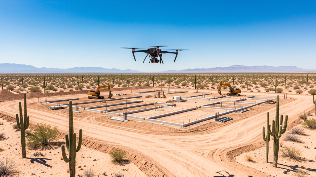
The Phoenix-Mesa-Chandler metro area consistently ranks among the top three US markets for new housing starts. Major master-planned communities in Buckeye, Goodyear, Surprise, and Queen Creek generate steady demand for topographic surveys and construction monitoring. The industrial corridor along I-10 continues to see logistics, data center, and manufacturing development.
Drone Surveys for Phoenix's Construction Market
Phoenix is one of the fastest-growing construction markets in the United States, ranking third nationally in new housing starts. Major master-planned communities in the West Valley (Buckeye, Surprise, Goodyear) and southeast Valley (Queen Creek, San Tan Valley) drive consistent demand for topographic surveys, construction monitoring, and earthwork verification. The industrial market along the I-10 corridor continues to expand with logistics and data center development.
Active Developers in the Area:
Typical Project Costs in Arizona
Cost ranges are based on market data for Phoenix-Mesa-Chandler. Actual pricing depends on site size, complexity, and deliverables.
| Service Type | Low End | High End |
|---|---|---|
| Topographic Survey | $1,800 | $4,500 |
| Drone Inspection | $200 | $800 |
| LiDAR Scanning | $2,500 | $8,000 |
| Environmental Monitoring | $800 | $3,000 |
| Aerial Imagery | $150 | $500 |
| Construction Monitoring | $1,000 | $3,000 |
| Real Estate Photography | $150 | $500 |
| Roof Inspection | $200 | $800 |
Local Airspace & Regulations in Phoenix, AZ
FAA Part 107 Requirements
All commercial drone operations in Arizona require the pilot to hold an active FAA Part 107 Remote Pilot Certificate. Our network surveyors are verified Part 107 holders.
State Drone Laws
Arizona SB 1449 (2016) was the first state law regulating drone use, prohibiting drone operations that interfere with law enforcement, emergency responders, or wildfire suppression efforts. The law prohibits drone flights within 3 miles of a wildfire or prescribed burn and makes violation a class 1 misdemeanor. ARS Title 13 Chapter 29 Article 3 restricts drone surveillance of private property and weaponization of drones. Commercial operators must hold a valid FAA Part 107 Remote Pilot Certificate. Arizona does not require a separate state drone license, but operators must comply with FAA Part 107 rules and any local ordinances. The Arizona Department of Public Safety maintains guidelines for drone operations near critical infrastructure including power plants, dams, and military installations.
Local Ordinances
Phoenix requires a commercial drone permit for operations taking off or landing on city-owned property. Flights from private property do not require a city permit but must comply with FAA Part 107 rules. Phoenix parks require a special use permit for commercial drone operations. The city prohibits drone flights over large public gatherings (sporting events, festivals) without prior authorization.
Restricted Airspace
- Class B airspace around Phoenix Sky Harbor (PHX) — extends 5–10 nautical miles from the airport surface to 10,000 ft MSL
- Luke AFB military operating area — located west of Phoenix in Glendale, active MOA and restricted zones
- Class D airspace around Scottsdale Airport (DVT)
- Falcon Field (FFZ) Class D airspace in Mesa
- TFR zones may be issued temporarily for wildfires, sporting events, or VIP visits — check B4UFLY before every flight
Airports in the area: undefined (undefined), undefined (undefined), undefined (undefined)
Why Hire Through Aerius View in Phoenix, AZ?
FAA-Certified
Every surveyor holds an active Part 107 Remote Pilot Certificate.
Local to Phoenix
Surveyors who know the Arizona airspace and local permitting.
No Cost to Quote
Submit your project at no charge. Pay the surveyor directly if you proceed.
Fast Turnaround
A local surveyor contacts you within 2 business days.
How Our Phoenix Matching Process Works
We're actively building our network of FAA-certified drone operators in Phoenix, AZ. Here's exactly what happens when you submit a project request.
Submit Your Project
Tell us your site location, acreage, and what you need (topographic survey, LiDAR, inspection, etc.). Takes 60 seconds. No cost, no obligation.
We Match & Vet
We identify Part 107-certified operators in Arizona with the right equipment for your project. Every pilot is verified for active certification, insurance, and relevant experience in Arizona airspace.
You Get Quotes
Matched surveyors contact you within 2 business days with quotes. You compare pricing, timelines, and deliverables, then choose the right fit. You pay the surveyor directly, no markup.
What Deliverables Do You Get?
Every project includes professional-grade deliverables compatible with standard construction and engineering software:
- Orthomosaic maps (GeoTIFF) for site overview and documentation
- Point clouds (LAS/LAZ) for 3D modeling and volumetric analysis
- DEM/DSM terrain models for cut/fill and grade analysis
- Contour lines (DXF/DWG, CAD-ready) for Civil 3D and Revit
- Progress reports with side-by-side comparisons for construction monitoring
- Coordinate systems matched to your project datum (State Plane, UTM, or local)
Insurance & Liability Protection
Pilot Insurance Required
Every operator in our network must carry active liability insurance. Minimum coverage: $1,000,000 general liability. Proof of insurance is verified before any pilot joins the network.
FAA Part 107 Verified
We confirm each pilot's Remote Pilot Certificate is active and in good standing through the FAA Airmen Inquiry system. Expired certificates are flagged automatically.
Equipment Documentation
Pilots list their drone models, sensors (RGB, LiDAR, thermal, multispectral), and payload specs so we can match the right equipment to your project requirements.
Site Safety Coordination
Pilots coordinate with your site superintendent for safe operations on active construction sites, including flight plans that avoid worker areas and equipment zones.
Phoenix, AZ Drone Survey FAQs
Do I need a permit for a drone survey in Phoenix?
You need a commercial drone permit only if you plan to take off or land on city-owned property. Surveys conducted from private property (with owner permission) do not require a Phoenix city permit. All commercial drone operations require an FAA Part 107 Remote Pilot Certificate, regardless of location.
How much does a drone survey cost in Arizona?
Costs vary by service type. Topographic surveys in the Phoenix metro typically range from $1,800 to $4,500. Roof inspections run $200–$800. LiDAR scanning for larger sites can cost $2,500–$8,000+. Real estate drone photography is the most affordable at $150–$500.
Can drones fly near Phoenix Sky Harbor Airport?
Phoenix Sky Harbor (PHX) has Class B controlled airspace extending up to 10 nautical miles from the airport. Commercial drone flights within this airspace require LAANC (Low Altitude Authorization and Notification Capability) authorization from the FAA. Our network surveyors are experienced with LAANC and handle all airspace approvals.
Are there restricted military airspace zones near Phoenix?
Yes. Luke Air Force Base, located west of Phoenix in Glendale, has active military operating areas and restricted zones. Drone flights in these areas require coordination with the military. The Barry M. Goldwater Range to the southwest also has restricted airspace. Our surveyors check B4UFLY and coordinate LAANC before every flight.
How long does a topographic survey take in Phoenix?
A standard 50-acre site can be flown in a single morning. Deliverables (DEM, contour maps, orthomosaic, point cloud) are typically ready within 3–5 business days. Larger sites or projects requiring ground control point placement may take longer.
Nearby Cities
Are You a Drone Surveyor in Phoenix?
Get pre-qualified leads in your service area. No membership fees, no monthly minimums. First lead free.
Ready to Start Your Project in Phoenix, AZ?
Get matched with a local, FAA-certified surveyor. No cost, no obligation.
Request a Free Quote