Drone Survey Services in Rexburg, ID
From the BYU-Idaho campus expansion to the US-20 corridor improvement project, Rexburg is one of eastern Idaho fastest-growing cities with $18 million in highway investment and 400+ new housing units permitted annually, driving demand for drone topographic and construction monitoring services in the Teton Valley.
Serving Madison County & the Rexburg area
Request a Free Quote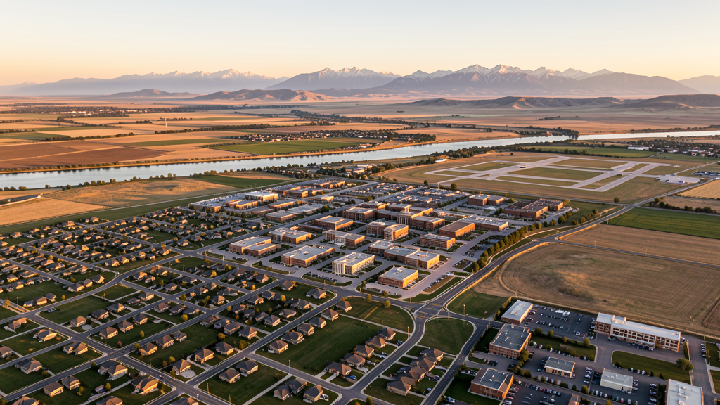
Get Matched With a Local Surveyor
Drone Survey Services Available in Rexburg, ID
Rexburg sits in the upper Snake River Plain of eastern Idaho, serving as the Madison County seat and home to Brigham Young University-Idaho. With the Idaho Transportation Department investing $18 million in US-20 improvements and BYU-Idaho expanding its campus, both institutional and residential construction are surging. The city proximity to Caribou-Targhee National Forest and the Yellowstone gateway corridor means commercial drone operators must check seasonal fire TFRs before flying in forested areas.
Drone Surveys for Rexburg's Construction Market
Rexburg is one of the fastest-growing cities in eastern Idaho, with a population of approximately 40,000 including BYU-Idaho students. Major construction includes the BYU-Idadio campus expansion (new science building and student housing), the Teton Riverfront residential development, and multiple apartment complexes serving the student population. The Idaho Transportation Department is improving US-20 through Rexburg with an $18 million corridor project. Residential permitting exceeded 400 new housing units in 2023-2024, driven by student housing demand and family residential growth.
Active Developers in the Area:

Typical Project Costs in Idaho
Cost ranges are based on market data for Rexburg. Actual pricing depends on site size, complexity, and deliverables.
| Service Type | Low End | High End |
|---|---|---|
| Topographic Survey | $1,050 | $3,900 |
| Drone Inspection | $650 | $2,600 |
| LiDAR Scanning | $2,700 | $7,000 |
| Environmental Monitoring | $1,400 | $4,600 |
| Aerial Imagery | $450 | $1,700 |
| Construction Monitoring | $900 | $3,100 |
| Real Estate Photography | $250 | $950 |
| Roof Inspection | $350 | $1,300 |
Local Airspace & Regulations in Rexburg, ID
FAA Part 107 Requirements
All commercial drone operations in Idaho require the pilot to hold an active FAA Part 107 Remote Pilot Certificate. Our network surveyors are verified Part 107 holders.
State Drone Laws
Idaho Code § 21-801 et seq (Title 21, Chapter 8) governs unmanned aircraft systems statewide. The law prohibits drone surveillance of private property without consent (§ 21-803, $500 civil penalty per violation), bans weaponization of drones (§ 21-804, misdemeanor), and prohibits using drones to interfere with wildfire suppression (§ 21-805). The state preempts local regulation of drone flight paths and airspace (§ 21-810), though cities may regulate takeoff and landing on public property they own. Idaho does not require a separate state-level drone license. Commercial drone operators must hold a valid FAA Part 107 Remote Pilot Certificate. Idaho was one of the first states to pass comprehensive drone legislation in 2013 (HB 279), amended by SB 1133 (2021) to align definitions with the federal Part 107 framework.
Local Ordinances
Rexburg City Code requires a Special Use Permit for commercial drone operations taking off or landing on city-owned property, including Smith Park, Porter Park, and Nature Park. The permit is processed through Rexburg Parks and Recreation. Flights from private property (with owner permission) do not require a city permit but must comply with FAA Part 107 rules. Idaho Code section 21-810 preempts Rexburg from regulating drone airspace or flight paths. Brigham Young University-Idaho campus requires coordination with Campus Security for any commercial drone operations over or near campus facilities.
Restricted Airspace
- Rexburg-Madison County Airport (RXE) is an untowered GA airport with Class G airspace. While LAANC is not required, operators must maintain visual line of sight and yield to manned aircraft. Use CTAF frequency 122.9 to announce intentions.
- Yellowstone National Park is 90 miles northeast. Drone flights are prohibited within all National Park Service-administered lands without a special use permit. The park boundary extends into the nearby Island Park area.
- Caribou-Targhee National Forest surrounds Rexburg to the east and north. Seasonal fire TFRs are common July through October. BLM lands south of Rexburg have seasonal fire restrictions during summer months.
- Rexburg City Code prohibits drone takeoff and landing in city parks (Smith Park, Porter Park, Nature Park) without a Special Use Permit from Rexburg Parks and Recreation.
- Brigham Young University-Idaho campus has drone flight restrictions. Commercial drone operators must coordinate with BYU-Idaho Campus Security before flying over or near campus buildings.
- Teton River corridor and Henrys Fork of the Snake River have seasonal wildlife restrictions. Operators should avoid disturbing trout spawning areas and nesting raptors during spring and fall.
Airports in the area: undefined (undefined), undefined (undefined), undefined (undefined), undefined (undefined)
Why Hire Through Aerius View in Rexburg, ID?
FAA-Certified
Every surveyor holds an active Part 107 Remote Pilot Certificate.
Local to Rexburg
Surveyors who know the Idaho airspace and local permitting.
No Cost to Quote
Submit your project at no charge. Pay the surveyor directly if you proceed.
Fast Turnaround
A local surveyor contacts you within 2 business days.
How Our Rexburg Matching Process Works
We're actively building our network of FAA-certified drone operators in Rexburg, ID. Here's exactly what happens when you submit a project request.
Submit Your Project
Tell us your site location, acreage, and what you need (topographic survey, LiDAR, inspection, etc.). Takes 60 seconds. No cost, no obligation.
We Match & Vet
We identify Part 107-certified operators in Idaho with the right equipment for your project. Every pilot is verified for active certification, insurance, and relevant experience in Idaho airspace.
You Get Quotes
Matched surveyors contact you within 2 business days with quotes. You compare pricing, timelines, and deliverables, then choose the right fit. You pay the surveyor directly, no markup.
What Deliverables Do You Get?
Every project includes professional-grade deliverables compatible with standard construction and engineering software:
- Orthomosaic maps (GeoTIFF) for site overview and documentation
- Point clouds (LAS/LAZ) for 3D modeling and volumetric analysis
- DEM/DSM terrain models for cut/fill and grade analysis
- Contour lines (DXF/DWG, CAD-ready) for Civil 3D and Revit
- Progress reports with side-by-side comparisons for construction monitoring
- Coordinate systems matched to your project datum (State Plane, UTM, or local)
Insurance & Liability Protection
Pilot Insurance Required
Every operator in our network must carry active liability insurance. Minimum coverage: $1,000,000 general liability. Proof of insurance is verified before any pilot joins the network.
FAA Part 107 Verified
We confirm each pilot's Remote Pilot Certificate is active and in good standing through the FAA Airmen Inquiry system. Expired certificates are flagged automatically.
Equipment Documentation
Pilots list their drone models, sensors (RGB, LiDAR, thermal, multispectral), and payload specs so we can match the right equipment to your project requirements.
Site Safety Coordination
Pilots coordinate with your site superintendent for safe operations on active construction sites, including flight plans that avoid worker areas and equipment zones.
Rexburg, ID Drone Survey FAQs
Do I need LAANC authorization to fly a drone in Rexburg?
No. Rexburg-Madison County Airport (RXE) has Class G (uncontrolled) airspace, so LAANC is not required for flights in the immediate Rexburg area. However, if your flight extends into the IDA Class D airspace 30 miles south, you will need LAANC authorization for that zone.
Can I fly a drone near the BYU-Idaho campus?
Commercial drone operators must coordinate with BYU-Idaho Campus Security before flying over or near campus buildings. The university has internal drone flight restrictions for safety and privacy. FAA Part 107 prohibits flights over people not under your control without a waiver.
How far is Rexburg from Yellowstone National Park, and does that affect drone flights?
Yellowstone National Park is 90 miles northeast of Rexburg. Drone flights are prohibited within all National Park Service-administered lands without a special use permit. The nearby Caribou-Targhee National Forest also has seasonal fire TFRs that can affect flight operations.
What construction projects are driving drone survey demand in Rexburg?
The BYU-Idaho campus expansion (new science building and student housing), the US-20 corridor improvement project ($18 million), and multiple student apartment complexes are the primary drivers. Residential permitting exceeded 400 new units in 2023-2024.
How much does a drone LiDAR survey cost in the Rexburg area?
LiDAR survey pricing in the Madison County area ranges from $2,700 to $7,000 depending on acreage, point density requirements, and deliverable complexity. Turnaround is generally 5-10 business days. Standard topographic surveys are less expensive at $1,100 to $4,000.
Nearby Cities
Are You a Drone Surveyor in Rexburg?
Get pre-qualified leads in your service area. No membership fees, no monthly minimums. First lead free.
Ready to Start Your Project in Rexburg, ID?
Get matched with a local, FAA-certified surveyor. No cost, no obligation.
Request a Free Quote