Drone Survey Services in Shelley, ID
Known as the Potato Capital of Idaho, Shelley is growing at nearly 2% annually with 80+ new housing units permitted in 2023-2024, driven by Idaho Falls commuters and agricultural industry expansion creating demand for drone survey and construction monitoring services along the Highway 91 corridor.
Serving Bingham County & the Idaho Falls area
Request a Free Quote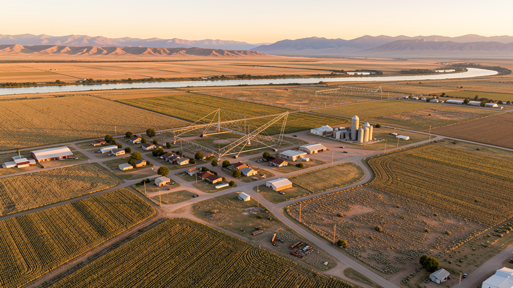
Get Matched With a Local Surveyor
Drone Survey Services Available in Shelley, ID
Shelley sits in Bingham County, 10 miles south of Idaho Falls along Highway 91. The city is known as the Potato Capital of Idaho and hosts the annual Idaho Potato Day celebration. Residential growth is driven by Idaho Falls commuters seeking affordable housing and by agricultural industry expansion. The Snake River and surrounding farmland create seasonal airspace coordination needs with crop duster operations. The Idaho National Laboratory to the west has restricted airspace that operators should check on FAA charts before flying in that direction.
Drone Surveys for Shelley's Construction Market
Shelley is a growing community in the Idaho Falls metro area, with residential construction driven by Idaho Falls commuters and local agricultural industry growth. Major construction includes the Shelley School District expansion, residential subdivisions along Highway 91, and commercial development along State Street. The city is known as the Potato Capital of Idaho and hosts the annual Idaho Potato Day celebration. Residential permitting grew to approximately 80 new units in 2023-2024, a strong rate for a city of 4,800.
Active Developers in the Area:

Typical Project Costs in Idaho
Cost ranges are based on market data for Idaho Falls. Actual pricing depends on site size, complexity, and deliverables.
| Service Type | Low End | High End |
|---|---|---|
| Topographic Survey | $950 | $3,600 |
| Drone Inspection | $620 | $2,300 |
| LiDAR Scanning | $2,350 | $6,200 |
| Environmental Monitoring | $1,150 | $4,200 |
| Aerial Imagery | $380 | $1,400 |
| Construction Monitoring | $780 | $2,900 |
| Real Estate Photography | $230 | $900 |
| Roof Inspection | $280 | $1,000 |
Local Airspace & Regulations in Shelley, ID
FAA Part 107 Requirements
All commercial drone operations in Idaho require the pilot to hold an active FAA Part 107 Remote Pilot Certificate. Our network surveyors are verified Part 107 holders.
State Drone Laws
Idaho Code § 21-801 et seq (Title 21, Chapter 8) governs unmanned aircraft systems statewide. The law prohibits drone surveillance of private property without consent (§ 21-803, $500 civil penalty per violation), bans weaponization of drones (§ 21-804, misdemeanor), and prohibits using drones to interfere with wildfire suppression (§ 21-805). The state preempts local regulation of drone flight paths and airspace (§ 21-810), though cities may regulate takeoff and landing on public property they own. Idaho does not require a separate state-level drone license. Commercial drone operators must hold a valid FAA Part 107 Remote Pilot Certificate. Idaho was one of the first states to pass comprehensive drone legislation in 2013 (HB 279), amended by SB 1133 (2021) to align definitions with the federal Part 107 framework.
Local Ordinances
Shelley does not have a formal drone permitting ordinance. Bingham County requests notification for commercial drone operations on county-owned property. Idaho Code section 21-810 preempts local regulation of drone airspace or flight paths. Flights from private property require owner permission and FAA Part 107 compliance. Agricultural operations around Shelley require coordination with aerial applicators during crop spraying season. The Idaho National Laboratory facilities 30 miles west have restricted airspace that should be checked on FAA charts.
Restricted Airspace
- Shelley is in uncontrolled Class G airspace. No LAANC authorization required for commercial drone flights in the immediate Shelley area. Flights north toward Idaho Falls may enter IDA Class D airspace requiring LAANC.
- Idaho National Laboratory (INL) facilities are 30 miles west. INL has restricted airspace and security zones. While Shelley is outside the INL restricted area, check FAA charts for any expanded TFRs related to INL operations.
- Snake River and surrounding agricultural lands. Agricultural drone operations should coordinate with crop duster operators during spraying season (April through September).
- Shelley City Code does not have specific drone ordinances. Bingham County requires notification for commercial operations on county property. Idaho Code section 21-810 preempts local airspace regulation.
- Seasonal fire TFRs from July through October affect rangeland and agricultural areas around Shelley. Check NOTAMs before flying in open areas during harvest season.
Airports in the area: undefined (undefined), undefined (undefined), undefined (undefined)
Why Hire Through Aerius View in Shelley, ID?
FAA-Certified
Every surveyor holds an active Part 107 Remote Pilot Certificate.
Local to Shelley
Surveyors who know the Idaho airspace and local permitting.
No Cost to Quote
Submit your project at no charge. Pay the surveyor directly if you proceed.
Fast Turnaround
A local surveyor contacts you within 2 business days.
How Our Shelley Matching Process Works
We're actively building our network of FAA-certified drone operators in Shelley, ID. Here's exactly what happens when you submit a project request.
Submit Your Project
Tell us your site location, acreage, and what you need (topographic survey, LiDAR, inspection, etc.). Takes 60 seconds. No cost, no obligation.
We Match & Vet
We identify Part 107-certified operators in Idaho with the right equipment for your project. Every pilot is verified for active certification, insurance, and relevant experience in Idaho airspace.
You Get Quotes
Matched surveyors contact you within 2 business days with quotes. You compare pricing, timelines, and deliverables, then choose the right fit. You pay the surveyor directly, no markup.
What Deliverables Do You Get?
Every project includes professional-grade deliverables compatible with standard construction and engineering software:
- Orthomosaic maps (GeoTIFF) for site overview and documentation
- Point clouds (LAS/LAZ) for 3D modeling and volumetric analysis
- DEM/DSM terrain models for cut/fill and grade analysis
- Contour lines (DXF/DWG, CAD-ready) for Civil 3D and Revit
- Progress reports with side-by-side comparisons for construction monitoring
- Coordinate systems matched to your project datum (State Plane, UTM, or local)
Insurance & Liability Protection
Pilot Insurance Required
Every operator in our network must carry active liability insurance. Minimum coverage: $1,000,000 general liability. Proof of insurance is verified before any pilot joins the network.
FAA Part 107 Verified
We confirm each pilot's Remote Pilot Certificate is active and in good standing through the FAA Airmen Inquiry system. Expired certificates are flagged automatically.
Equipment Documentation
Pilots list their drone models, sensors (RGB, LiDAR, thermal, multispectral), and payload specs so we can match the right equipment to your project requirements.
Site Safety Coordination
Pilots coordinate with your site superintendent for safe operations on active construction sites, including flight plans that avoid worker areas and equipment zones.
Shelley, ID Drone Survey FAQs
Do I need LAANC authorization to fly a drone in Shelley?
Most of Shelley is in uncontrolled Class G airspace and does not require LAANC. Flights north toward Idaho Falls may enter IDA Class D airspace requiring authorization. Check the FAA UAS Facility Map for your specific flight area.
What airspace restrictions affect the Idaho National Laboratory area near Shelley?
The Idaho National Laboratory facilities are 30 miles west of Shelley with restricted airspace and security zones. While Shelley is outside the INL restricted area, check FAA charts for any expanded TFRs related to INL operations before flying west.
What construction activity is happening in Shelley?
Shelley is experiencing residential growth with approximately 80 new housing units permitted in 2023-2024, driven by Idaho Falls commuters. The Shelley School District expansion and commercial development along State Street are the main projects. The city is known as the Potato Capital of Idaho.
Are there agricultural drone restrictions around Shelley?
Shelley is surrounded by active agricultural lands with crop duster operations from April through September. Coordinate with local aerial applicators before flying over farmland during spraying season.
How much does a drone survey cost in the Shelley area?
Topographic surveys in Shelley range from $950 to $3,600. LiDAR scanning costs $2,350 to $6,200. Construction monitoring runs $780 to $2,900. Pricing reflects the smaller market with lower operating costs compared to Idaho Falls proper.
Nearby Cities
Are You a Drone Surveyor in Shelley?
Get pre-qualified leads in your service area. No membership fees, no monthly minimums. First lead free.
Ready to Start Your Project in Shelley, ID?
Get matched with a local, FAA-certified surveyor. No cost, no obligation.
Request a Free Quote