Drone Survey Services in Syracuse, UT
Davis County city near Great Salt Lake with Antelope Island views and suburban development
Serving Davis County & the Ogden-Clearfield Metropolitan Area area
Request a Free Quote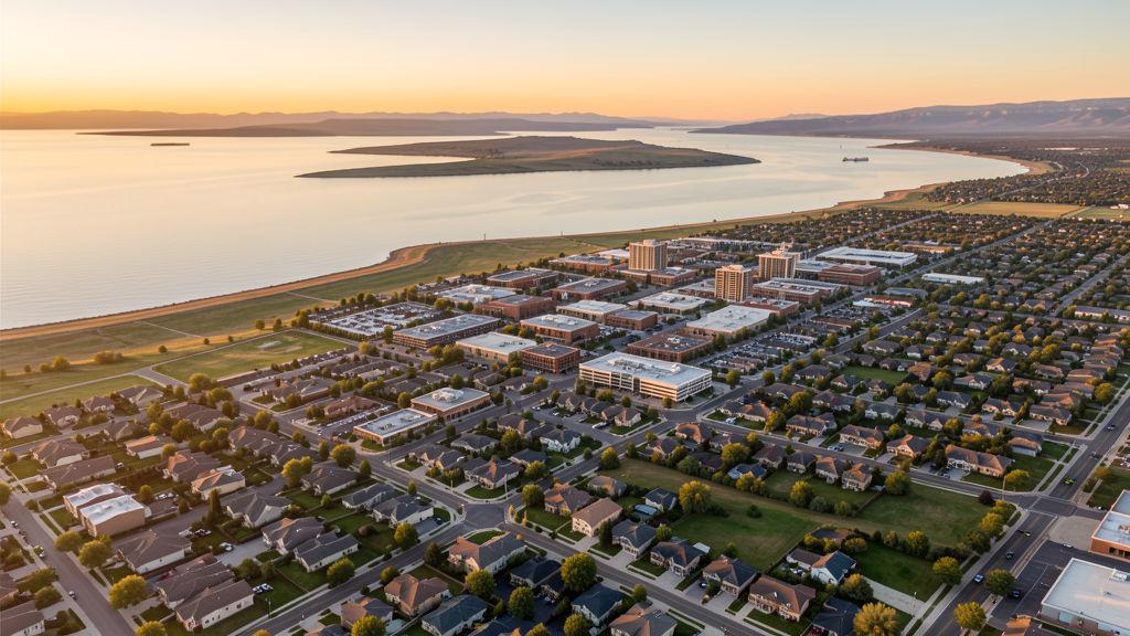
Get Matched With a Local Surveyor
Drone Survey Services Available in Syracuse, UT
Syracuse is a growing Davis County city near the Great Salt Lake. Residential subdivision development, City Center construction, and the Arts Center project drive construction, with Antelope Island State Park creating a no-drone zone to the west.
Drone Surveys for Syracuse's Construction Market
Syracuse is a growing Davis County city near the Great Salt Lake. Construction is driven by residential subdivision development, the Syracuse City Center project, and commercial development along Antelope Drive. The city has the Syracuse Arts Center and ongoing community facility construction. The Great Salt Lake shoreline and Antelope Island proximity create tourism-adjacent development demand.
Active Developers in the Area:
- Syracuse City Center — Downtown development and civic facility construction
- Residential developers — Subdivision development expanding westward toward Great Salt Lake
- Syracuse Arts Center — Community and arts facility construction

Typical Project Costs in Utah
Cost ranges are based on market data for Ogden-Clearfield Metropolitan Area. Actual pricing depends on site size, complexity, and deliverables.
| Service Type | Low End | High End |
|---|---|---|
| Topographic Survey | $1,700 | $7,500 |
| Drone Inspection | $550 | $3,200 |
| LiDAR Scanning | $2,800 | $13,000 |
| Environmental Monitoring | $1,400 | $6,500 |
| Aerial Imagery | $350 | $2,200 |
| Construction Monitoring | $750 | $4,200 |
| Real Estate Photography | $300 | $1,800 |
| Roof Inspection | $350 | $1,800 |
Local Airspace & Regulations in Syracuse, UT
FAA Part 107 Requirements
All commercial drone operations in Utah require the pilot to hold an active FAA Part 107 Remote Pilot Certificate. Our network surveyors are verified Part 107 holders.
State Drone Laws
Utah enacted SB 167 (2019), establishing state authority over UAS operations and preempting local municipalities from regulating drone flight paths, airspace, or pilot requirements. SB 210 (2021) added privacy protections and restrictions on drone surveillance of private property. Utah has significant restricted military airspace including Hill Air Force Base (home to F-35 and F-16 fighter wings and the Ogden Air Logistics Center), Dugway Proving Ground, and Utah Test and Training Range. The state also has extensive National Park and National Monument no-drone zones, including Zion, Bryce Canyon, Arches, Canyonlands, Capitol Reef, and Grand Staircase-Escalante. Commercial operators must hold a valid FAA Part 107 Remote Pilot Certificate. Utah does not require a separate state drone license. Operators flying near military installations, national parks, tribal lands, or ski areas must coordinate with the controlling agency. Utah mountain terrain and winter weather create significant operational challenges, with density altitude affecting performance at elevations above 5,000 feet and winter storms limiting flying windows.
Local Ordinances
Syracuse follows FAA Part 107 regulations. Under Utah state law (SB 167, 2019), only the state may regulate drone flight paths. Antelope Island State Park to the west has Utah State Parks drone restrictions.
Restricted Airspace
- Ogden-Hinckley Airport Class D airspace nearby (distance)
- Antelope Island State Park drone restrictions to the west
- Great Salt Lake shoreline
Airports in the area: Ogden-Hinckley Airport (OGD)
Why Hire Through Aerius View in Syracuse, UT?
FAA-Certified
Every surveyor holds an active Part 107 Remote Pilot Certificate.
Local to Syracuse
Surveyors who know the Utah airspace and local permitting.
No Cost to Quote
Submit your project at no charge. Pay the surveyor directly if you proceed.
Fast Turnaround
A local surveyor contacts you within 2 business days.
How Our Syracuse Matching Process Works
We're actively building our network of FAA-certified drone operators in Syracuse, UT. Here's exactly what happens when you submit a project request.
Submit Your Project
Tell us your site location, acreage, and what you need (topographic survey, LiDAR, inspection, etc.). Takes 60 seconds. No cost, no obligation.
We Match & Vet
We identify Part 107-certified operators in Utah with the right equipment for your project. Every pilot is verified for active certification, insurance, and relevant experience in Utah airspace.
You Get Quotes
Matched surveyors contact you within 2 business days with quotes. You compare pricing, timelines, and deliverables, then choose the right fit. You pay the surveyor directly, no markup.
What Deliverables Do You Get?
Every project includes professional-grade deliverables compatible with standard construction and engineering software:
- Orthomosaic maps (GeoTIFF) for site overview and documentation
- Point clouds (LAS/LAZ) for 3D modeling and volumetric analysis
- DEM/DSM terrain models for cut/fill and grade analysis
- Contour lines (DXF/DWG, CAD-ready) for Civil 3D and Revit
- Progress reports with side-by-side comparisons for construction monitoring
- Coordinate systems matched to your project datum (State Plane, UTM, or local)
Insurance & Liability Protection
Pilot Insurance Required
Every operator in our network must carry active liability insurance. Minimum coverage: $1,000,000 general liability. Proof of insurance is verified before any pilot joins the network.
FAA Part 107 Verified
We confirm each pilot's Remote Pilot Certificate is active and in good standing through the FAA Airmen Inquiry system. Expired certificates are flagged automatically.
Equipment Documentation
Pilots list their drone models, sensors (RGB, LiDAR, thermal, multispectral), and payload specs so we can match the right equipment to your project requirements.
Site Safety Coordination
Pilots coordinate with your site superintendent for safe operations on active construction sites, including flight plans that avoid worker areas and equipment zones.
Syracuse, UT Drone Survey FAQs
Can I fly a drone over Antelope Island from Syracuse?
Antelope Island State Park, west of Syracuse in the Great Salt Lake, is managed by Utah State Parks. Drone operations in state parks are restricted. Check Utah State Parks guidelines before flying toward the island. The causeway to the island may offer different rules than the island itself.
What drone services are most needed in Syracuse?
Residential subdivision development survey and construction monitoring are primary demands. The Syracuse City Center development creates commercial survey demand. The Arts Center construction provides institutional survey needs. Real estate photography for the growing residential market is steady.
Is Syracuse in controlled airspace?
Syracuse is near Ogden-Hinckley Airport Class D airspace but much of the city may be outside the Class D area. The Great Salt Lake to the west is in uncontrolled airspace. Check the LAANC grid for your specific location.
How does Syracuse elevation affect drone flying?
Syracuse sits at approximately 4,300 feet elevation in Davis County near the Great Salt Lake. The lake creates micro-climate effects with morning fog possible. The elevation reduces drone performance. The lake can create variable wind conditions.
Does Syracuse have its own drone ordinances?
No. Under Utah state law SB 167 (2019), only the state may regulate drone flight paths. Syracuse follows FAA Part 107 regulations.
What makes Syracuse unique for drone survey?
Syracuse is a growing Davis County city near the Great Salt Lake and Antelope Island. The residential development expanding westward and the City Center project create survey demand. The lakefront location creates unique aerial photography opportunities, but Antelope Island State Park restricts flights to the west.
Nearby Cities
Are You a Drone Surveyor in Syracuse?
Get pre-qualified leads in your service area. No membership fees, no monthly minimums. First lead free.
Ready to Start Your Project in Syracuse, UT?
Get matched with a local, FAA-certified surveyor. No cost, no obligation.
Request a Free Quote