Drone Survey Services in Truth or Consequences, NM
Rio Grande valley desert town with Elephant Butte Lake and Spaceport America territory to the southeast
Serving Sierra & the Truth or Consequences Micropolitan Area area
Request a Free Quote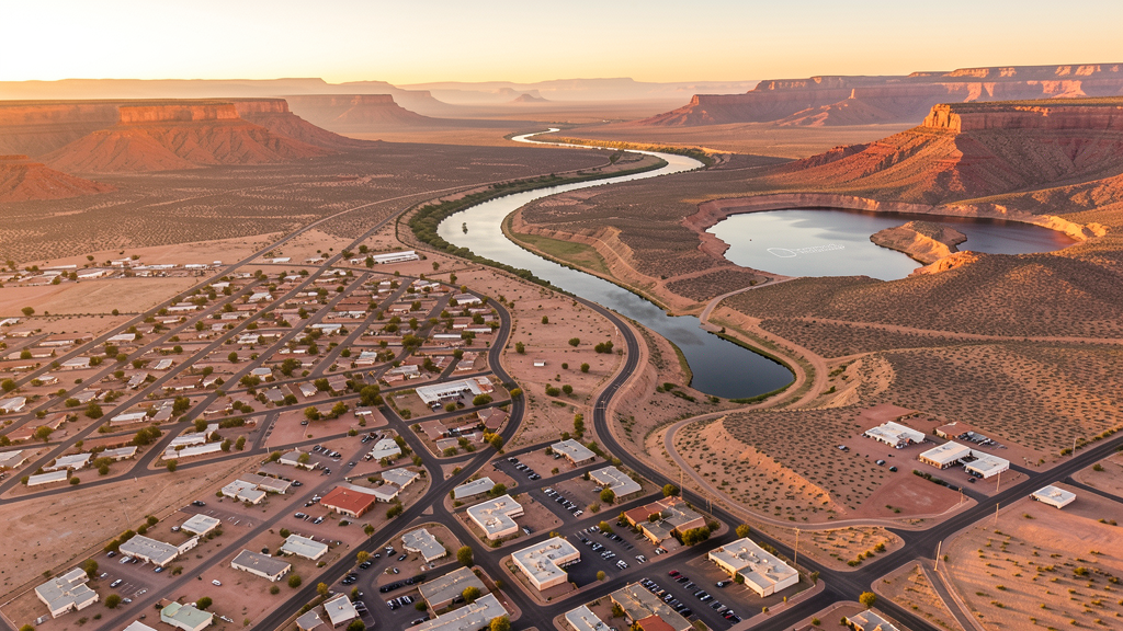
Get Matched With a Local Surveyor
Drone Survey Services Available in Truth or Consequences, NM
Truth or Consequences serves as the gateway to Spaceport America and Elephant Butte Lake. Spaceport support infrastructure, tourism development, and government facilities drive construction, with White Sands Missile Range and Spaceport restricted airspace creating operational constraints to the southeast.
Drone Surveys for Truth or Consequences's Construction Market
Truth or Consequences construction is driven by Spaceport America support infrastructure, tourism development, and healthcare facilities. The city serves as the closest lodging base for Spaceport America visitors. Elephant Butte Lake recreation area creates tourism infrastructure demand. Sierra County government facilities and residential development provide modest construction activity.
Active Developers in the Area:
- Spaceport America — Launch facility upgrades and visitor infrastructure
- Sierra County — County facility upgrades and road infrastructure
- Tourism developers — Hot springs resort renovations and lake-area hospitality

Typical Project Costs in New Mexico
Cost ranges are based on market data for Truth or Consequences Micropolitan Area. Actual pricing depends on site size, complexity, and deliverables.
| Service Type | Low End | High End |
|---|---|---|
| Topographic Survey | $1,100 | $5,500 |
| Drone Inspection | $450 | $2,500 |
| LiDAR Scanning | $1,800 | $9,000 |
| Environmental Monitoring | $900 | $4,500 |
| Aerial Imagery | $250 | $1,500 |
| Construction Monitoring | $550 | $2,800 |
| Real Estate Photography | $200 | $1,000 |
| Roof Inspection | $200 | $1,200 |
Local Airspace & Regulations in Truth or Consequences, NM
FAA Part 107 Requirements
All commercial drone operations in New Mexico require the pilot to hold an active FAA Part 107 Remote Pilot Certificate. Our network surveyors are verified Part 107 holders.
State Drone Laws
New Mexico enacted SB 240 (2021), the UAS Act, which established a state UAS Advisory Commission under the New Mexico Department of Transportation and preempted local municipalities from enacting their own drone flight regulations. The law prohibits weaponization of drones and restricts surveillance of private property without consent. New Mexico hosts extensive restricted military airspace — including White Sands Missile Range, Kirtland Air Force Base, Cannon Air Force Base (home to the 27th Special Operations Wing MQ-9 Reaper drone operations), Holloman Air Force Base (F-16 and MQ-9 training), and Los Alamos National Laboratory — each with active no-drone zones. Spaceport America near Truth or Consequences has restricted airspace during launch operations. Commercial operators must hold a valid FAA Part 107 Remote Pilot Certificate. The state does not require a separate state drone license, but operators flying near military installations, national laboratories, or tribal lands must coordinate with the controlling agency. New Mexico's high desert terrain and density altitude considerations affect drone performance at elevations above 5,000 feet.
Local Ordinances
Truth or Consequences follows FAA Part 107 regulations. The city is near White Sands Missile Range restricted airspace to the southeast and Spaceport America, which has intermittent restricted airspace during launch operations. Operators should check NOTAMs for launch windows and missile range activity. Cibola National Forest to the west requires Forest Service permits for commercial flights.
Restricted Airspace
- Class D airspace around Truth or Consequences Municipal Airport (TCS)
- White Sands Missile Range restricted airspace to the southeast
- Spaceport America restricted airspace to the southeast during launch operations
- Cibola National Forest and Black Range restrictions to the west
Airports in the area: Truth or Consequences Municipal Airport (TCS)
Why Hire Through Aerius View in Truth or Consequences, NM?
FAA-Certified
Every surveyor holds an active Part 107 Remote Pilot Certificate.
Local to Truth or Consequences
Surveyors who know the New Mexico airspace and local permitting.
No Cost to Quote
Submit your project at no charge. Pay the surveyor directly if you proceed.
Fast Turnaround
A local surveyor contacts you within 2 business days.
How Our Truth or Consequences Matching Process Works
We're actively building our network of FAA-certified drone operators in Truth or Consequences, NM. Here's exactly what happens when you submit a project request.
Submit Your Project
Tell us your site location, acreage, and what you need (topographic survey, LiDAR, inspection, etc.). Takes 60 seconds. No cost, no obligation.
We Match & Vet
We identify Part 107-certified operators in New Mexico with the right equipment for your project. Every pilot is verified for active certification, insurance, and relevant experience in New Mexico airspace.
You Get Quotes
Matched surveyors contact you within 2 business days with quotes. You compare pricing, timelines, and deliverables, then choose the right fit. You pay the surveyor directly, no markup.
What Deliverables Do You Get?
Every project includes professional-grade deliverables compatible with standard construction and engineering software:
- Orthomosaic maps (GeoTIFF) for site overview and documentation
- Point clouds (LAS/LAZ) for 3D modeling and volumetric analysis
- DEM/DSM terrain models for cut/fill and grade analysis
- Contour lines (DXF/DWG, CAD-ready) for Civil 3D and Revit
- Progress reports with side-by-side comparisons for construction monitoring
- Coordinate systems matched to your project datum (State Plane, UTM, or local)
Insurance & Liability Protection
Pilot Insurance Required
Every operator in our network must carry active liability insurance. Minimum coverage: $1,000,000 general liability. Proof of insurance is verified before any pilot joins the network.
FAA Part 107 Verified
We confirm each pilot's Remote Pilot Certificate is active and in good standing through the FAA Airmen Inquiry system. Expired certificates are flagged automatically.
Equipment Documentation
Pilots list their drone models, sensors (RGB, LiDAR, thermal, multispectral), and payload specs so we can match the right equipment to your project requirements.
Site Safety Coordination
Pilots coordinate with your site superintendent for safe operations on active construction sites, including flight plans that avoid worker areas and equipment zones.
Truth or Consequences, NM Drone Survey FAQs
Can I fly a drone near Spaceport America from Truth or Consequences?
Spaceport America, approximately 30 miles southeast of Truth or Consequences, has intermittent restricted airspace during launch operations. Operators should check NOTAMs for launch windows. The spaceport itself is private property requiring authorization for flights on or near the facility.
How does White Sands Missile Range affect drone operations near Truth or Consequences?
White Sands Missile Range restricted airspace extends to the southeast of Truth or Consequences. The missile range conducts testing that creates intermittent TFRs. Operators flying south or southeast of the city should check current restricted area charts and NOTAMs.
What drone services are most needed in Truth or Consequences?
Spaceport support infrastructure survey, tourism development monitoring, and government facility inspection are primary needs. The city position as a gateway to Spaceport America creates unique aerospace-adjacent survey opportunities. Elephant Butte Lake recreation creates environmental and tourism survey demand.
Does Truth or Consequences have controlled airspace?
Truth or Consequences Municipal Airport (TCS) has Class D airspace. Drone operators flying within the Class D radius need LAANC authorization. The airport primarily serves general aviation.
What tourism-related drone survey opportunities exist near Truth or Consequences?
Elephant Butte Lake State Park creates tourism infrastructure survey needs. Hot springs resort development and lake-area hospitality construction provide demand. The city historic hot springs district has renovation projects requiring aerial documentation. Tourism marketing aerial photography is also a potential service area.
How does Truth or Consequences elevation affect drone flying?
Truth or Consequences sits at approximately 4,200 feet elevation along the Rio Grande. The nearby Elephant Butte Reservoir creates micro-climate effects. Summer temperatures above 100 degrees reduce drone performance. The relatively moderate elevation compared to northern NM cities provides better operating conditions, but hot conditions remain a factor.
Nearby Cities
Are You a Drone Surveyor in Truth or Consequences?
Get pre-qualified leads in your service area. No membership fees, no monthly minimums. First lead free.
Ready to Start Your Project in Truth or Consequences, NM?
Get matched with a local, FAA-certified surveyor. No cost, no obligation.
Request a Free Quote