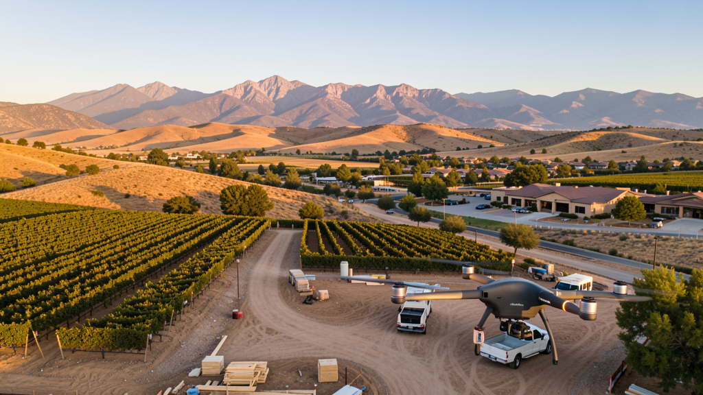
Drone Survey Services in Cottonwood, AZ
From Verde River residential development and Verde Valley winery construction to Northern Arizona Healthcare campus improvements and Highway 89A commercial growth, Cottonwood is the commercial hub of the Verde Valley where national forest boundaries and state park restrictions shape every survey mission.
Serving Yavapai County & the Cottonwood area
Request a Free Quote
Get Matched With a Local Surveyor
Drone Survey Services Available in Cottonwood, AZ
Cottonwood is the Verde Valley commercial hub driven by residential growth, wine tourism infrastructure, and healthcare facilities. The Verde Valley wine region is a growing destination. At 3,300 ft, the milder climate attracts retirees. Coconino and Prescott National Forests and Dead Horse Ranch State Park create airspace constraints.
Drone Surveys for Cottonwood's Construction Market
Cottonwood is the commercial hub of the Verde Valley in Yavapai County, with a construction market driven by residential growth, wine tourism infrastructure, and healthcare facilities. The city has seen residential development along the Verde River corridor and in the Cottonwood Ranch area. The Verde Valley wine region is a growing tourism destination, generating demand for winery construction and tasting room development. The Northern Arizona Healthcare Cottonwood campus generates medical facility construction needs. Commercial development along Highway 89A and Main Street continues. The city serves as the retail and service center for the Verde Valley including Clarkdale, Jerome, and Cornville. At 3,300 feet elevation, Cottonwood has a milder climate than Phoenix, attracting retirees and remote workers.
Active Developers in the Area:
Typical Project Costs in Arizona
Cost ranges are based on market data for Cottonwood. Actual pricing depends on site size, complexity, and deliverables.
| Service Type | Low End | High End |
|---|---|---|
| Topographic Survey | $1,800 | $4,500 |
| Drone Inspection | $250 | $850 |
| LiDAR Scanning | $2,800 | $8,500 |
| Environmental Monitoring | $800 | $3,200 |
| Aerial Imagery | $175 | $500 |
| Construction Monitoring | $1,200 | $3,200 |
| Real Estate Photography | $175 | $450 |
| Roof Inspection | $225 | $800 |
Local Airspace & Regulations in Cottonwood, AZ
FAA Part 107 Requirements
All commercial drone operations in Arizona require the pilot to hold an active FAA Part 107 Remote Pilot Certificate. Our network surveyors are verified Part 107 holders.
State Drone Laws
Arizona SB 1449 (2016) was the first state law regulating drone use, prohibiting drone operations that interfere with law enforcement, emergency responders, or wildfire suppression efforts. The law prohibits drone flights within 3 miles of a wildfire or prescribed burn and makes violation a class 1 misdemeanor. ARS Title 13 Chapter 29 Article 3 restricts drone surveillance of private property and weaponization of drones. Commercial operators must hold a valid FAA Part 107 Remote Pilot Certificate. Arizona does not require a separate state drone license, but operators must comply with FAA Part 107 rules and any local ordinances. The Arizona Department of Public Safety maintains guidelines for drone operations near critical infrastructure including power plants, dams, and military installations.
Local Ordinances
Cottonwood follows Yavapai County regulations for drone operations. Commercial operators must hold FAA Part 107 certification. The city does not have a specific drone ordinance but Dead Horse Ranch State Park within city limits prohibits drone takeoff and landing. Flights from private property with owner permission do not require a city permit but must comply with FAA Part 107 rules. The city requires a special event permit for drone demonstrations at public events. The nearby Verde Valley wine region may have additional considerations for drone flights over vineyards. HOAs in Cottonwood, particularly in Cottonwood Ranch and Verde Village, may have their own guidelines.
Restricted Airspace
- Cottonwood Airport (CFT) is uncontrolled but has general aviation traffic. Drone operators should monitor CTAF 122.8 and maintain visual line of sight.
- Coconino National Forest and Prescott National Forest border the Cottonwood area. Designated wilderness areas within both forests prohibit drone flights by the US Forest Service.
- Jerome State Historic Park and the surrounding Mingus Mountain area have challenging wind patterns. Pre-programmed waypoint missions are recommended for survey flights in mountainous terrain.
- Dead Horse Ranch State Park within Cottonwood city limits prohibits drone takeoff and landing within park boundaries under Arizona State Parks regulations.
- The Verde River corridor is a riparian habitat area. Drone operators should avoid disturbing wildlife, especially during bird nesting season.
Airports in the area: undefined (undefined), undefined (undefined), undefined (undefined)
Why Hire Through Aerius View in Cottonwood, AZ?
FAA-Certified
Every surveyor holds an active Part 107 Remote Pilot Certificate.
Local to Cottonwood
Surveyors who know the Arizona airspace and local permitting.
No Cost to Quote
Submit your project at no charge. Pay the surveyor directly if you proceed.
Fast Turnaround
A local surveyor contacts you within 2 business days.
How Our Cottonwood Matching Process Works
We're actively building our network of FAA-certified drone operators in Cottonwood, AZ. Here's exactly what happens when you submit a project request.
Submit Your Project
Tell us your site location, acreage, and what you need (topographic survey, LiDAR, inspection, etc.). Takes 60 seconds. No cost, no obligation.
We Match & Vet
We identify Part 107-certified operators in Arizona with the right equipment for your project. Every pilot is verified for active certification, insurance, and relevant experience in Arizona airspace.
You Get Quotes
Matched surveyors contact you within 2 business days with quotes. You compare pricing, timelines, and deliverables, then choose the right fit. You pay the surveyor directly, no markup.
What Deliverables Do You Get?
Every project includes professional-grade deliverables compatible with standard construction and engineering software:
- Orthomosaic maps (GeoTIFF) for site overview and documentation
- Point clouds (LAS/LAZ) for 3D modeling and volumetric analysis
- DEM/DSM terrain models for cut/fill and grade analysis
- Contour lines (DXF/DWG, CAD-ready) for Civil 3D and Revit
- Progress reports with side-by-side comparisons for construction monitoring
- Coordinate systems matched to your project datum (State Plane, UTM, or local)
Insurance & Liability Protection
Pilot Insurance Required
Every operator in our network must carry active liability insurance. Minimum coverage: $1,000,000 general liability. Proof of insurance is verified before any pilot joins the network.
FAA Part 107 Verified
We confirm each pilot's Remote Pilot Certificate is active and in good standing through the FAA Airmen Inquiry system. Expired certificates are flagged automatically.
Equipment Documentation
Pilots list their drone models, sensors (RGB, LiDAR, thermal, multispectral), and payload specs so we can match the right equipment to your project requirements.
Site Safety Coordination
Pilots coordinate with your site superintendent for safe operations on active construction sites, including flight plans that avoid worker areas and equipment zones.
Cottonwood, AZ Drone Survey FAQs
Do I need a permit for a drone survey in Cottonwood?
Cottonwood follows Yavapai County regulations. You need a permit only for flights on public property. Surveys from private property with owner permission do not require a city permit. All commercial operations require FAA Part 107 certification. Dead Horse Ranch State Park prohibits drone takeoff and landing.
Can I fly drones near Dead Horse Ranch State Park?
No. Dead Horse Ranch State Park within Cottonwood city limits prohibits drone takeoff and landing within park boundaries under Arizona State Parks regulations. Plan survey routes that avoid the park area along the Verde River.
What are the main construction survey needs in Cottonwood?
Residential development along the Verde River and Cottonwood Ranch, winery construction in the Verde Valley wine region, Northern Arizona Healthcare campus improvements, and commercial development along Highway 89A are the primary drivers.
Are there restrictions near the national forests?
Coconino and Prescott National Forests border the Cottonwood area. Designated wilderness areas within both forests prohibit drone flights. The Verde River corridor is a riparian habitat area where operators should avoid disturbing wildlife. Verify Forest Service boundaries before flying.
How much does a drone survey cost in Cottonwood?
Topographic surveys range from $1,800 to $4,500. Roof inspections run $225-$800. Real estate drone photography starts at $175. LiDAR scanning for larger or mountainous sites can cost $2,800-$8,500. Winery and vineyard aerial photography is a growing niche market.
Nearby Cities
Are You a Drone Surveyor in Cottonwood?
Get pre-qualified leads in your service area. No membership fees, no monthly minimums. First lead free.
Ready to Start Your Project in Cottonwood, AZ?
Get matched with a local, FAA-certified surveyor. No cost, no obligation.
Request a Free Quote