Drone Survey Services in Douglas, AZ
From border port of entry expansion and CBP infrastructure to Sulphur Springs Valley agriculture and Chiricahua Mountain tourism, Douglas is a US-Mexico border city where federal air operations and international boundary constraints shape every survey mission.
Serving Cochise County & the Sierra Vista area
Request a Free Quote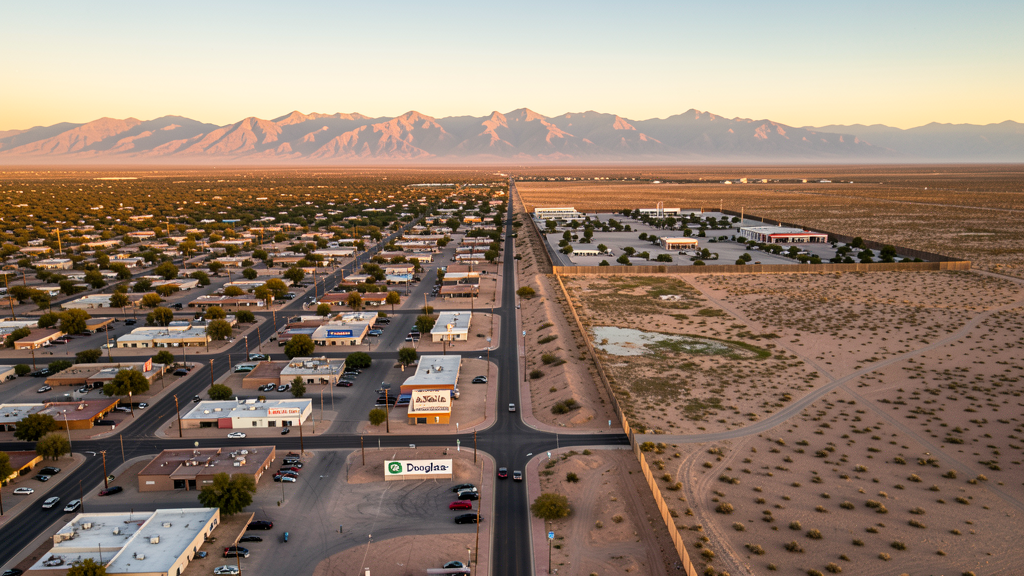
Get Matched With a Local Surveyor
Drone Survey Services Available in Douglas, AZ
Douglas is a border city driven by border infrastructure, agriculture, and small-scale industrial development. CBP port of entry expansion generates construction demand. Agricultural operations in the Sulphur Springs Valley need aerial survey. The Chiricahua Mountains and Coronado National Forest create airspace constraints to the east.
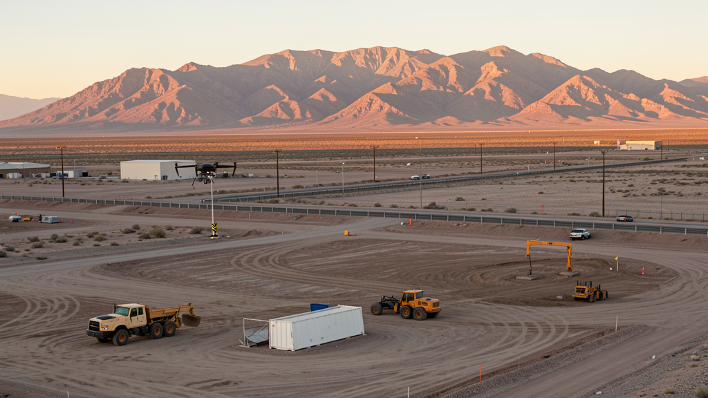
Drone Surveys for Douglas's Construction Market
Douglas is a border city in Cochise County with a construction market driven by border infrastructure, agriculture, and small-scale industrial development. Customs and Border Protection has invested in port of entry expansion and border technology infrastructure. The city has seen residential development along Highway 80 and the Geronimo Trail area. Agricultural operations in the Sulphur Springs Valley generate demand for aerial survey and crop monitoring. The nearby Chiricahua Mountains and Coronado National Forest create tourism-related construction needs. Water infrastructure improvements are ongoing. The city serves as a port of entry community with cross-border economic activity with Agua Prieta, Sonora.
Active Developers in the Area:
Typical Project Costs in Arizona
Cost ranges are based on market data for Sierra Vista. Actual pricing depends on site size, complexity, and deliverables.
| Service Type | Low End | High End |
|---|---|---|
| Topographic Survey | $1,800 | $4,500 |
| Drone Inspection | $250 | $850 |
| LiDAR Scanning | $2,800 | $8,500 |
| Environmental Monitoring | $800 | $3,200 |
| Aerial Imagery | $175 | $500 |
| Construction Monitoring | $1,200 | $3,200 |
| Real Estate Photography | $175 | $450 |
| Roof Inspection | $225 | $800 |
Local Airspace & Regulations in Douglas, AZ
FAA Part 107 Requirements
All commercial drone operations in Arizona require the pilot to hold an active FAA Part 107 Remote Pilot Certificate. Our network surveyors are verified Part 107 holders.
State Drone Laws
Arizona SB 1449 (2016) was the first state law regulating drone use, prohibiting drone operations that interfere with law enforcement, emergency responders, or wildfire suppression efforts. The law prohibits drone flights within 3 miles of a wildfire or prescribed burn and makes violation a class 1 misdemeanor. ARS Title 13 Chapter 29 Article 3 restricts drone surveillance of private property and weaponization of drones. Commercial operators must hold a valid FAA Part 107 Remote Pilot Certificate. Arizona does not require a separate state drone license, but operators must comply with FAA Part 107 rules and any local ordinances. The Arizona Department of Public Safety maintains guidelines for drone operations near critical infrastructure including power plants, dams, and military installations.
Local Ordinances
Douglas follows Cochise County regulations for drone operations. Commercial operators must hold FAA Part 107 certification. The city does not have a specific drone ordinance but the border location creates unique airspace requirements. Drone flights crossing the US-Mexico border are illegal under both FAA and Mexican regulations. Customs and Border Protection maintains active air operations in the area. The city requires coordination with CBP for any survey work near the border fence. Flights over the Douglas Port of Entry and border infrastructure require authorization. The city has historically addressed drone concerns through coordination with federal authorities rather than local ordinances.
Restricted Airspace
- Douglas is on the US-Mexico border. Customs and Border Protection (CBP) maintains active air operations including drone and manned aircraft patrols. Temporary flight restrictions are common in the border zone. Always check NOTAMs before flying.
- Class D airspace from Sierra Vista Municipal Airport/Libby Army Airfield extends into the northern edge of the Douglas area. Verify boundaries before flying north.
- Coronado National Forest and the Chiricahua Mountains to the east include designated wilderness areas where drone flights are prohibited by the US Forest Service.
- Agua Prieta, Sonora (Mexico) is directly across the border. Drone flights crossing the international border are illegal under FAA and Mexican regulations. All drone operations must remain within US airspace.
- Remote desert location with limited cell coverage. Pre-programmed waypoint missions are recommended for survey flights outside town limits.
Airports in the area: undefined (undefined), undefined (undefined)
Why Hire Through Aerius View in Douglas, AZ?
FAA-Certified
Every surveyor holds an active Part 107 Remote Pilot Certificate.
Local to Douglas
Surveyors who know the Arizona airspace and local permitting.
No Cost to Quote
Submit your project at no charge. Pay the surveyor directly if you proceed.
Fast Turnaround
A local surveyor contacts you within 2 business days.
How Our Douglas Matching Process Works
We're actively building our network of FAA-certified drone operators in Douglas, AZ. Here's exactly what happens when you submit a project request.
Submit Your Project
Tell us your site location, acreage, and what you need (topographic survey, LiDAR, inspection, etc.). Takes 60 seconds. No cost, no obligation.
We Match & Vet
We identify Part 107-certified operators in Arizona with the right equipment for your project. Every pilot is verified for active certification, insurance, and relevant experience in Arizona airspace.
You Get Quotes
Matched surveyors contact you within 2 business days with quotes. You compare pricing, timelines, and deliverables, then choose the right fit. You pay the surveyor directly, no markup.
What Deliverables Do You Get?
Every project includes professional-grade deliverables compatible with standard construction and engineering software:
- Orthomosaic maps (GeoTIFF) for site overview and documentation
- Point clouds (LAS/LAZ) for 3D modeling and volumetric analysis
- DEM/DSM terrain models for cut/fill and grade analysis
- Contour lines (DXF/DWG, CAD-ready) for Civil 3D and Revit
- Progress reports with side-by-side comparisons for construction monitoring
- Coordinate systems matched to your project datum (State Plane, UTM, or local)
Insurance & Liability Protection
Pilot Insurance Required
Every operator in our network must carry active liability insurance. Minimum coverage: $1,000,000 general liability. Proof of insurance is verified before any pilot joins the network.
FAA Part 107 Verified
We confirm each pilot's Remote Pilot Certificate is active and in good standing through the FAA Airmen Inquiry system. Expired certificates are flagged automatically.
Equipment Documentation
Pilots list their drone models, sensors (RGB, LiDAR, thermal, multispectral), and payload specs so we can match the right equipment to your project requirements.
Site Safety Coordination
Pilots coordinate with your site superintendent for safe operations on active construction sites, including flight plans that avoid worker areas and equipment zones.
Douglas, AZ Drone Survey FAQs
Do I need a permit for a drone survey in Douglas?
Douglas follows Cochise County regulations. You need a permit only for flights on public property. All commercial operations require FAA Part 107 certification. The border location creates unique requirements. Coordinate with CBP for any survey work near the border fence or port of entry.
Can I fly drones near the US-Mexico border in Douglas?
Douglas is directly on the US-Mexico border. CBP maintains active air operations including drone patrols. Temporary flight restrictions are common. Drone flights crossing the international border are illegal under FAA and Mexican regulations. Always check NOTAMs and coordinate with CBP before flying near the border zone.
What are the main survey needs in Douglas?
Border infrastructure projects including the port of entry expansion and border technology are primary drivers. Agricultural operations in the Sulphur Springs Valley need crop monitoring and aerial survey. Water infrastructure improvements and residential development along Highway 80 also generate demand.
Are there wilderness area restrictions near Douglas?
The Chiricahua Mountains and Coronado National Forest to the east include designated wilderness areas where drone flights are prohibited by the US Forest Service. Verify Forest Service boundaries before flying east of Douglas.
How much does a drone survey cost in Douglas?
Topographic surveys range from $1,800 to $4,500. Roof inspections run $225-$800. Agricultural drone survey for crop monitoring is a growing market. LiDAR scanning for larger desert or mountainous sites can cost $2,800-$8,500. The remote location may add travel costs.
Nearby Cities
Are You a Drone Surveyor in Douglas?
Get pre-qualified leads in your service area. No membership fees, no monthly minimums. First lead free.
Ready to Start Your Project in Douglas, AZ?
Get matched with a local, FAA-certified surveyor. No cost, no obligation.
Request a Free Quote