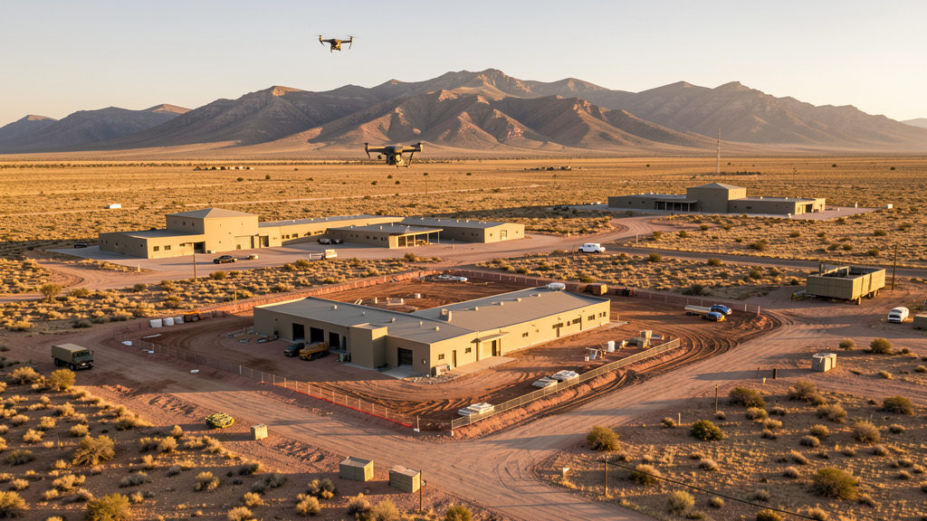
Drone Survey Services in Sierra Vista, AZ
From Fort Huachuca cyber facility upgrades and border security infrastructure to Ramsey Canyon residential growth and Buffalo Soldier Trail improvements, Sierra Vista is a military-adjacent city where Army airspace and the US-Mexico border zone shape every survey mission.
Serving Cochise County & the Sierra Vista area
Request a Free Quote
Get Matched With a Local Surveyor
Drone Survey Services Available in Sierra Vista, AZ
Sierra Vista is driven by Fort Huachuca infrastructure, retirement community growth, and border security infrastructure. The Army invests in cyber and intelligence facility upgrades. Border security projects including CBP facilities generate specialized demand. The Huachuca Mountains and San Pedro Riparian area create airspace constraints.
Drone Surveys for Sierra Vista's Construction Market
Sierra Vista is a military-adjacent city in Cochise County with a construction market driven by Fort Huachuca infrastructure, retirement community growth, and border security infrastructure. The Army has invested in cyber and intelligence facility upgrades at Fort Huachuca. Residential development in the Ramsey Canyon area and along Highway 92 generates demand for topographic surveys. The city has invested in water infrastructure and the Buffalo Soldier Trail improvement project. Commercial development along Fry Boulevard continues. Border security infrastructure projects, including CBP facilities and technology installations, generate specialized survey demand. The nearby Bisbee and Tombstone tourism areas also create periodic construction needs.
Active Developers in the Area:
Typical Project Costs in Arizona
Cost ranges are based on market data for Sierra Vista. Actual pricing depends on site size, complexity, and deliverables.
| Service Type | Low End | High End |
|---|---|---|
| Topographic Survey | $1,800 | $4,500 |
| Drone Inspection | $250 | $850 |
| LiDAR Scanning | $2,800 | $8,500 |
| Environmental Monitoring | $800 | $3,200 |
| Aerial Imagery | $175 | $500 |
| Construction Monitoring | $1,200 | $3,200 |
| Real Estate Photography | $175 | $450 |
| Roof Inspection | $225 | $800 |
Local Airspace & Regulations in Sierra Vista, AZ
FAA Part 107 Requirements
All commercial drone operations in Arizona require the pilot to hold an active FAA Part 107 Remote Pilot Certificate. Our network surveyors are verified Part 107 holders.
State Drone Laws
Arizona SB 1449 (2016) was the first state law regulating drone use, prohibiting drone operations that interfere with law enforcement, emergency responders, or wildfire suppression efforts. The law prohibits drone flights within 3 miles of a wildfire or prescribed burn and makes violation a class 1 misdemeanor. ARS Title 13 Chapter 29 Article 3 restricts drone surveillance of private property and weaponization of drones. Commercial operators must hold a valid FAA Part 107 Remote Pilot Certificate. Arizona does not require a separate state drone license, but operators must comply with FAA Part 107 rules and any local ordinances. The Arizona Department of Public Safety maintains guidelines for drone operations near critical infrastructure including power plants, dams, and military installations.
Local Ordinances
Sierra Vista requires a commercial drone permit for operations taking off or landing on city-owned property, including parks and recreation areas. The city prohibits drone flights over Fort Huachuca without specific military authorization. Flights from private property with owner permission do not require a city permit but must comply with FAA Part 107 rules. Sierra Vista Municipal Airport and Libby Army Airfield airspace coordination is managed through LAANC for the civilian side. The city prohibits drone flights over large public gatherings at Veterans Memorial Park and the Sierra Vista Sports Complex without authorization. The proximity to Fort Huachuca and the US-Mexico border creates unique airspace complexity.
Restricted Airspace
- Class D airspace around Sierra Vista Municipal Airport/Libby Army Airfield (FHU) — extends 5 nautical miles. LAANC authorization required for commercial drone flights within this zone. The airport shares facilities with Fort Huachuca.
- Fort Huachuca — active US Army installation with restricted military airspace. The base is home to the US Army Intelligence Center and Network Enterprise Technology Command. Drone flights within 5 miles require prior coordination with base operations. The base has extensive electronic warfare and intelligence training operations.
- Coronado National Forest and the Huachuca Mountains to the west include designated wilderness areas where drone flights are prohibited by the US Forest Service.
- San Pedro Riparian National Conservation Area along the San Pedro River — BLM-managed area with restrictions on drone operations near wildlife habitat, especially during bird nesting season.
- US-Mexico border zone: Sierra Vista is approximately 20 miles from the US-Mexico border. Customs and Border Protection (CBP) operates drones and manned aircraft in this area. Drone operators should be aware of CBP air operations and potential temporary flight restrictions.
Airports in the area: undefined (undefined), undefined (undefined)
Why Hire Through Aerius View in Sierra Vista, AZ?
FAA-Certified
Every surveyor holds an active Part 107 Remote Pilot Certificate.
Local to Sierra Vista
Surveyors who know the Arizona airspace and local permitting.
No Cost to Quote
Submit your project at no charge. Pay the surveyor directly if you proceed.
Fast Turnaround
A local surveyor contacts you within 2 business days.
How Our Sierra Vista Matching Process Works
We're actively building our network of FAA-certified drone operators in Sierra Vista, AZ. Here's exactly what happens when you submit a project request.
Submit Your Project
Tell us your site location, acreage, and what you need (topographic survey, LiDAR, inspection, etc.). Takes 60 seconds. No cost, no obligation.
We Match & Vet
We identify Part 107-certified operators in Arizona with the right equipment for your project. Every pilot is verified for active certification, insurance, and relevant experience in Arizona airspace.
You Get Quotes
Matched surveyors contact you within 2 business days with quotes. You compare pricing, timelines, and deliverables, then choose the right fit. You pay the surveyor directly, no markup.
What Deliverables Do You Get?
Every project includes professional-grade deliverables compatible with standard construction and engineering software:
- Orthomosaic maps (GeoTIFF) for site overview and documentation
- Point clouds (LAS/LAZ) for 3D modeling and volumetric analysis
- DEM/DSM terrain models for cut/fill and grade analysis
- Contour lines (DXF/DWG, CAD-ready) for Civil 3D and Revit
- Progress reports with side-by-side comparisons for construction monitoring
- Coordinate systems matched to your project datum (State Plane, UTM, or local)
Insurance & Liability Protection
Pilot Insurance Required
Every operator in our network must carry active liability insurance. Minimum coverage: $1,000,000 general liability. Proof of insurance is verified before any pilot joins the network.
FAA Part 107 Verified
We confirm each pilot's Remote Pilot Certificate is active and in good standing through the FAA Airmen Inquiry system. Expired certificates are flagged automatically.
Equipment Documentation
Pilots list their drone models, sensors (RGB, LiDAR, thermal, multispectral), and payload specs so we can match the right equipment to your project requirements.
Site Safety Coordination
Pilots coordinate with your site superintendent for safe operations on active construction sites, including flight plans that avoid worker areas and equipment zones.
Sierra Vista, AZ Drone Survey FAQs
Do I need a permit for a drone survey in Sierra Vista?
You need a commercial drone permit only if you plan to take off or land on city-owned property, including parks. Surveys from private property with owner permission do not require a city permit. All commercial operations require FAA Part 107 certification. The proximity to Fort Huachuca requires extra attention to restricted airspace.
Can I fly drones near Fort Huachuca?
Fort Huachuca is an active US Army installation with restricted military airspace. Drone flights within 5 miles require prior coordination with base operations. The base is home to the Army Intelligence Center and Network Enterprise Technology Command. The airport shares facilities with Libby Army Airfield, creating a complex military/civilian airspace environment.
Are there border zone restrictions near Sierra Vista?
Sierra Vista is approximately 20 miles from the US-Mexico border. Customs and Border Protection operates drones and manned aircraft in this area. Drone operators should be aware of CBP air operations and potential temporary flight restrictions. Always check NOTAMs before flying near the border zone.
Can I fly drones in the San Pedro Riparian area?
The San Pedro Riparian National Conservation Area is BLM-managed with restrictions on drone operations near wildlife habitat, especially during bird nesting season. The Coronado National Forest and Huachuca Mountains also have designated wilderness areas where drone flights are prohibited.
How much does a drone survey cost in Sierra Vista?
Topographic surveys range from $1,800 to $4,500. Roof inspections run $225-$800. LiDAR scanning for larger or mountainous sites can cost $2,800-$8,500. Real estate drone photography starts at $175. Military and border security infrastructure survey work may have specialized requirements and pricing.
Nearby Cities
Are You a Drone Surveyor in Sierra Vista?
Get pre-qualified leads in your service area. No membership fees, no monthly minimums. First lead free.
Ready to Start Your Project in Sierra Vista, AZ?
Get matched with a local, FAA-certified surveyor. No cost, no obligation.
Request a Free Quote