Drone Survey Services in Fort Worth, TX
From the $1.1B Panther Island waterfront project and the Stockyards redevelopment to Clearfork, Walsh Ranch, and the NAS JRB military pipeline, Fort Worth is the fastest-growing large city in DFW where the Trinity River corridor and Tornado Alley weather drive diverse survey demand.
Serving Tarrant County & the Dallas-Fort Worth-Arlington area
Request a Free Quote
Get Matched With a Local Surveyor
Drone Survey Services Available in Fort Worth, TX
The Dallas-Fort Worth-Arlington metro is the 4th-largest US metro with 7.6 million residents, and Fort Worth is its fastest-growing large city at 980,000. The $1.1 billion Panther Island waterfront project, Stockyards redevelopment, Clearfork and Walsh Ranch MPCs, I-35W expansion, and NAS JRB military construction pipeline generate sustained demand for topographic surveys, construction monitoring, and LiDAR mapping. Tornado Alley weather patterns add a significant post-storm inspection market.
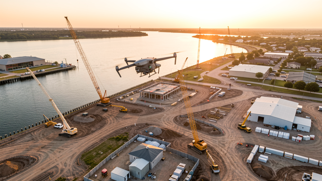
Drone Surveys for Fort Worth's Construction Market
Fort Worth is the fastest-growing large city in DFW, with a construction market exceeding $12 billion annually. The $1.1 billion Panther Island waterfront project is reshaping the Trinity River corridor with mixed-use development, flood control infrastructure, and a new urban neighborhood. The Historic Stockyards District is undergoing a major redevelopment with new hotels, entertainment venues, and residential lofts. Clearfork, a 1,000-acre master-planned community along the Clear Fork of the Trinity River, is building office, retail, and residential space. Walsh Ranch, a 7,200-acre MPC in west Fort Worth, is one of the largest undeveloped urban tracts in the US. The I-35W expansion through downtown and the North Tarrant Express managed lanes project generate continuous heavy civil survey demand. Cook Children's Medical Center and Texas Health Harris Methodist expansions add institutional construction. The Naval Air Station JRB military construction pipeline and the B-52 reactivation project drive federal survey contracts.
Active Developers in the Area:
Typical Project Costs in Texas
Cost ranges are based on market data for Dallas-Fort Worth-Arlington. Actual pricing depends on site size, complexity, and deliverables.
| Service Type | Low End | High End |
|---|---|---|
| Topographic Survey | $1,700 | $5,200 |
| Drone Inspection | $250 | $850 |
| LiDAR Scanning | $2,800 | $9,500 |
| Environmental Monitoring | $900 | $3,600 |
| Aerial Imagery | $200 | $550 |
| Construction Monitoring | $950 | $3,000 |
| Real Estate Photography | $175 | $500 |
| Roof Inspection | $225 | $800 |
Local Airspace & Regulations in Fort Worth, TX
FAA Part 107 Requirements
All commercial drone operations in Texas require the pilot to hold an active FAA Part 107 Remote Pilot Certificate. Our network surveyors are verified Part 107 holders.
State Drone Laws
Texas Government Code Chapter 423 restricts drone use over critical infrastructure facilities, including oil and gas pipelines, refineries, power plants, and water treatment facilities. HB 1484 (2023) added protections for agricultural operations and expanded penalties for drone surveillance of private property. Commercial operators must hold a valid FAA Part 107 Remote Pilot Certificate. Texas does not require a separate state drone license, but operators flying near critical infrastructure must obtain authorization from the facility owner. The Texas Department of Public Safety maintains additional guidelines for drone operations near state facilities.
Local Ordinances
Fort Worth does not issue a separate city-level drone permit for commercial operators. FAA Part 107 certification and LAANC authorization for DFW Class B airspace are the primary requirements. The Fort Worth Police Department Aviation Unit operates helicopters from Meacham Field and should be notified of extended drone operations in the downtown and Trinity River corridor. Commercial filming on city property requires a permit through the Fort Worth Film Commission. Drone takeoff and landing in Fort Worth parks requires a special use permit from the Parks and Recreation Department, including Trinity Park, Heritage Park, and Log Cabin Village. Flights over the Stockyards National Historic District should be coordinated with the Stockyards Heritage Development Co.
Restricted Airspace
- Class B airspace around DFW International — extends 15 nautical miles, surface to 10,000 ft MSL. Northern Fort Worth falls within DFW Class B shelves. LAANC authorization required for all commercial drone flights north of I-820 and Loop 820.
- Fort Worth Alliance Airport (AFW) — cargo hub with heavy freight traffic. While not Class B, the volume of cargo operations creates significant drone flight hazards. Avoid flights within 3 nautical miles during peak cargo hours (early morning and late evening).
- Naval Air Station Joint Reserve Base Fort Worth (NAS JRB) — located 5 miles west in White Settlement. Military restricted airspace (R-2301) covers the base and surrounding area. LAANC authorization and DoD coordination required for flights within 5 nautical miles.
- AT&T Stadium (Cowboys) and Globe Life Field (Rangers) — stadium TFRs during events prohibit drone flights within 3 nautical miles up to 3,000 ft AGL. Both venues are in Arlington, 10 miles east, but TFRs can extend into eastern Fort Worth.
- Trinity River and Panther Island project — while not formal restricted airspace, the Trinity River Vision/ Panther Island project area has active construction zones with crane operations. Drone flights over construction sites require coordination with the general contractor per FAA Part 107.39.
- Texas Motor Speedway — located 15 miles north in Justin, TX. Stadium TFRs during NASCAR and IndyCar events prohibit drone flights within 3 nautical miles up to 3,000 ft AGL.
- Clearfork and Walsh Ranch construction zones — active heavy equipment and crane operations. Survey flights over these MPC sites should be coordinated with site managers and safety officers.
- Severe weather: Fort Worth is in the heart of Tornado Alley. Spring thunderstorms (April-June) can produce tornadoes, large hail, and damaging winds. Post-storm survey work (roof inspections, hail damage documentation) is a significant drone survey use case but requires careful weather monitoring. Summer heat (100+ degrees F) limits flight windows to early morning and evening.
Airports in the area: undefined (undefined), undefined (undefined), undefined (undefined), undefined (undefined)
Why Hire Through Aerius View in Fort Worth, TX?
FAA-Certified
Every surveyor holds an active Part 107 Remote Pilot Certificate.
Local to Fort Worth
Surveyors who know the Texas airspace and local permitting.
No Cost to Quote
Submit your project at no charge. Pay the surveyor directly if you proceed.
Fast Turnaround
A local surveyor contacts you within 2 business days.
How Our Fort Worth Matching Process Works
We're actively building our network of FAA-certified drone operators in Fort Worth, TX. Here's exactly what happens when you submit a project request.
Submit Your Project
Tell us your site location, acreage, and what you need (topographic survey, LiDAR, inspection, etc.). Takes 60 seconds. No cost, no obligation.
We Match & Vet
We identify Part 107-certified operators in Texas with the right equipment for your project. Every pilot is verified for active certification, insurance, and relevant experience in Texas airspace.
You Get Quotes
Matched surveyors contact you within 2 business days with quotes. You compare pricing, timelines, and deliverables, then choose the right fit. You pay the surveyor directly, no markup.
What Deliverables Do You Get?
Every project includes professional-grade deliverables compatible with standard construction and engineering software:
- Orthomosaic maps (GeoTIFF) for site overview and documentation
- Point clouds (LAS/LAZ) for 3D modeling and volumetric analysis
- DEM/DSM terrain models for cut/fill and grade analysis
- Contour lines (DXF/DWG, CAD-ready) for Civil 3D and Revit
- Progress reports with side-by-side comparisons for construction monitoring
- Coordinate systems matched to your project datum (State Plane, UTM, or local)
Insurance & Liability Protection
Pilot Insurance Required
Every operator in our network must carry active liability insurance. Minimum coverage: $1,000,000 general liability. Proof of insurance is verified before any pilot joins the network.
FAA Part 107 Verified
We confirm each pilot's Remote Pilot Certificate is active and in good standing through the FAA Airmen Inquiry system. Expired certificates are flagged automatically.
Equipment Documentation
Pilots list their drone models, sensors (RGB, LiDAR, thermal, multispectral), and payload specs so we can match the right equipment to your project requirements.
Site Safety Coordination
Pilots coordinate with your site superintendent for safe operations on active construction sites, including flight plans that avoid worker areas and equipment zones.
Fort Worth, TX Drone Survey FAQs
Do I need a permit for a drone survey in Fort Worth?
Fort Worth does not issue a separate city-level drone permit for commercial operators. FAA Part 107 certification is mandatory. LAANC authorization is required for flights in northern Fort Worth within the DFW Class B airspace shelves. The NAS JRB military restricted airspace west of the city requires DoD coordination. Drone takeoff and landing in city parks requires a special use permit from Fort Worth Parks and Recreation.
How much does a drone survey cost in Fort Worth?
Fort Worth pricing is similar to the DFW metro average. Topographic surveys typically range from $1,700 to $5,200. LiDAR scanning runs $2,800 to $9,500 for wooded or hilly sites. Roof inspections cost $225 to $800 per building. Construction monitoring is typically $950 to $3,000 per month for recurring flights at sites like Panther Island, Clearfork, or Walsh Ranch.
Can I fly a drone near the Panther Island construction site?
The Panther Island waterfront project is an active construction zone with crane operations and heavy equipment. Drone flights over the site require coordination with the general contractor per FAA Part 107.39 (no flight over moving vehicles or people not involved in the operation). Survey flights for the Trinity River Vision Authority should be scheduled during non-peak construction hours and coordinated with site safety officers.
How does NAS JRB affect drone operations in Fort Worth?
Naval Air Station Joint Reserve Base Fort Worth is located 5 miles west in White Settlement. Military restricted airspace (R-2301) covers the base. All drone flights within 5 nautical miles require DoD coordination and LAANC authorization. The base operates F/A-18s, F-16s, and C-130s, creating significant low-altitude traffic. Always check NOTAMs and the LAANC grid for R-2301 restrictions before flying in western Fort Worth.
Are there stadium TFR restrictions near Fort Worth?
Yes. AT&T Stadium (Dallas Cowboys) and Globe Life Field (Texas Rangers) are in Arlington, 10 miles east. Stadium TFRs during events prohibit drone flights within 3 nautical miles up to 3,000 ft AGL. Texas Motor Speedway, 15 miles north in Justin, has similar TFRs during NASCAR and IndyCar events. Always check the FAA TFR list before scheduling survey flights near these venues.
What makes Fort Worth unique for drone survey work?
Fort Worth is the fastest-growing large city in DFW, with a $12B+ construction market driven by the $1.1B Panther Island waterfront project, Stockyards redevelopment, Clearfork and Walsh Ranch MPCs, and the I-35W/North Tarrant Express highway expansions. The NAS JRB military construction pipeline adds federal survey work. Tornado Alley weather patterns create significant post-storm roof inspection and hail damage documentation demand, making Fort Worth one of the most diverse drone survey markets in Texas.
Nearby Cities
Are You a Drone Surveyor in Fort Worth?
Get pre-qualified leads in your service area. No membership fees, no monthly minimums. First lead free.
Ready to Start Your Project in Fort Worth, TX?
Get matched with a local, FAA-certified surveyor. No cost, no obligation.
Request a Free Quote