Drone Survey Services in Denton, TX
From the 57,000-student UNT/TWU university corridor and the I-35E/I-35W split to Robson Ranch and the proposed DFW passenger rail, Denton is the northern anchor of the DFW metroplex, where university enrollment and transit-oriented development drive diverse survey demand.
Serving Denton County & the Dallas-Fort Worth-Arlington area
Request a Free Quote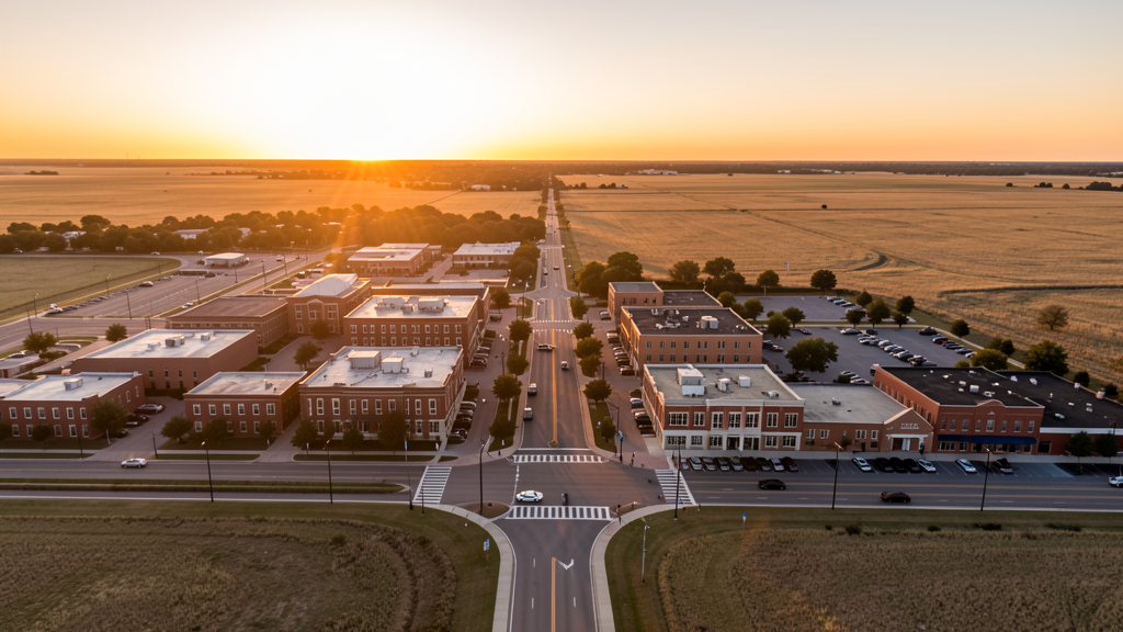
Get Matched With a Local Surveyor
Drone Survey Services Available in Denton, TX
The Dallas-Fort Worth-Arlington metro is the fastest-growing major metro in the US, and Denton anchors its northern edge as the Denton County seat. With 147,000 residents and 57,000+ university students (UNT + TWU), Denton has continuous institutional, residential, and retail construction demand. The I-35E/I-35W split, the proposed passenger rail line, master-planned communities (Robson Ranch, Pecan Creek), and the airport industrial corridor generate diverse survey demand. However, Denton is in the heart of Tornado Alley, requiring careful weather monitoring and post-storm assessment capabilities.
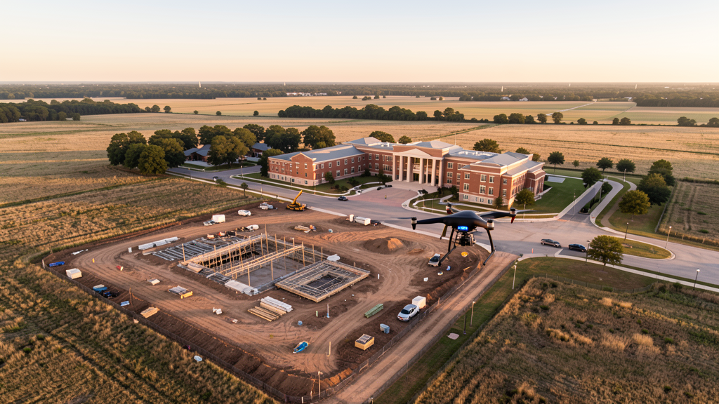
Drone Surveys for Denton's Construction Market
Denton is the county seat of Denton County and the northern anchor of the DFW metroplex, with 147,000 residents. The city is home to the University of North Texas (42,000+ students) and Texas Woman's University (15,000+ students), creating a combined university enrollment of 57,000+ that drives continuous institutional, residential, and retail construction. The I-35E/I-35W split creates a unique transportation hub, with both corridors undergoing expansion. The proposed DFW-to-Denton passenger rail line (A-train extension and Denton County Transportation Authority projects) is catalyzing transit-oriented development around downtown Denton. Master-planned communities including Robson Ranch (active adult, 3,000+ acres), Pecan Creek, and Crosses Creek drive residential construction. The Denton Enterprise Airport industrial corridor and the Golden Triangle Business Park add industrial and warehouse construction. The city's music and arts scene drives hospitality and entertainment venue construction in the historic downtown square district.
Active Developers in the Area:
Typical Project Costs in Texas
Cost ranges are based on market data for Dallas-Fort Worth-Arlington. Actual pricing depends on site size, complexity, and deliverables.
| Service Type | Low End | High End |
|---|---|---|
| Topographic Survey | $1,600 | $4,800 |
| Drone Inspection | $225 | $800 |
| LiDAR Scanning | $2,500 | $8,500 |
| Environmental Monitoring | $850 | $3,200 |
| Aerial Imagery | $175 | $500 |
| Construction Monitoring | $900 | $2,800 |
| Real Estate Photography | $150 | $450 |
| Roof Inspection | $200 | $750 |
Local Airspace & Regulations in Denton, TX
FAA Part 107 Requirements
All commercial drone operations in Texas require the pilot to hold an active FAA Part 107 Remote Pilot Certificate. Our network surveyors are verified Part 107 holders.
State Drone Laws
Texas Government Code Chapter 423 restricts drone use over critical infrastructure facilities, including oil and gas pipelines, refineries, power plants, and water treatment facilities. HB 1484 (2023) added protections for agricultural operations and expanded penalties for drone surveillance of private property. Commercial operators must hold a valid FAA Part 107 Remote Pilot Certificate. Texas does not require a separate state drone license, but operators flying near critical infrastructure must obtain authorization from the facility owner. The Texas Department of Public Safety maintains additional guidelines for drone operations near state facilities.
Local Ordinances
Denton does not issue a separate city-level drone permit for commercial operators. FAA Part 107 certification and LAANC authorization for Class D (DTO) and Class B (DFW) airspace are the primary requirements. Commercial filming on city property requires a permit through the Denton Parks and Recreation Department. The city prohibits drone takeoff and landing in city parks without a special use permit, including North Lakes Park, South Lakes Park, and the Denton Civic Center Park. Flights from private property (with owner permission) do not require a city permit but must comply with all FAA Part 107 rules and Texas Government Code Chapter 423 critical infrastructure restrictions. The Ray Roberts Lake and Lewisville Lake dam structures are federal critical infrastructure.
Restricted Airspace
- Class D airspace around Denton Enterprise Airport (DTO) — located within Denton city limits. Drone flights within 4 nautical miles require LAANC authorization. DTO has active general aviation traffic including corporate jets, flight training operations from UNT's aviation program, and military helicopter traffic. This affects survey work throughout central Denton.
- Class B airspace around DFW International — located 25 miles south. The outer northern shelves of DFW Class B may extend into southern Denton County. Verify altitude shelves on FAA UAS Facility Maps for survey work along the I-35E corridor toward the DFW airport.
- Class D airspace around Fort Worth Alliance Airport (AFW) — located 20 miles west. AFW is a major cargo airport (Amazon Air, FedEx) with heavy freight operations. The eastern edge of AFW Class D may extend into western Denton County. LAANC authorization required for flights near the Alliance corridor.
- University of North Texas (UNT) campus — while not formal restricted airspace, the 550-acre campus has active security and large outdoor event areas. Drone flights over the campus during classes, sporting events at Apogee Stadium, and outdoor events should be coordinated with UNT Police. Stadium TFRs apply during UNT Mean Green football games.
- Texas Woman's University (TWU) campus — similar to UNT, the TWU campus has security monitoring and outdoor event areas. Drone flights over the campus should be coordinated with TWU Police, especially during graduation and outdoor events.
- Ray Roberts Lake and Lewisville Lake — US Army Corps of Engineers facilities. Drone flights over the dam structures require authorization (critical infrastructure under TX Government Code Chapter 423). Recreational areas around the lakes restrict drone takeoff and landing. The lakes are popular for boating; drone flights over moving watercraft are discouraged under FAA Part 107 rules.
- Severe weather: Denton is in the heart of Tornado Alley and experiences some of the most severe weather in Texas. Spring thunderstorms (March-June) regularly produce tornadoes, large hail, and damaging winds. The 2015 Denton tornado caused significant damage. Drone operations during severe weather warnings are strictly prohibited. Post-storm damage assessment flights require coordination with Denton County Emergency Management.
Airports in the area: undefined (undefined), undefined (undefined), undefined (undefined), undefined (undefined)
Why Hire Through Aerius View in Denton, TX?
FAA-Certified
Every surveyor holds an active Part 107 Remote Pilot Certificate.
Local to Denton
Surveyors who know the Texas airspace and local permitting.
No Cost to Quote
Submit your project at no charge. Pay the surveyor directly if you proceed.
Fast Turnaround
A local surveyor contacts you within 2 business days.
How Our Denton Matching Process Works
We're actively building our network of FAA-certified drone operators in Denton, TX. Here's exactly what happens when you submit a project request.
Submit Your Project
Tell us your site location, acreage, and what you need (topographic survey, LiDAR, inspection, etc.). Takes 60 seconds. No cost, no obligation.
We Match & Vet
We identify Part 107-certified operators in Texas with the right equipment for your project. Every pilot is verified for active certification, insurance, and relevant experience in Texas airspace.
You Get Quotes
Matched surveyors contact you within 2 business days with quotes. You compare pricing, timelines, and deliverables, then choose the right fit. You pay the surveyor directly, no markup.
What Deliverables Do You Get?
Every project includes professional-grade deliverables compatible with standard construction and engineering software:
- Orthomosaic maps (GeoTIFF) for site overview and documentation
- Point clouds (LAS/LAZ) for 3D modeling and volumetric analysis
- DEM/DSM terrain models for cut/fill and grade analysis
- Contour lines (DXF/DWG, CAD-ready) for Civil 3D and Revit
- Progress reports with side-by-side comparisons for construction monitoring
- Coordinate systems matched to your project datum (State Plane, UTM, or local)
Insurance & Liability Protection
Pilot Insurance Required
Every operator in our network must carry active liability insurance. Minimum coverage: $1,000,000 general liability. Proof of insurance is verified before any pilot joins the network.
FAA Part 107 Verified
We confirm each pilot's Remote Pilot Certificate is active and in good standing through the FAA Airmen Inquiry system. Expired certificates are flagged automatically.
Equipment Documentation
Pilots list their drone models, sensors (RGB, LiDAR, thermal, multispectral), and payload specs so we can match the right equipment to your project requirements.
Site Safety Coordination
Pilots coordinate with your site superintendent for safe operations on active construction sites, including flight plans that avoid worker areas and equipment zones.
Denton, TX Drone Survey FAQs
Do I need a permit for a drone survey in Denton?
Denton does not issue a separate city-level drone permit for commercial operators. FAA Part 107 certification is mandatory. LAANC authorization is required for flights within the Denton Enterprise Airport (DTO) Class D zone, which covers central Denton. Flights from private property with owner permission do not require a city permit. Drone takeoff and landing in city parks requires a special use permit from Denton Parks and Recreation.
How much does a drone survey cost in Denton?
Denton pricing is competitive with the broader DFW metro. Topographic surveys typically range from $1,600 to $4,800. LiDAR scanning runs $2,500 to $8,500 for larger sites. Roof inspections cost $200 to $750 per building. Construction monitoring is typically $900 to $2,800 per month for recurring flights at MPC sites like Robson Ranch, Pecan Creek, and Crosses Creek.
Can I fly a drone near the UNT campus and Apogee Stadium?
The University of North Texas campus is not formal restricted airspace, but drone flights over the 550-acre campus should be coordinated with UNT Police. Apogee Stadium has stadium TFRs during UNT Mean Green football games, prohibiting drone flights within 3 nautical miles up to 3,000 ft AGL. The TWU campus also requires coordination with TWU Police. Always check university event schedules before scheduling survey flights near either campus.
How does Denton's location in Tornado Alley affect drone operations?
Denton is in the heart of Tornado Alley and experiences some of the most severe weather in Texas. Spring thunderstorms (March-June) regularly produce tornadoes, large hail, and damaging winds. The 2015 Denton tornado caused significant damage. Drone operations during severe thunderstorm or tornado warnings are strictly prohibited. Post-storm damage assessment flights require coordination with Denton County Emergency Management. Real-time weather monitoring is essential during spring storm season.
What are the main development drivers in Denton?
Denton is driven by three factors: the combined UNT and TWU university enrollment of 57,000+ students generating continuous institutional and residential construction, the I-35E/I-35W split creating a transportation hub with transit-oriented development potential, and master-planned communities like Robson Ranch (3,000+ acres of active adult housing). The proposed DFW-to-Denton passenger rail line is catalyzing downtown mixed-use development. The Denton Enterprise Airport industrial corridor and Golden Triangle Business Park add industrial construction demand.
What makes Denton unique for drone survey work?
Denton combines the DFW metro's growth dynamics with a unique university-town character. The 57,000+ combined student enrollment creates year-round residential and institutional construction demand that is less seasonal than typical home-building. The I-35E/I-35W split and the proposed passenger rail line create transportation infrastructure survey opportunities. The DTO Class D airspace covering central Denton means LAANC is frequently required, but the flat Blackland Prairie terrain makes photogrammetry efficient. The severe weather risk creates ongoing post-storm damage assessment demand.
Nearby Cities
Are You a Drone Surveyor in Denton?
Get pre-qualified leads in your service area. No membership fees, no monthly minimums. First lead free.
Ready to Start Your Project in Denton, TX?
Get matched with a local, FAA-certified surveyor. No cost, no obligation.
Request a Free Quote