Drone Survey Services in Galveston, TX
From the Port of Galveston cruise terminal expansion and US Army Corps seawall projects to UTMB campus growth and post-hurricane elevated residential construction, Galveston is an island city with unique coastal construction demands.
Serving Galveston County & the Houston-The Woodlands-Sugar Land area
Request a Free Quote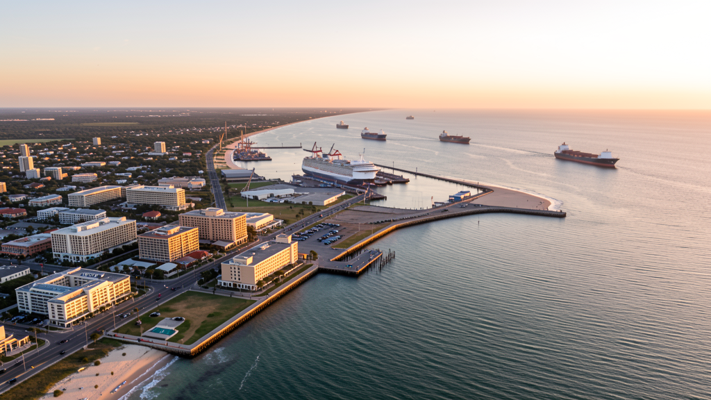
Get Matched With a Local Surveyor
Drone Survey Services Available in Galveston, TX
Galveston sits on a barrier island in Galveston County, about 50 miles SE of downtown Houston. The city has a population of 54,000 with a unique coastal construction market. The Port of Galveston is undergoing multi-phase expansion for cruise terminals and cargo. The US Army Corps of Engineers continues seawall projects. UTMB Health is expanding its medical campus. Post-hurricane construction standards drive elevated residential building, and the tourism sector drives hotel and resort development along the seawall.
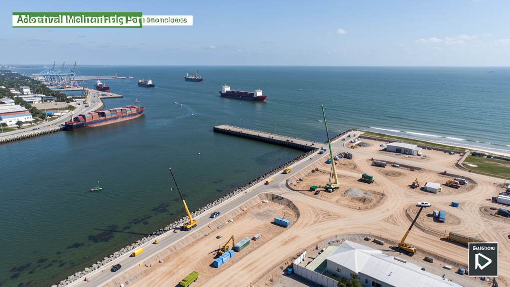
Drone Surveys for Galveston's Construction Market
Galveston is an island city with unique coastal construction demands. The Port of Galveston is undergoing multi-phase expansion including new cruise terminal facilities and cargo handling infrastructure. The Galveston seawall is a continuing US Army Corps of Engineers project requiring ongoing aerial monitoring. Post-Hurricane Ike recovery construction continues, with elevated residential construction and hurricane-resistant building standards driving specialized survey needs. The University of Texas Medical Branch (UTMB) is expanding its campus, and hotel/resort construction along the seawall and beachfront is active. The island's tourism sector also drives commercial photography demand.
Active Developers in the Area:
Typical Project Costs in Texas
Cost ranges are based on market data for Houston-The Woodlands-Sugar Land. Actual pricing depends on site size, complexity, and deliverables.
| Service Type | Low End | High End |
|---|---|---|
| Topographic Survey | $2,200 | $5,500 |
| Drone Inspection | $300 | $950 |
| LiDAR Scanning | $3,000 | $9,000 |
| Environmental Monitoring | $1,000 | $4,000 |
| Aerial Imagery | $200 | $600 |
| Construction Monitoring | $1,200 | $3,500 |
| Real Estate Photography | $200 | $550 |
| Roof Inspection | $250 | $900 |
Local Airspace & Regulations in Galveston, TX
FAA Part 107 Requirements
All commercial drone operations in Texas require the pilot to hold an active FAA Part 107 Remote Pilot Certificate. Our network surveyors are verified Part 107 holders.
State Drone Laws
Texas Government Code Chapter 423 restricts drone use over critical infrastructure facilities, including oil and gas pipelines, refineries, power plants, and water treatment facilities. HB 1484 (2023) added protections for agricultural operations and expanded penalties for drone surveillance of private property. Commercial operators must hold a valid FAA Part 107 Remote Pilot Certificate. Texas does not require a separate state drone license, but operators flying near critical infrastructure must obtain authorization from the facility owner. The Texas Department of Public Safety maintains additional guidelines for drone operations near state facilities.
Local Ordinances
Galveston follows Galveston County regulations and FAA Part 107 rules. No city-specific drone permit is required for operations from private property. The city has Scholes International Airport (GLS) on the island, and pilots should notify the airport when operating nearby. Galveston Island State Park requires a Texas Parks and Wildlife permit for drone use. The Port of Galveston has security zones requiring coordination with port security and the Coast Guard. Beach and seawall areas have high pedestrian traffic, requiring careful flight planning for commercial operations.
Restricted Airspace
- Scholes International Airport (GLS) is Class E airspace — no LAANC required but pilots must notify the airport when operating within 5 miles.
- Class C airspace around Hobby Airport (HOU) extends 20 nautical miles and may affect the western end of Galveston Island at higher altitudes.
- Galveston Island State Park prohibits drone takeoff/landing without a Texas Parks and Wildlife permit. The seawall and beach areas have high pedestrian traffic.
- The Port of Galveston has security zones — drone flights over port facilities may require coordination with port security and the US Coast Guard.
- Hurricane recovery and coastal construction projects may have temporary flight restrictions. Check NOTAMs before flying.
Airports in the area: undefined (undefined), undefined (undefined), undefined (undefined), undefined (undefined)
Why Hire Through Aerius View in Galveston, TX?
FAA-Certified
Every surveyor holds an active Part 107 Remote Pilot Certificate.
Local to Galveston
Surveyors who know the Texas airspace and local permitting.
No Cost to Quote
Submit your project at no charge. Pay the surveyor directly if you proceed.
Fast Turnaround
A local surveyor contacts you within 2 business days.
How Our Galveston Matching Process Works
We're actively building our network of FAA-certified drone operators in Galveston, TX. Here's exactly what happens when you submit a project request.
Submit Your Project
Tell us your site location, acreage, and what you need (topographic survey, LiDAR, inspection, etc.). Takes 60 seconds. No cost, no obligation.
We Match & Vet
We identify Part 107-certified operators in Texas with the right equipment for your project. Every pilot is verified for active certification, insurance, and relevant experience in Texas airspace.
You Get Quotes
Matched surveyors contact you within 2 business days with quotes. You compare pricing, timelines, and deliverables, then choose the right fit. You pay the surveyor directly, no markup.
What Deliverables Do You Get?
Every project includes professional-grade deliverables compatible with standard construction and engineering software:
- Orthomosaic maps (GeoTIFF) for site overview and documentation
- Point clouds (LAS/LAZ) for 3D modeling and volumetric analysis
- DEM/DSM terrain models for cut/fill and grade analysis
- Contour lines (DXF/DWG, CAD-ready) for Civil 3D and Revit
- Progress reports with side-by-side comparisons for construction monitoring
- Coordinate systems matched to your project datum (State Plane, UTM, or local)
Insurance & Liability Protection
Pilot Insurance Required
Every operator in our network must carry active liability insurance. Minimum coverage: $1,000,000 general liability. Proof of insurance is verified before any pilot joins the network.
FAA Part 107 Verified
We confirm each pilot's Remote Pilot Certificate is active and in good standing through the FAA Airmen Inquiry system. Expired certificates are flagged automatically.
Equipment Documentation
Pilots list their drone models, sensors (RGB, LiDAR, thermal, multispectral), and payload specs so we can match the right equipment to your project requirements.
Site Safety Coordination
Pilots coordinate with your site superintendent for safe operations on active construction sites, including flight plans that avoid worker areas and equipment zones.
Galveston, TX Drone Survey FAQs
Do I need a permit for a drone survey in Galveston?
No city-specific permit is required for commercial drone operations from private property in Galveston. However, Galveston Island State Park requires a Texas Parks and Wildlife permit. The Port of Galveston requires coordination with port security. All flights must comply with FAA Part 107 rules. Beach and seawall operations require careful pedestrian traffic management.
How much does a drone survey cost in Galveston, TX?
Topographic surveys in Galveston County typically range from $2,200 to $5,500, higher than inland markets due to coastal access and weather planning. Roof inspections run $250-$900. LiDAR scanning for port or coastal projects costs $3,000-$9,000. Real estate drone photography for beachfront properties starts at $200.
Can I fly a drone over the Port of Galveston?
The Port of Galveston has designated security zones. Drone flights over port facilities require coordination with port security and may require US Coast Guard notification. Cruise terminal construction areas may have TFRs during ship movements. Our surveyors coordinate with port authorities for authorized access.
What coastal construction projects need drone surveys in Galveston?
The Port of Galveston cruise terminal expansion, seawall US Army Corps projects, UTMB campus expansion, post-hurricane elevated residential construction, and hotel/resort development along the seawall all require aerial surveys. Coastal construction monitoring also includes beach erosion tracking and dune restoration projects.
How does coastal weather affect drone surveys in Galveston?
Galveston's coastal location means consistent sea breezes, frequent humidity, and hurricane season (June-November) disruptions. Morning flights are preferred when winds are calmer. Salt air requires specialized drone maintenance. Surveyors must account for tidal timing when planning coastal mapping missions. Weather delays are more common than inland markets.
Nearby Cities
Are You a Drone Surveyor in Galveston?
Get pre-qualified leads in your service area. No membership fees, no monthly minimums. First lead free.
Ready to Start Your Project in Galveston, TX?
Get matched with a local, FAA-certified surveyor. No cost, no obligation.
Request a Free Quote