Drone Survey Services in Ken Caryl, CO
Ken Caryl is an affluent foothills suburb where custom home construction, major residential renovation, and commercial corridor projects along C-470 create steady demand for high-end aerial survey and roof inspection services.
Serving Jefferson County & the Denver-Aurora-Lakewood MSA area
Request a Free Quote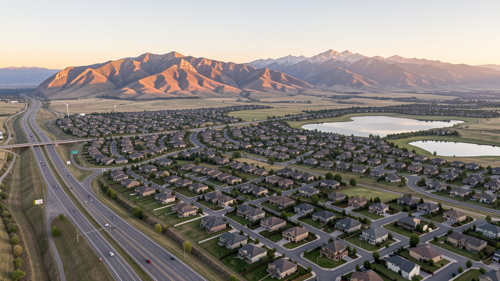
Get Matched With a Local Surveyor
Drone Survey Services Available in Ken Caryl, CO
Ken Caryl is an unincorporated census-designated place in Jefferson County, situated in the foothills along the C-470 corridor south of the Denver metro area. The community is largely built out but sees ongoing custom home construction, renovation of aging housing stock, and commercial development along the Ken Caryl Avenue corridor. The foothills location creates terrain challenges and wildlife considerations for drone operations.
Drone Surveys for Ken Caryl's Construction Market
Ken Caryl is an affluent foothills suburb in Jefferson County with steady residential renovation and infill activity. The community is largely built out but sees ongoing custom home construction, major renovation projects, and some infill development along the C-470 corridor. Commercial development along the Ken Caryl Avenue and Chatfield Avenue corridors continues to generate demand for survey services. Infrastructure investment includes C-470 express lane construction by CDOT along the northern boundary.
Active Developers in the Area:

Typical Project Costs in Colorado
Cost ranges are based on market data for Denver-Aurora-Lakewood MSA. Actual pricing depends on site size, complexity, and deliverables.
| Service Type | Low End | High End |
|---|---|---|
| Topographic Survey | $1,500 | $5,200 |
| Drone Inspection | $950 | $3,600 |
| LiDAR Scanning | $2,900 | $8,500 |
| Environmental Monitoring | $1,700 | $5,600 |
| Aerial Imagery | $650 | $2,500 |
| Construction Monitoring | $1,200 | $4,200 |
| Real Estate Photography | $500 | $1,900 |
| Roof Inspection | $550 | $2,200 |
Local Airspace & Regulations in Ken Caryl, CO
FAA Part 107 Requirements
All commercial drone operations in Colorado require the pilot to hold an active FAA Part 107 Remote Pilot Certificate. Our network surveyors are verified Part 107 holders.
State Drone Laws
Colorado HB 1070 (2023) aligns state drone law with federal FAA Part 107 requirements. The law prohibits local municipalities from regulating drone flight paths or airspace, but allows cities to regulate takeoff and landing on public property. Colorado does not require a separate state-level drone license. Commercial drone operators must hold a valid FAA Part 107 Remote Pilot Certificate and comply with all federal regulations. The Colorado Department of Transportation has additional guidelines for drone operations near state highways and infrastructure.
Local Ordinances
Ken Caryl is an unincorporated census-designated place in Jefferson County, so drone regulations are governed by Jefferson County zoning and land use codes. Jefferson County Open Space regulations prohibit drone use on county open space properties without a special use permit. The Ken Caryl Ranch Metropolitan District governs parks, trails, and recreation facilities; drone use in Metro District parks requires authorization. Commercial filming on county property requires a permit through Jefferson County. Commercial operators must comply with FAA Part 107 and Colorado HB 1070 (2023).
Restricted Airspace
- KAPA Class D surface area extends 5 NM from Centennial Airport. Eastern portions of Ken Caryl may fall within the western edge of this Class D area. LAANC authorization may be required for eastern areas.
- KDEN Class B shelves at higher altitudes. Standard drone operations below 400 AGL not impacted.
- Chatfield State Park and Reservoir approximately 3 miles south. Colorado state parks prohibit drone takeoff and landing without a special use permit from CPW.
- Waterton Canyon approximately 5 miles southwest with Denver Water infrastructure restrictions and wildlife sensitivity (bighorn sheep habitat).
- Jefferson County Open Space parcels surrounding Ken Caryl have county restrictions on drone operations.
Airports in the area: undefined (undefined), undefined (undefined), undefined (undefined)
Why Hire Through Aerius View in Ken Caryl, CO?
FAA-Certified
Every surveyor holds an active Part 107 Remote Pilot Certificate.
Local to Ken Caryl
Surveyors who know the Colorado airspace and local permitting.
No Cost to Quote
Submit your project at no charge. Pay the surveyor directly if you proceed.
Fast Turnaround
A local surveyor contacts you within 2 business days.
How Our Ken Caryl Matching Process Works
We're actively building our network of FAA-certified drone operators in Ken Caryl, CO. Here's exactly what happens when you submit a project request.
Submit Your Project
Tell us your site location, acreage, and what you need (topographic survey, LiDAR, inspection, etc.). Takes 60 seconds. No cost, no obligation.
We Match & Vet
We identify Part 107-certified operators in Colorado with the right equipment for your project. Every pilot is verified for active certification, insurance, and relevant experience in Colorado airspace.
You Get Quotes
Matched surveyors contact you within 2 business days with quotes. You compare pricing, timelines, and deliverables, then choose the right fit. You pay the surveyor directly, no markup.
What Deliverables Do You Get?
Every project includes professional-grade deliverables compatible with standard construction and engineering software:
- Orthomosaic maps (GeoTIFF) for site overview and documentation
- Point clouds (LAS/LAZ) for 3D modeling and volumetric analysis
- DEM/DSM terrain models for cut/fill and grade analysis
- Contour lines (DXF/DWG, CAD-ready) for Civil 3D and Revit
- Progress reports with side-by-side comparisons for construction monitoring
- Coordinate systems matched to your project datum (State Plane, UTM, or local)
Insurance & Liability Protection
Pilot Insurance Required
Every operator in our network must carry active liability insurance. Minimum coverage: $1,000,000 general liability. Proof of insurance is verified before any pilot joins the network.
FAA Part 107 Verified
We confirm each pilot's Remote Pilot Certificate is active and in good standing through the FAA Airmen Inquiry system. Expired certificates are flagged automatically.
Equipment Documentation
Pilots list their drone models, sensors (RGB, LiDAR, thermal, multispectral), and payload specs so we can match the right equipment to your project requirements.
Site Safety Coordination
Pilots coordinate with your site superintendent for safe operations on active construction sites, including flight plans that avoid worker areas and equipment zones.
Ken Caryl, CO Drone Survey FAQs
What airspace restrictions apply to drone surveys in Ken Caryl?
Eastern portions of Ken Caryl may fall within the western edge of the KAPA (Centennial Airport) Class D airspace, which extends 5 nautical miles from the airport. LAANC authorization may be required for eastern areas. Most of central and western Ken Caryl is in Class G/E airspace. The foothills location creates terrain challenges for drone operations.
Since Ken Caryl is not an incorporated city, who governs drone regulations?
Ken Caryl is an unincorporated CDP in Jefferson County, so drone regulations are governed by Jefferson County zoning and land use codes, the Ken Caryl Ranch Metropolitan District for parks and trails, and any HOA covenant restrictions. Commercial operators must check county open space rules, Metro District park rules, and FAA Part 107 compliance.
Can I fly a drone in Ken Caryl parks and open space areas?
Drone use in Ken Caryl Ranch Metro District parks requires authorization from the Metro District. Jefferson County open space properties prohibit drone use without a special use permit from the Jefferson County Open Space Division. Chatfield State Park, approximately 3 miles south, has its own Colorado State Parks regulations restricting drone use.
What construction activity is driving drone survey demand in Ken Caryl?
Although largely built out, demand comes from custom home construction and major renovation of the existing housing stock, infill residential development, commercial development along Ken Caryl Avenue and C-470, and the CDOT C-470 Express Lanes project on the northern boundary. The affluent market supports high-end custom home survey work.
Are there wildlife considerations for drone flights near Ken Caryl?
Waterton Canyon, approximately 5 miles southwest, is a bighorn sheep habitat area where drone use is discouraged due to wildlife sensitivity. The foothills location means operators should be aware of wildlife disturbance, particularly during spring and summer nesting and birthing seasons. Jefferson County Open Space areas have specific wildlife protection provisions.
Are You a Drone Surveyor in Ken Caryl?
Get pre-qualified leads in your service area. No membership fees, no monthly minimums. First lead free.
Ready to Start Your Project in Ken Caryl, CO?
Get matched with a local, FAA-certified surveyor. No cost, no obligation.
Request a Free Quote