Drone Survey Services in Centennial, CO
Centennial position in the Denver Tech Center corridor drives continuous commercial office and mixed-use development, all under the busy KAPA Class D airspace that requires every drone flight to have LAANC authorization.
Serving Arapahoe County & the Denver-Aurora-Lakewood MSA area
Request a Free Quote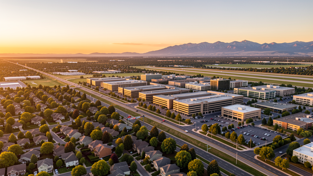
Get Matched With a Local Surveyor
Drone Survey Services Available in Centennial, CO
Centennial is a relatively young incorporated city (2001) located in the southern Denver metro along the I-25 corridor, anchored by the Denver Tech Center and numerous corporate campuses. The city benefits from proximity to Centennial Airport (KAPA), one of the busiest general aviation airports in the country. Commercial development along Arapahoe Road and I-25 continues to drive construction activity and demand for aerial survey services.
Drone Surveys for Centennial's Construction Market
Centennial construction market centers on the Denver Tech Center corridor with continued office park redevelopment, commercial tenant buildouts, and mixed-use projects along Arapahoe Road and I-25. The city benefits from corporate relocations within the south Denver metro and infrastructure improvements along the I-25 corridor. Demand for drone survey services is strong due to the density of commercial construction projects and proximity to Centennial Airport.
Active Developers in the Area:

Typical Project Costs in Colorado
Cost ranges are based on market data for Denver-Aurora-Lakewood MSA. Actual pricing depends on site size, complexity, and deliverables.
| Service Type | Low End | High End |
|---|---|---|
| Topographic Survey | $1,900 | $4,800 |
| Drone Inspection | $1,300 | $3,800 |
| LiDAR Scanning | $3,800 | $9,500 |
| Environmental Monitoring | $2,200 | $6,500 |
| Aerial Imagery | $900 | $3,000 |
| Construction Monitoring | $1,600 | $5,500 |
| Real Estate Photography | $450 | $1,400 |
| Roof Inspection | $700 | $2,200 |
Local Airspace & Regulations in Centennial, CO
FAA Part 107 Requirements
All commercial drone operations in Colorado require the pilot to hold an active FAA Part 107 Remote Pilot Certificate. Our network surveyors are verified Part 107 holders.
State Drone Laws
Colorado HB 1070 (2023) aligns state drone law with federal FAA Part 107 requirements. The law prohibits local municipalities from regulating drone flight paths or airspace, but allows cities to regulate takeoff and landing on public property. Colorado does not require a separate state-level drone license. Commercial drone operators must hold a valid FAA Part 107 Remote Pilot Certificate and comply with all federal regulations. The Colorado Department of Transportation has additional guidelines for drone operations near state highways and infrastructure.
Local Ordinances
City of Centennial does not have a standalone drone ordinance but defers to FAA Part 107 for airspace regulation. South Suburban Park and Recreation District, which manages many parks in Centennial, prohibits drone takeoff and landing in district parks without prior written permission. Colorado HB 1070 (2023) preempts local regulation of drone navigation, flight paths, and airspace. Centennial has no additional city drone licensing or permit requirement beyond FAA Part 107. Denver Tech Center and surrounding commercial properties are privately owned, so drone operators should coordinate with property management for takeoff and landing on private commercial property.
Restricted Airspace
- KAPA Class D airspace (approximately 4.8 nm radius, surface to 8,000 MSL) covers most of Centennial. One of the busiest GA airports in the country with over 300,000 annual operations. LAANC authorization is mandatory and drone operators should be alert to heavy helicopter and fixed-wing traffic.
- KDEN Class B airspace extends into portions of eastern Centennial at varying shelf altitudes. LAANC authorization required for drone operations under Class B shelves.
- Stadium TFRs may be active for Empower Field at Mile High and Ball Arena (Denver) during NFL/NBA/NHL events. Some TFRs extend into airspace near Centennial.
- Multiple hospitals in the south Denver metro area (Swedish Medical Center, Centennial Hospital) have medevac helicopter operations. Drone operators should maintain awareness of low-altitude helicopter traffic near medical facilities.
Airports in the area: undefined (undefined), undefined (undefined)
Why Hire Through Aerius View in Centennial, CO?
FAA-Certified
Every surveyor holds an active Part 107 Remote Pilot Certificate.
Local to Centennial
Surveyors who know the Colorado airspace and local permitting.
No Cost to Quote
Submit your project at no charge. Pay the surveyor directly if you proceed.
Fast Turnaround
A local surveyor contacts you within 2 business days.
How Our Centennial Matching Process Works
We're actively building our network of FAA-certified drone operators in Centennial, CO. Here's exactly what happens when you submit a project request.
Submit Your Project
Tell us your site location, acreage, and what you need (topographic survey, LiDAR, inspection, etc.). Takes 60 seconds. No cost, no obligation.
We Match & Vet
We identify Part 107-certified operators in Colorado with the right equipment for your project. Every pilot is verified for active certification, insurance, and relevant experience in Colorado airspace.
You Get Quotes
Matched surveyors contact you within 2 business days with quotes. You compare pricing, timelines, and deliverables, then choose the right fit. You pay the surveyor directly, no markup.
What Deliverables Do You Get?
Every project includes professional-grade deliverables compatible with standard construction and engineering software:
- Orthomosaic maps (GeoTIFF) for site overview and documentation
- Point clouds (LAS/LAZ) for 3D modeling and volumetric analysis
- DEM/DSM terrain models for cut/fill and grade analysis
- Contour lines (DXF/DWG, CAD-ready) for Civil 3D and Revit
- Progress reports with side-by-side comparisons for construction monitoring
- Coordinate systems matched to your project datum (State Plane, UTM, or local)
Insurance & Liability Protection
Pilot Insurance Required
Every operator in our network must carry active liability insurance. Minimum coverage: $1,000,000 general liability. Proof of insurance is verified before any pilot joins the network.
FAA Part 107 Verified
We confirm each pilot's Remote Pilot Certificate is active and in good standing through the FAA Airmen Inquiry system. Expired certificates are flagged automatically.
Equipment Documentation
Pilots list their drone models, sensors (RGB, LiDAR, thermal, multispectral), and payload specs so we can match the right equipment to your project requirements.
Site Safety Coordination
Pilots coordinate with your site superintendent for safe operations on active construction sites, including flight plans that avoid worker areas and equipment zones.
Centennial, CO Drone Survey FAQs
Do I need LAANC authorization to fly a drone in Centennial?
Yes. Virtually all of Centennial falls within the KAPA (Centennial Airport) Class D airspace, approximately 4.8 nm radius from the airport. KAPA is one of the three busiest general aviation airports in the United States, making LAANC authorization mandatory and extra situational awareness critical due to heavy helicopter and fixed-wing traffic.
How busy is Centennial Airport airspace, and what does that mean for drone operators?
Centennial Airport (KAPA) ranks among the top three busiest general aviation airports in the US by aircraft operations, with over 300,000 annual operations. This means drone operators share airspace with a constant flow of training aircraft, corporate jets, medevac helicopters, and flight school traffic. Always monitor CTAF/ATC frequencies, obtain LAANC authorization, and maintain visual line of sight with awareness of approaching traffic.
Can I fly a drone in Centennial parks?
The City of Centennial itself does not have a drone-specific park ordinance, but South Suburban Park and Recreation District manages many of the parks within Centennial and prohibits drone takeoff and landing without prior written permission. Contact the district office for permission before planning any park-based drone operations.
Does Colorado require a separate state drone license for operations in Centennial?
No. Colorado HB 1070 (2023) preempts local drone regulation and aligns with FAA Part 107. A valid FAA Remote Pilot Certificate is the only license required for commercial drone operations in Centennial. Neither the state nor the city requires an additional local permit for airspace operations.
What makes Centennial construction market attractive for drone survey services?
Centennial sits in the Denver Tech Center corridor, one of the most active commercial real estate submarkets in the Denver metro. The density of office park redevelopment, corporate tenant buildouts, and infrastructure projects along I-25 and Arapahoe Road creates consistent demand for construction progress monitoring, aerial imagery, and topographic surveys. Proximity to KAPA also means local operators familiar with LAANC procedures have a competitive advantage.
Nearby Cities
Are You a Drone Surveyor in Centennial?
Get pre-qualified leads in your service area. No membership fees, no monthly minimums. First lead free.
Ready to Start Your Project in Centennial, CO?
Get matched with a local, FAA-certified surveyor. No cost, no obligation.
Request a Free Quote