Drone Survey Services in Leander, TX
As the northern terminus of Austin's MetroRail and the gateway to Hill Country terrain, Leander is one of Williamson County's fastest-growing cities, where Travisso, Bryson, and the TOD district drive diverse survey demand in the simplest airspace in the Austin metro.
Serving Williamson County & the Austin-Round Rock-Georgetown area
Request a Free Quote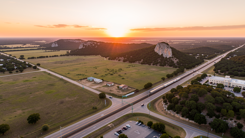
Get Matched With a Local Surveyor
Drone Survey Services Available in Leander, TX
The Austin-Round Rock-Georgetown metro is one of the fastest-growing in the US, and Leander anchors its northwest expansion along US 183. The CapMetro Rail Red Line extension has catalyzed rapid growth to 42,000 residents. Master-planned communities (Travisso, Bryson, Devine Lake Ranch) and the Transit-Oriented Development district around Leander Station generate sustained survey demand. The transition from flat Blackland Prairie to Hill Country terrain creates diverse survey conditions, and most of the city is in uncontrolled Class E airspace, making it the simplest airspace in the Austin metro for drone operations.
Drone Surveys for Leander's Construction Market
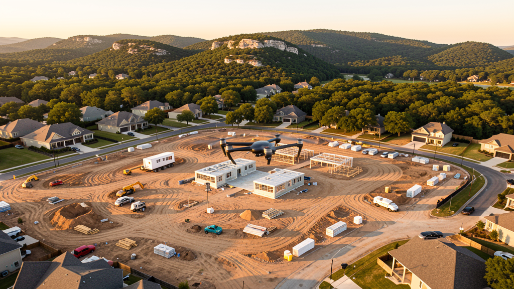
Leander is one of the fastest-growing cities in Williamson County, with the population more than doubling from 2010 to 2024. The Capital MetroRail Red Line extension to Leander Station has been a major growth catalyst, providing direct commuter rail service to downtown Austin. Master-planned communities are the primary growth engine: Travisso (1,700 acres, Hill Country luxury), Bryson (500 acres along US 183), and Devine Lake Ranch drive continuous residential construction. The US 183 corridor expansion and the planned Hero Way (formerly FM 2243) improvements are opening new development corridors. The Leander Transit-Oriented Development (TOD) district around the Leander Station is seeing mixed-use construction including residential, retail, and office. The transition from flat Blackland Prairie to Hill Country terrain creates diverse survey conditions, from efficient photogrammetry on the east to LiDAR-demanding wooded hills on the west.
Active Developers in the Area:
Typical Project Costs in Texas
Cost ranges are based on market data for Austin-Round Rock-Georgetown. Actual pricing depends on site size, complexity, and deliverables.
| Service Type | Low End | High End |
|---|---|---|
| Topographic Survey | $1,500 | $4,500 |
| Drone Inspection | $200 | $750 |
| LiDAR Scanning | $2,500 | $8,500 |
| Environmental Monitoring | $800 | $3,000 |
| Aerial Imagery | $150 | $450 |
| Construction Monitoring | $850 | $2,500 |
| Real Estate Photography | $150 | $400 |
| Roof Inspection | $175 | $700 |
Local Airspace & Regulations in Leander, TX
FAA Part 107 Requirements
All commercial drone operations in Texas require the pilot to hold an active FAA Part 107 Remote Pilot Certificate. Our network surveyors are verified Part 107 holders.
State Drone Laws
Texas Government Code Chapter 423 restricts drone use over critical infrastructure facilities, including oil and gas pipelines, refineries, power plants, and water treatment facilities. HB 1484 (2023) added protections for agricultural operations and expanded penalties for drone surveillance of private property. Commercial operators must hold a valid FAA Part 107 Remote Pilot Certificate. Texas does not require a separate state drone license, but operators flying near critical infrastructure must obtain authorization from the facility owner. The Texas Department of Public Safety maintains additional guidelines for drone operations near state facilities.
Local Ordinances
Leander does not issue a separate city-level drone permit for commercial operators. FAA Part 107 certification is the primary requirement. Most of Leander falls outside controlled airspace (uncontrolled Class E near GTU), so LAANC authorization is rarely needed for survey work in the city proper. Commercial filming on city property requires a permit through the Leander Parks and Recreation Department. The city prohibits drone takeoff and landing in city parks without a special use permit, including Devine Lake Park, Robin Bledsoe Park, and Benbrook Ranch Park. Flights from private property (with owner permission) do not require a city permit but must comply with all FAA Part 107 rules and Texas Government Code Chapter 423 critical infrastructure restrictions.
Restricted Airspace
- Class C airspace around Austin-Bergstrom International (AUS) — located 30 miles south. The outer shelves of AUS Class C may extend into far southern Leander. Most of Leander proper falls outside controlled airspace, making LAANC unnecessary for most residential and commercial survey work. Verify altitude shelves on FAA UAS Facility Maps for flights near the southern city limits.
- Georgetown Municipal Airport (GTU) — located 10 miles east, uncontrolled Class E airspace. No LAANC required for flights in Leander. However, GTU has active general aviation traffic including corporate jets and flight training. Pilots should monitor CTAF and maintain visual separation.
- Devine Lake and South San Gabriel River — recreational areas where drone takeoff and landing is restricted on city park property without a special use permit. The South San Gabriel River corridor is prone to flash flooding during spring thunderstorms, creating post-flood survey demand for elevation and drainage assessment.
- CapMetro Rail Red Line — the Leander Station is the northern terminus of Austin's commuter rail. While not restricted airspace, drone flights near the rail corridor should maintain safe distance from overhead catenary lines and moving trains. FAA Part 107 prohibits flights over moving vehicles not under operator control.
- Hill Country terrain transition: western Leander marks the eastern edge of the Texas Hill Country, with limestone outcroppings, cedar-covered hills, and elevation changes. Drone pilots must account for terrain-following altitude limits, as FAA Part 107 requires maintaining flight within 400 ft of the ground surface. The terrain transition makes LiDAR particularly valuable here.
- Severe weather: Leander is in Tornado Alley's southern extent and experiences severe thunderstorms with large hail, damaging winds, and occasional tornadoes from March through June. Flash flooding along the South San Gabriel River is common. Drone operations during severe weather warnings are restricted. Summer temperatures above 100 degrees Fahrenheit reduce drone battery performance.
Airports in the area: undefined (undefined), undefined (undefined), undefined (undefined), undefined (undefined)
Why Hire Through Aerius View in Leander, TX?
FAA-Certified
Every surveyor holds an active Part 107 Remote Pilot Certificate.
Local to Leander
Surveyors who know the Texas airspace and local permitting.
No Cost to Quote
Submit your project at no charge. Pay the surveyor directly if you proceed.
Fast Turnaround
A local surveyor contacts you within 2 business days.
How Our Leander Matching Process Works
We're actively building our network of FAA-certified drone operators in Leander, TX. Here's exactly what happens when you submit a project request.
Submit Your Project
Tell us your site location, acreage, and what you need (topographic survey, LiDAR, inspection, etc.). Takes 60 seconds. No cost, no obligation.
We Match & Vet
We identify Part 107-certified operators in Texas with the right equipment for your project. Every pilot is verified for active certification, insurance, and relevant experience in Texas airspace.
You Get Quotes
Matched surveyors contact you within 2 business days with quotes. You compare pricing, timelines, and deliverables, then choose the right fit. You pay the surveyor directly, no markup.
What Deliverables Do You Get?
Every project includes professional-grade deliverables compatible with standard construction and engineering software:
- Orthomosaic maps (GeoTIFF) for site overview and documentation
- Point clouds (LAS/LAZ) for 3D modeling and volumetric analysis
- DEM/DSM terrain models for cut/fill and grade analysis
- Contour lines (DXF/DWG, CAD-ready) for Civil 3D and Revit
- Progress reports with side-by-side comparisons for construction monitoring
- Coordinate systems matched to your project datum (State Plane, UTM, or local)
Insurance & Liability Protection
Pilot Insurance Required
Every operator in our network must carry active liability insurance. Minimum coverage: $1,000,000 general liability. Proof of insurance is verified before any pilot joins the network.
FAA Part 107 Verified
We confirm each pilot's Remote Pilot Certificate is active and in good standing through the FAA Airmen Inquiry system. Expired certificates are flagged automatically.
Equipment Documentation
Pilots list their drone models, sensors (RGB, LiDAR, thermal, multispectral), and payload specs so we can match the right equipment to your project requirements.
Site Safety Coordination
Pilots coordinate with your site superintendent for safe operations on active construction sites, including flight plans that avoid worker areas and equipment zones.
Leander, TX Drone Survey FAQs
Do I need a permit for a drone survey in Leander?
Leander does not issue a separate city-level drone permit for commercial operators. FAA Part 107 certification is mandatory. Most of Leander falls outside controlled airspace (uncontrolled Class E near Georgetown Municipal Airport), so LAANC authorization is rarely needed for survey work in the city proper. This makes Leander one of the easiest cities in the Austin metro for drone operations from an airspace perspective. Drone takeoff and landing in city parks requires a special use permit.
How much does a drone survey cost in Leander?
Leander pricing is slightly below the Austin metro average, reflecting the lower cost of operating outside the urban core. Topographic surveys typically range from $1,500 to $4,500. LiDAR scanning runs $2,500 to $8,500, with Hill Country sites on the higher end due to wooded terrain. Roof inspections cost $175 to $700 per building. Construction monitoring is typically $850 to $2,500 per month for recurring flights at MPC sites like Travisso and Bryson.
Does Leander's Hill Country terrain affect drone survey operations?
Yes. Western Leander marks the eastern edge of the Texas Hill Country, with limestone outcroppings, cedar-covered hills, and elevation changes. FAA Part 107 requires maintaining flight within 400 ft of the ground surface, which is challenging in hilly terrain. LiDAR is particularly valuable here, as photogrammetry alone struggles with the dense cedar and oak canopy. The terrain transition from flat prairie (east) to rolling hills (west) within one city creates diverse survey conditions.
How does the CapMetro Rail corridor affect drone operations in Leander?
The Leander Station is the northern terminus of Austin's Capital MetroRail Red Line. While the rail corridor is not formal restricted airspace, drone flights near the tracks should maintain safe distance from overhead catenary lines and moving trains. FAA Part 107 prohibits flights over moving vehicles not under operator control. The Transit-Oriented Development district around the station has active mixed-use construction that generates survey demand, but pilots should coordinate with site managers and avoid flight paths over the rail right-of-way during commuting hours.
What makes Leander attractive for drone survey work compared to Austin?
Leander offers the Austin metro growth dynamics with the simplest airspace in the region. Most of the city is in uncontrolled Class E airspace near Georgetown Municipal Airport, meaning no LAANC authorization is needed for most flights. The CapMetro Rail extension has catalyzed rapid growth, with MPCs like Travisso (1,700 acres) and Bryson (500 acres) generating multi-year survey contracts. The Hill Country terrain transition makes LiDAR particularly valuable, and the lower cost of operating outside Austin's urban core allows competitive pricing.
What severe weather considerations apply to drone survey work in Leander?
Leander is in the southern extent of Tornado Alley and experiences severe thunderstorms from March through June, with large hail, damaging winds, and occasional tornadoes. Flash flooding along the South San Gabriel River is common. Drone operations during severe weather warnings are prohibited. Summer temperatures regularly exceed 100 degrees Fahrenheit, reducing drone battery life by 20-30%. Morning flights are preferred year-round, and real-time weather monitoring is essential during spring storm season.
Nearby Cities
Are You a Drone Surveyor in Leander?
Get pre-qualified leads in your service area. No membership fees, no monthly minimums. First lead free.
Ready to Start Your Project in Leander, TX?
Get matched with a local, FAA-certified surveyor. No cost, no obligation.
Request a Free Quote