Drone Survey Services in Round Rock, TX
From Dell Technologies' global HQ and the Kalahari convention complex to Teravista and the I-35 expansion, Round Rock is the Austin metro's second-largest city and a tech corridor where corporate campuses and MPCs drive continuous survey demand.
Serving Williamson County & the Austin-Round Rock-Georgetown area
Request a Free Quote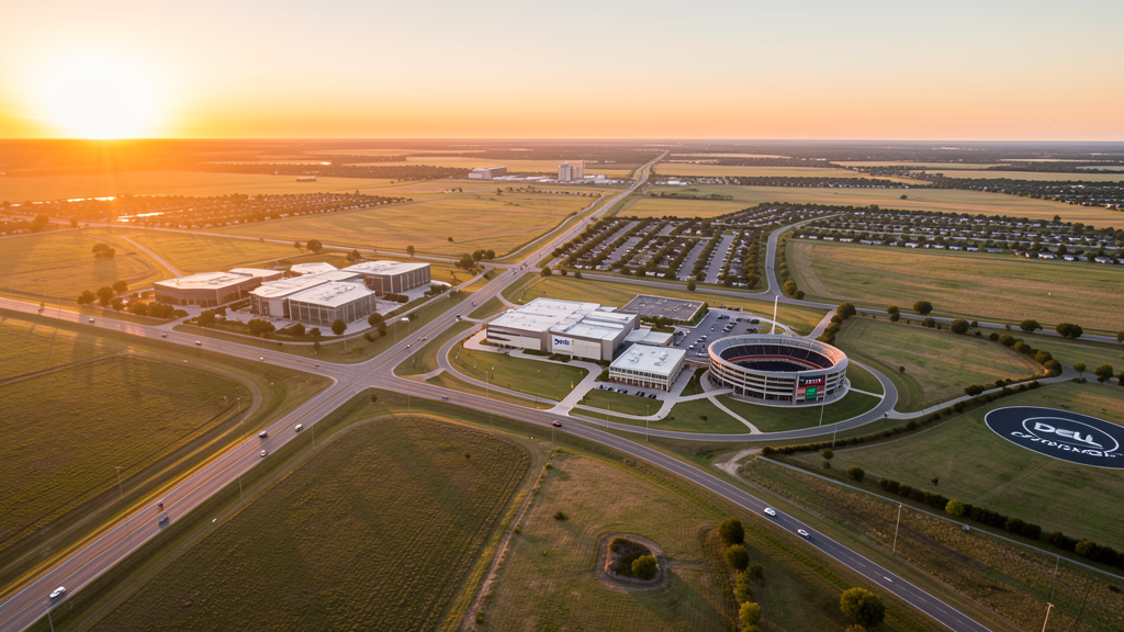
Get Matched With a Local Surveyor
Drone Survey Services Available in Round Rock, TX
The Austin-Round Rock-Georgetown metro is one of the fastest-growing in the United States, and Round Rock is its second-largest city at 134,000 residents. Anchored by Dell Technologies' global headquarters, the city has grown rapidly along the I-35 and US 79 corridors. Master-planned communities (Teravista, Sendero, Crystal Falls), the Kalahari Resorts convention complex, and the I-35 expansion project generate sustained demand for topographic surveys, construction monitoring, and LiDAR mapping.
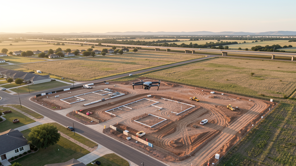
Drone Surveys for Round Rock's Construction Market
Round Rock is the Austin metro's second-largest city and home to Dell Technologies' global headquarters, which anchors a major tech corridor along I-35 and US 79. The city has grown from 100,000 to 134,000 in just five years, driven by Dell campus expansion, the Kalahari Resorts convention complex, and master-planned communities including Teravista, Sendero, and Vizcaya. The SH 45 toll road and the Mopac Expressway extension have improved connectivity to Austin, accelerating residential and commercial development. The Round Rock Higher Education Center (Texas State University campus) and the Baylor Scott & White Medical Center expansion add institutional construction demand. The I-35 expansion project through Williamson County is a major heavy civil undertaking generating survey demand. The Forest Creek and Crystal Falls master-planned communities along the US 183 corridor continue to convert ranchland to residential.
Active Developers in the Area:
Typical Project Costs in Texas
Cost ranges are based on market data for Austin-Round Rock-Georgetown. Actual pricing depends on site size, complexity, and deliverables.
| Service Type | Low End | High End |
|---|---|---|
| Topographic Survey | $1,600 | $4,800 |
| Drone Inspection | $225 | $800 |
| LiDAR Scanning | $2,600 | $9,000 |
| Environmental Monitoring | $850 | $3,500 |
| Aerial Imagery | $175 | $500 |
| Construction Monitoring | $900 | $2,800 |
| Real Estate Photography | $150 | $450 |
| Roof Inspection | $200 | $750 |
Local Airspace & Regulations in Round Rock, TX
FAA Part 107 Requirements
All commercial drone operations in Texas require the pilot to hold an active FAA Part 107 Remote Pilot Certificate. Our network surveyors are verified Part 107 holders.
State Drone Laws
Texas Government Code Chapter 423 restricts drone use over critical infrastructure facilities, including oil and gas pipelines, refineries, power plants, and water treatment facilities. HB 1484 (2023) added protections for agricultural operations and expanded penalties for drone surveillance of private property. Commercial operators must hold a valid FAA Part 107 Remote Pilot Certificate. Texas does not require a separate state drone license, but operators flying near critical infrastructure must obtain authorization from the facility owner. The Texas Department of Public Safety maintains additional guidelines for drone operations near state facilities.
Local Ordinances
Round Rock does not issue a separate city-level drone permit for commercial operators. FAA Part 107 certification and LAANC authorization for Class C (AUS) and Class D (EDC) airspace are the primary requirements. Commercial filming on city property requires a permit through the Round Rock Parks and Recreation Department. The city prohibits drone takeoff and landing in city parks without a special use permit, including Old Settlers Park, Play for All Abilities Park, and Round Rock Memorial Park. Flights from private property (with owner permission) do not require a city permit but must comply with all FAA Part 107 rules and Texas Government Code Chapter 423 critical infrastructure restrictions.
Restricted Airspace
- Class C airspace around Austin-Bergstrom International (AUS) — located 20 miles south. The northern shelves of AUS Class C extend into southern Round Rock. LAANC authorization is required for commercial drone flights south of SH 45 and along the I-35 corridor approaching Austin.
- Class D airspace around Austin Executive Airport (EDC) — located 12 miles south in Manor. Drone flights within 4 nautical miles require LAANC authorization. This affects survey work in southern Round Rock near SH 45 and the Dell campus area.
- Georgetown Municipal Airport (GTU) — located 8 miles north, uncontrolled Class E airspace. No LAANC required for most of Round Rock proper. However, GTU has active general aviation traffic including corporate jets and flight training. Pilots should monitor CTAF and maintain visual separation, especially during weekday commuting hours.
- Dell Technologies World HQ campus — while not formal restricted airspace, the 100-acre Dell campus has active security monitoring. Drone flights over the campus should be coordinated with Dell security, especially during corporate events and product launches.
- Dell Diamond and Round Rock Sports Complex — stadium TFRs during Round Rock Express games and sporting events prohibit drone flights within 3 nautical miles up to 3,000 ft AGL. The sports complex area along US 79 and Harrell Parkway is actively monitored during events.
- Kalahari Resorts and Convention Center — large indoor waterpark and convention facility. While not formal restricted airspace, the density of guests and outdoor pool areas means drone pilots should avoid flights over the resort, especially during peak season and conventions.
- Flash flooding and weather: Round Rock sits on Brushy Creek and Lake Creek, both of which are prone to flash flooding during spring thunderstorms. The city experienced severe flooding in 2010 and 2015. Post-flood survey work requires coordination with the City of Round Rock Emergency Management. Summer thunderstorms and high humidity affect flight windows — morning flights are preferred May through September.
Airports in the area: undefined (undefined), undefined (undefined), undefined (undefined), undefined (undefined)
Why Hire Through Aerius View in Round Rock, TX?
FAA-Certified
Every surveyor holds an active Part 107 Remote Pilot Certificate.
Local to Round Rock
Surveyors who know the Texas airspace and local permitting.
No Cost to Quote
Submit your project at no charge. Pay the surveyor directly if you proceed.
Fast Turnaround
A local surveyor contacts you within 2 business days.
How Our Round Rock Matching Process Works
We're actively building our network of FAA-certified drone operators in Round Rock, TX. Here's exactly what happens when you submit a project request.
Submit Your Project
Tell us your site location, acreage, and what you need (topographic survey, LiDAR, inspection, etc.). Takes 60 seconds. No cost, no obligation.
We Match & Vet
We identify Part 107-certified operators in Texas with the right equipment for your project. Every pilot is verified for active certification, insurance, and relevant experience in Texas airspace.
You Get Quotes
Matched surveyors contact you within 2 business days with quotes. You compare pricing, timelines, and deliverables, then choose the right fit. You pay the surveyor directly, no markup.
What Deliverables Do You Get?
Every project includes professional-grade deliverables compatible with standard construction and engineering software:
- Orthomosaic maps (GeoTIFF) for site overview and documentation
- Point clouds (LAS/LAZ) for 3D modeling and volumetric analysis
- DEM/DSM terrain models for cut/fill and grade analysis
- Contour lines (DXF/DWG, CAD-ready) for Civil 3D and Revit
- Progress reports with side-by-side comparisons for construction monitoring
- Coordinate systems matched to your project datum (State Plane, UTM, or local)
Insurance & Liability Protection
Pilot Insurance Required
Every operator in our network must carry active liability insurance. Minimum coverage: $1,000,000 general liability. Proof of insurance is verified before any pilot joins the network.
FAA Part 107 Verified
We confirm each pilot's Remote Pilot Certificate is active and in good standing through the FAA Airmen Inquiry system. Expired certificates are flagged automatically.
Equipment Documentation
Pilots list their drone models, sensors (RGB, LiDAR, thermal, multispectral), and payload specs so we can match the right equipment to your project requirements.
Site Safety Coordination
Pilots coordinate with your site superintendent for safe operations on active construction sites, including flight plans that avoid worker areas and equipment zones.
Round Rock, TX Drone Survey FAQs
Do I need a permit for a drone survey in Round Rock?
Round Rock does not issue a separate city-level drone permit for commercial operators. FAA Part 107 certification is mandatory. LAANC authorization is required for flights in southern Round Rock within the AUS Class C shelves or the EDC Class D zone. Most of central and northern Round Rock falls outside controlled airspace, making LAANC unnecessary for many survey jobs. Drone takeoff and landing in city parks requires a special use permit from Round Rock Parks and Recreation.
How much does a drone survey cost in Round Rock?
Round Rock pricing is similar to the Austin metro average. Topographic surveys typically range from $1,600 to $4,800. LiDAR scanning runs $2,600 to $9,000 for wooded or hilly sites. Roof inspections cost $200 to $750 per building. Construction monitoring is typically $900 to $2,800 per month for recurring flights at master-planned community sites like Teravista and Sendero.
Can I fly a drone near the Dell Technologies campus?
The Dell Technologies World HQ campus is not formal restricted airspace, but it has active security monitoring. Drone flights over the 100-acre campus should be coordinated with Dell security, especially during corporate events. Flights over adjacent commercial and residential areas are permissible with Part 107 certification. Always check FAA UAS Facility Maps for altitude restrictions in the area.
Are there no-fly zones around Dell Diamond and the sports complex?
Yes. Dell Diamond (home of the Round Rock Express) and the surrounding Round Rock Sports Complex have stadium TFRs during games and sporting events. Drone flights within 3 nautical miles up to 3,000 ft AGL are prohibited during events. The sports complex area along US 79 and Harrell Parkway is actively monitored. Always check the event schedule before scheduling survey flights near these venues.
Does Round Rock's location in the Austin metro affect drone operations?
Yes. Southern Round Rock falls within the AUS Class C airspace shelves, requiring LAANC authorization. The Austin Executive Airport (EDC) Class D zone is 12 miles south and also requires LAANC. Most of northern Round Rock near Georgetown Municipal Airport (GTU) is uncontrolled Class E, where no LAANC is needed. The I-35 corridor through Round Rock is a transitional zone — always check FAA UAS Facility Maps before flying.
What makes Round Rock unique for drone survey work?
Round Rock is the Austin metro's second-largest city and home to Dell Technologies' global HQ. The combination of corporate campus construction, master-planned communities (Teravista, Sendero, Crystal Falls), the Kalahari convention complex, and the I-35 expansion project creates diverse survey demand. The city offers Austin metro growth dynamics with less airspace complexity than Austin proper, since northern Round Rock is in uncontrolled Class E airspace near Georgetown Municipal Airport.
Nearby Cities
Are You a Drone Surveyor in Round Rock?
Get pre-qualified leads in your service area. No membership fees, no monthly minimums. First lead free.
Ready to Start Your Project in Round Rock, TX?
Get matched with a local, FAA-certified surveyor. No cost, no obligation.
Request a Free Quote