Drone Survey Services in Pocatello, ID
Pocatello high-desert elevation at 4,446 ft, proximity to Idaho State University expanding campus, and surrounding agricultural and industrial operations from Simplot to the Portneuf Valley create steady demand for drone survey services tailored to eastern Idaho unique terrain and institutional construction needs.
Serving Bannock County & the Pocatello area
Request a Free Quote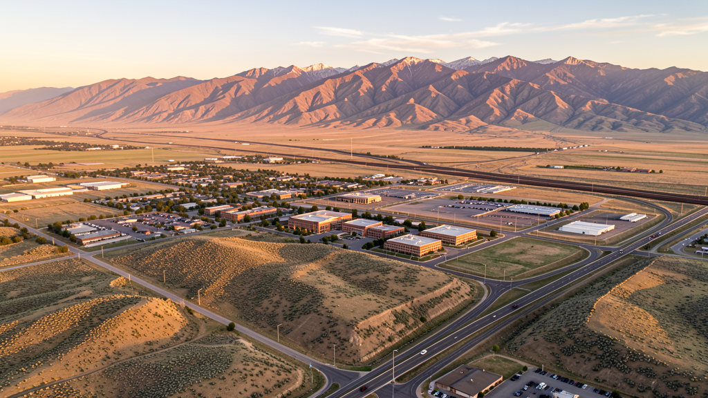
Get Matched With a Local Surveyor
Drone Survey Services Available in Pocatello, ID
Pocatello is southeastern Idaho second-tier metro, anchored by Idaho State University and supported by agricultural, industrial, and healthcare sectors. The construction market is moderate but consistent, with institutional expansion at ISU, healthcare upgrades at Portneuf Medical Center, and industrial development along the I-15 corridor. The city proximity to the Fort Hall Indian Reservation, the INL restricted airspace to the northwest, and Mountain Home AFB military training routes creates a complex regulatory environment requiring expert airspace coordination for commercial drone survey operations.
Drone Surveys for Pocatello's Construction Market
Pocatello construction market is steady but smaller than Boise or Coeur dAlene, driven by institutional expansion at Idaho State University, healthcare facility upgrades at Portneuf Medical Center, and transportation infrastructure. The city has seen moderate residential growth in the Chubbuck area and along the Yellowstone and Highway 15 corridor. Commercial development includes retail and warehouse projects along the I-15 Business I-15 corridor. Agricultural infrastructure and industrial development including Simplot and FMC facilities create specialized demand for industrial site surveying. Annual construction valuation in Bannock County is typically in the $50-80M range.
Active Developers in the Area:

Typical Project Costs in Idaho
Cost ranges are based on market data for Pocatello. Actual pricing depends on site size, complexity, and deliverables.
| Service Type | Low End | High End |
|---|---|---|
| Topographic Survey | $1,200 | $4,500 |
| Drone Inspection | $650 | $3,000 |
| LiDAR Scanning | $2,200 | $7,500 |
| Environmental Monitoring | $1,000 | $4,000 |
| Aerial Imagery | $250 | $1,200 |
| Construction Monitoring | $800 | $3,500 |
| Real Estate Photography | $175 | $700 |
| Roof Inspection | $200 | $900 |
Local Airspace & Regulations in Pocatello, ID
FAA Part 107 Requirements
All commercial drone operations in Idaho require the pilot to hold an active FAA Part 107 Remote Pilot Certificate. Our network surveyors are verified Part 107 holders.
State Drone Laws
Idaho Code § 21-801 et seq (Title 21, Chapter 8) governs unmanned aircraft systems statewide. The law prohibits drone surveillance of private property without consent (§ 21-803, $500 civil penalty per violation), bans weaponization of drones (§ 21-804, misdemeanor), and prohibits using drones to interfere with wildfire suppression (§ 21-805). The state preempts local regulation of drone flight paths and airspace (§ 21-810), though cities may regulate takeoff and landing on public property they own. Idaho does not require a separate state-level drone license. Commercial drone operators must hold a valid FAA Part 107 Remote Pilot Certificate. Idaho was one of the first states to pass comprehensive drone legislation in 2013 (HB 279), amended by SB 1133 (2021) to align definitions with the federal Part 107 framework.
Local Ordinances
Pocatello generally follows Idaho state law and does not impose additional drone-specific regulations. Idaho State University has campus policies regarding drone use on university property. Commercial drone operators should coordinate with ISU Facilities Services for any flights on campus. Bannock County does not have a county-level drone ordinance. Drone use in Pocatello city parks may be subject to park rules. The Fort Hall Indian Reservation immediately north has its own regulatory framework. Non-tribal members must obtain permission from the Shoshone-Bannock Tribal Business Council for drone operations on reservation land.
Restricted Airspace
- PIH Class D airspace around Pocatello Regional Airport, 4-5 NM radius up to 2,500 ft MSL. LAANC authorization required when tower is active.
- Idaho National Laboratory (INL) restricted airspace, 55 miles northwest. Includes Prohibited Area P-462 and Restricted Areas R-4601, R-4602, R-4603. Drone operations strictly prohibited without DOE authorization.
- Fort Hall Indian Reservation immediately north of Pocatello (Shoshone-Bannock Tribes). Drone operations over tribal lands require permission from the Shoshone-Bannock Tribes. Unauthorized drone flights over tribal land may result in tribal legal action.
- Military Training Routes (MTRs) crossing southern Idaho including low-level jet routes used by Mountain Home AFB. Check VFR sectional charts for temporary hazard conditions.
- Mountain Home AFB MOA airspace extends across southern Idaho and may affect drone operations in the broader region, though the base is over 100 miles southwest.
- Pocatello city parks may restrict drone use. Operators should check with Pocatello Parks and Recreation for current rules at city parks.
Airports in the area: undefined (undefined), undefined (undefined), undefined (undefined)
Why Hire Through Aerius View in Pocatello, ID?
FAA-Certified
Every surveyor holds an active Part 107 Remote Pilot Certificate.
Local to Pocatello
Surveyors who know the Idaho airspace and local permitting.
No Cost to Quote
Submit your project at no charge. Pay the surveyor directly if you proceed.
Fast Turnaround
A local surveyor contacts you within 2 business days.
How Our Pocatello Matching Process Works
We're actively building our network of FAA-certified drone operators in Pocatello, ID. Here's exactly what happens when you submit a project request.
Submit Your Project
Tell us your site location, acreage, and what you need (topographic survey, LiDAR, inspection, etc.). Takes 60 seconds. No cost, no obligation.
We Match & Vet
We identify Part 107-certified operators in Idaho with the right equipment for your project. Every pilot is verified for active certification, insurance, and relevant experience in Idaho airspace.
You Get Quotes
Matched surveyors contact you within 2 business days with quotes. You compare pricing, timelines, and deliverables, then choose the right fit. You pay the surveyor directly, no markup.
What Deliverables Do You Get?
Every project includes professional-grade deliverables compatible with standard construction and engineering software:
- Orthomosaic maps (GeoTIFF) for site overview and documentation
- Point clouds (LAS/LAZ) for 3D modeling and volumetric analysis
- DEM/DSM terrain models for cut/fill and grade analysis
- Contour lines (DXF/DWG, CAD-ready) for Civil 3D and Revit
- Progress reports with side-by-side comparisons for construction monitoring
- Coordinate systems matched to your project datum (State Plane, UTM, or local)
Insurance & Liability Protection
Pilot Insurance Required
Every operator in our network must carry active liability insurance. Minimum coverage: $1,000,000 general liability. Proof of insurance is verified before any pilot joins the network.
FAA Part 107 Verified
We confirm each pilot's Remote Pilot Certificate is active and in good standing through the FAA Airmen Inquiry system. Expired certificates are flagged automatically.
Equipment Documentation
Pilots list their drone models, sensors (RGB, LiDAR, thermal, multispectral), and payload specs so we can match the right equipment to your project requirements.
Site Safety Coordination
Pilots coordinate with your site superintendent for safe operations on active construction sites, including flight plans that avoid worker areas and equipment zones.
Pocatello, ID Drone Survey FAQs
Do I need authorization to fly a drone near Pocatello Regional Airport (PIH)?
Yes. PIH has Class D airspace when its control tower is active. Commercial drone pilots operating under Part 107 must obtain LAANC authorization before flying within the Class D surface area (approximately 4-5 nautical miles around the airport). Check current FAA UAS Facility Maps for PIH.
Can I fly a drone over the Fort Hall Indian Reservation north of Pocatello?
Drone operations over the Fort Hall Indian Reservation require permission from the Shoshone-Bannock Tribes. The reservation, located immediately north of Chubbuck, is sovereign tribal land. Non-tribal members should contact the Shoshone-Bannock Tribal Business Council for authorization. Unauthorized drone flights over tribal land may result in tribal legal action.
How does the Idaho National Laboratory restricted airspace affect drone operations near Pocatello?
The INL restricted airspace is approximately 55 miles northwest of Pocatello and does not directly affect Pocatello-area operations. However, if you are conducting surveys along the US-20 corridor toward Arco or the Craters of the Moon area, you must check FAA sectional charts for the extensive restricted areas surrounding the INL site.
What types of drone survey services are most in demand in the Pocatello area?
Pocatello market is driven by agricultural surveying (precision agriculture for surrounding farmland), industrial site monitoring (Simplot and other industrial facilities), institutional construction monitoring (Idaho State University campus projects), and infrastructure inspection. The city high elevation (4,446 ft) and mountainous terrain create demand for topographic surveys for rural development.
Are there altitude considerations for drone flights in Pocatello due to its elevation?
Yes. Pocatello sits at approximately 4,446 ft elevation. Battery life may be reduced, and maximum service ceiling is reached more quickly relative to MSL. Surrounding mountains (Portneuf Range east, Bannock Range south) rise steeply, meaning terrain-following flights require careful planning. Density altitude can exceed 7,000 ft on hot summer days, affecting aircraft performance.
Nearby Cities
Are You a Drone Surveyor in Pocatello?
Get pre-qualified leads in your service area. No membership fees, no monthly minimums. First lead free.
Ready to Start Your Project in Pocatello, ID?
Get matched with a local, FAA-certified surveyor. No cost, no obligation.
Request a Free Quote