Drone Survey Services in Richland, WA
Home to Pacific Northwest National Laboratory and adjacent to the Hanford Nuclear Reservation, Richland is the scientific hub of the Tri-Cities with ongoing environmental remediation work and 400+ new housing units permitted in 2023-2024 creating specialized demand for drone environmental monitoring and research site survey services.
Serving Benton County & the Tri-Cities area
Request a Free Quote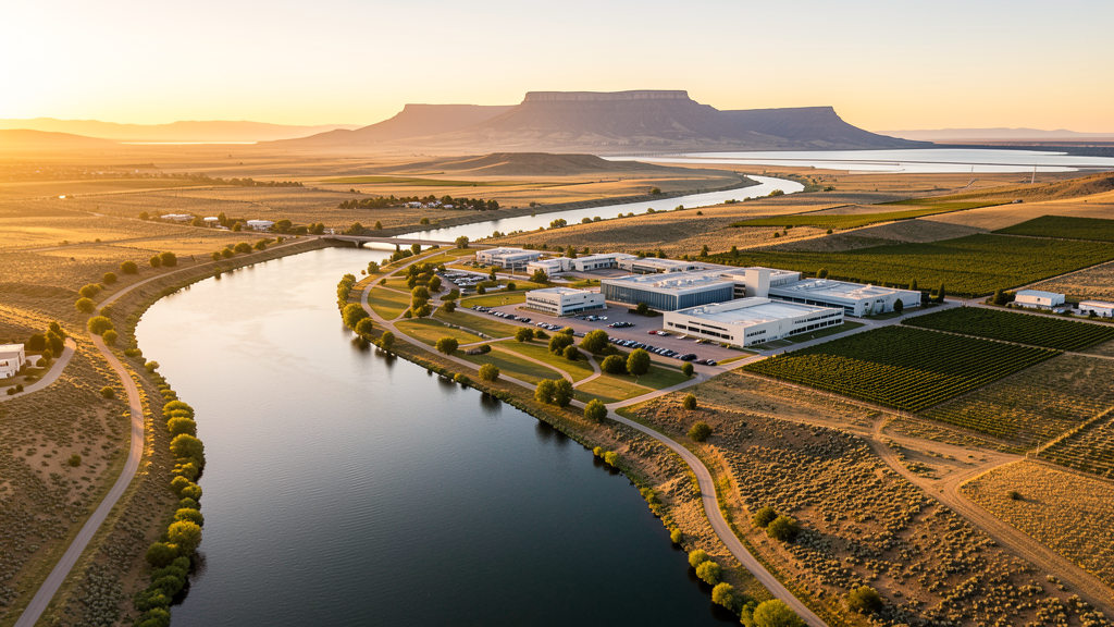
Get Matched With a Local Surveyor
Drone Survey Services Available in Richland, WA
Richland sits at the confluence of the Yakima and Columbia Rivers in the Tri-Cities region of southeastern Washington. The city is the scientific and research center, anchored by the Pacific Northwest National Laboratory and the adjacent Hanford Nuclear Reservation. The Hanford cleanup and environmental remediation create unique, ongoing demand for drone-based environmental monitoring and site survey services. The Columbia River waterfront is being redeveloped with trails and mixed-use development. Wine industry growth and research sector employment drive the residential market. The Hanford site creates unique airspace restrictions for drone operators in the northern portion of the city.
Drone Surveys for Richland's Construction Market
Richland is the scientific and research hub of the Tri-Cities, home to the Pacific Northwest National Laboratory (PNNL) and adjacent to the Hanford Nuclear Reservation. Construction activity includes the PNNL campus expansion, the Richland downtown waterfront development, and residential subdivisions in the West Richland area. The city is investing in the Columbia River waterfront trail and the George Washington Way corridor improvements. Residential permitting exceeded 400 new units in 2023-2024, driven by research sector employment and the growing wine industry. The Hanford cleanup and environmental remediation work creates ongoing demand for drone-based environmental monitoring and site survey services.
Active Developers in the Area:

Typical Project Costs in Washington
Cost ranges are based on market data for Tri-Cities. Actual pricing depends on site size, complexity, and deliverables.
| Service Type | Low End | High End |
|---|---|---|
| Topographic Survey | $1,050 | $4,000 |
| Drone Inspection | $720 | $2,600 |
| LiDAR Scanning | $2,500 | $7,000 |
| Environmental Monitoring | $1,250 | $4,300 |
| Aerial Imagery | $400 | $1,500 |
| Construction Monitoring | $850 | $3,100 |
| Real Estate Photography | $280 | $1,050 |
| Roof Inspection | $330 | $1,150 |
Local Airspace & Regulations in Richland, WA
FAA Part 107 Requirements
All commercial drone operations in Washington require the pilot to hold an active FAA Part 107 Remote Pilot Certificate. Our network surveyors are verified Part 107 holders.
State Drone Laws
Washington regulates drones through multiple statutes. ESSB 6001 (2015) requires law enforcement to obtain a warrant before using drones for surveillance, with exceptions for emergency response, search and rescue, and forest fire management. RCW 9A.44.115 extends voyeurism laws to drone-based image capture of private premises. RCW 46.60.130 prohibits drone interference with manned aircraft and emergency response operations. Washington does not require a separate state-level drone license for commercial operators, but all commercial drone pilots must hold a valid FAA Part 107 Remote Pilot Certificate. The state preempts local regulation of drone flight paths and navigable airspace (RCW 47.68), though cities may regulate takeoff and landing on public property they own. Washington State Parks prohibit drone takeoff and landing without a permit (WAC 352-32). Commercial operators near military installations (JBLM, Fairchild AFB, Naval Air Station Whidbey Island) must coordinate with base operations.
Local Ordinances
Richland does not have a formal drone permitting ordinance, but requests 48-hour notification for commercial drone operations on city-owned property. Washington ESSB 6001 governs law enforcement drone use. Flights from private property require owner permission and FAA Part 107 compliance. The Hanford Nuclear Reservation adjacent to north Richland has restricted airspace and security zones that must be checked on FAA charts before flying. The Pacific Northwest National Laboratory campus has security zones and potential no-drone areas. Washington State Parks prohibit drone operations without a permit (WAC 352-32).
Restricted Airspace
- Richland is primarily in uncontrolled Class G airspace. Most of the city does not require LAANC. Flights east toward Kennewick may enter PSC Class D airspace requiring authorization.
- Hanford Nuclear Reservation is adjacent to north Richland. The Hanford site has restricted airspace and security zones. Check FAA charts for TFRs and security flight restrictions before flying north. The 300 Area and 200 Area have security perimeters.
- Columbia River creates over-water flight considerations. The river corridor through Richland is used for recreation and research. Drone flights must maintain visual line of sight over water.
- Pacific Northwest National Laboratory (PNNL) campus has security zones. Drone flights over or near PNNL facilities require coordination with facility security. Some areas are no-drone zones.
- Richland City Code requires notification for commercial drone operations on city property including Howard Amon Park, Leslie Groves Park, and Chamna Natural Preserve. No formal permit fee but 48-hour notice required.
Airports in the area: undefined (undefined), undefined (undefined), undefined (undefined)
Why Hire Through Aerius View in Richland, WA?
FAA-Certified
Every surveyor holds an active Part 107 Remote Pilot Certificate.
Local to Richland
Surveyors who know the Washington airspace and local permitting.
No Cost to Quote
Submit your project at no charge. Pay the surveyor directly if you proceed.
Fast Turnaround
A local surveyor contacts you within 2 business days.
How Our Richland Matching Process Works
We're actively building our network of FAA-certified drone operators in Richland, WA. Here's exactly what happens when you submit a project request.
Submit Your Project
Tell us your site location, acreage, and what you need (topographic survey, LiDAR, inspection, etc.). Takes 60 seconds. No cost, no obligation.
We Match & Vet
We identify Part 107-certified operators in Washington with the right equipment for your project. Every pilot is verified for active certification, insurance, and relevant experience in Washington airspace.
You Get Quotes
Matched surveyors contact you within 2 business days with quotes. You compare pricing, timelines, and deliverables, then choose the right fit. You pay the surveyor directly, no markup.
What Deliverables Do You Get?
Every project includes professional-grade deliverables compatible with standard construction and engineering software:
- Orthomosaic maps (GeoTIFF) for site overview and documentation
- Point clouds (LAS/LAZ) for 3D modeling and volumetric analysis
- DEM/DSM terrain models for cut/fill and grade analysis
- Contour lines (DXF/DWG, CAD-ready) for Civil 3D and Revit
- Progress reports with side-by-side comparisons for construction monitoring
- Coordinate systems matched to your project datum (State Plane, UTM, or local)
Insurance & Liability Protection
Pilot Insurance Required
Every operator in our network must carry active liability insurance. Minimum coverage: $1,000,000 general liability. Proof of insurance is verified before any pilot joins the network.
FAA Part 107 Verified
We confirm each pilot's Remote Pilot Certificate is active and in good standing through the FAA Airmen Inquiry system. Expired certificates are flagged automatically.
Equipment Documentation
Pilots list their drone models, sensors (RGB, LiDAR, thermal, multispectral), and payload specs so we can match the right equipment to your project requirements.
Site Safety Coordination
Pilots coordinate with your site superintendent for safe operations on active construction sites, including flight plans that avoid worker areas and equipment zones.
Richland, WA Drone Survey FAQs
Do I need LAANC authorization to fly a drone in Richland?
Most of Richland is in uncontrolled Class G airspace and does not require LAANC. Flights east toward Kennewick may enter PSC Class D airspace. The Hanford site to the north has restricted airspace. Check FAA charts before flying north.
What airspace restrictions affect the Hanford Nuclear Reservation area?
The Hanford Nuclear Reservation adjacent to north Richland has restricted airspace, security zones, and potential TFRs. The 300 Area and 200 Area have security perimeters. Always check FAA charts for current restrictions before flying in the northern portion of Richland or toward the Hanford site.
Can I fly a drone over the Pacific Northwest National Laboratory?
PNNL campus has security zones and potential no-drone areas. Drone flights over or near PNNL facilities require coordination with facility security. While FAA Part 107 governs airspace, the facility may enforce no-drone policies on its property.
What construction activity is happening in Richland?
The PNNL campus expansion, downtown waterfront development, and 400+ new housing units permitted in 2023-2024 are the main projects. The Hanford cleanup and environmental remediation work creates ongoing demand for drone-based environmental monitoring services.
How much does a drone survey cost in Richland?
Topographic surveys in Richland range from $1,050 to $4,000. LiDAR scanning costs $2,500 to $7,000. Environmental monitoring runs $1,250 to $4,300, with premium demand from Hanford remediation work. Construction monitoring runs $850 to $3,100.
Nearby Cities
Are You a Drone Surveyor in Richland?
Get pre-qualified leads in your service area. No membership fees, no monthly minimums. First lead free.
Ready to Start Your Project in Richland, WA?
Get matched with a local, FAA-certified surveyor. No cost, no obligation.
Request a Free Quote