Drone Survey Services in Fruita, CO
Fruita construction is driven by rapid residential growth and outdoor recreation infrastructure, with new subdivisions expanding along the Highway 6 corridor while the city balances development against the immediate proximity of Colorado National Monument airspace restrictions.
Serving Mesa County & the Grand Junction MSA area
Request a Free Quote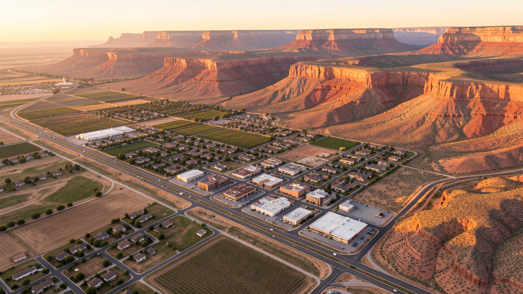
Get Matched With a Local Surveyor
Drone Survey Services Available in Fruita, CO
Fruita is the fastest-growing community in the Grand Valley, benefiting from its position as a more affordable residential alternative to Grand Junction and its reputation as a mountain biking and outdoor recreation destination at the gateway to Colorado National Monument. The construction market is fueled by residential subdivision development, commercial expansion near I-70, and municipal investment in trails and water infrastructure.
Drone Surveys for Fruita's Construction Market
Fruita is one of the fastest-growing communities on the Western Slope, with annual growth rates of approximately 3-4%, driven by its position as a more affordable alternative to Grand Junction and its outdoor recreation economy. Major projects include residential subdivision development along the Highway 6 and 50 corridors, the Fruita Civic Center and parks improvement projects, and expansion of commercial retail along the I-70 Highway 340 interchange. The city has invested in trail infrastructure connecting to the Kokopelli Trail system, water system expansion for new residential areas, and downtown streetscape improvements.
Active Developers in the Area:

Typical Project Costs in Colorado
Cost ranges are based on market data for Grand Junction MSA. Actual pricing depends on site size, complexity, and deliverables.
| Service Type | Low End | High End |
|---|---|---|
| Topographic Survey | $1,100 | $4,200 |
| Drone Inspection | $750 | $2,800 |
| LiDAR Scanning | $2,400 | $7,500 |
| Environmental Monitoring | $950 | $3,200 |
| Aerial Imagery | $550 | $2,200 |
| Construction Monitoring | $850 | $3,200 |
| Real Estate Photography | $400 | $1,400 |
| Roof Inspection | $450 | $1,600 |
Local Airspace & Regulations in Fruita, CO
FAA Part 107 Requirements
All commercial drone operations in Colorado require the pilot to hold an active FAA Part 107 Remote Pilot Certificate. Our network surveyors are verified Part 107 holders.
State Drone Laws
Colorado HB 1070 (2023) aligns state drone law with federal FAA Part 107 requirements. The law prohibits local municipalities from regulating drone flight paths or airspace, but allows cities to regulate takeoff and landing on public property. Colorado does not require a separate state-level drone license. Commercial drone operators must hold a valid FAA Part 107 Remote Pilot Certificate and comply with all federal regulations. The Colorado Department of Transportation has additional guidelines for drone operations near state highways and infrastructure.
Local Ordinances
Fruita Municipal Code Chapter 10 addresses reckless operation of aircraft and motorized devices applicable to drone operations creating nuisance or hazard. Fruita Municipal Code Chapter 12 regulates activities in city parks; drone operations require city authorization through the Fruita Parks and Recreation Department. Fruita Municipal Code Chapter 16 addresses land use and zoning; commercial drone operations as a business use may require a home occupation or business license through the City Clerk office. Commercial filming permits for city property are processed through the Fruita Community Development Department.
Restricted Airspace
- Colorado National Monument borders Fruita directly to the south. All drone operations prohibited within monument boundaries under 36 CFR 1.5. The no-fly zone covers a significant area immediately south of downtown Fruita.
- McInnis Canyons National Conservation Area (BLM-managed, west and northwest of Fruita) including Rabbit Valley and Colorado River corridor. BLM drone regulations differ from NPS; commercial use may be permitted with BLM authorization from the Grand Junction Field Office.
- KGJT Class D airspace when control tower is active extends approximately 4 nautical miles from the airport. Most Fruita operations fall outside this area.
- James M. Robb Colorado River State Park adjacent to Fruita requires a special activity permit from Colorado Parks and Wildlife for commercial drone operations.
- Wildfire TFRs possible in surrounding BLM and national forest lands during summer and fall.
Airports in the area: undefined (undefined), undefined (undefined)
Why Hire Through Aerius View in Fruita, CO?
FAA-Certified
Every surveyor holds an active Part 107 Remote Pilot Certificate.
Local to Fruita
Surveyors who know the Colorado airspace and local permitting.
No Cost to Quote
Submit your project at no charge. Pay the surveyor directly if you proceed.
Fast Turnaround
A local surveyor contacts you within 2 business days.
How Our Fruita Matching Process Works
We're actively building our network of FAA-certified drone operators in Fruita, CO. Here's exactly what happens when you submit a project request.
Submit Your Project
Tell us your site location, acreage, and what you need (topographic survey, LiDAR, inspection, etc.). Takes 60 seconds. No cost, no obligation.
We Match & Vet
We identify Part 107-certified operators in Colorado with the right equipment for your project. Every pilot is verified for active certification, insurance, and relevant experience in Colorado airspace.
You Get Quotes
Matched surveyors contact you within 2 business days with quotes. You compare pricing, timelines, and deliverables, then choose the right fit. You pay the surveyor directly, no markup.
What Deliverables Do You Get?
Every project includes professional-grade deliverables compatible with standard construction and engineering software:
- Orthomosaic maps (GeoTIFF) for site overview and documentation
- Point clouds (LAS/LAZ) for 3D modeling and volumetric analysis
- DEM/DSM terrain models for cut/fill and grade analysis
- Contour lines (DXF/DWG, CAD-ready) for Civil 3D and Revit
- Progress reports with side-by-side comparisons for construction monitoring
- Coordinate systems matched to your project datum (State Plane, UTM, or local)
Insurance & Liability Protection
Pilot Insurance Required
Every operator in our network must carry active liability insurance. Minimum coverage: $1,000,000 general liability. Proof of insurance is verified before any pilot joins the network.
FAA Part 107 Verified
We confirm each pilot's Remote Pilot Certificate is active and in good standing through the FAA Airmen Inquiry system. Expired certificates are flagged automatically.
Equipment Documentation
Pilots list their drone models, sensors (RGB, LiDAR, thermal, multispectral), and payload specs so we can match the right equipment to your project requirements.
Site Safety Coordination
Pilots coordinate with your site superintendent for safe operations on active construction sites, including flight plans that avoid worker areas and equipment zones.
Fruita, CO Drone Survey FAQs
What airspace restrictions apply to drone operations in Fruita given the proximity to Colorado National Monument?
Colorado National Monument borders Fruita directly to the south, and all drone operations are prohibited within the monument boundaries under 36 CFR 1.5. The monument contains towering red rock cliffs and canyons, and the no-fly zone covers a significant area immediately south of downtown Fruita. Drone operators surveying adjacent private land must ensure flight paths do not enter monument airspace. Violations can result in federal citations with fines up to $5,000.
Do I need LAANC authorization to fly a drone in Fruita?
Fruita itself is not within Class D airspace. Grand Junction Regional Airport (KGJT) has Class D airspace when the control tower is active, but that extends approximately 4 nautical miles from the airport, which is about 18 miles east-southeast of Fruita. Most Fruita operations fall outside this Class D area and do not require LAANC. However, operators working east toward Grand Junction should check whether they are within the KGJT Class D surface area.
Can I fly a drone over BLM land in the McInnis Canyons National Conservation Area near Fruita?
The McInnis Canyons National Conservation Area, managed by the BLM, is located west and northwest of Fruita. Unlike National Park Service lands, BLM lands are generally more permissive for drone use. However, commercial drone operations still require authorization from the BLM Grand Junction Field Office. Recreational drone use is generally allowed on BLM land outside designated wilderness study areas.
Are there drone restrictions at James M. Robb Colorado River State Park near Fruita?
James M. Robb Colorado River State Park, which includes the Fruita section along the Colorado River, is managed by Colorado Parks and Wildlife. Commercial drone operations within state parks require a special activity permit from CPW. The park is popular for birdwatching, and drone disturbance of nesting raptors and waterfowl is a particular concern during spring and summer nesting seasons.
How does Fruita growth affect demand for construction drone services?
Fruita is among the fastest-growing communities on the Western Slope, with growth rates of 3-4% annually driven by its outdoor recreation economy and affordability relative to Grand Junction. Residential subdivisions along Highways 6 and 50, commercial development near the I-70 interchange, and municipal infrastructure projects including water system expansion and trail network construction all create demand for topographic survey, construction monitoring, and aerial imagery services.
Nearby Cities
Are You a Drone Surveyor in Fruita?
Get pre-qualified leads in your service area. No membership fees, no monthly minimums. First lead free.
Ready to Start Your Project in Fruita, CO?
Get matched with a local, FAA-certified surveyor. No cost, no obligation.
Request a Free Quote