Drone Survey Services in Montrose, CO
Montrose construction activity centers on hospital expansion, water infrastructure upgrades, and residential growth along the Uncompahgre River corridor, with the city serving as the primary commercial and healthcare hub for the Western Slope between Grand Junction and Durango.
Serving Montrose County & the Montrose MSA area
Request a Free Quote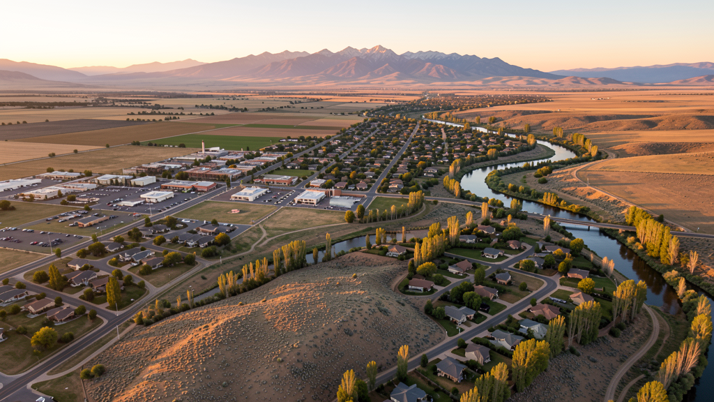
Get Matched With a Local Surveyor
Drone Survey Services Available in Montrose, CO
Montrose serves as the regional commercial and healthcare hub for a large portion of the Western Slope, with a construction market driven by retirement migration, outdoor recreation, and infrastructure investment. The city benefits from its position at the intersection of US Highways 50 and 550, serving as a gateway to the San Juan Mountains and Telluride.
Drone Surveys for Montrose's Construction Market
Montrose has experienced steady growth at approximately 2-3% annually, driven by retirement migration, outdoor recreation, and its role as a regional hub for the Western Slope. Major projects include the Montrose Memorial Hospital expansion (adding new patient tower and emergency department), the City of Montrose capital improvement program investing in water infrastructure and downtown streetscape improvements, and continued residential development along the Uncompahgre River corridor. The city has also invested in the Montrose Recreation Center and aquatic facility expansion.
Active Developers in the Area:

Typical Project Costs in Colorado
Cost ranges are based on market data for Montrose MSA. Actual pricing depends on site size, complexity, and deliverables.
| Service Type | Low End | High End |
|---|---|---|
| Topographic Survey | $1,200 | $4,500 |
| Drone Inspection | $800 | $3,000 |
| LiDAR Scanning | $2,500 | $8,000 |
| Environmental Monitoring | $1,000 | $3,500 |
| Aerial Imagery | $600 | $2,500 |
| Construction Monitoring | $900 | $3,500 |
| Real Estate Photography | $400 | $1,500 |
| Roof Inspection | $500 | $1,800 |
Local Airspace & Regulations in Montrose, CO
FAA Part 107 Requirements
All commercial drone operations in Colorado require the pilot to hold an active FAA Part 107 Remote Pilot Certificate. Our network surveyors are verified Part 107 holders.
State Drone Laws
Colorado HB 1070 (2023) aligns state drone law with federal FAA Part 107 requirements. The law prohibits local municipalities from regulating drone flight paths or airspace, but allows cities to regulate takeoff and landing on public property. Colorado does not require a separate state-level drone license. Commercial drone operators must hold a valid FAA Part 107 Remote Pilot Certificate and comply with all federal regulations. The Colorado Department of Transportation has additional guidelines for drone operations near state highways and infrastructure.
Local Ordinances
Montrose Municipal Code Section 12.04.040 prohibits operation of powered aircraft, including drones, in city parks without prior written authorization from the Parks Manager. Commercial drone operators conducting business on city property must coordinate through the City of Montrose Public Works Department. Film and commercial photography permits are issued through the Montrose City Managers Office for city-owned property. No standalone drone ordinance; regulations are distributed across parks, nuisance, and traffic codes.
Restricted Airspace
- KMTJ Class D airspace when control tower is active (primarily during ski season December through March). LAANC authorization required within the Class D surface area. When tower is closed, airspace reverts to Class E.
- Black Canyon of the Gunnison National Park (15 miles east) prohibits all drone operations under 36 CFR 1.5. Both North Rim and South Rim areas are no-fly zones.
- Curecanti National Recreation Area (35 miles east) is NPS-managed with drone restrictions applying to all lands within the recreation area.
- Uncompahgre National Forest surrounds the area; commercial drone operations require a special use permit from the GMUG National Forest office. Wilderness areas prohibit all motorized equipment including drones.
- Seasonal wildfire TFRs are common June through October across the Uncompahgre Plateau and West Elk Mountains. Check NOTAMs before every flight.
Airports in the area: undefined (undefined), undefined (undefined)
Why Hire Through Aerius View in Montrose, CO?
FAA-Certified
Every surveyor holds an active Part 107 Remote Pilot Certificate.
Local to Montrose
Surveyors who know the Colorado airspace and local permitting.
No Cost to Quote
Submit your project at no charge. Pay the surveyor directly if you proceed.
Fast Turnaround
A local surveyor contacts you within 2 business days.
How Our Montrose Matching Process Works
We're actively building our network of FAA-certified drone operators in Montrose, CO. Here's exactly what happens when you submit a project request.
Submit Your Project
Tell us your site location, acreage, and what you need (topographic survey, LiDAR, inspection, etc.). Takes 60 seconds. No cost, no obligation.
We Match & Vet
We identify Part 107-certified operators in Colorado with the right equipment for your project. Every pilot is verified for active certification, insurance, and relevant experience in Colorado airspace.
You Get Quotes
Matched surveyors contact you within 2 business days with quotes. You compare pricing, timelines, and deliverables, then choose the right fit. You pay the surveyor directly, no markup.
What Deliverables Do You Get?
Every project includes professional-grade deliverables compatible with standard construction and engineering software:
- Orthomosaic maps (GeoTIFF) for site overview and documentation
- Point clouds (LAS/LAZ) for 3D modeling and volumetric analysis
- DEM/DSM terrain models for cut/fill and grade analysis
- Contour lines (DXF/DWG, CAD-ready) for Civil 3D and Revit
- Progress reports with side-by-side comparisons for construction monitoring
- Coordinate systems matched to your project datum (State Plane, UTM, or local)
Insurance & Liability Protection
Pilot Insurance Required
Every operator in our network must carry active liability insurance. Minimum coverage: $1,000,000 general liability. Proof of insurance is verified before any pilot joins the network.
FAA Part 107 Verified
We confirm each pilot's Remote Pilot Certificate is active and in good standing through the FAA Airmen Inquiry system. Expired certificates are flagged automatically.
Equipment Documentation
Pilots list their drone models, sensors (RGB, LiDAR, thermal, multispectral), and payload specs so we can match the right equipment to your project requirements.
Site Safety Coordination
Pilots coordinate with your site superintendent for safe operations on active construction sites, including flight plans that avoid worker areas and equipment zones.
Montrose, CO Drone Survey FAQs
Can I fly a drone near Montrose Regional Airport?
Montrose Regional Airport (KMTJ) has Class D airspace when the control tower is active, primarily during ski season (roughly December through March) when commercial airline service operates. When the tower is closed, the airspace reverts to Class E. Part 107 pilots must obtain LAANC authorization to operate within the Class D surface area. The tower frequency is 118.3 MHz. Always check NOTAMs before flying as airline schedules vary seasonally.
Are drones allowed at parks in Montrose?
Montrose Municipal Code Section 12.04.040 prohibits the operation of powered aircraft, including drones, in city parks without prior written authorization from the Parks Manager. Operators should contact the Montrose Parks Division to request a permit for commercial drone work in parks like Cerise Park, Baldridge Park, or Riverbottom Park along the Uncompahgre River.
What are the airspace restrictions near Black Canyon of the Gunnison?
Black Canyon of the Gunnison National Park, located about 15 miles east of Montrose, is National Park Service land where all drone operations are prohibited under 36 CFR 1.5. This includes both the North Rim and South Rim areas. Violations can result in federal fines. Drone operators needing to survey adjacent private land must ensure flight paths do not enter park airspace.
Do I need a Forest Service permit for commercial drone survey on USFS land near Montrose?
Yes. The Grand Mesa, Uncompahgre, and Gunnison (GMUG) National Forest surrounds much of the Montrose area. Commercial drone operations on Forest Service land require a special use permit from the local ranger district office. Wilderness areas such as the Uncompahgre Wilderness prohibit all motorized equipment including drones.
How does wildfire season affect drone operations in the Montrose area?
Wildfire TFRs are common in the Montrose region from June through October. When a TFR is active, all non-participating aircraft including drones are prohibited from the designated area. Operators must check NOTAMs and the FAA TFR map before every flight. Firefighting aircraft operate at low altitudes, creating a significant collision hazard for drones. Violating a wildfire TFR is a federal offense with penalties up to $75,000.
Nearby Cities
Are You a Drone Surveyor in Montrose?
Get pre-qualified leads in your service area. No membership fees, no monthly minimums. First lead free.
Ready to Start Your Project in Montrose, CO?
Get matched with a local, FAA-certified surveyor. No cost, no obligation.
Request a Free Quote