Drone Survey Services in McAllen, TX
From the McAllen Medical Center and La Plaza Mall retail district to the Anzalduas International Bridge and SH 68 expansion, McAllen is the Rio Grande Valley retail and medical hub where border logistics and residential growth drive diverse survey demand under MFE Class C airspace.
Serving Hidalgo County & the McAllen-Edinburg-Mission area
Request a Free Quote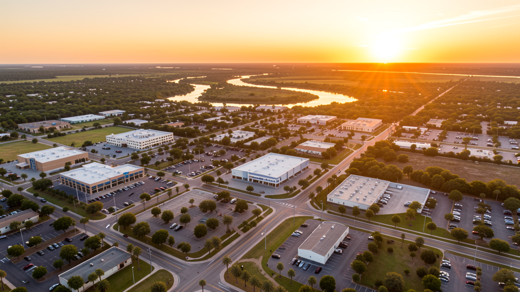
Get Matched With a Local Surveyor
Drone Survey Services Available in McAllen, TX
McAllen is the retail and medical hub of the Rio Grande Valley with 145,000 residents. The McAllen Medical Center, border logistics boom, I-2/US 281 improvements, and SH 68 expansion drive construction survey demand. MFE Class C airspace covers most of McAllen, with border security considerations throughout.
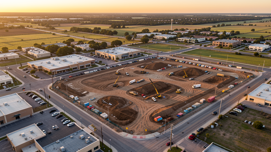
Drone Surveys for McAllen's Construction Market
McAllen is the retail and medical hub of the Rio Grande Valley, anchored by the McAllen Medical Center, the McAllen Convention Center, and the La Plaza Mall retail district. The Anzalduas International Bridge and the I-2/US 281 expressway improvements drive border logistics construction. The McAllen Foreign Trade Zone and warehousing boom along the US-Mexico border creates industrial facility demand. The Bicentennial Boulevard extension and the SH 68 expansion add heavy civil survey work. Residential growth in north McAllen (Sharyland, Albores) continues to convert farmland to subdivisions.
Active Developers in the Area:
Typical Project Costs in Texas
Cost ranges are based on market data for McAllen-Edinburg-Mission. Actual pricing depends on site size, complexity, and deliverables.
| Service Type | Low End | High End |
|---|---|---|
| Topographic Survey | $1,350 | $4,000 |
| Drone Inspection | $200 | $700 |
| LiDAR Scanning | $2,200 | $7,200 |
| Environmental Monitoring | $700 | $2,800 |
| Aerial Imagery | $150 | $450 |
| Construction Monitoring | $750 | $2,500 |
| Real Estate Photography | $125 | $400 |
| Roof Inspection | $175 | $600 |
Local Airspace & Regulations in McAllen, TX
FAA Part 107 Requirements
All commercial drone operations in Texas require the pilot to hold an active FAA Part 107 Remote Pilot Certificate. Our network surveyors are verified Part 107 holders.
State Drone Laws
Texas Government Code Chapter 423 restricts drone use over critical infrastructure facilities, including oil and gas pipelines, refineries, power plants, and water treatment facilities. HB 1484 (2023) added protections for agricultural operations and expanded penalties for drone surveillance of private property. Commercial operators must hold a valid FAA Part 107 Remote Pilot Certificate. Texas does not require a separate state drone license, but operators flying near critical infrastructure must obtain authorization from the facility owner. The Texas Department of Public Safety maintains additional guidelines for drone operations near state facilities.
Local Ordinances
McAllen does not issue a separate city-level drone permit for commercial operators. FAA Part 107 certification and LAANC authorization for MFE Class C airspace are the primary requirements. Drone flights near the US-Mexico border require awareness of CBP operations. Drone takeoff and landing in city parks requires a permit.
Restricted Airspace
- Class C airspace around McAllen Miller International (MFE) — located 2 miles south. MFE Class C extends over most of McAllen. LAANC authorization required for all commercial drone flights.
- US-Mexico border zone: McAllen is a major Rio Grande Valley border city. Drone flights near the border require awareness of CBP operations and security restrictions.
- Severe weather: Rio Grande Valley heat (100+ degrees F in summer) limits flight windows. Hurricane season (June-November) can produce high winds and flooding. Hurricane Dolly (2008) caused significant damage.
Airports in the area: undefined (undefined), undefined (undefined)
Why Hire Through Aerius View in McAllen, TX?
FAA-Certified
Every surveyor holds an active Part 107 Remote Pilot Certificate.
Local to McAllen
Surveyors who know the Texas airspace and local permitting.
No Cost to Quote
Submit your project at no charge. Pay the surveyor directly if you proceed.
Fast Turnaround
A local surveyor contacts you within 2 business days.
How Our McAllen Matching Process Works
We're actively building our network of FAA-certified drone operators in McAllen, TX. Here's exactly what happens when you submit a project request.
Submit Your Project
Tell us your site location, acreage, and what you need (topographic survey, LiDAR, inspection, etc.). Takes 60 seconds. No cost, no obligation.
We Match & Vet
We identify Part 107-certified operators in Texas with the right equipment for your project. Every pilot is verified for active certification, insurance, and relevant experience in Texas airspace.
You Get Quotes
Matched surveyors contact you within 2 business days with quotes. You compare pricing, timelines, and deliverables, then choose the right fit. You pay the surveyor directly, no markup.
What Deliverables Do You Get?
Every project includes professional-grade deliverables compatible with standard construction and engineering software:
- Orthomosaic maps (GeoTIFF) for site overview and documentation
- Point clouds (LAS/LAZ) for 3D modeling and volumetric analysis
- DEM/DSM terrain models for cut/fill and grade analysis
- Contour lines (DXF/DWG, CAD-ready) for Civil 3D and Revit
- Progress reports with side-by-side comparisons for construction monitoring
- Coordinate systems matched to your project datum (State Plane, UTM, or local)
Insurance & Liability Protection
Pilot Insurance Required
Every operator in our network must carry active liability insurance. Minimum coverage: $1,000,000 general liability. Proof of insurance is verified before any pilot joins the network.
FAA Part 107 Verified
We confirm each pilot's Remote Pilot Certificate is active and in good standing through the FAA Airmen Inquiry system. Expired certificates are flagged automatically.
Equipment Documentation
Pilots list their drone models, sensors (RGB, LiDAR, thermal, multispectral), and payload specs so we can match the right equipment to your project requirements.
Site Safety Coordination
Pilots coordinate with your site superintendent for safe operations on active construction sites, including flight plans that avoid worker areas and equipment zones.
McAllen, TX Drone Survey FAQs
Do I need a permit for a drone survey in McAllen?
McAllen does not issue a separate city-level drone permit for commercial operators. FAA Part 107 certification and LAANC authorization for MFE Class C airspace are the primary requirements. Drone flights near the US-Mexico border require awareness of CBP operations. Drone takeoff and landing in city parks requires a permit.
How much does a drone survey cost in McAllen?
McAllen pricing reflects the regional market. Topographic surveys typically range from $1,350 to $4,000. LiDAR scanning runs $2,200 to $7,000. Roof inspections cost $150 to $600 per building.
How does the US-Mexico border affect drone operations in McAllen?
McAllen is a major Rio Grande Valley border city. Drone flights near the border require awareness of CBP operations and security restrictions. The Anzalduas International Bridge area has enhanced security zones. Always coordinate with CBP for any survey work near border infrastructure.
Are there seasonal considerations for drone surveys in McAllen?
Rio Grande Valley heat (100+ degrees F in summer) limits flight windows to early morning. Hurricane season (June-November) can produce high winds and flooding. Hurricane Dolly (2008) caused significant damage. Winter offers the best flight conditions with mild temperatures.
What drives drone survey demand in the Rio Grande Valley?
The border logistics boom, foreign trade zone warehousing, residential growth in Sharyland and north McAllen, and the I-2/US 281/SH 68 highway expansions create diverse construction survey demand. The McAllen Medical Center and Convention Center expansions add institutional survey work.
What makes McAllen unique for drone survey work?
From the McAllen Medical Center and La Plaza Mall retail district to the Anzalduas International Bridge and SH 68 expansion, McAllen is the Rio Grande Valley retail and medical hub where border logistics and residential growth drive diverse survey demand under MFE Class C airspace.
Nearby Cities
Are You a Drone Surveyor in McAllen?
Get pre-qualified leads in your service area. No membership fees, no monthly minimums. First lead free.
Ready to Start Your Project in McAllen, TX?
Get matched with a local, FAA-certified surveyor. No cost, no obligation.
Request a Free Quote