Drone Survey Services in McKinney, TX
From Stonebridge Ranch and Craig Ranch to the US 380 expansion frontier and McKinney National Airport, McKinney was the fastest-growing city in America and the Collin County seat is still building at a torrid pace.
Serving Collin County & the Dallas-Fort Worth-Arlington area
Request a Free Quote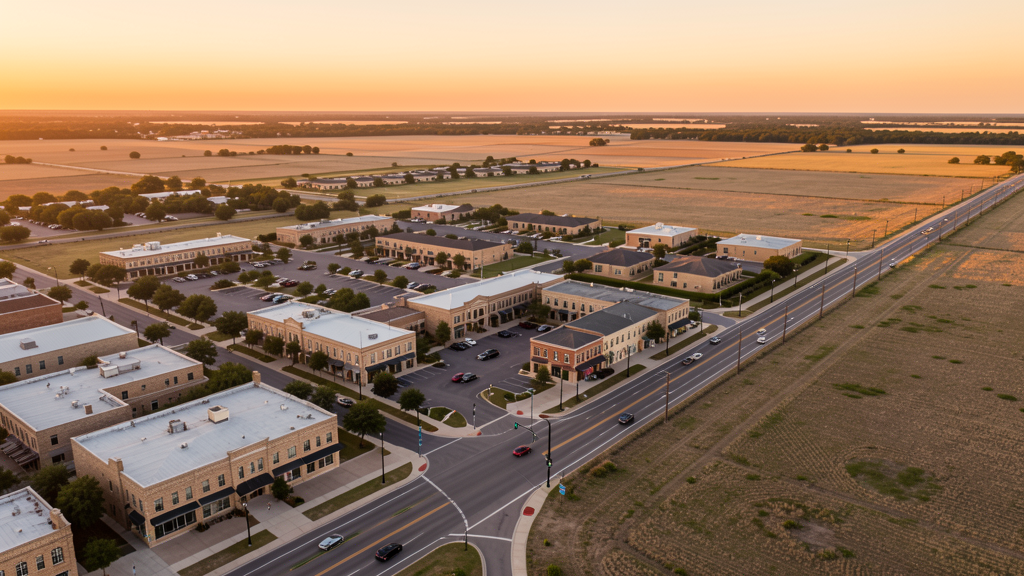
Get Matched With a Local Surveyor
Drone Survey Services Available in McKinney, TX
The Dallas-Fort Worth-Arlington metro is the fastest-growing major metro in the US, and McKinney anchors its northern expansion along US 380. As the Collin County seat with 195,000 residents, McKinney was the fastest-growing city in the US from 2010-2020. Massive master-planned communities (Stonebridge Ranch, Craig Ranch, Trinity Falls), the airport terminal expansion, and the US 380 corridor conversion generate sustained demand for topographic surveys, construction monitoring, and LiDAR mapping across the flat Blackland Prairie.
Drone Surveys for McKinney's Construction Market
McKinney was the fastest-growing city in the US from 2010-2020 among cities over 50,000, and continues to grow at 4-5% annually. The population has reached 195,000, driven by the US 380 expansion corridor, massive master-planned communities, and corporate relocations from the DFW urban core. Stonebridge Ranch (3,200 acres, 7,000+ homes), Craig Ranch (2,200 acres with the McKinney National Airport at its center), and Trinity Falls (1,000 acres along the Trinity River) are the primary residential growth engines. The historic downtown square is seeing adaptive reuse and mixed-use development. The SH 121 and US 380 corridors are major commercial and retail expansion zones. The McKinney National Airport expansion, including a new terminal and runway extension, is driving aviation-related construction. Collin College's McKinney campus expansion adds institutional demand.
Active Developers in the Area:
Typical Project Costs in Texas
Cost ranges are based on market data for Dallas-Fort Worth-Arlington. Actual pricing depends on site size, complexity, and deliverables.
| Service Type | Low End | High End |
|---|---|---|
| Topographic Survey | $1,700 | $4,800 |
| Drone Inspection | $225 | $800 |
| LiDAR Scanning | $2,600 | $9,000 |
| Environmental Monitoring | $850 | $3,500 |
| Aerial Imagery | $175 | $500 |
| Construction Monitoring | $900 | $2,800 |
| Real Estate Photography | $150 | $450 |
| Roof Inspection | $200 | $750 |
Local Airspace & Regulations in McKinney, TX
FAA Part 107 Requirements
All commercial drone operations in Texas require the pilot to hold an active FAA Part 107 Remote Pilot Certificate. Our network surveyors are verified Part 107 holders.
State Drone Laws
Texas Government Code Chapter 423 restricts drone use over critical infrastructure facilities, including oil and gas pipelines, refineries, power plants, and water treatment facilities. HB 1484 (2023) added protections for agricultural operations and expanded penalties for drone surveillance of private property. Commercial operators must hold a valid FAA Part 107 Remote Pilot Certificate. Texas does not require a separate state drone license, but operators flying near critical infrastructure must obtain authorization from the facility owner. The Texas Department of Public Safety maintains additional guidelines for drone operations near state facilities.
Local Ordinances
McKinney does not issue a separate city-level drone permit for commercial operators. FAA Part 107 certification and LAANC authorization for Class D (TKI) and Class B (DFW) airspace are the primary requirements. Commercial filming on city property requires a permit through the McKinney Parks and Recreation Department. The city prohibits drone takeoff and landing in city parks without a special use permit, including Towne Lake Park, Bonnie Wenk Park, and Gabe Nesbitt Community Park. Flights from private property (with owner permission) do not require a city permit but must comply with all FAA Part 107 rules and Texas Government Code Chapter 423 critical infrastructure restrictions.
Restricted Airspace
- Class D airspace around McKinney National Airport (TKI) — located within McKinney city limits. Drone flights within 4 nautical miles require LAANC authorization. This affects a significant portion of central and western McKinney, particularly the Craig Ranch and Stonebridge Ranch areas. TKI has active corporate jet traffic and flight training operations.
- Class B airspace around DFW International — located 25 miles southwest. The outer northeastern shelves of DFW Class B may extend into far western McKinney near the Frisco border. Verify altitude shelves on FAA UAS Facility Maps for survey work along the US 380 and Dallas North Tollway corridors.
- Class D airspace around Addison Airport (ADS) — located 18 miles south. The northern edge of ADS Class D may extend into southern McKinney. Drone flights within 4 nautical miles require LAANC authorization. This affects survey work near Craig Ranch and SH 121.
- Collin County Youth Park and Myers Park — county-owned facilities with event-driven drone restrictions during fairs, rodeos, and youth events. Coordinate with Collin County Parks and Recreation before flying near these venues.
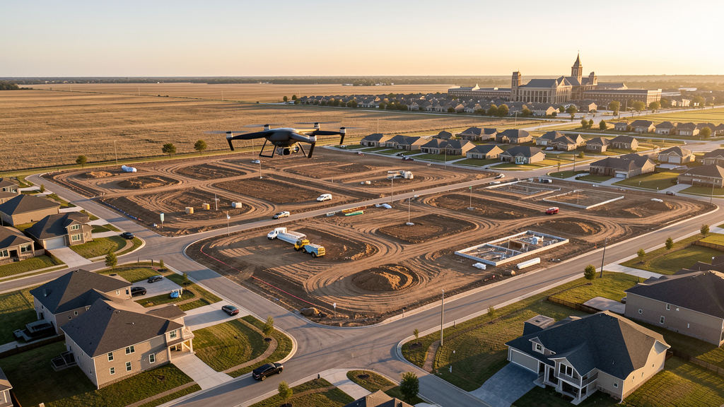
- Trinity Falls MPC active construction — 1,000-acre master-planned community along the Trinity River with continuous residential construction. Crane operations and heavy equipment require drone pilots to coordinate with site superintendents. The Trinity River floodplain creates additional survey demand for elevation certification and drainage design.
- Hurricane and severe weather: While McKinney is far enough inland to avoid Gulf hurricane impacts, it is in Tornado Alley. Spring thunderstorms can produce tornadoes, large hail, and damaging winds. Drone operations during severe thunderstorm warnings are restricted. Post-storm damage assessment flights require coordination with Collin County Emergency Management. Summer heat above 100 degrees Fahrenheit affects drone battery performance and flight times.
Airports in the area: undefined (undefined), undefined (undefined), undefined (undefined), undefined (undefined)
Why Hire Through Aerius View in McKinney, TX?
FAA-Certified
Every surveyor holds an active Part 107 Remote Pilot Certificate.
Local to McKinney
Surveyors who know the Texas airspace and local permitting.
No Cost to Quote
Submit your project at no charge. Pay the surveyor directly if you proceed.
Fast Turnaround
A local surveyor contacts you within 2 business days.
How Our McKinney Matching Process Works
We're actively building our network of FAA-certified drone operators in McKinney, TX. Here's exactly what happens when you submit a project request.
Submit Your Project
Tell us your site location, acreage, and what you need (topographic survey, LiDAR, inspection, etc.). Takes 60 seconds. No cost, no obligation.
We Match & Vet
We identify Part 107-certified operators in Texas with the right equipment for your project. Every pilot is verified for active certification, insurance, and relevant experience in Texas airspace.
You Get Quotes
Matched surveyors contact you within 2 business days with quotes. You compare pricing, timelines, and deliverables, then choose the right fit. You pay the surveyor directly, no markup.
What Deliverables Do You Get?
Every project includes professional-grade deliverables compatible with standard construction and engineering software:
- Orthomosaic maps (GeoTIFF) for site overview and documentation
- Point clouds (LAS/LAZ) for 3D modeling and volumetric analysis
- DEM/DSM terrain models for cut/fill and grade analysis
- Contour lines (DXF/DWG, CAD-ready) for Civil 3D and Revit
- Progress reports with side-by-side comparisons for construction monitoring
- Coordinate systems matched to your project datum (State Plane, UTM, or local)
Insurance & Liability Protection
Pilot Insurance Required
Every operator in our network must carry active liability insurance. Minimum coverage: $1,000,000 general liability. Proof of insurance is verified before any pilot joins the network.
FAA Part 107 Verified
We confirm each pilot's Remote Pilot Certificate is active and in good standing through the FAA Airmen Inquiry system. Expired certificates are flagged automatically.
Equipment Documentation
Pilots list their drone models, sensors (RGB, LiDAR, thermal, multispectral), and payload specs so we can match the right equipment to your project requirements.
Site Safety Coordination
Pilots coordinate with your site superintendent for safe operations on active construction sites, including flight plans that avoid worker areas and equipment zones.
McKinney, TX Drone Survey FAQs
Do I need a permit for a drone survey in McKinney?
McKinney does not issue a separate city-level drone permit for commercial operators. FAA Part 107 certification is mandatory. LAANC authorization is required for flights within the McKinney National Airport (TKI) Class D zone, which covers much of central and western McKinney. Flights from private property with owner permission do not require a city permit. Drone takeoff and landing in city parks requires a special use permit.
How much does a drone survey cost in McKinney?
McKinney pricing tracks slightly below the DFW metro average. Topographic surveys typically range from $1,700 to $4,800. LiDAR scanning runs $2,600 to $9,000 for larger sites. Roof inspections cost $200 to $750 per building. Construction monitoring is typically $900 to $2,800 per month for recurring flights at master-planned community sites like Stonebridge Ranch, Craig Ranch, and Trinity Falls.
Can I fly a drone near McKinney National Airport?
McKinney National Airport (TKI) is located within McKinney city limits and has Class D airspace. Drone flights within 4 nautical miles require LAANC authorization. TKI has active corporate jet traffic and flight training operations, especially during weekday commuting hours (7-9 AM and 4-6 PM). The airport is at the center of the Craig Ranch MPC, so many residential survey jobs in that area require LAANC. Always check FAA UAS Facility Maps for exact boundaries.
How does tornado risk affect drone operations in McKinney?
McKinney is in Tornado Alley, and spring thunderstorms (March-June) can produce tornadoes, large hail, and damaging winds. Drone operations during severe thunderstorm or tornado warnings are strictly prohibited. Post-storm damage assessment flights require coordination with Collin County Emergency Management. Summer temperatures above 100 degrees Fahrenheit reduce drone battery life by 20-30%, requiring shorter flight segments and more battery swaps. Morning flights are preferred year-round.
What are the main master-planned communities generating survey demand in McKinney?
McKinney has some of the largest MPCs in Collin County. Stonebridge Ranch (3,200 acres, 7,000+ homes), Craig Ranch (2,200 acres with McKinney National Airport at its center), and Trinity Falls (1,000 acres along the Trinity River) are the primary growth engines. The US 380 corridor north of downtown is the next major development frontier, with thousands of acres of agricultural land being converted to mixed-use and residential. These projects generate multi-year survey contracts for topographic mapping, construction monitoring, and earthwork verification.
What makes McKinney unique for drone survey work?
McKinney was the fastest-growing city in the US from 2010-2020 and continues at 4-5% annual growth. The combination of massive MPCs (Stonebridge Ranch, Craig Ranch, Trinity Falls), the US 380 expansion frontier, the McKinney National Airport terminal expansion, and the historic downtown adaptive reuse creates diverse survey demand. The city's own airport with Class D airspace means LAANC is frequently required, but the flat Blackland Prairie terrain makes photogrammetry highly efficient.
Nearby Cities
Are You a Drone Surveyor in McKinney?
Get pre-qualified leads in your service area. No membership fees, no monthly minimums. First lead free.
Ready to Start Your Project in McKinney, TX?
Get matched with a local, FAA-certified surveyor. No cost, no obligation.
Request a Free Quote