Drone Survey Services in Wheat Ridge, CO
Wheat Ridge is riding a wave of transit-oriented and corridor redevelopment along Wadsworth and 38th Avenue, creating steady demand for drone-based construction monitoring, topographic surveys, and infill-site mapping.
Serving Jefferson County & the Denver-Aurora-Lakewood MSA area
Request a Free Quote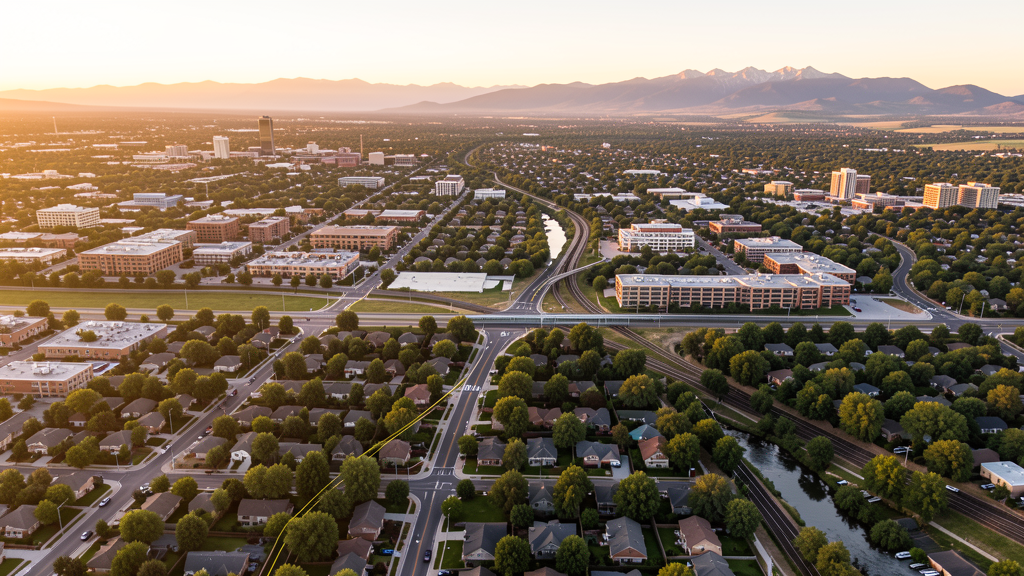
Get Matched With a Local Surveyor
Drone Survey Services Available in Wheat Ridge, CO
Wheat Ridge sits between Denver and the foothills in Jefferson County, giving it a unique mix of established residential neighborhoods and rapidly densifying mixed-use corridors. The Wadsworth BRT and 38th Avenue plan are the two largest public-infrastructure investments, attracting infill multifamily and townhome developers.
Drone Surveys for Wheat Ridge's Construction Market
Wheat Ridge is in the midst of a multi-year revitalization concentrated along the Wadsworth BRT corridor and the 38th Avenue plan, with the city projecting 3-4% annual construction growth. Major investments include the $40M Wadsworth Boulevard BRT project (CDOT/RTD), the 38th Avenue corridor streetscape, and several mixed-use ground-up developments in the Ridge at 38 district. Single-family ADU construction and residential infill is accelerating under the city updated zoning code.
Active Developers in the Area:

Typical Project Costs in Colorado
Cost ranges are based on market data for Denver-Aurora-Lakewood MSA. Actual pricing depends on site size, complexity, and deliverables.
| Service Type | Low End | High End |
|---|---|---|
| Topographic Survey | $1,800 | $6,500 |
| Drone Inspection | $1,200 | $4,500 |
| LiDAR Scanning | $3,500 | $12,000 |
| Environmental Monitoring | $2,000 | $7,500 |
| Aerial Imagery | $900 | $3,500 |
| Construction Monitoring | $1,500 | $5,000 |
| Real Estate Photography | $700 | $2,800 |
| Roof Inspection | $600 | $2,500 |
Local Airspace & Regulations in Wheat Ridge, CO
FAA Part 107 Requirements
All commercial drone operations in Colorado require the pilot to hold an active FAA Part 107 Remote Pilot Certificate. Our network surveyors are verified Part 107 holders.
State Drone Laws
Colorado HB 1070 (2023) aligns state drone law with federal FAA Part 107 requirements. The law prohibits local municipalities from regulating drone flight paths or airspace, but allows cities to regulate takeoff and landing on public property. Colorado does not require a separate state-level drone license. Commercial drone operators must hold a valid FAA Part 107 Remote Pilot Certificate and comply with all federal regulations. The Colorado Department of Transportation has additional guidelines for drone operations near state highways and infrastructure.
Local Ordinances
Wheat Ridge Municipal Code Chapter 10.40 prohibits takeoff and landing of drones in city parks, trails, and open space without a written permit from the Director of Parks and Recreation. Section 10.40.030 requires commercial drone pilots operating for compensation to carry proof of FAA Part 107 Remote Pilot Certificate and liability insurance of at least $1M. Film permit Ordinance 1490 requires a Special Use Permit for commercial filming with a drone on city property with fee approximately $100 per day.
Restricted Airspace
- KBJC Class D surface to 8,000 MSL within 5 NM immediately north. Operators near northern Wheat Ridge should coordinate with BJC Tower and use LAANC.
- KDEN Class B western shelf at 10,000 MSL extends toward eastern Wheat Ridge. Low-altitude Part 107 flights below 400 AGL are below the shelf floor.
- Rocky Flats National Wildlife Refuge partially near northwest Wheat Ridge boundary. USFWS prohibits drone operations over refuge lands under 50 CFR 27.34.
- Coors Field and Empower Field stadium TFRs approximately 5-7 miles east may affect area during game days.
- Clear Creek trail corridor and city open space have park restrictions on drone takeoff and landing.
Airports in the area: undefined (undefined), undefined (undefined), undefined (undefined)
Why Hire Through Aerius View in Wheat Ridge, CO?
FAA-Certified
Every surveyor holds an active Part 107 Remote Pilot Certificate.
Local to Wheat Ridge
Surveyors who know the Colorado airspace and local permitting.
No Cost to Quote
Submit your project at no charge. Pay the surveyor directly if you proceed.
Fast Turnaround
A local surveyor contacts you within 2 business days.
How Our Wheat Ridge Matching Process Works
We're actively building our network of FAA-certified drone operators in Wheat Ridge, CO. Here's exactly what happens when you submit a project request.
Submit Your Project
Tell us your site location, acreage, and what you need (topographic survey, LiDAR, inspection, etc.). Takes 60 seconds. No cost, no obligation.
We Match & Vet
We identify Part 107-certified operators in Colorado with the right equipment for your project. Every pilot is verified for active certification, insurance, and relevant experience in Colorado airspace.
You Get Quotes
Matched surveyors contact you within 2 business days with quotes. You compare pricing, timelines, and deliverables, then choose the right fit. You pay the surveyor directly, no markup.
What Deliverables Do You Get?
Every project includes professional-grade deliverables compatible with standard construction and engineering software:
- Orthomosaic maps (GeoTIFF) for site overview and documentation
- Point clouds (LAS/LAZ) for 3D modeling and volumetric analysis
- DEM/DSM terrain models for cut/fill and grade analysis
- Contour lines (DXF/DWG, CAD-ready) for Civil 3D and Revit
- Progress reports with side-by-side comparisons for construction monitoring
- Coordinate systems matched to your project datum (State Plane, UTM, or local)
Insurance & Liability Protection
Pilot Insurance Required
Every operator in our network must carry active liability insurance. Minimum coverage: $1,000,000 general liability. Proof of insurance is verified before any pilot joins the network.
FAA Part 107 Verified
We confirm each pilot's Remote Pilot Certificate is active and in good standing through the FAA Airmen Inquiry system. Expired certificates are flagged automatically.
Equipment Documentation
Pilots list their drone models, sensors (RGB, LiDAR, thermal, multispectral), and payload specs so we can match the right equipment to your project requirements.
Site Safety Coordination
Pilots coordinate with your site superintendent for safe operations on active construction sites, including flight plans that avoid worker areas and equipment zones.
Wheat Ridge, CO Drone Survey FAQs
Can I fly a drone commercially in Wheat Ridge parks without a permit?
No. Wheat Ridge Municipal Code Section 10.40.020 prohibits takeoff, landing, and operation of drones in city parks, trails, or open space without a written permit from the Director of Parks and Recreation. Commercial operators must also show a valid FAA Part 107 Remote Pilot Certificate and carry at least $1M liability insurance per Section 10.40.030.
Does Wheat Ridge fall under Denver Class B airspace?
Partially. The Denver Class B western shelf with a 10,000 ft MSL floor extends toward eastern Wheat Ridge. Most low-altitude Part 107 flights under 400 ft AGL are below the shelf floor. The BJC Class D surface area lies just to the north and requires coordination and LAANC for flights within its 5-NM ring.
What is the nearest airport for airspace coordination?
Rocky Mountain Metropolitan Airport (BJC), about 7 miles north, is the nearest towered airport with Class D airspace. Drone pilots operating near its 5-NM ring must coordinate with BJC Tower. LAANC is available for the BJC grids.
Are there special restrictions near Rocky Flats?
Yes. The Rocky Flats National Wildlife Refuge, administered by USFWS, prohibits drone operations over refuge lands under 50 CFR 27.34. Portions of the refuge lie along the northwest edge of Wheat Ridge. Check refuge boundaries carefully before launch.
Does the city require film permits for drone-based real estate video?
Yes. Commercial filming with a drone on city property including rights-of-way and parks requires a Special Use/Film Permit (Ord. 1490) through the City Clerks Office, with a fee of approximately $100 per day. Flights over private property with owner consent do not require this permit but still require FAA Part 107 compliance.
Nearby Cities
Are You a Drone Surveyor in Wheat Ridge?
Get pre-qualified leads in your service area. No membership fees, no monthly minimums. First lead free.
Ready to Start Your Project in Wheat Ridge, CO?
Get matched with a local, FAA-certified surveyor. No cost, no obligation.
Request a Free Quote